Rogue River Navigable
Posted: 10/08/2007
By: Thomas O'Keefe
Oregon's Department of State Lands recently released a draft navigability report for the Rogue
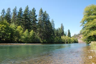
River from RM 68.5 to 157.5 (Grave Creek to Lost Creek Dam) in Josephine and Jackson Counties
(where the river flows through the towns of Grants Pass, Rogue River, Gold Hill, and Shady Cove).
This is the section of the Rogue upstream of the popular Wild and Scenic multiday trip but it
includes reaches that are popular for whitewater day trips.
The draft report determines that this reach is navigable. Specifically the reports concludes:
"It is reasonable to conclude that the 89-mile segment of the Rogue River from Grave Creek to Lost Creek Dam, in its ordinary and natural condition, was used, was susceptible to use, or both, as a highway of commerce over which trade and travel were or could have been conducted in the customary modes of trade and travel on water at the time of statehood [in 1859]."
When the Land Board determines a waterway is navigable it asserts a claim to the ownership of the submerged and submersible land underlying a waterway. These lands are thus publicly-owned and it would be the state's position that the public has the right to use the submerged and submersible land underlying the waterway for activities such as fishing and boating.
Department of State Lands has completed its draft report concerning the navigability of the 89-mile segment of the Rogue River. This report, entitled "Rogue River Draft Navigability Study Report," summarizes the evidence that DSL has collected concerning the navigability of the study segment. (download the full report)
Evidence of current use by drift boats, rafts, canoes, kayaks and other recreational watercraft may be persuasive where it also demonstrated that vessels that were used at the time of statehood required similar depths of water, or that similar modes of travel were customary at the time of statehood.
We encourage paddlers who are familiar with this reach to contribute any additional information they may have and support the preliminary conclusions that this river is indeed navigable.
DSL welcomes public comment on this first draft concerning:
* The accuracy of the data presented in it, as well as
* Any additional information concerning the historical uses and condition of the waterway that support or refute the information presented in the report.
You can submit your comments to DSL in one of three ways:
* At a public hearing to be held:
Wednesday, October 24, 2007 beginning at 7PM
Grants Pass School District Performing Arts Center
Grants Pass High School
830 NE 9th Street
Grants Pass, Oregon
* Via E-mail to: roguerivercomments@dsl.state.or.us
* Via US Mail to:
Oregon Department of State Lands
Rogue River Navigability Study Comments
775 Summer St NE, Suite 100
Salem, Oregon 97301-1279
You will have another opportunity to present your comments before the Land Board concerning the content of a revision to this draft at its March 12, 2008 meeting in Medford. Further information concerning this meeting will be posted on this website and mailed to interested persons as it becomes available.
Thomas O'Keefe
3537 NE 87th St.
Seattle, WA 98115
E-mail: okeefe@americanwhitewater.org
Phone: 425-417-9012
Full Profile