The GPS Project: Taking the “Search” out of “Search and Rescue”
Posted: 09/01/2006
By: Eric Nies
Here’s the scenario: You and your buddy have just blitzed out the last eight miles of the
upper Gnarly Fork, leaving Sketchy Fred at Liquidator, the big drop on the run. True to form,
Sketchy Fred has managed to break both his ankle and his arm on the portage, and is now sitting at
the bottom of the drop with two wet PowerBars, an expired Percocet, and a lighter that
doesn’t seem to have any butane in it. None of you have a clue about the hike out from
Liquidator, other than it is terrible, and that somebody said you definitely don’t want to
hike out the wrong side. In other words, Sketchy Fred is, once again, screwed.
At the takeout, you find, to your surprise, that your cell phone has two bars. Reluctantly you call 911 and give them the lowdown. Their half of the conversation goes like this: “The Gnarly Fork? You mean Silver Creek, or Oak Creek? Is that on County 28? Liquidator, you say? Is that by the Crystal Hole? China Bar? Jumper’s Glory? Big Bend? Wobbly Rock? The Wiggles? Is there a big stump that looks like Elvis?....” As the conversation deteriorates, you realize that Fred will have a long, lonely night, sucking on a Percocet and flicking his Bic.
What is needed here is a way to translate what we know about rivers—the rapid and camp names, road and trail crossings, side creeks, etc.—into something that emergency and rescue professionals can use. And no doubt about it, what they like best is a nice set of GPS coordinates.
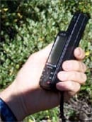
For those of you unfamiliar with GPS, it stands for Global Positioning System. This system consists of a few dozen expensive satellites (thank you, President Reagan) and widely available, hand-held gizmos that interpret signals from those satellites and calculate their position on the ground with an impressive accuracy. The usual $99 K-Mart units can be accurate to a few meters, and high-dollar models are now capable of locating within the centimeter range.
Over the next decade, AW hopes to serve as the collecting point for GPS data on whitewater rivers for the purpose of aiding rescue professionals. We hope to create a set of GPS data for river runs listed on AW’s website, starting with the coordinates of the put-in, continuing with info on the major rapids and landmarks, and finishing with the numbers for the take-out. This data would be freely available to anyone visiting AW’s website, and would have any number of potential uses. Foremost, though, it would allow search and rescue folks to translate the kind of info boaters give them (“Liquidator, Gnarly Fork”) into a known point on the map, with just a few mouse clicks.
How will this happen? To be honest, we will need your help. AW is calling for you, the boating community at large, to start packing your GPS units on the river and collecting waypoints. Collect what you think is useful—put-in, take-out, rapids, camps, side creeks, places that a helicopter can land—and maybe take a few photos of each waypoint as well. In the months to come, AW will provide a place on its website to enter this data for all to see and use.
In a perfect world, the GPS project would grow into the comprehensive and definitive go-to database for rescue folks, so that the person answering your 911 call will know about and use it. Until that day, it will be our responsibility to grow the site, make it work, and then get the word out to EMS services. This can even happen in real-time: “Hello, 911? My buddy’s stuck at Liquidator on the Gnarly Fork. Where’s that? Well, go to ‘www dot americanwhitewater dot org’ … not ‘dot com’—sorry, that’s a rafting company.”
Right now, though, this project is just a dream. So start collecting those waypoints, and keep your eye on the AW website in the months to come. We’ll have a place to put your data, and we’ll even try to give some swag (or at least some credit) to the folks who contribute. And thanks in advance. Together we can make sure that Sketchy Fred doesn’t have to find out the useful life of a PowerBar or the nutritional value of Percocet.
At the takeout, you find, to your surprise, that your cell phone has two bars. Reluctantly you call 911 and give them the lowdown. Their half of the conversation goes like this: “The Gnarly Fork? You mean Silver Creek, or Oak Creek? Is that on County 28? Liquidator, you say? Is that by the Crystal Hole? China Bar? Jumper’s Glory? Big Bend? Wobbly Rock? The Wiggles? Is there a big stump that looks like Elvis?....” As the conversation deteriorates, you realize that Fred will have a long, lonely night, sucking on a Percocet and flicking his Bic.
What is needed here is a way to translate what we know about rivers—the rapid and camp names, road and trail crossings, side creeks, etc.—into something that emergency and rescue professionals can use. And no doubt about it, what they like best is a nice set of GPS coordinates.
For those of you unfamiliar with GPS, it stands for Global Positioning System. This system consists of a few dozen expensive satellites (thank you, President Reagan) and widely available, hand-held gizmos that interpret signals from those satellites and calculate their position on the ground with an impressive accuracy. The usual $99 K-Mart units can be accurate to a few meters, and high-dollar models are now capable of locating within the centimeter range.
Over the next decade, AW hopes to serve as the collecting point for GPS data on whitewater rivers for the purpose of aiding rescue professionals. We hope to create a set of GPS data for river runs listed on AW’s website, starting with the coordinates of the put-in, continuing with info on the major rapids and landmarks, and finishing with the numbers for the take-out. This data would be freely available to anyone visiting AW’s website, and would have any number of potential uses. Foremost, though, it would allow search and rescue folks to translate the kind of info boaters give them (“Liquidator, Gnarly Fork”) into a known point on the map, with just a few mouse clicks.
How will this happen? To be honest, we will need your help. AW is calling for you, the boating community at large, to start packing your GPS units on the river and collecting waypoints. Collect what you think is useful—put-in, take-out, rapids, camps, side creeks, places that a helicopter can land—and maybe take a few photos of each waypoint as well. In the months to come, AW will provide a place on its website to enter this data for all to see and use.
In a perfect world, the GPS project would grow into the comprehensive and definitive go-to database for rescue folks, so that the person answering your 911 call will know about and use it. Until that day, it will be our responsibility to grow the site, make it work, and then get the word out to EMS services. This can even happen in real-time: “Hello, 911? My buddy’s stuck at Liquidator on the Gnarly Fork. Where’s that? Well, go to ‘www dot americanwhitewater dot org’ … not ‘dot com’—sorry, that’s a rafting company.”
Right now, though, this project is just a dream. So start collecting those waypoints, and keep your eye on the AW website in the months to come. We’ll have a place to put your data, and we’ll even try to give some swag (or at least some credit) to the folks who contribute. And thanks in advance. Together we can make sure that Sketchy Fred doesn’t have to find out the useful life of a PowerBar or the nutritional value of Percocet.