Rogue River Draft Navigability Report Issued
The Oregon Department of State Lands has recently released a Rogue River Navigability Report
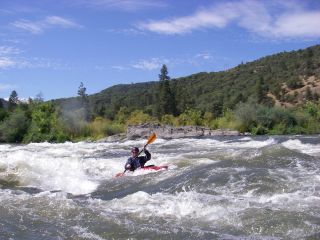
concluding that the 89 mile stretch of the Rogue River from Lost Creek Dam to Grave Creek meets
the federal test for navigability. While this staff report supports American Whitewater's
position, the final decision concerning navigability rests with the State Land Board (consisting
of the Governor, Secretary of State, and State Treasurer). The section of the river under
consideration is just upstream of the wilderness run and provides a diversity of opportunities
for day trips and is clearly a navigable waterway.
On Wednesday March 19th the State Land Board will hold a meeting in Medford to hear public
testimony on the findings of the staff report.
Time: Wednesday March 19, 2008, 10 am-12 noon
Location: Ramada Medford & Convention Center, Pacific Ballroom, 2250 Biddle Road, Medford, OR
97504.
The purpose of the meeting is to hear public testimony in response to the following two
questions:
1) Does the factual evidence presented in the second draft of the Rogue River navigability study
meet the federal test for title navigability?
2) Should the Land Board, based on the factual evidence contained in the second draft of this
study, make a declaration of public ownership of the 89-mile segment of the Rogue River from
Grave Creek (RM 68.5) to Lost Creek Dam (RM 157.5).
The answer to both of these questions is clearly yes. The Land Board will not make decisions at
this meeting and will only listen to testimony presented on these two questions. We encourage
paddlers who enjoy this section to attend and support the findings in the staff report.
An alternative is to submit written comments.
Email: roguerivercomments@dsl.state.or.us
Mail: Rogue River Comments, Oregon Department of State Lands, 775 Summer Street NE, Suite 100,
Salem, Oregon 97301-1279.
All input must be received by 5 pm on March 26 in order to be considered.
Any members who are interested in representing AW our would otherwise like to assist on this
project are encouraged to contact us.
Additional Background
The Department of State Lands has a Rogue River web page with a copy of the
Rogue River Draft Navigability Report dated Feb. 19, 2008 along with other documents and a
complete description of the process.
The Department of State Lands has come to this finding that this 89-mile segment of the waterway
meets the requirements of the federal test for navigability based on the following
considerations:
• The Rogue River study segment has been used in a variety of ways since statehood.
Documented evidence exists that Indians traveled on stretches of the study segment in
canoes. In addition, the study segment was also used by ferries, for log driving, by
commercial fishermen, for the transportation of passengers and cargo and by various recreational
watercraft.
• With the exception of a few areas, the general physical orientation of the Rogue River
study segment has not changed appreciably since statehood. This conclusion is based on an
examination of the maps prepared by the
cadastral surveyors, and a review of post-statehood maps available to the Department.
• The flow of the Rogue River through the study segment was at the time of statehood greater
than it is today. This is not only because of the dams that have been constructed
throughout the Rogue River Basin, but also
withdrawals that are taking water from the waterway for irrigation, municipal and domestic
uses.
• Most of the recreational watercraft currently used on the Rogue River study segment draw
less than 8 inches and can use the study segment with some difficulty at a minimum flow of 900
cfs. Based on a model developed by the Oregon Water Resources Department, an 80% likelihood
exists that this rate of flow would have occurred throughout the year at the time of statehood
(1859).
• Similarly, there is also an 80% likelihood that a flow of 1,000 cfs (which would provide a
trip with fewer obstructions) would have occurred throughout the year in 1859.
• Indian dugout canoes of the type used on the Rogue River and in other parts of the Pacific
Northwest typically draw 6 to 8 inches. Therefore, they are comparable to canoes, kayaks, drift
boats and rafts in current use on the waterway.
From these findings staff have come to the following preliminary conclusion:
In light of the foregoing evidence presented in this study and the above listed conclusions, it
is reasonable to conclude that the 89-mile segment of the Rogue River from Grave Creek to Lost
Creek Dam, in its ordinary and natural condition, was used, was susceptible to use, or both, as a
highway of commerce over which trade and travel were or could have been conducted in the
customary modes of trade and travel on water at the time of statehood.
Thomas O'Keefe
3537 NE 87th St.
Seattle, WA 98115