Fish Creek, E. Branch
Point Rock to Taberg
| Difficulty | II-IV |
| Length | 9.3 mi |
| Avg Gradient | 48 fpm |
| Gauge | East Branch Fish Creek at Taberg Ny |
| Flow Rate as of 663 days | 164 cfsstale data |
| Reach Info Last Updated | February 16, 2018 |
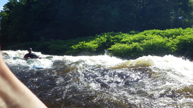
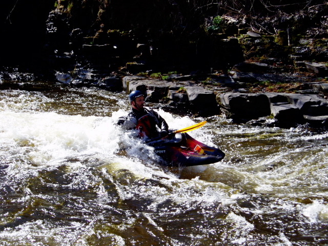
Fish Creek may be the finest play river in the Northeast, with big, fast waves and holes that range from purring pussycat to sneering tiger. Paddlers may put in below the City of Rome dam (Lat: 43.3377991 Lon: -75.5815353) or at Point Rock (coords given below); the takeout is 1/2 mile below the town of Taberg along Blossvale Road (4.5 miles from the dam, feels like 10 miles).
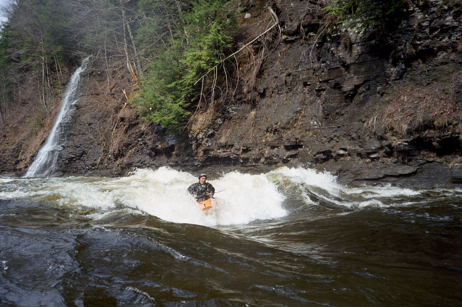
Most of the action takes place below the dam; you get a shorter, concentrated run, but you have to walk your boat down to put in. The stretch from Point Rock to the dam is more mellow, but many paddlers use it, especially at higher levels (3 feet and above), because that avoids the long walk to the dam; also, the upper section does have good play and some beautiful scenery, with waterfalls (icy in the early spring) cascading down the steep gorge walls at every turn.
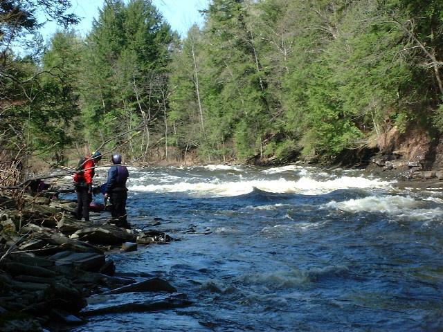
Important: The takeout is located on private property, and relies on the generosity of the land owner. During the year the area is used by fisherman who litter and make a mess. If you use the takeout please pick up any trash, and be friendly if approached by the elderly gentleman who owns the property. He takes great pride in the distances boaters come to boat the river and has been a friend to the community for decades. Please show him the respect he deserves.
Directions to takeout:
From the West (Syracuse and Thruway West):
Take Exit 34 (Canastota), head North on Rte. 13 toward Vienna.
Where Rte. 13 T's into Rte. 49 (North of Sylvan Beach), head Right onto Rte. 49.
After about 2.2 miles, just after Kimball Rd., take a Left onto Pine Rd. (If you miss this turn, take the Left, three miles farther, onto Herder Rd.)
Pine Rd. will T into Blossvale / Herder Rd. Take a Left, toward Taberg.
After about 3 miles, the road will follow E. Br., Fish Creek. Park where a takeout looks convenient.
The takeout is about 1/2 mile South
...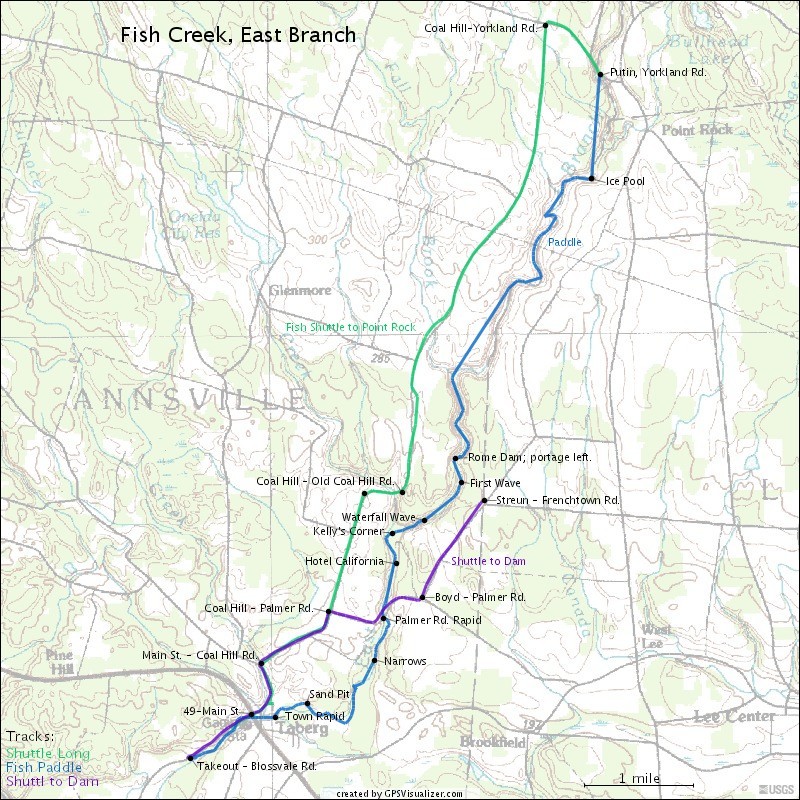
Check out the map, which shows the shuttle to the Point Rock putin, as well as the shuttle to the Dam. At Point Rock, park on the North side of Yorkland Rd., and walk down the easy path to the river.
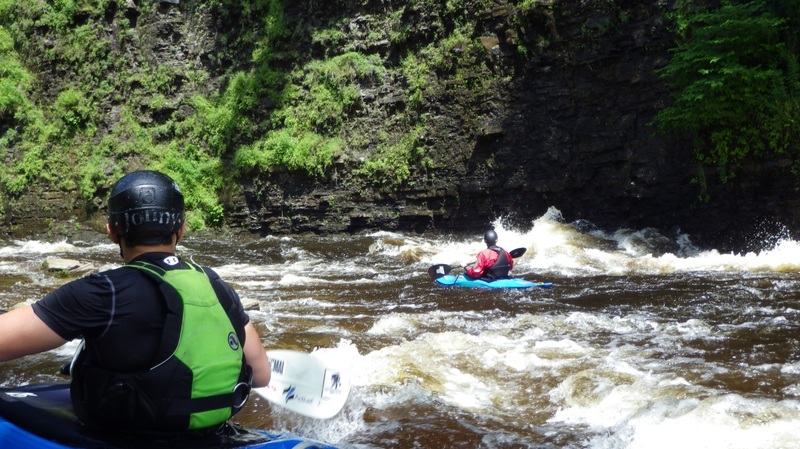
A big eddy, from which you can see huge ice cascades on the river walls in the early Spring. Not really a rapid, but very scenic.
This is a beautiful waterfall on the tributary, river right, just before the confluence with the East Branch Fish. We have no indication that this has ever been run, but some paddlers have the opinion that it's runnable.
Don't even think about it. Portage left.This is also the secondary access point; to get there, walk half a mile down from Streun Road.

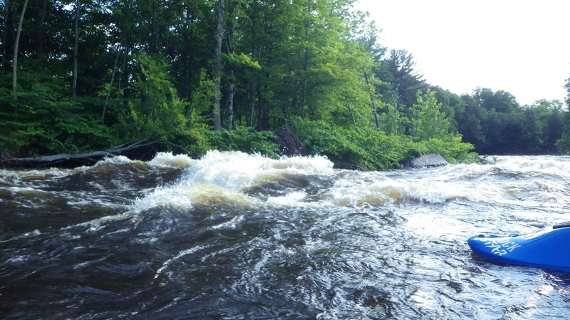
Just above a waterfall on the right, this is one great wave for surfing.
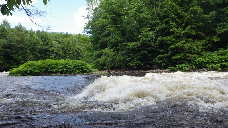
Big-a$$ed hole. 'You can check out any time you like, but you can never leave'. As the level rises, Hotel gets meatier and grabbier. How badly do you wanna get spanked today?
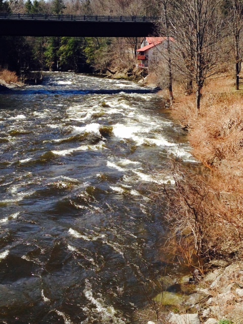
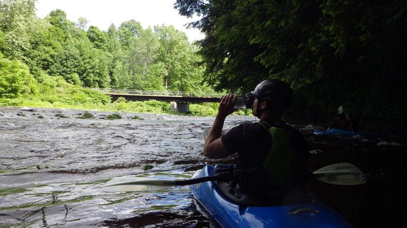
After you pass under the road, this rapid appears. It's got a bunch o play.
Not a hard rapid; it has some phenomenal surfing holes/waves at the end.
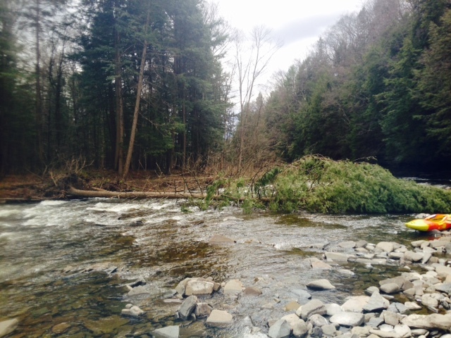
After the river takes a sharp right turn, you'll see sand cliffs on your right. This one isn't particularly difficult, but it's a common place where wood collects (on the right side, the outside corner of the turn). The wood should be easy for seasoned paddlers to avoid, but people who find the Fish a step up would be well advised to head hard left to avoid any screw-ups.
This one has a couple of ledges in it. Some play must be attained on the fly, though the last wave has big eddy service.
After a couple more phenomenal play waves, look for the ladder on river right.
Oct 2, 2014
River right 1/4 down stream from Palmer Rd