Blacklick Creek
Route 259 to Saylor Park in Blacklick
| Difficulty | II-III(IV) |
| Length | 6.8 mi |
| Avg Gradient | 43 fpm |
| Gauge | Blacklick Creek at Josephine, Pa |
| Flow Rate as of 1 hour | 125 cfsbelow recommended |
| Reach Info Last Updated | July 4, 2013 |
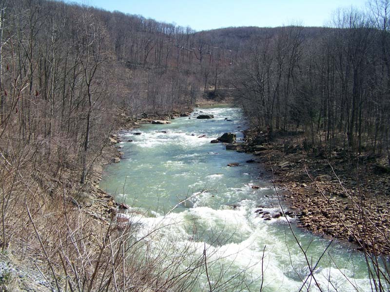
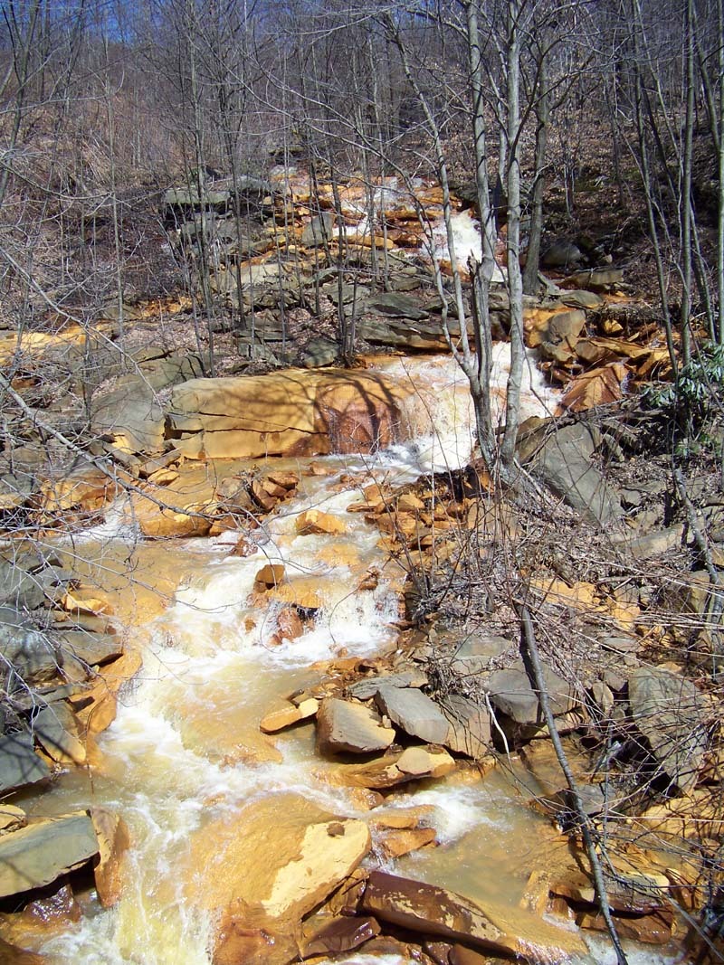
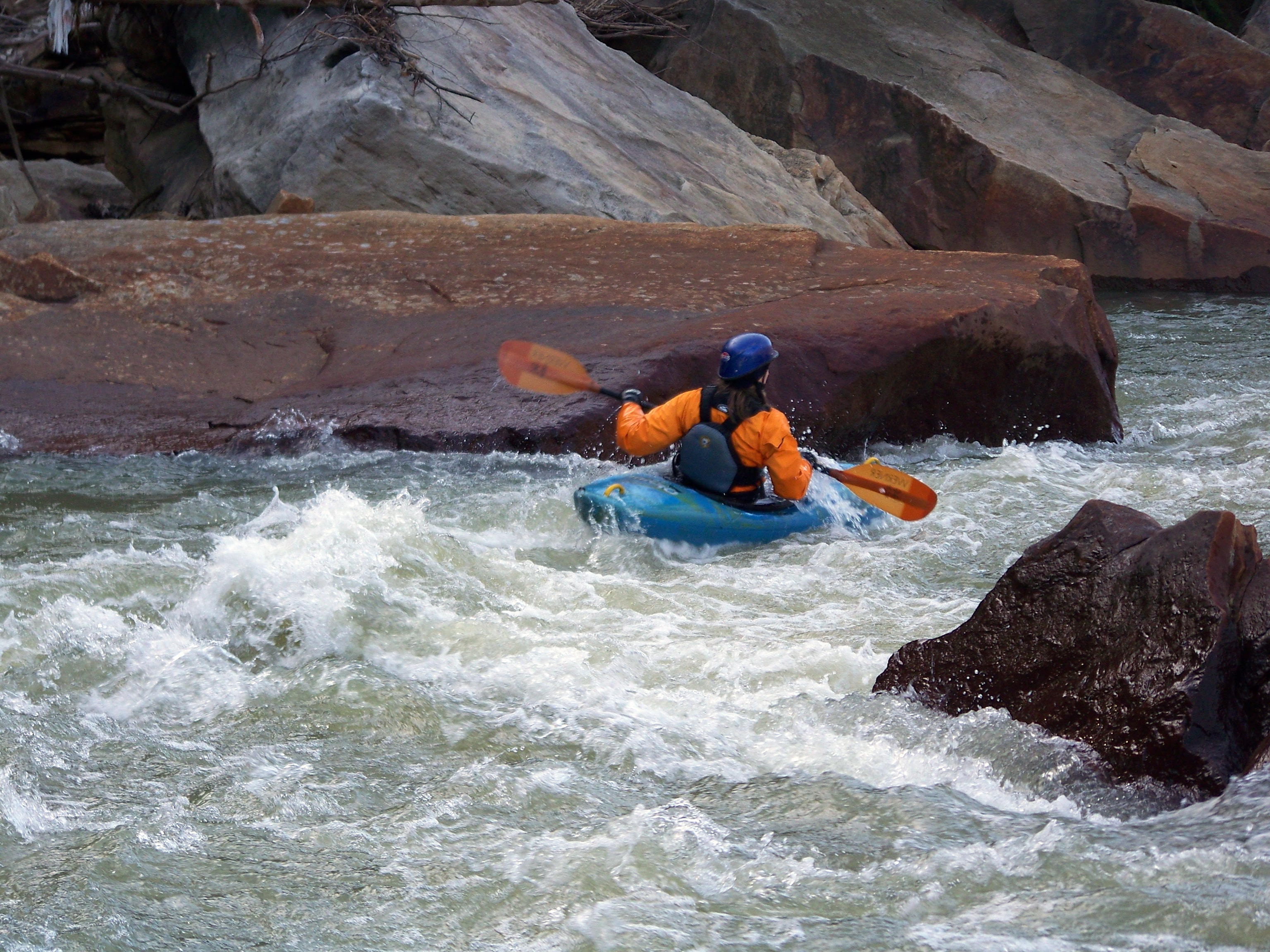
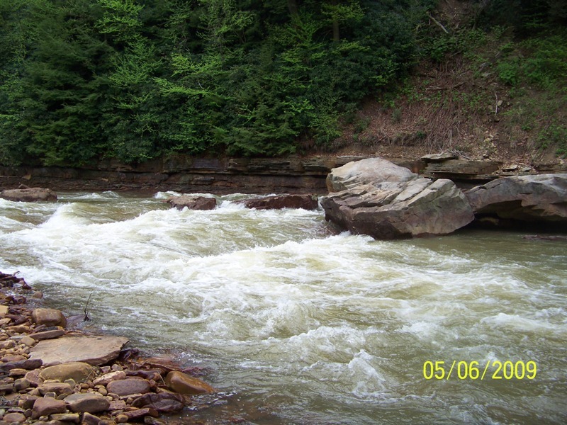
Blacklick Creek is located in southern Indiana County, Pennsylvania.It has been overlooked for years by many paddlers because of its bad reputation for acid polution and a devastated landscape, both the result of a coal mining past. Today, the Blacklick is a river in recovery. It has a way to go yet, but the upstream acid mine drainage has been significatly reduced . The conversion of the railroad bed to the Ghost Town multi-use trail included some clean up of the banks and hill sides. Trees have grown back and hide much of what remains of the boney piles and discarded mine equipment. The over-all impression the paddler now gets is one of beauty, mared only in spots. The white-water starts about a hundred yards above the Rt. 259 bridge in Heshbon. Put in from the Ghost Town Trail upstream of the bridge on the northern side. It is permissible to drive up to the gate to unload boats and equipment. Parking is back at the gravel lot by the road. The put-in is just beyond the gate on the right by a large rusting cable winch. You may also put-in on the down stream side of the North end of the bridge, but this is difficult and you miss some rapids. This section starts with the Heshbon Rapid, about 3/4 of a mile of ledges and boulder gardens that lead into Auld's Run Rapid (IV-). On your right you will pass Auld's Run, a small tributary. It is bright orange. Auld's Run Rapid is just below. Work your way over to the right and eddy out on the right just above the drop. You can scout the rapid from here(by boat or bank). The line is a diagonal one from right to left. You need to enter the rapid high from the top of the eddy, and get all the way over to the left near the leaning boulder to hit the clean line. The river maintains a busy class II-III pace for the next two and a half miles. With one last good class III just past the half way point called Diagonal Ledges. After this drop there are still a bunch of small ledges that provide good surfing opportunities. As the rapi
...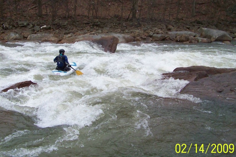
About 3/4 of a mile below the putin the stream bed constricts at a boulder strewn ledge called Auld's Run Rapid. So called because of the entry of Auld's Run from river right before the drop. This small tributary is easy to spot due to its bright orange color. After this, also on the right there is a good scouting eddy just above the drop. It is possible to beach here to scout or portage as well. The cleanest line is a diagonal across the rapid from the eddy dropping over on the left by the leaning boulder.
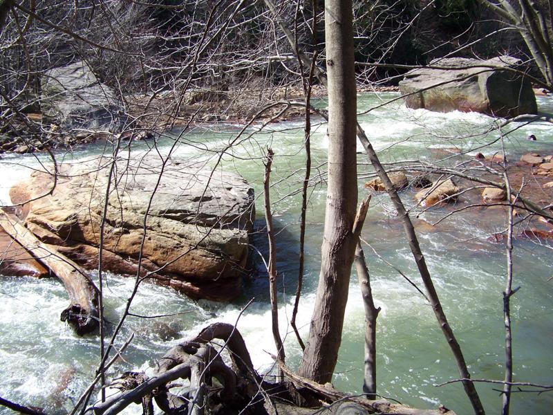
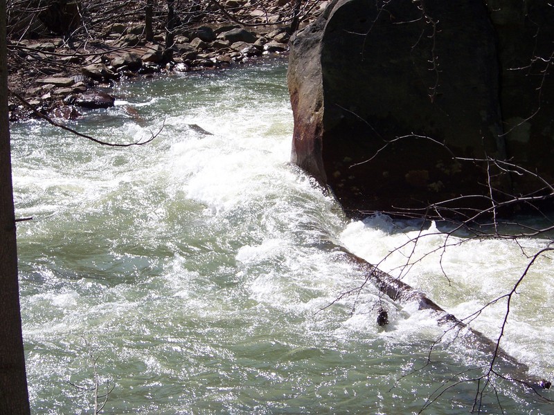
The photo shows the right channel. The big square rock in mid channel, at the bottom is Jack's Rock. It is slightly undercut, and has logs across the bottom of both routes around the rock that will be there for years. Although it is possible to paddle over the logs, the danger of entrapment for swimmers is very high. The left channel of the island is a fun and safe route.
The left channel of this rapid ends in a boulder sive. So, enter this rapid right of the two mid stream boulders. Stay left and above the drop until you are past the first diagonal wave-hole then run down the left. http://youtu.be/yACU5PDjr48
Apr 26, 2011
Ran Blacklick on 4/24/11 @ 1000cfs on the new gauge with Hap and Jamie, this is a good level with all the bells and whistles. I hear good things about 1500cfs from Jen & Phil. What we need to know is at what level on the new gauge do things begin to washout.
Rand
Apr 26, 2011
A new fish commision access has been made at the rt 119 bridge on Blacklick creek. It is only accessible from the North bound direction on rt 119 just after the bridge. It is 1/2 mile further down stream from the Saylor Park takeout but parking is very close to the water.
Nov 6, 2010
This is the log at the bottom of the right channel of the large island below Heshbon.
The left channel is open.
Mar 24, 2010
3/21/10 Ran Blacklick @ 780cfs this appears to be close to a min. for fun level with the new gauge if it is indeed operating properly. The old stage numbers are out and new ones will be needed. No painted gauge exists so cfs should be used. I have not heard back from USGS
Nov 23, 2009
11/22/09 Sunday I walked to the location of the log strainer at low water. It is still there. There are actually 3 large logs that form the strainer. They are across the entire bottom of both channels around the rock. When the river is up, you can most likely get around or over the blockage if you are in your boat. However anyone swimming above here would be in great danger of entrapment beneath the logs. The left channel of the island is open and is a fun route.