Wooley Creek
Near Wooley Camp to Salmon River
| Difficulty | IV-V |
| Length | 5.2 mi |
| Avg Gradient | 103 fpm |
| Gauge | Salmon R a Somes Bar Ca |
| Flow Rate as of 50 minutes | 281 cfsbelow recommended |
| Reach Info Last Updated | May 26, 2025 |
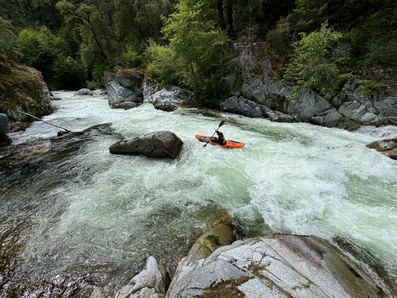
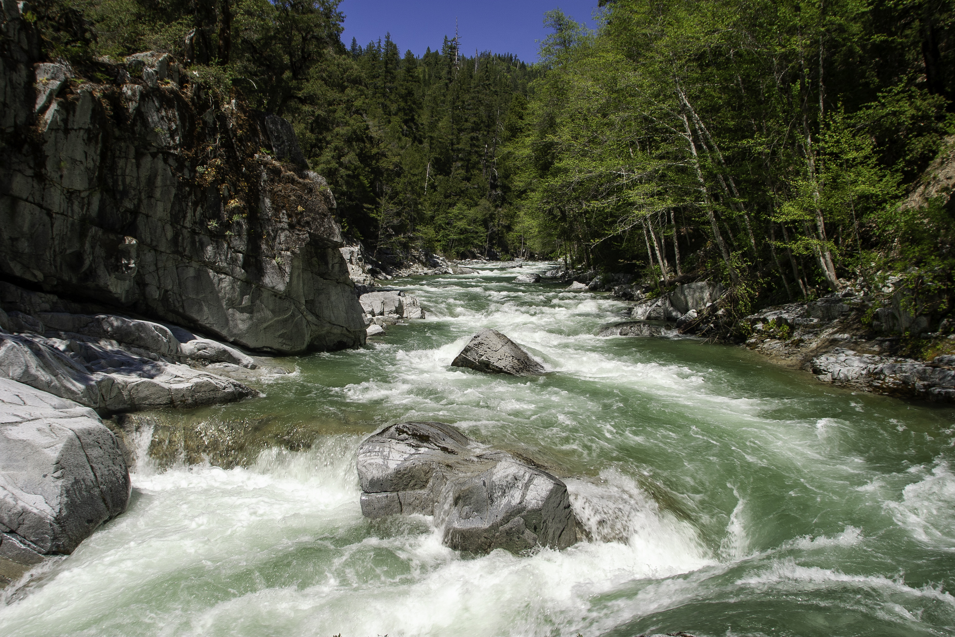
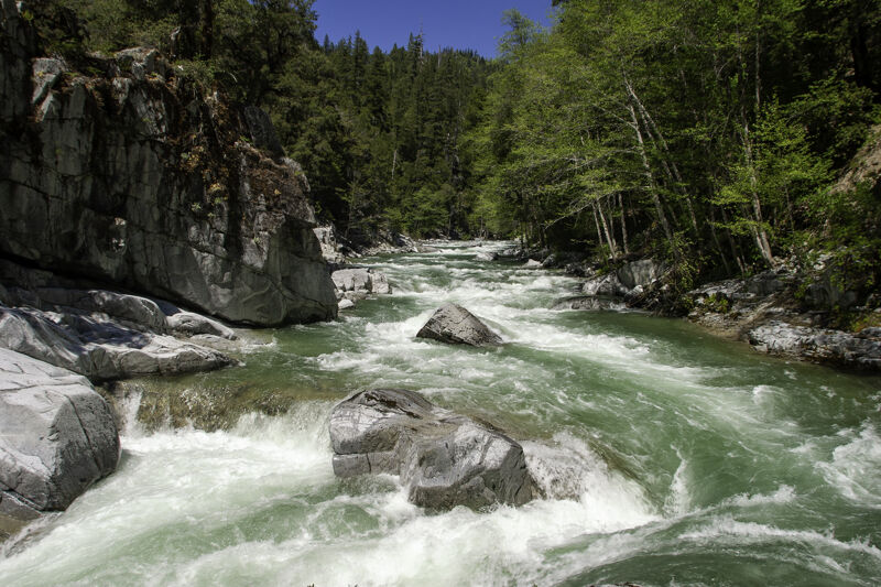
Wooley Creek is one of the most beautiful and remote hike-in boating runs in California. Draining the heart of the 241,000-acre Marble Mountain Wilderness Area, it cuts through an eponymous granitic batholith with three mini-gorges filled with round boulders, ledges, blind drops, classic boofs, and sometimes vertical walls—all set against a backdrop of pristine scenery. It is the epitome of hike-in wilderness paddling with challenge both on the trail and the water. Boating here is an adventure experience.
Although it is named as a creek, Wooley is really the smallest fork of the Salmon River, draining 95,192 acres or about 20% of the Salmon River watershed. Except at high flows, the run is Class IV/IV+: Wooley is not hair boating, and a lot of it can be boat-scouted by experienced paddlers. Everything can be run assuming there are no wood hazards--but there usually are some.
Wooley's remoteness factor is high, and any mishap here could become serious because there is essentially no prospect of getting out quickly or summoning outside help in time if needed. The trail is mostly quite high above the creek and doesn't offer an easy way out. Be prepared to be fully self-sufficient for anything you may encounter on or off the water. A satellite communicator is an essential safety item for this run but help will still take a long time to arrive.
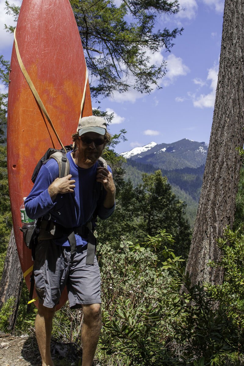
Use some kind of pack system to carry your kayak: it's a long way to shoulder a boat and dragging is not only bad for your kayak, it's a poor ethic to leave plastic shavings all along the trail. Rafters may want to consider hiring a local mule packer to get gear in (this is how Dean Munroe's pioneer commercial rafting trip with Munroe's Wilderness Adventures on Wooley Creek was done in 1984!). Packrafters will find the hike comparatively easy, and this is likely the future of Wooley Creek boating, which is actually going somewhat full-circle back to
...
Park here and start hiking. Vehicle security is an issue at this trailhead and there have been break-ins (and a few firebombings--likely targeted--in the past). It's best to park on the side of the parking area where your vehicle isn't visible from Salmon River Road. The parking area for the Brannons Bar River Access (by the bathroom) seems to have fewer issues and it's a short walk to the trail from there. Due to the sensitivity of this area, it's recommended to not camp here.

Wooley Camp is a private inholding within the Marble Mountain Wilderness Area. A short spur trail off the Wooley Creek Trail descends to the camp, which includes a large communal building and several cabins on the creek. It is tended by an on-site caretaker.
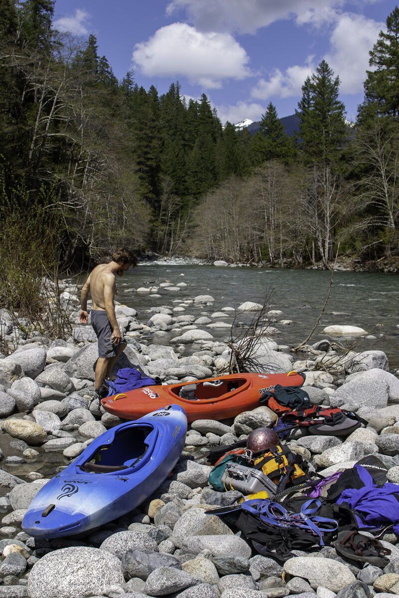
Put in near Wooley Camp, using the spur trail from the Wooley Creek Trail to get close to the creek. To avoid trespassing on the privately owned Wooley Camp Association land, walk off-trail directly to the creek before passing through the Wooley Camp gate. This is the fastest route to the creek.
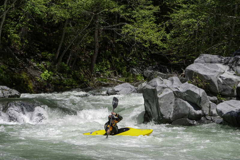
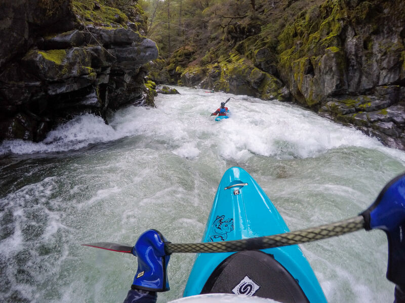
Wooley Creek enters its first gorge immediately upon on a sharp left bend a little more than a mile below Wooley Camp. This bend conceals the first rapid so that by the time you see that it's there, you're comitted to run its entry ledge. To scout, get out on the left as soon as you see the sharp left bend. This rapid can also (sort of) be seen from the hike in but is far below the creek and a view of it depends on the leaves being off the trees (winter and early spring). There are three distinct drops in this rapid.
Gates Creek is the second significant rapid of the run, separated from the first significant rapid by a couple smaller rapids. Scout right.
Steep rapid with boulders and holes. Scout right.
This undeveloped put-in provides access to the lowermost gorge of Wooley Creek. Reaching it requires a three-mile hike, and gets you about two miles of boating on the creek. From the trail, continue upstream from the first spot where it drops closer to the creek, pass two obvious dispersed campsites, and hike another few minutes to nearly reach Deer Lick Creek. Look for the most manageable spot to scramble down to Wooley Creek.
A picturesque ledge drop on a right hand bend. Depending on flow, different line options are available. Although not visible from the trail, this rapid can be easily scouted from the hike-in by venturing off the trail in the upriver direction at the dispersed camp sites about three miles from the trailhead--this also makes a nice break on the hike.
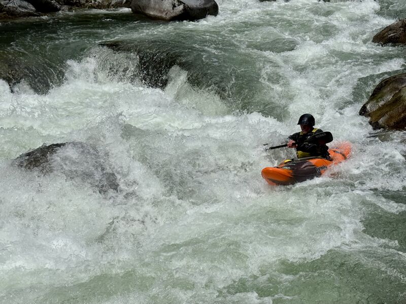
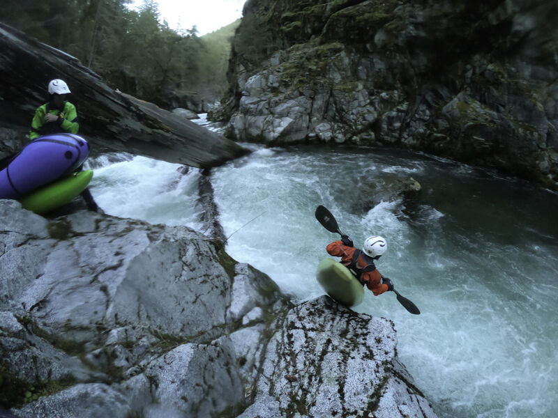
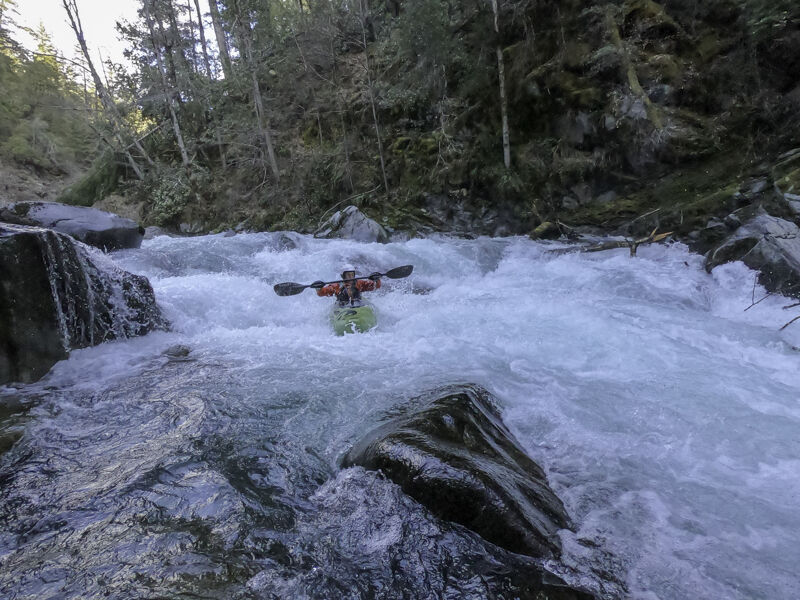
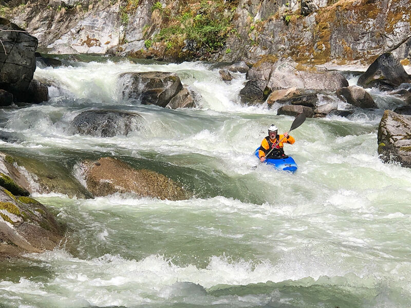
This is arguably the longest and most consequential rapid of the run—and it’s a must-run. Near the bottom, vertical cliff walls on both sides eliminate any portage option. At medium and high flows, the rapid becomes especially powerful, with multiple holes, including a river-wide, recirculating hole at the bottom.
A large boulder at the top splits the current and marks the start of the rapid. If you’re unfamiliar with the line—especially at medium or higher flows—scouting is strongly recommended. Use river left well upstream of the boulder, bushwhack through willows, and scramble along sloping granite as far downstream as possible before reaching the cliffs.
The rapid has a long lead-in before the gradient increases, followed by a series of sloping drops, each with a hole. The left side generally offers a cleaner line than the right but you'll probably be nudged center for the powerful, river-wide hole at the bottom that is unavoidable.
To add to the consequences, a seemingly permanent logjam spans the creek just downstream, blocking the exit of the runout pool. At higher flows, swift current pushes through the pool toward the logjam. If you swim, do everything you can to reach shore—fast. At lower flows, the pool is calmer. The logjam can be portaged on river right.
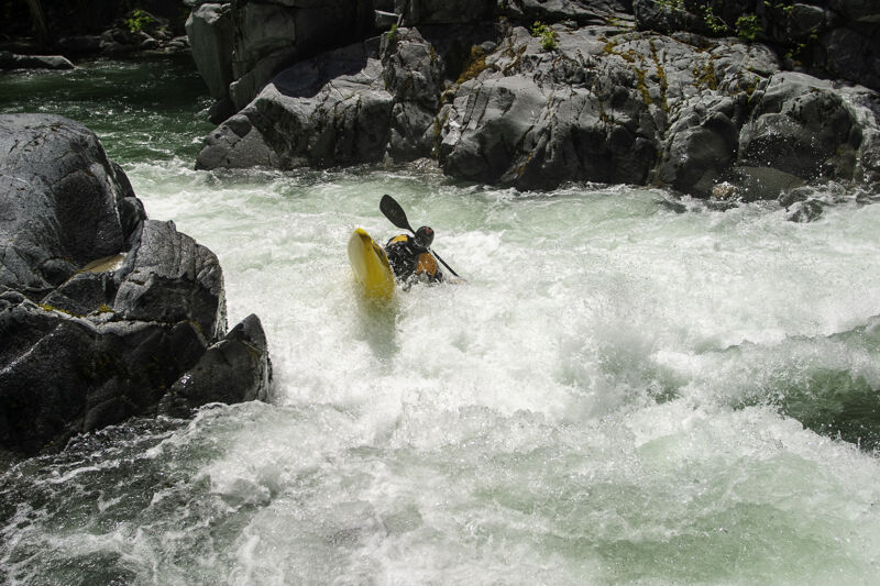
The Fat Lady Sings is the only truly named rapid on Wooley Creek and, fittingly, marks the last major drop on the run—though not the final rapid. It’s a series of boulder-formed pourovers that is technical at low flows and pushy with big holes at higher flows. Often cited as the run’s biggest rapid, that title is arguable, with the double drop just upstream also in contention. Boat-scout from river left before entering the main flow, or scout from the right bank for a more conservative look. The primary portage route is on the right, but re-entry can be tricky. At low flows, it may be possible to run partway down the left and then portage from the river-left boulder bar.
If it's not over until the fat lady sings, and then there's more, that must be the encore. The next rapid below The Fat Lady Sings is a straightforward III+ drop. Though there are even more rapids downstream of here, all of them are less difficult.
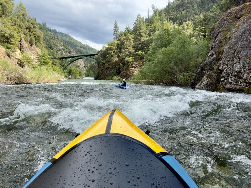
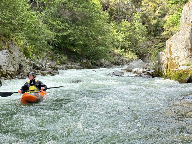
Wooley Creek enters the Salmon River straight on, making for a confusing view that seems as if you will paddle upriver on the Salmon beneath the green arch of the Steinacher bridge. To get to the take-out, continue downstream on the Salmon River's Butler Run for about a half mile to reach the Brannon Bar River Access just downstream of the Salmon River Road bridge (that locals confusingly refer to as the Wooley Creek bridge).
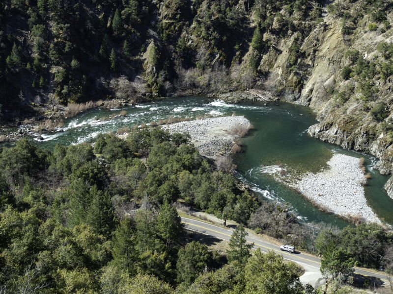
Take out on river right at the Brannon Bar River Access, located off Salmon River Road about 3.5 miles upriver from Highway 96 in Somes Bar. The parking area for the river access is on the opposite side of Salmon River Road. The area closer to the river is reserved for loading/unloading only.
May 25, 2025
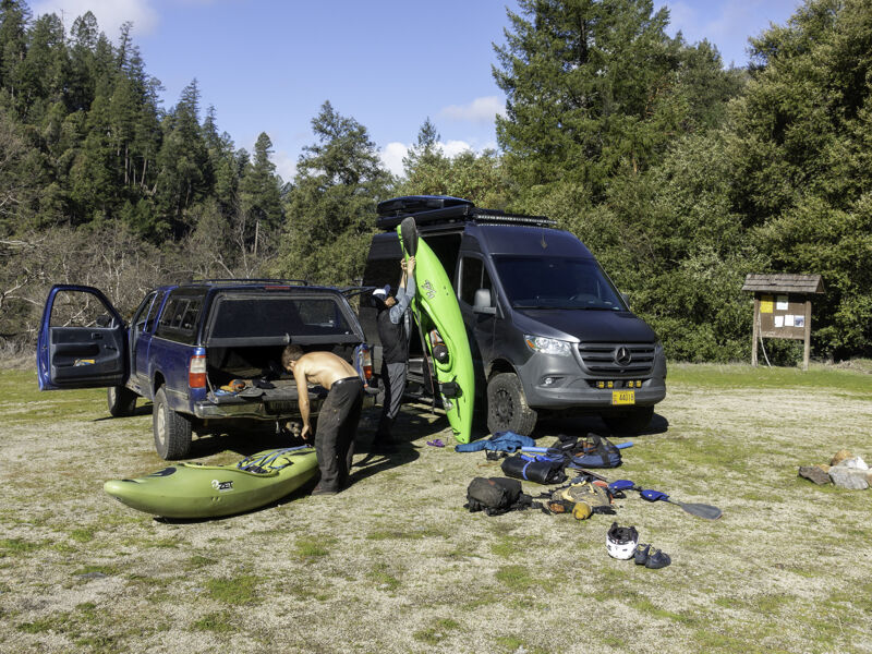
Second Wooley run in the past two weeks. After a warm day prior (90°F), flows bumped up about 10% from the previous day’s peak, reaching 3,300 cfs at the Somes Bar gage. We boated Wooley on the diurnal drop from that overnight peak. Compared to two weeks earlier—when we ran it on the drop from a 4,200 cfs peak—it wasn’t much lower, and certainly not enough to change the creek’s pace or power. It was juicy (in a good way), though that made things more challenging for the two packrafters in our group of three.
We started hiking at 8:40 a.m. and were shaded by marine layer clouds and terrain for the steep climb from the trailhead. We kept a moderate pace, more or less at the speed of the kayak hiker. Total hike time was 3.5 hours—about an hour longer than my hike two weeks prior. That’s been my experience: for various reasons, the hike takes somewhere between 2.5 and 4 hours.
I paddled my Alpacka Mage again. It’s a delight on the trail at 32 pounds with all my gear, food, and water. It’s also a delight on the water—though Wooley pushes it to its limits. The Valkyrie is the better choice, and Jim had one.
Boating started with a bang at the first rapid. With slightly lower flow, the line in the entry narrowed and forced us further left into the edge of a big curler off the bank. It didn’t go well for the packrafters—Jim and I both swam, briefly, into the river right eddy.
After that rough start, Jim and I portaged the third significant rapid—one of the tallest and most powerful on the run. Geoff aced it, as he did with all the drops all day.
Jim and I each had one more swim in the second gorge. Not ideal, but both were short and into eddies, with no drama. One downside of the Mage is how hard it is to roll, and its large tubes make every hit feel big.
Jim opted to skip the lower gorge and hike out on the Wooley Creek Trail from Deer Lick Creek. Geoff and I continued slowly, scouting the long, complex rapid that forms the crux of the run—and that can’t be fully portaged. A strainer lurks not far downstream, and I’d had a close call swimming over it two weeks prior. I’d hoped scouting would give me the confidence to run it clean, but the opposite happened—I couldn’t envision a clean packraft line through the stacked holes and laterals. With no full portage option, I ran the entry, caught a small left eddy, portaged the heart of the drop, and re-entered where the canyon walls required to run the final river-wide hole. That took the teeth out of it, and I made it through clean. Geoff ran the whole thing.
The strainer just downstream looked worse with a bit more water—logs were now partially exposed, not buried. Geoff barely squeezed through far left, skimming the logs. I portaged right.
The hole in the middle of Fat Lady Sings was big, so I portaged that too—bringing my total to three. I’d have run all of them in my kayak, but not in the packraft. That’s the tradeoff: easier hike, higher swim likelihood. It’s a questionable bargain when Wooley is on the high end of medium. I plan to return at 2,500 cfs—a true medium—which I think is the sweet spot for the packraft compromise, particularly in the Mage.
We took our time in the final gorge—and never moved fast all day. Total paddle time: 3.5 hours. With the hike, transition, and lunch the total mission was 7.5 hours.
May 11, 2025
The last day of the 2025 Salmon River Whitewater Gathering was the perfect May day to hike into Wooley: cool, completely overcast, which is great for the hike. The Somes Bar gage on the mainstem Salmon River peaked overnight at 4,230 cfs ans was reading about 4,000 cfs and dropping when we got on the creek. That gage doesn’t measure Wooley directly, but since Wooley’s watershed is about 20% of the total Salmon watershed, the rule of thumb says Wooley should be carrying about 20% of that flow.
That rule didn’t quite hold today—Wooley looked like it was running more than expected. Based on photo comparisons from previous runs, I’d say it matched what I've seen before at 4,800 cfs. So, bigger than anticipated, but not quite high water. Still, it was on the higher end of medium—pushy and padded out, fast in the rapids, but with eddies and breaks between the drops: a great flow.
The hike in took me 2 hours and 29 minutes carryin a 32-pound pack with a packraft and all my gear. The fastest kayaker was only about 15 minutes behind, and the rest of the crew made it in around the 3-hour mark—which is pretty good for that approach. There were no trees blocking the trail and only one burned log that required stepping over.
This was my second packraft run of Wooley, and this time I paddled the Alpacka Mage, a huge upgrade from the oversized Gnarwhal I used before. The ability to edge and control the boat made a massive difference.
On my first packraft run, I portaged two drops I felt were guaranteed Gnarwhal-eaters. This time, I ran both. The higher flow actually helped—though both rapids (the first and third major drops) were pretty juiced. The Mage gave me the control I needed, and I managed to roll back up when I flipped near the bottom of the first one—then again in another rapid in the second gorge.
We moved fast on the water and were probably on track for a sub-hour descent…until we had two simultaneous swims in what I think is the crux of the run: a long, hole-studded rapid in the lower gorge, a few bends upstream of The Fat Lady Sings. Yes, I was one of the swimmers. I swam hard in the runout, but couldn’t reach shore before a big sloping log downstream. That log has others pinned beneath it, blocking nearly the full width of the creek. Luckily, the water was just high enough that the creek-spanning logs were barely submerged (which means not visible too), and I was able to float flat on my back and over them. They brushed the back of my PFD. Close call.
The crew got me reunited with my packraft pretty easily, but both my paddle and the other swimmer’s paddle had gone downstream—along with his kayak. With no boat, no paddle, and vertical gorge walls cutting off downstream travel, he had to climb out the insanely steep bank and hike back to the trailhead.
We found the lost paddles and kayak stuck in a swirly eddy on the right not far downstream. What followed was the real clown show of the day: herding a boaterless kayak down the last 1.5 miles of Wooley. It filled with water constantly, caught multiple eddies, got pinned in a log jam, and at one point ran me over in a whirlpool eddy while another kayaker with no paddle and no skirt was swirling against me too—triggering what I consider a clown show swim that doesn't really count. That last mile took us about an hour and a half, maybe longer--then the boat caught one ore recirculating eddy on the Salmon.
Just as we reached the take-out at Brannon Bar, the first patters of a light rain began to fall. We started hiking at 10:40 AM and got off the river by 5:00 PM. Not bad, all things considered.
Mar 26, 2023
Winter is hanging on into spring 2023 on the Salmon River and after a cold morning start, we rolled from home in Forks of Salmon downriver to the Wooley Creek Trailhead to embark on what is almost certainly the first Wooley Creek run of 2023. The sun was out, the mountains frosted and snow-capped, and temperatures were perfect for a day of hiking and boating: about 50ºF for a high.
Our group of three included two kayakers and myself, a kayaker normally but today a packrafter. After having hiked into Wooley probably 12 times over the years, I decided a lighter boat was appealing.
So, with good flows on this beautful March day in 2023, I strapped a large Alpacka Gnarwhal (10 pounds) onto my pack and started the hike with my friends and their much heavier kayak loads. The seven-mile hike is always worth the effort but it took extra effort this time due to about 35 downed trees on the hike in. Unlike the kayakers, I was able to walk over, around, or crawl under all of them. Still, it added effort and about an hour to the hike. With breaks and time hanging out with the slower kayak-laden hikers, the hike took me 4 hours and 15 minutes.
I'm quite confident on Wooley Creek in a kayak but, to be honest, I was a bit apprehensive to take it on in a packraft, especially one that is a size too large for me and not known for its technical performance on tight creeks. I've only paddled a packraft maybe 12 times, and I've had more swims in out of one than in my last 25 years in a kayak. Heading into a committing wilderness IV/V creek run had me nervous but also feeling ready. It would be an adventure, which is what this is all about.
As usual, we got on the creek later than we'd hoped to but still had some glorious sun at the start. At 2,550 cfs at Somes Bar gage, this was the low end of a medium flow but it was perfect for the day. We put on around 4:25 pm.
After one barely do-able log duck not far below the put-in, we came upon the sharp left bend that signals the first significant rapid and the start of the first gorge. I scouted because the glimpse I got of it on the hike in made me think it would be a challenge in the packraft. The current piled onto the river left rock wall and folded back on itself at the first of three consecutive drops. What would've been a simple move in a kayak would almost surely have been a flip in the packraft, so I walked it. And I walked the next big one too for much the same reason. I know the Alpacka Valkyrie is the kayaker's packraft and its ability to edge makes it better adapted to these types of lateral curlers that challenge the Gnarwhal. If you have one, bring it for this run. That said, the Gnarwhal was capable and I soon eased into it and ran all the other rapids except one that had a nasty piece of wood in the main line.
The creek was a gorgeous, translucent emerald and sun on the ridges above helped illuminate the inner canyon. Waterfalls poured in from all the tributary creeks, adding beauty and making it unecessary to drink from a bottle.
We had a touch of drama with a kayak swim that required the paddler to hike part of the next rapid then swim its runout through a vertical-walled canyon to get back to his kayak below. Already short on daylight, we didn't have time for any further drama but we all held it together and before we knew it we were entering the third and final gorge and headed for the some of the run's biggest rapids. We all portaged a nasty creek-spanning wood jam in swift current between drops here.
By this point I was feeling pretty confident in the packraft but the kinda stout ledge drop above The Fat Lady Sings had me worried all day. It can easily throttle a kayak. Turned out fine. Same for The Fat Lady Sings. We floated out of Wooley and onto the Salmon River just as a car was driving upriver, headlights on. Another great Wooley day done! A thin crescent moon lit the sky as we loaded up at Brannons Bar and cruised back to Forks for a hot dinner. Wooley is always such a special experience.
Update: the downed trees on the trail were cleared by the Siskiyou Mountain Club in late April 2023. According to boaters who ran Wooley on May 6, 2023, only the creek-spanning wood hazard in the lower gorge remained after the high flows of late April.
Feb 20, 2021
Great late-day winter run on Wooley with a mixed group of local, semi-local, and out-of-area kayakers.
It had been a while since I’d seen Wooley at these flows, and it was a great reminder of just how fun this creek can be.
The hike in felt especially long and took us about four hours. A few downed trees on the trail added some delay, but the real factor was probably our group of eight—we took a lot of breaks. We finally got on the water around 3:30 PM.
By the time we reached Brannons Bar, it was after 5 PM and already dusky. Despite the fading light, four of us decided to continue downstream—we had a shuttle set at Dolans Bar on the Klamath. It was dark when we reached the confluence with the Klamath, and truly dark by the time we passed Little Ike. It's amazing how you can run big rapids in the dark. We literally used starlight to guide us in to Dolans Bar.
The Klamath was running about 12,000 cfs, which feels especially huge at night. It was wild to start on a small creek with maybe 500 cfs at the put-in, then merge into the Salmon at 4,500 cfs, and finally into the Klamath at 12,000 cfs—all in one continuous trip.
Next time: start earlier, hike faster.
Feb 27, 2019
The 'easier trail' mentioned above should probably be deleted. A few years back a group from OR was dropped off at the end of the road, with the driver taking off before really checking things out. So there was no way out but down and no real trail at that point. Turned into an ugly fiasco. The trail is still a future possibility. I talked to various people about it. Someone from local firefighting unit thought it sounded like a viable trail for firefighting efforts and Steindorf agreed it sounded interesting for river access. BUT (and a big one) is that it would need concerted effort from various agencies to ever make it happen. After a fire that road access fell apart, so Forest Service would need to clear the road and approve the work. No chain saws in wilderness so people with big pull saws, etc. Would be awesome though!!
Apr 22, 2006
Another great day on Wooley, just two of us local boaters hiked in to Wooley Camp. Came across an abandoned army jacket at the point at the top of the climb overlooking the Salmon River, a spot known to locals as Joint Point and the jacket's owner packed appropriate equipment in a pocket then left it behind to be found.
Didn't take many photos on the creek, as is often the case, but it was gorgeous sunny day at a great level.