Rockcastle
Beech Creek to Bee Rock Campground (5 miles)(Lower Rockcastle)
| Difficulty | III-IV |
| Length | 15 mi |
| Avg Gradient | 11 fpm |
| Permit | No permit required, backcountry camping permits are required for the Daniel Boone National Forest and there are fees to camp at Bee Rock Campground. |
| Gauge | Rockcastle River at Billows, Ky |
| Flow Rate as of 35 minutes | 292 cfslow runnable |
| Reach Info Last Updated | March 27, 2014 |
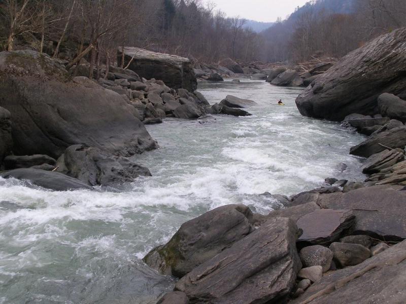
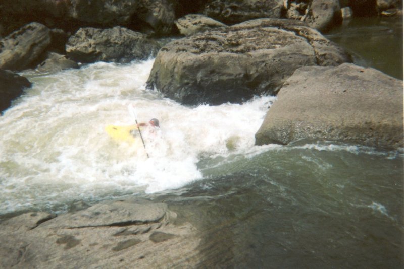
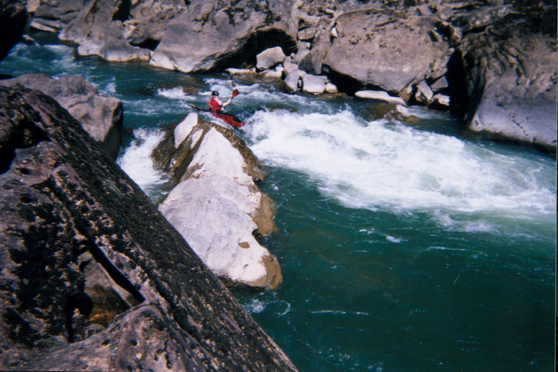
Classic Cumberland Plateau boating. This narrow river has sections of whitewater to give any capable boater goose bumps. The narrows section is representative of the boulder choked, undercut, and sieved rapid-pool style whitewater associated with the Cumberland Plateau.
Class IV Beech Narrows is the only non-read-and-run rapid, making this 1.5 mile section of whitewater perfect for all skill levels. While remote and wild this section also has trails following the river on both sides eventually ending downstream at Bee Rock Campground. The Rockcastle Narrows sections becomes very pushy and has a bigger water feel at levels above 1000 CFS. Bring your reliable roll when paddling this remote section of whitewater beauty.
In January 2007 the U.S. Army Corps of Engineers announced an emergency drawdown of Lake Cumberland, which the Rockcastle is a tributary of. After 7 years and nearly $1 billion dollars the dam repairs were reported by the USACE to have been completed. The lake will resume its normal summer pool level of 723 feet above sea level in Spring of 2014. If you have paddled this river in the past 7 years there are some significant rapids that will be inundated below the pool level, possibly including Crybaby and Guy's Surprise. This will obviously create a much longer flat paddle to the takeout but provide an opportunity for a non-shuttle method to paddle and walk the trail onf river left to run what rapids that arent under the lakes pool.
A 25 minute park and hike-in shuttle takes the old monster drive/shuttle out of play. It is the 503 Trail that also connects to the 529 trail at Bee Rock Campground making the shuttle completely hikeable (~50 minutes). This completely takes out all the flat water sections of the Rockcastle except that between Beech and Lower Narrows. The 503 trail actually hits the river downstream of Beech Narrows so you will probaby want ot turn left (upstream) when you intersect with the riverside
...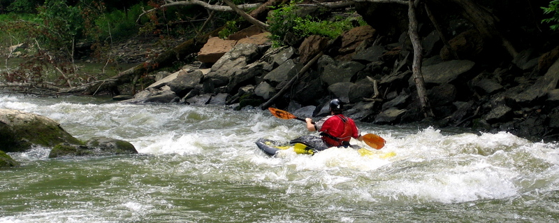
Wave train right down the middle with a couple of nice surfs thrown in.
Spalding Hurst contributes: Very fun. Run multiple times, portage back up on river left, it's easier.
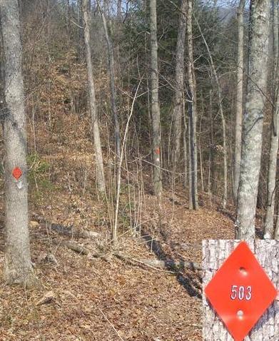
A 25 minute park and hike-in shuttle takes the old monster drive/shuttle out of play. It is the 503 Trail that also connects to the 529 trail at Bee Rock Campground making the shuttle completely hikeable (~50 minutes). This completely takes out all the flat water sections of the Rockcastle except that between Beech and Lower Narrows.
From Bee Rock take 192 west two miles then turn right onto Close Rd. Two (2) miles in be on the lookout for orange diamond shaped trail markers(labled 503) on the trees about 8 feet up on the left side of the road. Parking is immediately ahead on both sides of the road. Park off the road as there is regular traffic here. Never block road gates in the National Forest they are there for emergency purposes.
Meaty pourover in the middle as a main line with alternate lines on the right and left. Undercuts galore downstream. Always scout as this one is different each time you see it.
Spalding Hurst contributes: Alright to run at very low levels like 140cfs. 300cfs and up the rapid is mean. At a high level there may be a left side chute available. Portage on the left.
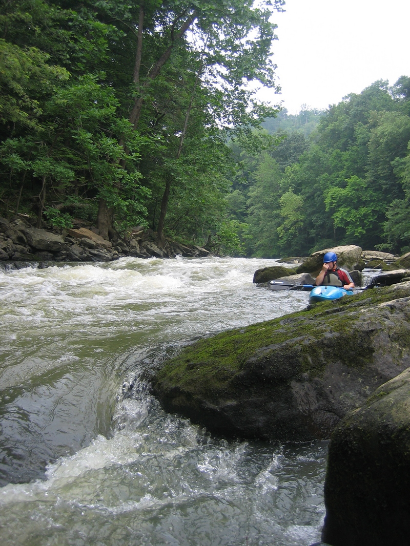
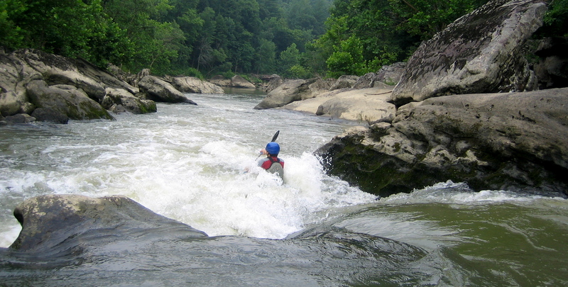
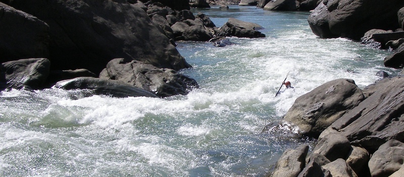
The Lower Narrows begins here at the sharp right hand turn in the river. From a distance it appears the river ends. This section greatly varies in its difficulty depending on water levels.
A series of 3 sucessive class II drops that alternate in direction. Pictured is the middle drop looking into the third.
This is where the narrows starts picking up and the fun begins. At high water this one and the next 3 drops are all one rapid.
Spalding Hurst Contributes: This one looks mean, even meaner from scouting above it on a rock. But, it is very straight forward. There is a tongue to ride straight down it. It is a big drop and can be run on the left or right of center, but we all preferred left of center.
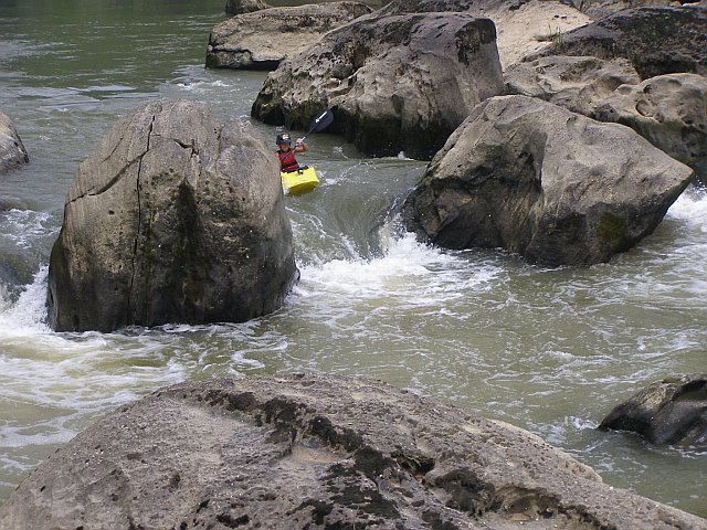
Spalding Hurst contributes: Rapid 03 (II+) This a entrance rapid for the next one. It's small ledge drop, you have to catch an eddy on the right or left afterwards to setup for the next rapid.
Rapid 04 (III)
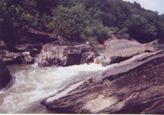
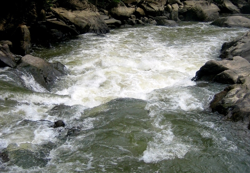
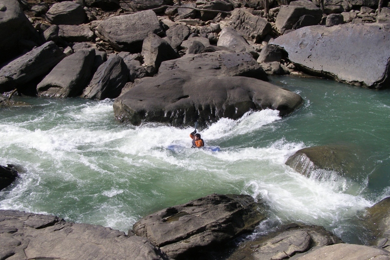
Last big rapid of the narrows. There is sneak along the left that is shallow and rocky but bypasses the big meat of the rapid. Run the meat in the center, right of a rock that sticks up and run it towards the left at the drop. The drop is diagonal with a large hole on the right.
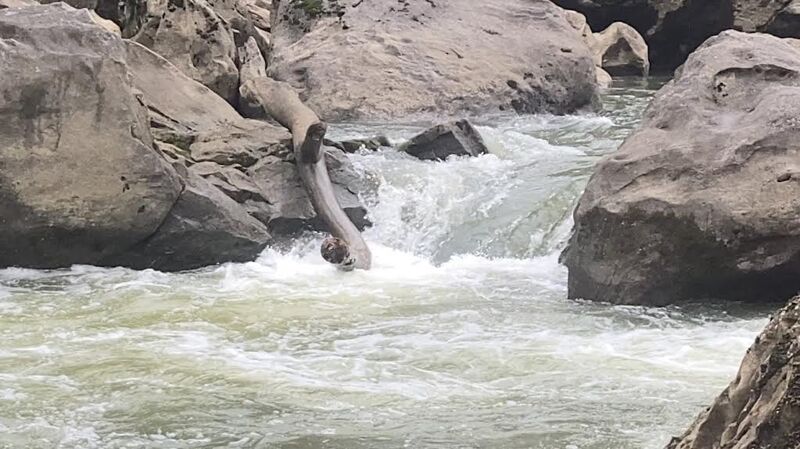
AVOID river right on this rapid, it is severely undercut and sieved
At normal summer pool levels for Lake Cumberland this rapid will likely be inundated by the pool and wont be a part of the run any longer. When the annual drawdown occurs in late summer/fall it will be present. Wave train of alternating diagonal waves/holes. Watch for OS rocks on the right and the funky water about half way down. This is the end of the continuous section of the lower narrows. There are pinning spots galore in this rapid so beware. At levels 400 and below there is a large rock in the center of the washout.
At normal summer pool levels for Lake Cumberland this rapid will likely be inundated by the pool and wont be a part of the run any longer.
Drop in the middle or boof right on the left side. Under Lake Cumberland most of the year, this is a surprise drop after the lower narrows have ended and a short flatwater paddle makes you think you have made it to the end. Until you look downstream at ... a Channeled drop leading into successive holes at the bottom above 600 cfs. Below that level the main hole(Big and perfect for play) is gone. The takeout at Bee Rock is a very short distance from here. At high water there are offset holes and waves.
Located on Highway 192 between London and Somerset, KY. Quality Parking on the river right past the campground at the 503 trailhead or on river left on down a few hundred feet. Both sides are part of Bee Rock Campground.
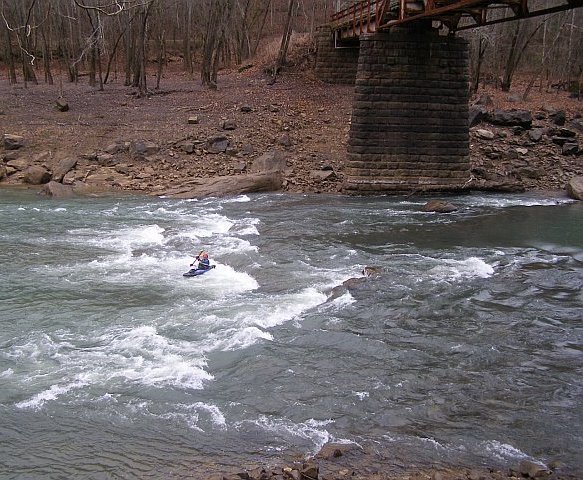
At normal summer pool levels for Lake Cumberland this rapid will likely be inundated by the pool and wont be a part of the run any longer. Past the boat ramp take out is the small bridge that crosses the river down stream. There is also a rapid underneath. This gives you a few hundred feet more past the normal takeout.
Mar 26, 2016
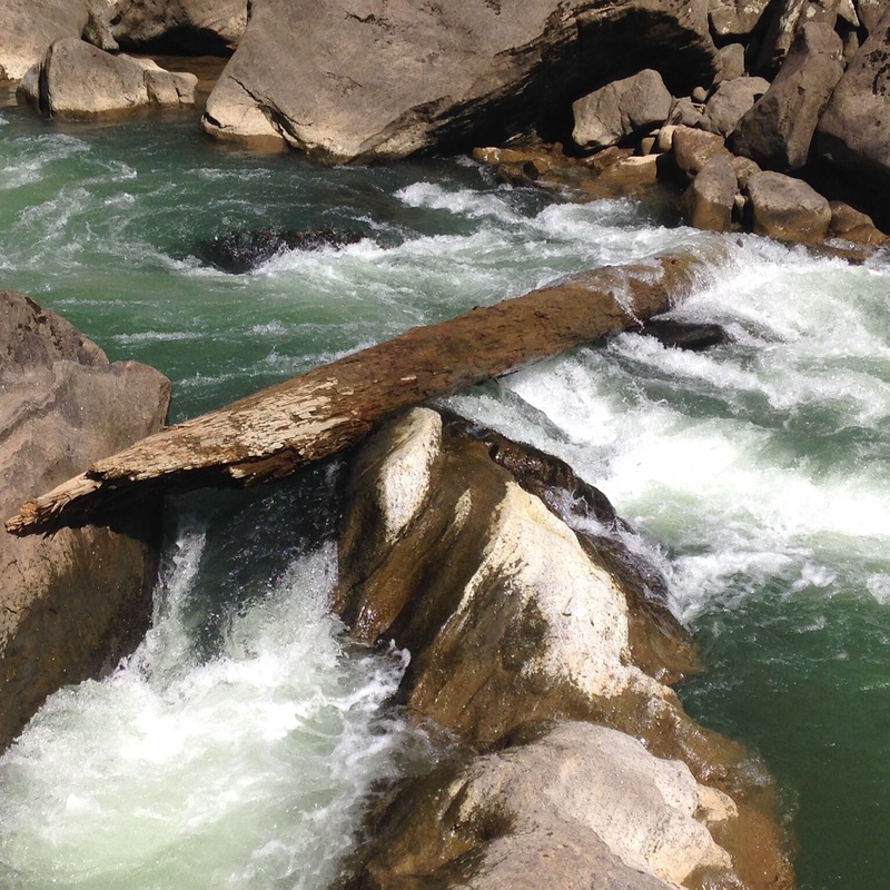
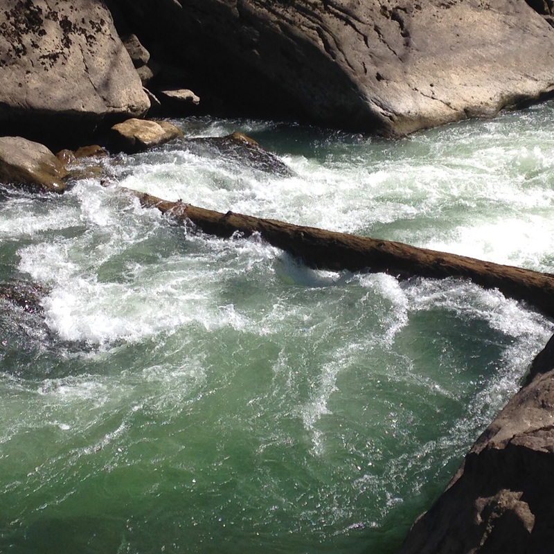
There is a river wide tree on drop 2 3-21-16
Mar 24, 2011
As a response to the comment below, I will add my opinion on levels. I personally believe that the Rockcastle is much more forgiving at levels below 800cfs. At these lower levels there is more time to react, more eddies to catch and not as much push. I think it is a III/IV run in this range, with Beech Narrows and Teeth possibly being IV's. Once you get much over 1000cfs I believe the whole run works it's way into the IV range. The lower narrows section turns into one class IV rapid that's a half-mile long, with push and holes to avoid. At 5000cfs, Beech becomes a significant V, while the lower narrows turns into upper Gauley quality stuff.
I will agree that levels over 1000cfs are a lot of fun, and class IV boaters should enjoy this range. However, I think it is misleading to suggest that 1500cfs is easier or safer than 300cfs. The again, I could be wrong. I have over 100 runs on this stretch from 60cfs to 5000 cfs and this is just my opinion.
Dec 4, 2009
This river is one of Kentucky's best for many reasons. The beauty of the rock structures, giving this river its name is one. Two, the rapid section from beech to bee rock above 2500cfs is some of the best set of rapids you will find in this state. I have run this section at 3200cfs and it is a blast, but starting to flush. 2200cfs to 2500cfs is the best level for surfing. There are a hand full of surf spots that you can play in until your heart desires, or until you are so tired that you think you may have to save some energy to procede to take out. Don't let high cfs #'s turn you off of this section. I think that this river is more dangerous at lower levels, ie 800cfs or below, than above 1500cfs. Be safe and have fun but always know your skill level. This section of river is a true Class IV river, at low or high water.
Sep 21, 2009
IMO the minimum for this run is closer to 80 cfs. The lowest I've run it is ~100 cfs and all the drops were totally doable without having to worry about scraping your boat up. Also, the gauge is about 16 miles upstream from the Narrows with a good number of tributaries in-between. As a guess, it takes about 8-12 hours for the water at the gauge to reach the Narrows and depending on where rain falls the tributaries can add a significant amount to the gauge reading. Expect the gauge to bump 1-2 days after a good rain.