Kettle
B) Banning State Park to Sandstone (2.8 or 4.3 miles)
| Difficulty | II-III(IV) |
| Length | 4.3 mi |
| Avg Gradient | 9 fpm |
| Gauge | Kettle River Below Sandstone, Mn |
| Flow Rate as of 1 hour | 410 cfsIIlow runnable |
| Reach Info Last Updated | April 2, 2019 |
Quick Facts:
Location: Sandstone, MN, about 82 miles N of Minneapolis/St.Paul, 56 miles SW of Duluth.
Shuttle Length: 7.4 miles. (See details in 'Directions' Tab.)
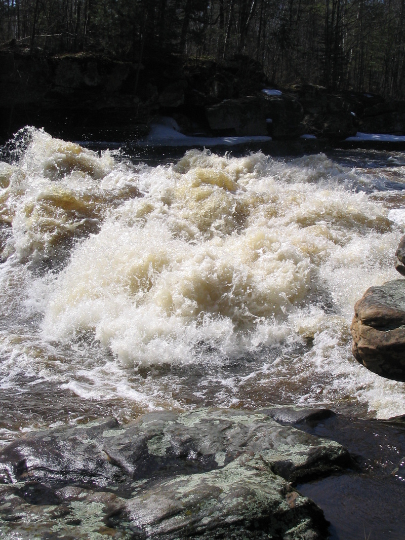
Character: Bedrock riverbed creates wonderful waves and holes. The rivername is appropriate as there are areas with various sized 'kettles' scoured out in the bedrock.
Drainage: 868 sq.mi. (at gauge site 2 miles downstream of take-out).
Put-in is approximately 1000' elevation.
Take-out is approximately 960' elevation.
Thus total elevation change is approximately 40'.
General Overview
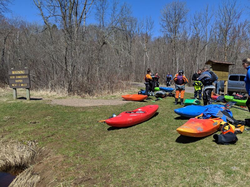
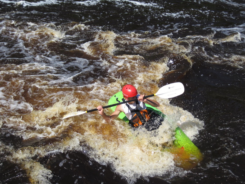
A popular playboating reach, with a few good surfing waves and holes. Caution should be exercised due to shallowness at most levels, and the existence of undercuts.
Put-in as listed is a roadside public access at the Hwy.23 bridge. However, the run from from there begins with 1.5 miles of flatwater paddling. Therefore, many (most) boaters opt to pay a park entrance fee at Banning State Park, to drive to a launch site which puts you in the river immediately above the first drop sequence, resulting in a run of 2.8 miles. Total elevation change is so little effected (no appreciable gradient loss in the 1.5 miles of flatwater), so overall gradient comes up to 14 fpm.
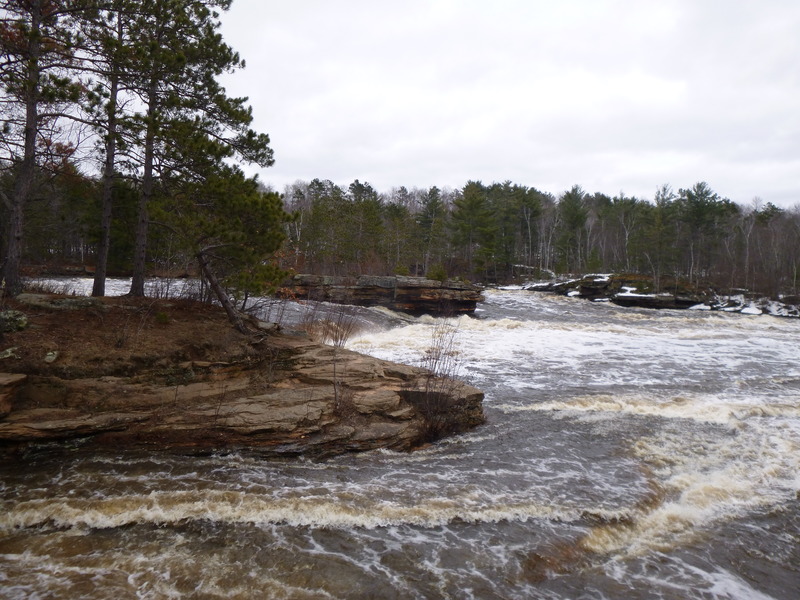
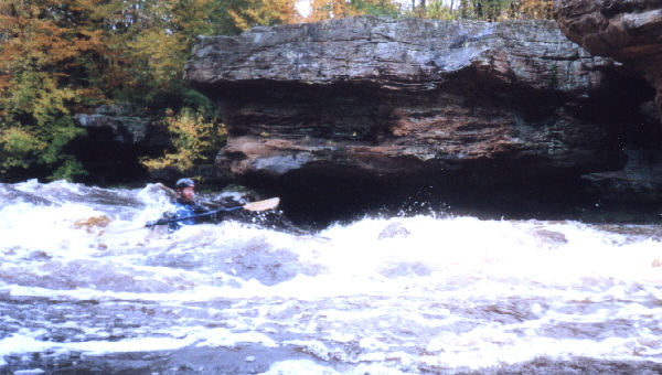
The first major rapids on this reach is Blueberry Slide. Two steeper pitches create a couple good holes and standing waves, including Shoulder Hole, Teachers and Teacher's Pet. Next up is Mother's Delight, and Dragon's Tooth, where the river rushes through steep boulder-bed rapids into a short, narrow canyon with sandstone walls which are severely undercut. This should not cause any problems under 1000cfs. In high water, large waves and holes may form here.
Caution: Holes in both parts of this dells tend to feed paddlers into the undercut right wall. Stay well to the left (at high water) to avoid this fate.
This is fo
...
Rather than using the listed public access (at Hwy.23), most boaters opt to pay the entrance fee to use this access in Banning State Park. Doing so cuts off 1.5 miles of nothing but flatwater.
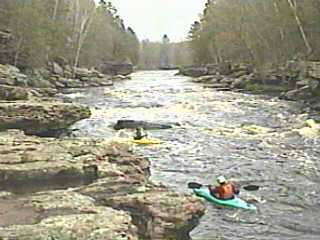
This 'entrance drop' lies immediately downstream of the river access in Banning State Park. Deepest flow is to river-left, through a great sequence of waves and holes. Named features down this stretch include Shoulder Hole, Teachers, Teacher's Pet, Mother's Delight, and Dragon's Tooth.
The following video (courtesy MnktoDave and YouTube) shows some great open-boat surfing at high water.
It also shows the undercut at Dragon's Tooth, as a kayaker deftly paddles by.
Passing the ruins of the town of Banning, you reach Hell's Gate, a long, boulder-bed rapids leading to the end of the Dalles. At levels up to about 1000cfs (more-or-less, depending on your tastes), this offers some of the best play on the river, with generally enough push and depth for surf and squirt maneuvers.
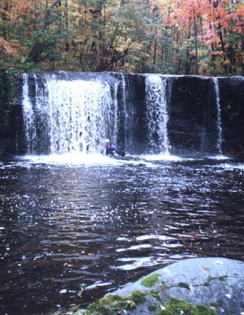
Shortly downstream from Devil's Gate, Wolf Creek enters from the right. Land on shore a ways before the mouth of the creek for the shortest carry across a narrow spit of land to get to Wolf Creek Falls A waterfall (about 10-15') drops into a fine pool. If you are here during peak runoff or after a good rain, put-in just above the drop, or carry a ways up this creek to have a fun flush with a great almost goof-proof boof at the end.
Quarry Rapids is formed by a broken-down dam/rubble-field, creating a class II with sharp boulders churning the flow. A wide smooth wave normally forms at the top of this drop. Bottom left of the drop (at higher levels) tends to form a somewhat sticky looking hole, while the right is a fine flush into great swirls in the pool below. Many cautious/timid boaters forego any play here over concerns about flipping onto the shallow rocky rubble.
A mile-and-a-half downstream of the usual take-out lies Big Spring Falls. (Some of the local boaters refer to it as Triple Drop, in reference to there being up to three separate falls across the width of the river to take your pick from when running this area.) At times of high flow, a far-right channel provides a fun 'bypass' route. An island splits the main channel. The right side cascades over a waterfall, with a steep, fast 'tongue' alongside the island. At the base of this tongue, a hole forms, which changes greatly at different water levels. By some reports, it has been a sweet, friendly surf at levels around 2500-3000cfs, but sticky and nasty between 2000-2500. The leftmost channel of the river drops over a ledge and twists through boulder-filled ledges. Again, there are some bad undercuts, so caution is advised for any who venture down here.
One more bit of gradient, before things peter out.
Jun 4, 2021
Click subscribe if you find the river guide useful:
https://youtu.be/N0dyMaCMnGQ
May 4, 2019
3 foot rock located at the put in was just a little out of the water
Oct 15, 2002
The falls have been run. The landing area is shallow though.
Catchin the small wave at Teacher's. Even at this level contacting the bottom with one's head is possible. Tuck tight and roll quick.
At this level, a side channel opens up near the bottom of Blueberry Slide. It's possible to paddle upstream a short ways from the put-in, enter the side channel and run the ledge. At higher flows it might either be a lot of fun or turn into a nasty hydraulic.