Presque Isle
D) 'Bottom Presque': South Boundary Rd to Lake Superior (1.1 miles)
| Difficulty | IV-V |
| Length | 1.1 mi |
| Avg Gradient | 115 fpm |
| Gauge | Presque Isle River Near Connorville, Mi |
| Flow Rate as of 55 minutes | 50 cfsbelow recommended |
| Reach Info Last Updated | September 27, 2020 |
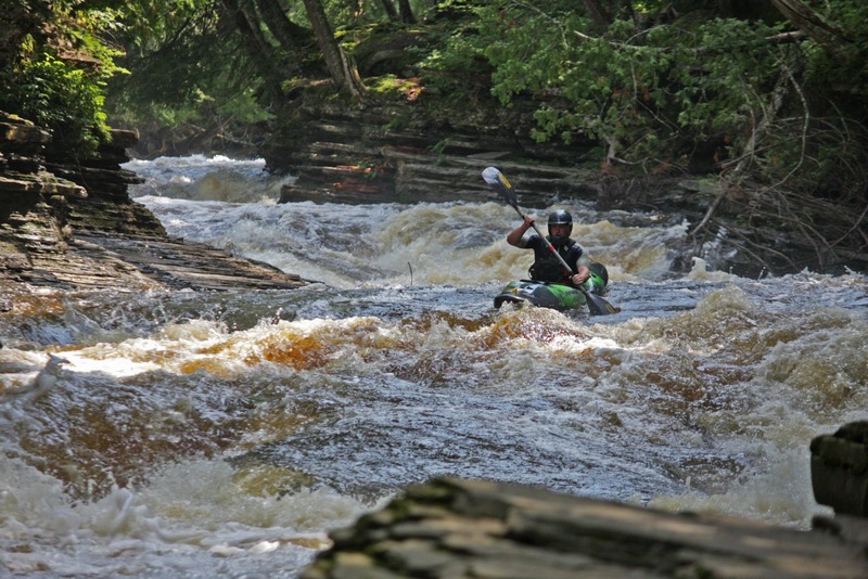
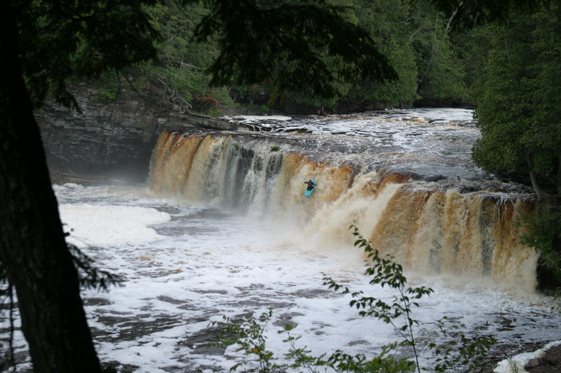
This short section contains four big drops: Nawadaha, Manido, Manabezho, and Swinging Bridge (along with a few lesser drops). All can be run by confident, experienced paddlers. All others will enjoy the impressive views (perhaps before or after running some upper reaches of this river).
The following video gives a good view of the drops on this run at ~550 cfs:
Put-in for this section is at South Boundary Road, just off Presque Isle Road.
The USGS gauge has been at this location since June, 2023.
We do not presently have good info from boaters about best ranges for this section! Please contribute your input by providing a 'Trip Report' stating the reported gauge reading, and your impressions of the run: too low (total boat abuse!), low-boatable (somewhat scrapey, but worthwhile), moderate-boatable (the sweet spot of flows), high-boatable (kinda hairy/scary), or too high (for mere mortal boaters).

USGS lists a site here with drainage area of 358 square miles.
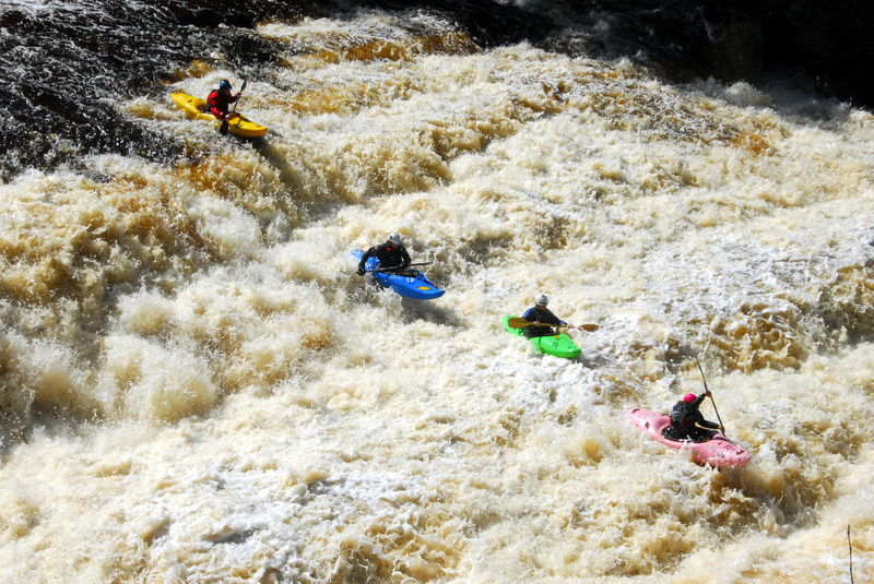
Pick a line that you like! Depending upon where you run this, it may be an easy, sliding drop (far left), a series of short ledge drops (more toward the center), or a big ledge to launch a boof (well to river-right).
A bigger series of short ledge drops.
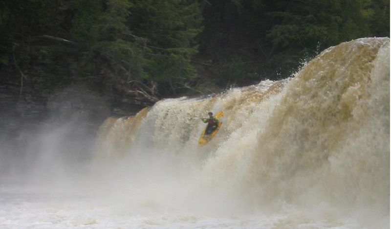
An impressive wide sheer falls, and a definite 'photo-op' (opportunity for great photo/video). This has reportedly been run quite a number of places across its width, though the most common is fairly well (though not 'tight') to river-left, aiming to launch off a 'point' extending a bit further out (downstream). At most flows, there apparently is sufficient depth to either 'boof' or 'pencil' (according to reports), though at least one boater has suffered a nasty piton resulting in boat and body damage.
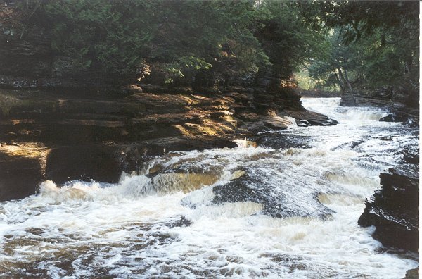
Just below Manabezho, will be a series of waves and holes (some of which may be a bit aggressive!) leading toward a LARGE island. By far the majority of the flow heads to the left. (Only at times of quite elevated flows will there be anything more than a trickle or rivulet down the right side.) As the left side heads down to pass under a suspension footbridge, you'll encounter quite a chaotic rush. It is impressive to come here at low flows to see the kettles scoured into the bedrock through this area. (Once you've seen this area 'dry', you'll see how being upside-down or out of your boat through here could be brutal.) As you pass under the footbridge the current slows as you head toward Lake Superior.
Take out anywhere you can reasonably get ashore past the swinging bridge. (Many folks like to dirft out into Lake Superior to do a celebratory roll in the ' Gitche Gumee'.)
Dec 2, 2013
Low water, the only real 'boatable' rapid at this level. Everything upstream was a portage/scrape down
Nov 1, 2013
Ran the Lower Presque Isle October 27th, 2013 at 6.1 on the South Boundary Rd. bridge gauge. Earlier this year there was a massive log jam river left against the middle bridge pillar and the shore which blocked a lot of the flow from running against the gauge. The park has cut out the jam, so the bridge reading is accurate as of 10/27/13. The only issue is new wood along the run below the bridge. The wood on the right side boof of Nawadaha Falls is still there, but looks cleaner than last year. We were able to run everything fine, with only Manido Falls presenting an issue running river left, as a small diameter log is laying ~8' off the left bank pointed downstream. We skirted the log on the right, still pretty close to 'main line' on the left side. Center right on Manabezho Falls has a pretty massive log laying up against the falls, which was there earlier this year. A small tree is still dangling over the left line in Zoom Flume. Where the river splits (left is Zoom Flume and right channel only runs with a lot of water), right channel had a huge log teetering over the edge (which we pushed in earlier this year) has floated away. This means the Presque must have had a big water event this past summer!