The River Summary Tool
The river summary tool allows you to quickly assess the rivers in a given area to determine what might potentially be running. This table set up by our national, state, and regional stream team editors and represents their best estimates of when a river may or may not be running. Gauge data comes into her system from a variety of data including flood warning systems found on the Internet, hydrologic data found on the Internet, and manual gauge reporting by our users. Not all of these systems are 100% reliable to please check the validity of the source before driving out to the river. Common sense, attention to the stream editors' river and gauge descriptions, consultation with local experts, and checking into the source of the gauge information would be wise before making any paddling decision based on automated system.
In our summary tool, green means that a river is running. All other colors are not advisable for general hard-boat navigatability. Within the color green we further define the range of runnable. Numbers are assigned from 0 to 9, from lowest to highest, to describe where in the range of runnable the most recently updated gauge indicates. Therefore, “R0” is low but runnable whereas”R9” is high and runnable. Stream editors have the capability to set these levels so that low can appear in the middle of a flow range and can also define difficulty ranges that vary based on flow.
For example, the Gauley River at flows below 800 CFS is used by local outfitters to run a ducky trip and is class III. At 1000 CFS the river takes on this more it's typical class IV/V character, but it is bony and low. At 2000 or more CFS, most people would agree that the Gauley becomes a class V river and above 5,000 CFS, most people would not choose to kayak the river.
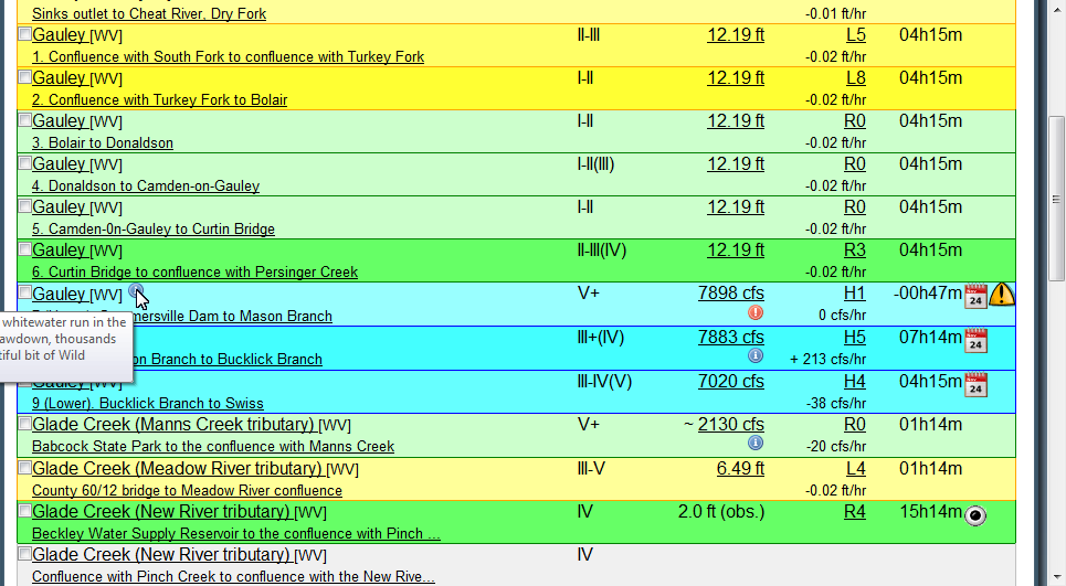
To get to the Gauley River, I can go to the West Virginia State summary and click on the table header to sort by any of the top-level headings. By default, rivers are sorted by name alphabetically. I can also choose to search for rivers that start with “Ga” in the State of West Virginia by using the search option at the top of the page.
By looking at the example entry for the Gauley River in the figure above, you will see that the river name is hyperlinked and will take you to a detail page. From there you can navigate the tabs in order to see more information about that river like local weather conditions, topo maps, directions, flow information, accident reports, news articles etc.
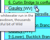
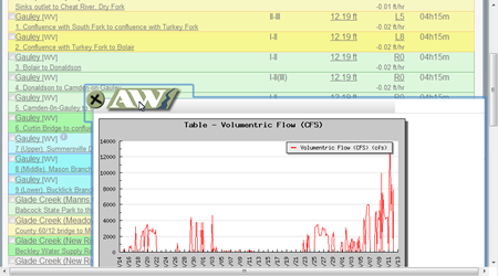
Returning to the list of rivers, you'll see there is a checkbox next to every river which can be used for the operations listed at the bottom the page. We also have an information icon that gives a summary of the river when hovered over. Not all rivers will have this information. Following the river name is the international Whitewater classification for the river at the given level. The next column displays the last updated gauge value that is linked to that reach. It is possible to have multiple gauges per reach, by clicking on the hyperlink you can see which gauge was updated as well as a graph of recent ups and downs on that gauge.
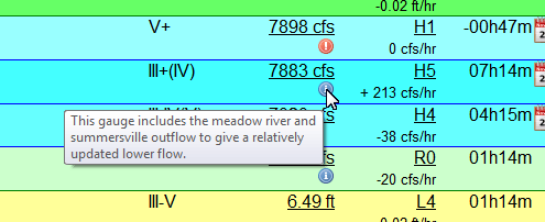
Underneath our gauge level is a red exclamation point in the figure. When you hover over the exclamation point you will see text directing you of danger is that the flow rate given. Sometimes this will just be a simple information icon, in which case the message will be should demand less attention.
Following the level is the relative level of the river based on the information that a stream editor has provided. By clicking on the relative level, you can see all the gauges that are linked to that particular river. Sometimes gauges are simply linked to the river because they have a passive association with the river like the Meadow River that flows into the middle of the run in the figure.
Underneath the relative level you'll see the change in volume over the last four hours. If the river goes up and then down by the same amount in four hours this will not show no relative change. The amount given on the rate should not be interpreted strictly because rivers behave in unpredictable ways. However, this might give you an idea where river is headed at the time of the last reading.
Following the rivers level, you'll see the time that the gauge was last updated. If we don't get an update from a gauge within two days than the gauge reading will disappear off of the summary page. You should interpret the gauge reading within the context of the time that was taken.
Even with the time, you should pay attention to the stream editors notes on the gauge in order to understand how this gauges interpretation may differ from the actual level of the river. All of the river interpretations are set by the stream editor. Detail about a gauge may vary considerably from stream editor to stream editor. In this example, Mann's Creek shows a little tilde mark next to the levels to tell you that this is not the actual streamflow. Underneath the information icon gives more information about how this gauge should be interpreted.
The last column is reserved for information icons. If we have information about a scheduled release then a calendar icon will be displayed. Hovering over the calendar icon will tell you when the event will take place. By clicking on the calendar icon, you can get an overview of what events are happening when.
Likewise, if a user of the website leaves a warning then the river will display an icon for the next 360 days. By hovering over the warning you can see when it was last updated. By clicking on the warning icon, you can get a list of warnings that have been left on the river over the last couple years.
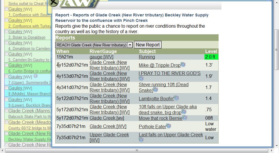
Finally, the new website allows users to contribute information on whether a river is running. The eyeball icon will appear for 24 hours after report has been made. By clicking on the eyeball, you can see a summary of the last couple of reports made on the river. These reports will also include photos in the case that someone has uploaded any. Reports made prior to 24 hours will appear on the rivers detail page under the flow information tab. The interpretation of that level will be set based on how the observer rated it (hi, medium, or low). If you register to watch this river, you will be notified by e-mail when an observation is made by another user. It is possible for user to make a observation on upstream gauge which will also affect this river but not show an eyeball icon. Sometimes this is useful for manual gauge observation that is linked to many downstream reaches.
Finally with regard to the check boxes next to the river names. By checking one of these boxes and scrolling down to the bottom of the river list you complete several operations. The river network allows you to register as an interested party on this river. Occasionally, when AW needs volunteers or a contact list of interested parties we can consult with people who have joined the river network for that particular river. You can also share information about a river by selecting one river and clicking “report level or photo” and “issue warning”. There are also two operations that allow you to be e-mailed the status of the river either daily or on a continuous basis. This allows people who observe her river to automatically report status to you via e-mail. When river statuses are e-mailed to you they will use a release correlation metric which is a numerical index indicating where river is currently running. Values between zero and one mean that the river is running according to the stream editor or the observer making a manual observation. If you receive an e-mail, you can come back to the website to see an interpretation of the release correlation. By default you will be notified whenever a rivers running or high. Please understand that reports from observers may not be reliable and that the stream editor's interpretation should be interpreted in the context of the flow tab on the river detail page.

