Flow Survey for Upper Colorado River Basin
Posted: 10/22/2007
By: Nathan Fey
Earlier in 2007, the Bureau of Land Management (BLM), Glenwood Springs and Kremmling Field Offices,
completed a Wild and Scenic Rivers Eligibility study as part of a revision of their 1984 Resource
Mangement Plan. The Federal Wild and Scenic River Act requires federal agencies to complete such a
study when they revise their land use and resource management plans.
The final Wild and Scenic Rivers Eligibility Report details which river and streams within BLM jurisdiction meet the criteria for Wild and Scenic River designation. The phase 1 report is simply an inventory of "Outstanding Resource Values" and does not examine competing uses on the identified waterways.
Phase 2 of the Wild and Scenic River study is now underway. This suitability study will determine whether each eligible river segment deserves to be added into the National Wild and Scenic Rivers system established by the National Wild and Scenic Rivers Act. The Act protects the free-flowing condition of rivers incorporated into the system, and requires federal review and evaluation of water projects propsed within the rivers bed or banks.
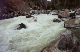
Opposition to Wild and Scenic designation has grown as Colorado continues to negotiate additional transfers of water out of the Colorado River basin and into reservoirs along the front range. In an effort to identify and protect recreational and environmental water needs for the study area, a group of stakehlders has organized to assist the BLM in evaluating alternatives to Wild and Scenic protection for the study area. Potential altenatives would allow for additional withdrawls of water from the Colorado River system, potentially threatening existing and future recreational and environmental water needs. In an effort to quantify recreational needs, American Whitewater is working with Colorado Whitewater, the Colorado River District, and the Colorado Basin Roundtable to identify and quantify the range of flows necessary to support recreational use in the upper Colorado River basin. Runs through Byers Canyon, Gore Canyon, and Glenwood Canyon are all potentially threatened by management alternatives.
Phase One of AW's needs identification and quantification can be found online: Click Here to take survey
Please spread the word and fill out the survey covering each run on the river. Later this year we will follow up with a paddler focus group to compare boater experiences at different flows.
Your participation now will help us in developing a comprehensive assessment of recreational flow needs in the upper Colorado River basin, and help protect some of the best whitewater in Colorado!
The final Wild and Scenic Rivers Eligibility Report details which river and streams within BLM jurisdiction meet the criteria for Wild and Scenic River designation. The phase 1 report is simply an inventory of "Outstanding Resource Values" and does not examine competing uses on the identified waterways.
Phase 2 of the Wild and Scenic River study is now underway. This suitability study will determine whether each eligible river segment deserves to be added into the National Wild and Scenic Rivers system established by the National Wild and Scenic Rivers Act. The Act protects the free-flowing condition of rivers incorporated into the system, and requires federal review and evaluation of water projects propsed within the rivers bed or banks.
Opposition to Wild and Scenic designation has grown as Colorado continues to negotiate additional transfers of water out of the Colorado River basin and into reservoirs along the front range. In an effort to identify and protect recreational and environmental water needs for the study area, a group of stakehlders has organized to assist the BLM in evaluating alternatives to Wild and Scenic protection for the study area. Potential altenatives would allow for additional withdrawls of water from the Colorado River system, potentially threatening existing and future recreational and environmental water needs. In an effort to quantify recreational needs, American Whitewater is working with Colorado Whitewater, the Colorado River District, and the Colorado Basin Roundtable to identify and quantify the range of flows necessary to support recreational use in the upper Colorado River basin. Runs through Byers Canyon, Gore Canyon, and Glenwood Canyon are all potentially threatened by management alternatives.
Phase One of AW's needs identification and quantification can be found online: Click Here to take survey
Please spread the word and fill out the survey covering each run on the river. Later this year we will follow up with a paddler focus group to compare boater experiences at different flows.
Your participation now will help us in developing a comprehensive assessment of recreational flow needs in the upper Colorado River basin, and help protect some of the best whitewater in Colorado!