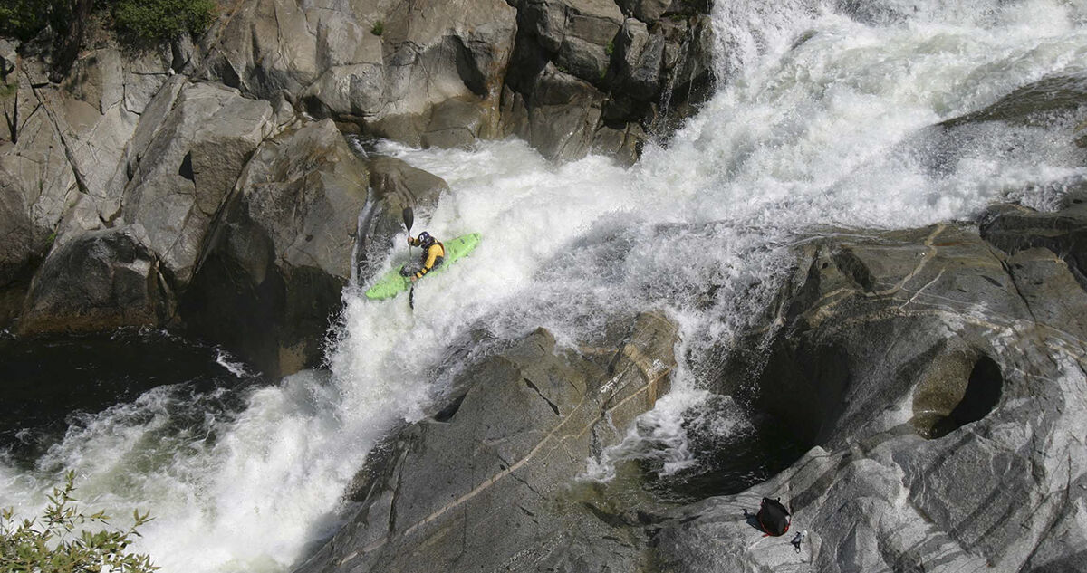
HELP THE USFS DISCOVER The WHITEWATER RECREATION IN THEIR OWN CA BACKYARD!
The United States Forest Service (USFS) recently released Draft Revisions for their Sequoia and Sierra National Forest Land Management Plans. As a part of this process, National Forests are required to identify the eligibility of rivers for inclusion into the National Wild and Scenic Rivers System. Once a river is found eligible it is managed to protect the values that support their inclusion. Over the course of 5 years of engagement, American Whitewater has identified 228 river miles in the Sequoia and Sierra National Forests that we regard to have outstandingly remarkable whitewater recreational value. These whitewater miles contain unique, rare or exemplary features that should qualify these rivers for inclusion into the Eligible Wild & Scenic Rivers Inventory. Yet, thus far, the USFS has only evaluated 25% of these river miles for whitewater recreation. Help the USFS discover whitewater recreation on rivers in their backyard by submitting personal a comment via our super simple form. If you have time please personalize our comment template, and if you really want to go the extra mile and you know these incredible rivers well, please send your comments, along with photos of rivers within the Sierra and Sequoia National Forests by September 26, 2019 directly via email to r5planrevision@fs.fed.us
The good news is most of our favored whitewater resources within the Sequoia National Forest were evaluated and are included in the Wild & Scenic Eligible Inventory. The teacups of Dry Meadows, the whitewater races on Brush Creek and the commercial outfitter use on the Kern below Lake Isabella were all considered outstandingly remarkable recreational values making them worthy of managing them as if they were Wild & Scenic. However, a glaring shortfall of consideration for whitewater recreation occurs within the Sierra National Forest. Approximately 157 river miles were excluded from consideration for their outstanding whitewater recreational value including the Infinislide and Waterfalls of Dinkey Creek, the latter half of Devil's Postpile on the Middle Fork San Joaquin, the boulder gardens of Chawanakee on the San Joaquin, and quality Class IV rapids on Horseshoe Bend of the San Joaquin.
American Whitewater believes part of sustainable recreation and proper watershed management within the Sierra & Sequoia National Forest begins with identifying the recreation that actually takes place on the rivers themselves. We hope our paddling members do too by helping us to point out their favorite whitewater resources in a comment today! Remember comments are due by September 26, 2019. Thank you!
Some easy instruction on personalizing comments:
Include -
- A brief summary of your boating expertise
- Where you are from
- Identify river name, whitewater boating section & GIS or Segment i.e. DInkey Creek, Ross Creek Trail to NF Kings Confluence, GIS 3.68.6 (see table below)
- Comments detailing experience on the river & photos that would help demonstrate the unique, rare or exemplary attraction, i.e. for Dinkey Creek - the succession of clean waterfalls and slides
SIERRA NATIONAL FOREST WHITEWATER RIVERS EXCLUDED FROM EVALUATION
River - WWB Reach & GIS
Bear Creek - Pacific Crest Trail to Bear Diversion Dam 3.11
Big Creek - First 3 Miles Fish Camp to SF Merced 3.20.2
Dinkey Creek - Dinkey Dome to Dinkey Campgrounds 3.68.3
Dinkey Creek - Includes Last Mile to Dinkey Campground to logging spur run 3.68.5
Dinkey Creek - Dinkey Campgrounds to logging spur road 3.68.4
Dinkey Creek- Ross Creek Trail to Confluence of NF Kings 3.68.6
Granite Creek - Strawberry Mine to Near Cassidy Trail 3.107.1
Granite Creek - Strawberry Mine to Near Cassidy Trail 3.107.2
Middle Fork San Joaquin - Devils Postpile Nat'l Monument to Mammoth Pool Reservoir Segment 4
Mono Creek - Mono Diversion to SF San Joaquin 3.166.4
Mono Creek - First Recess to Lake Edison 3.166.2
North Fork Kings - Above Whison Reservoir 3.177.2
North Fork Kings - Balch Afterbay to Confluence w/Dinkey Creek 3.177.8
North Fork Kings - Dinkey Creek to Main Kings Confluence 3.177.8
Piute Creek - Below Golden Trout Lake to Confluence with South Fork San Joaquin 3.199.2
Piute Creek - Below Golden Trout Lake to Confluence with South Fork San Joaquin 3.199.3
San Joaquin - Part of Devil's Postpile National Monument to Mammoth Pool 3.233.1
San Joaquin - Chawnankee Gorge 3.233.4
South Fork San Joaquin River - Mono Hot Springs to Middle Fork, to Mammoth Pool 3.260.2
South Fork San Joaquin River - Florence Lake to Mono Hot Springs 3.260.2
South Fork San Joaquin River - Bridge over Piute Creek to Florence Lake Segments 2,3,4
West Fork Granite Creek - Strawberry Mine to Near Cassidy Trail 3.294.2
San Joaquin - Horseshoe Bend 3.233.6