| Difficulty | III |
| Length | 4.6 mi |
| Avg Gradient | 28 fpm |
| Gauge | Rocky River Near Berea Oh |
| Flow Rate as of 39 minutes | 88 cfsbelow recommended |
| Reach Info Last Updated | August 23, 2017 |
River Description
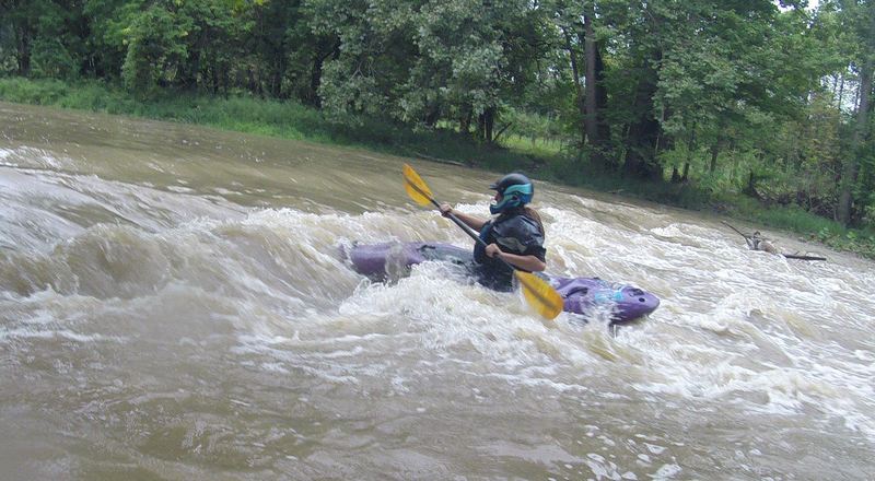
Corey Spoores shares:
I have run this section at time of higher water (with put-in gauge reading 4’ and the take-out reading 7’!); Bigger, pushy water common for this area of Ohio.
Rapids Description:
The run consists of shelf-style drops and ledges, which creates play waves and friendly surf spots for the majority of the run. There are some holes to watch out for but they are easily spotted, and none of them should hold a boater. There are some manmade obstacles but the main one to watch out for is towards the end of the run near the 252 bridge, where a couple of cables attached to the bank hold some old trees in place for bank stabilization. This is located on river right tight to the stream bank. Just past this is a good surf wave mid-river, so setting up for this feature will have you a safe distance away from the hazard.
Rapids of note: (rating/difficulty dependent on flow, based on average observations)
#1 - just past the oxbow - after coming to a glacial erratic mid-stream you come to an oxbow, river right commonly collects wood but can be easily scouted by eddy hopping. This leads to a play hole with good eddy service on river left. (III)
#2 - at the end of the gabion-basket wall on river left: A surf hole and wave action. (III)
#3 - downstream of the first bridge: A collection of surf waves ending in a river wide ledge.
#4 - about a mile downstream from the railroad trestle, river-right: A double-ledge surf spot that extends to mid-river and can wash out at higher flow, with strong eddy service that affords all-day play opportunities. (III)
River Features
Put In
Access PointDistance: 0 mi
NOTE:
OtherDistance: 0 mi

From our listed take-out, it is (approximately) 14 river-miles downstream to the next listed section. While that section of river might certainly be paddled, it has much less interest from a whitewater perspective (almost no true rapids). Much of that distance is very rural, but nearly 1.5 miles will be flanked by Columbia Hills Golf Club, and more than a quarter-mile (near the end) viewing the extensive greenhouses of Casa Verde Growers.
Take Out
Access PointDistance: 4.6 mi
Trip Reports
Log in to add a reportMJ
Matt Jackson
Sep 12, 2014
I ran this with 3 other paddles on September 11, 2014, at about ~2000 cfs. Even at that level it was extremely low, and the only rapids of note I can recall are two surfing waves. The first one is a bit sticky, and even though it flows over a rock, has the general shape of resembling a low head dam. The second is a larger wave that is very forgiving and very easy to attain up to via a river right eddy. There are one or two longer rapids, and I would be reluctant to classify them at above a class ii at that level. A lot of flatwater existed between the rapids