Oak Creek
Mill Road to Lake Michigan (PnP or 0.8 mile)*Access&Safety Issues*
| Difficulty | I-II |
| Length | 0.7 mi |
| Avg Gradient | 20 fpm |
| Gauge | Oak Creek at South Milwaukee, Wi |
| Flow Rate as of 43 minutes | 4 cfsbelow recommended |
| Reach Info Last Updated | February 23, 2024 |
This description is being included in the AW listings primarily in case some boater in the area figures they've made a discovery of an 'unknown' bit of whitewater.
For some miles above the Mill Pond, Oak Creek could provide some very mild swiftwater/whitewater entertainment since there are a few areas of (minor) gradient containing riffles, rips, and minor rapids and logjam/rootball 'pourovers'. However, we cannot recommend attempting to boat upstream of the Mill Pond. The creek is heavily modified, having been long ago straightened (not necessarily 'straight', just smoothed, altered course) channelized (a few areas of cement or otherwise armored streambanks), and confined for the convenience of building roads, houses and businesses along its banks. When the creek leaves the most heavily altered area and enters more natural, wooded banks, it is highly prone to deadfall and snags. In such a small, tight creek, any deadfall will be difficult to avoid, and it is likely it will be difficult (at any elevated flows, at least) to find slackwater or eddies to safely get out and portage.
The Mill Pond has (over decades) silted in, and is generally quite shallow. Water spills over the dam and lands on very shallow uniform bedrock. DO NOT EVEN THINK ABOUT GOING OVER THE DAM!
Immediately after the dam, water rushes under Mill Street bridge, sheeting across sloping bedrock, then encounters a bit of a pool. A fine looking wave sometimes builds up here (at moderate flows). Play would be possible, but putting in upstream of the wave (to run the brief approach, eddy out, and play) is quite awkward due to the vertical stone walls. So, skip the run-in by just putting in at the pool.
Any time the creek runs high enough to form the wave, water quality tends to be disgusting, often with much trash and debris in the eddies.
This pool is an extremely popular spot for area fishermen who are likely to be qui
...
25 sq.mi., 631.13' above sea level, 2.8 mi. upstream of mouth.
Lake Michigan mean elevation is 580', thus ~51' total drop to lake from gauge, for 18 FPM gradient.
Unfortunately, 12-15' of that is backed up by the unrunnable Mill Dam, leaving maybe 13 FPM as the effective gradient.
Put-in is most convenient from the pool just downstream of the dam at Mill Road. However, one of the biggest 'safety' issues is likely to be contentious fishermen, protesting your intrusion and interference with their right to fish.
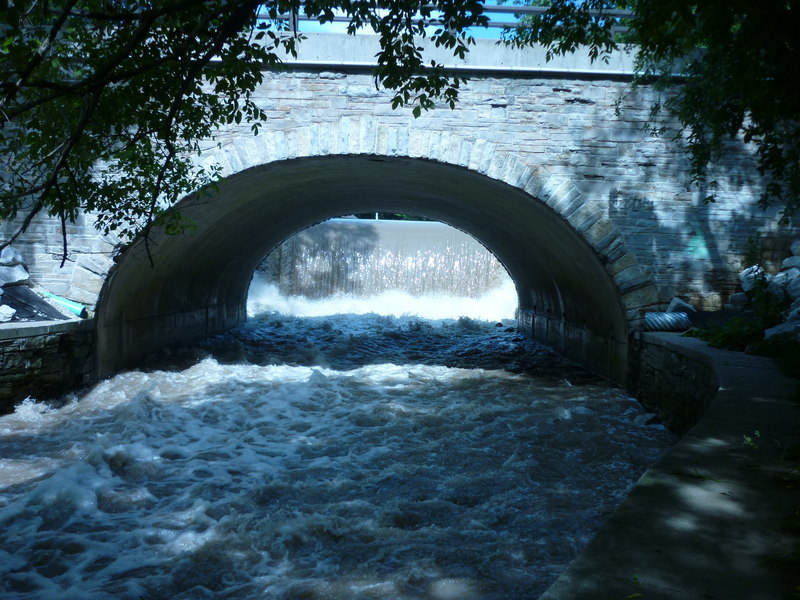
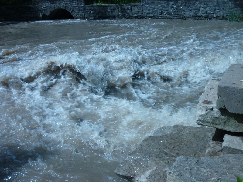
Looking upstream at the dam, framed by the arch of the Mill Street bridge.
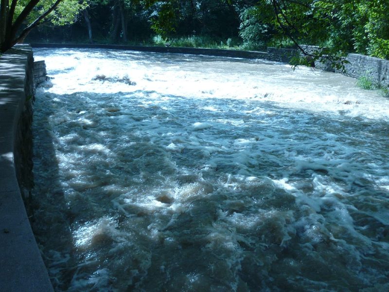
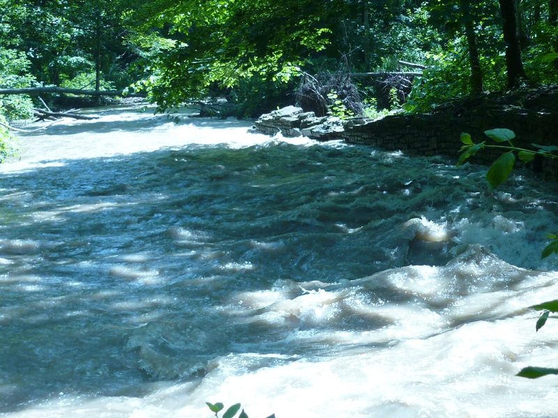
Cascading off the dam, water lands on shallow bedrock and sheets swiftly downriver between vertical walls of rock.
The water flowing over the dam and down the sloping bedrock quickly hits a brief pool. A fairly fine wave can form here at moderate flows, though it tends to surf a bit odd due to how fast the water sheets across the shallow bedrock. (You'll 'feel' the presence of the bottom just inches under your hull!)
Water quality (at any likely boatable flow) tends to be atrocious on this extremely flashy urban stream, and there tends to be a lot of debris in the eddy. Worse (for any potential boaters), this is an extremely popular location for fishermen, many of whom take very vociferous objection to any interference with their chosen pursuits here.
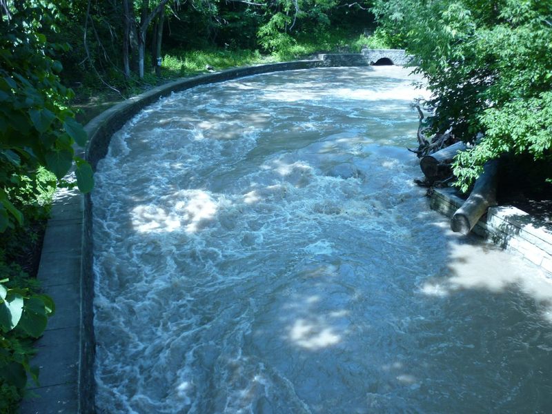
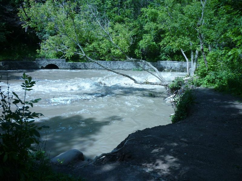
Standing on the bridge, looking upstream, this is the outflow from the above mentioned wave and pool.
As you can see, water piles against a vertical rock wall armoring the outside (river-right) of the bend, before heading down under the parkway road.
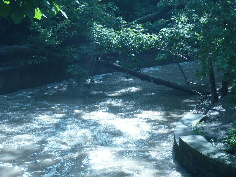
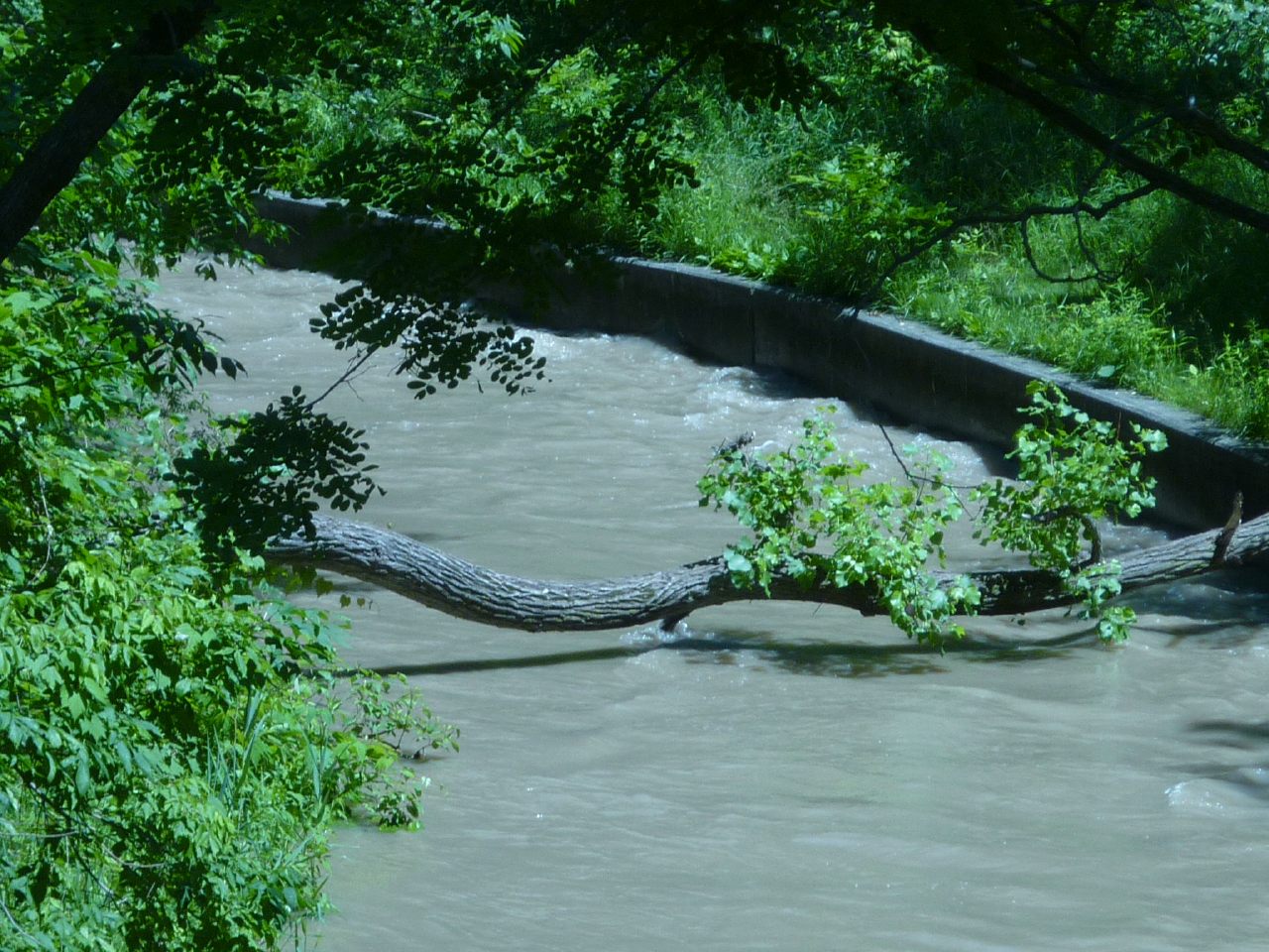
Looking downstream of the aforementioned bridge, the creek twists off to the right.
On the occasion that I took these photos, there was a tree laying diagonally across the creek, the first of many. While this one could be fairly easily bypassed (passing under river left), others were far more problematic.
A very minor (6' - 1') rockledge in the stream can create a bit of a wave. At some (moderate) flows this can provide a little bit of a surf, but barely worth more than a couple minutes entertainment.
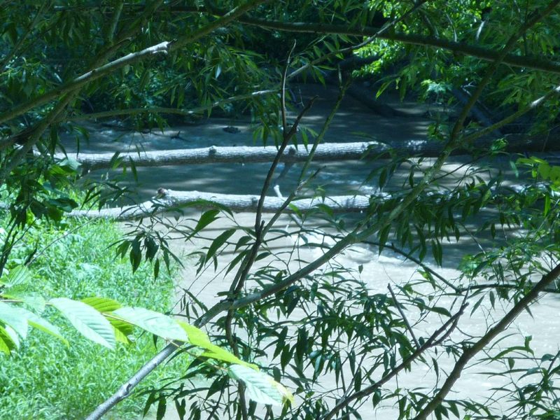
Just another sampling of the sort of deadfall and snags which seem all too common in the stretch downstream of the dam en route to the lake.
With the vertical rock walls on both sides, getting out to get around any such snags is somewhere between very difficult and impossible.
For this reason, any boater thinking about running this to the next bridge or to the mouth should walk virtually the whole stretch of creek before putting on, so as to know whether and where wood exists in the way, and whether passage is possible.
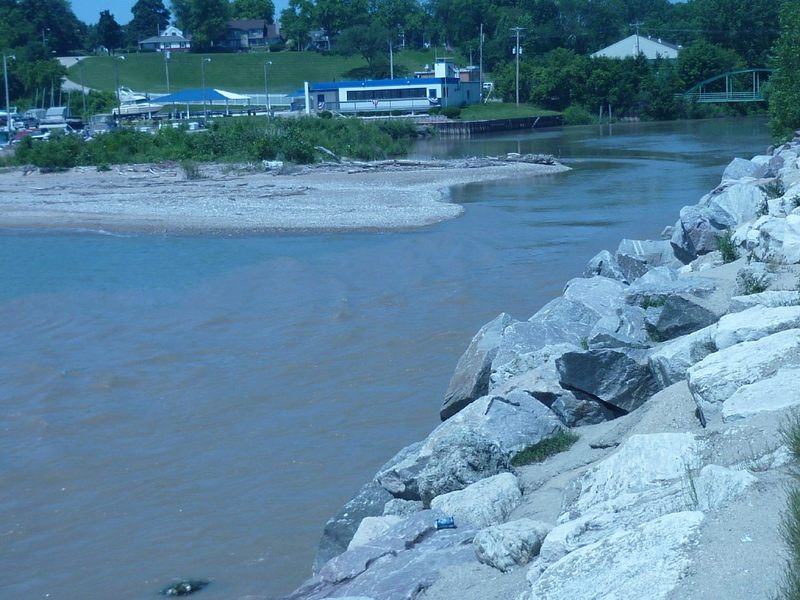
The mouth lies between South Milwaukee Yacht Club (photo-left, river-right) and Grant Park Beach at Lake Michigan.
Jun 22, 2010
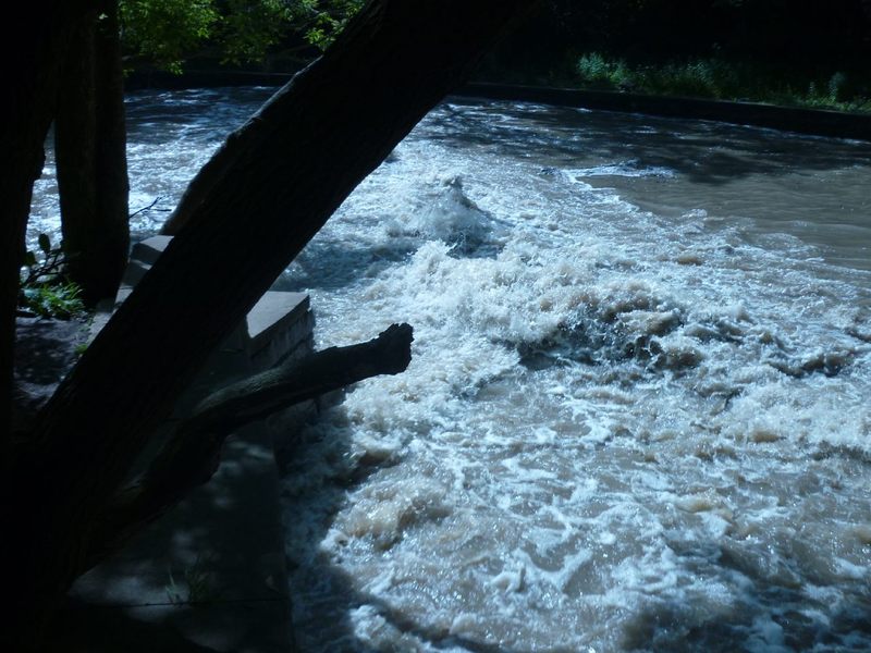
A closer look at the wave train and the pool. (Flow of 375 cfs.)
Jun 22, 2010
There is a very small ledge just a little downstream (immediate foreground of photo). For years massive trees blocked flow right at this ledge. Presently those are gone, but just downstream (background in photo) two more trees lay in and over the water, blocking passage. (Flow of 375 cfs.)