| Difficulty | IV-V |
| Length | 18.5 mi |
| Avg Gradient | 104 fpm |
| Reach Info Last Updated | March 22, 2011 |
River Description
River Description
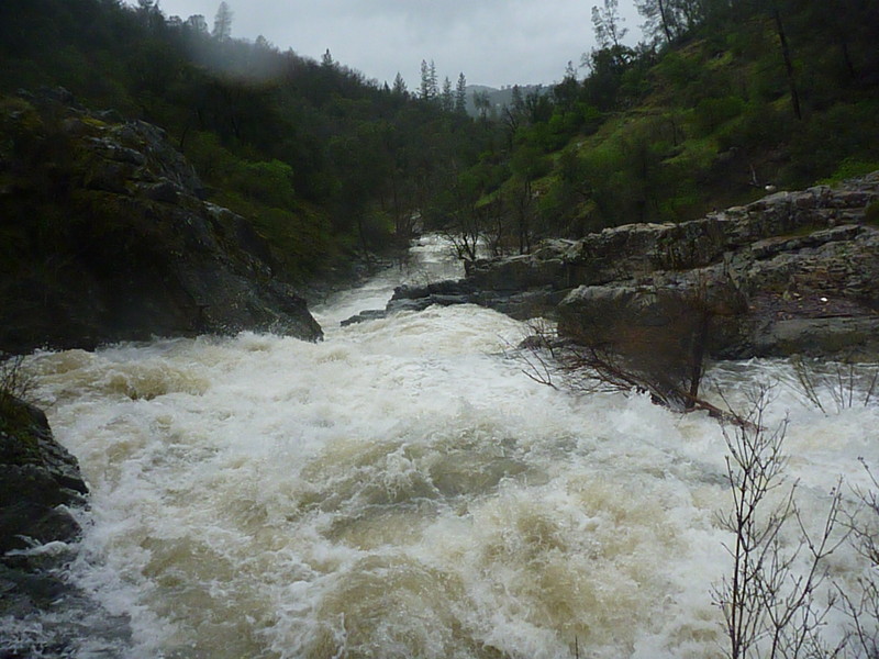
Weber Creek is often boatable in the wet season during and after heavy rains. It seems to be popular with locals who don't mind dealing with the challenges of low elevation Sierra creeks: trees, portages, logs, bushes, manky rapids, etc. The rewards of overcoming such challenges, are the interesting scenery and many fun rapids. This run has some fun rapids but isn’t a typical high quality California run. It is low sierra adventure boating -- worth doing if you are in the area or local, but not worth a significant drive.
This creek is a low elevation tributary of the SF American River. It originates to the south east of Placerville and flows into the Gorge of the SF American at Bouncing Rock Rapid.
There are several sections of Weber that can be run by starting and stopping at different road bridges.
Elevations:
Big Cut Road - 1700 feet
Green Valley Road - 1460 feet (Painted Gauge Here – see picture tab)
Lotus Road - 890 feet
Confluence with SF American - 450 feet
Sections:
Big Cut Road (1700ft) to Green Valley Road (1460 ft) – IV
Summary: Boof.com forum - Big Cut Rd to Green Valley Road.
Green Valley Road (1460) to Town of Cold Springs (~1200ft) – IV+/V
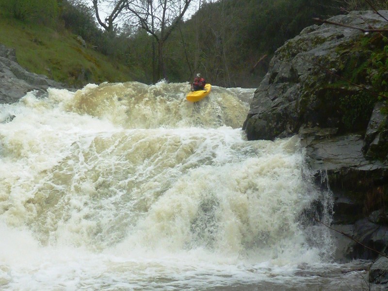
Character: This is the steepest of the Weber Creek sections. Bedrock rapids interspersed by in stream willows with wood commonly in play. First 3-4 rapids are (IV) with some hazards in the landing zones. Rapids continue to increase in size with a 10-15’ slide, followed by a 20-25’ double drop, followed immediately by a portage (3 tier slide, 50-60’ vertical, main hazard = questionable landing zone.
Flow: Look for 1’ to 3” on the painted gauge on the Green Valley Road bridge (dow
...River Features
Big Cut Road
Access PointDistance: 0 mi (approx.)

Elevation is about 1700 feet at this access location.
Put In
Access PointDistance: 0 mi
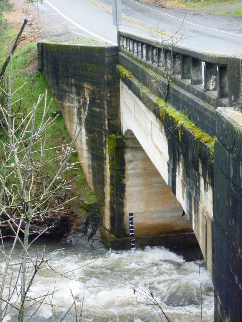
Highway 49 bridge
OtherDistance: 1.4 mi (approx.)
Look out for a small dam near the bridge. There does not appear to be any public access at this bridge.
Forni Road
OtherDistance: 2.4 mi (approx.)
There does not appear to be any public access at this bridge.
Highway 50 bridge
OtherDistance: 3 mi (approx.)
Some of the biggest rapids of the upper reaches are said to be just downstream of highway 50. Highway 50 is high above and does not provide any public access to the creek.
Green Valley Road
Access PointDistance: 4 mi (approx.)
There is a painted gauge on the bridge at this access point. Runnable levels are generally considered to be from about 1 to 3 feet. Parking options appear limited and there are 'No Trespassing' signs, but it is reported to be a common put in. Elevation is about 1460 feet.
Cold Springs Road
Access PointDistance: 6 mi (approx.)
Accessing the creek here, requires boat carrying for a little ways.
Lotus Road
Access PointDistance: 8 mi (approx.)
Elevation is about 890 feet. This is the most common put in for those paddling down to the SF American and the Salmon Falls take out.
Take Out
Access PointDistance: 12 mi
SF American Confluence
OtherDistance: 12 mi
The creek enters the river at Bouncing Rock rapid. Paddle another 2.3 miles down to the take out at Salmon Falls bridge. Elevation at the confluence is about 450 feet.
Trip Reports
Log in to add a reportCT
Chris Tulley
Mar 21, 2011
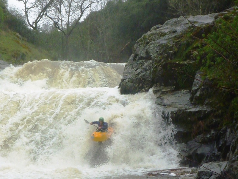
This rapid drops 50-60 vertical feet thru 2-3 major tiers. The first two sections look very runnable. The landing zone on the final tier looks questionable. This rapid remains unrun to the authors current knowledge. Be safe.
CT
Chris Tulley
Mar 19, 2011
Highest Quality drop. Just above the portage on the Green Valley to Cold Springs Section (above Lotus road). Flow is ~2.4' on the Green Valley Bridge. ~225 cfs at Green Valley bridge