Abiqua Creek
1. Crooked Finder Spur Road to Abiqua Falls(Upper Abiqua)
| Difficulty | III-IV+ |
| Length | 4.7 mi |
| Avg Gradient | n/a |
| Gauge | Butte Creek at Monitor, or |
| Flow Rate as of 22 minutes | 7 cfsbelow recommended |
| Reach Info Last Updated | June 4, 2019 |
Detailed information at Into The Outside.
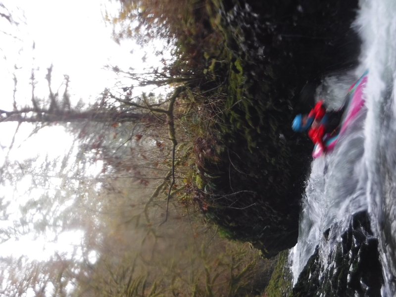
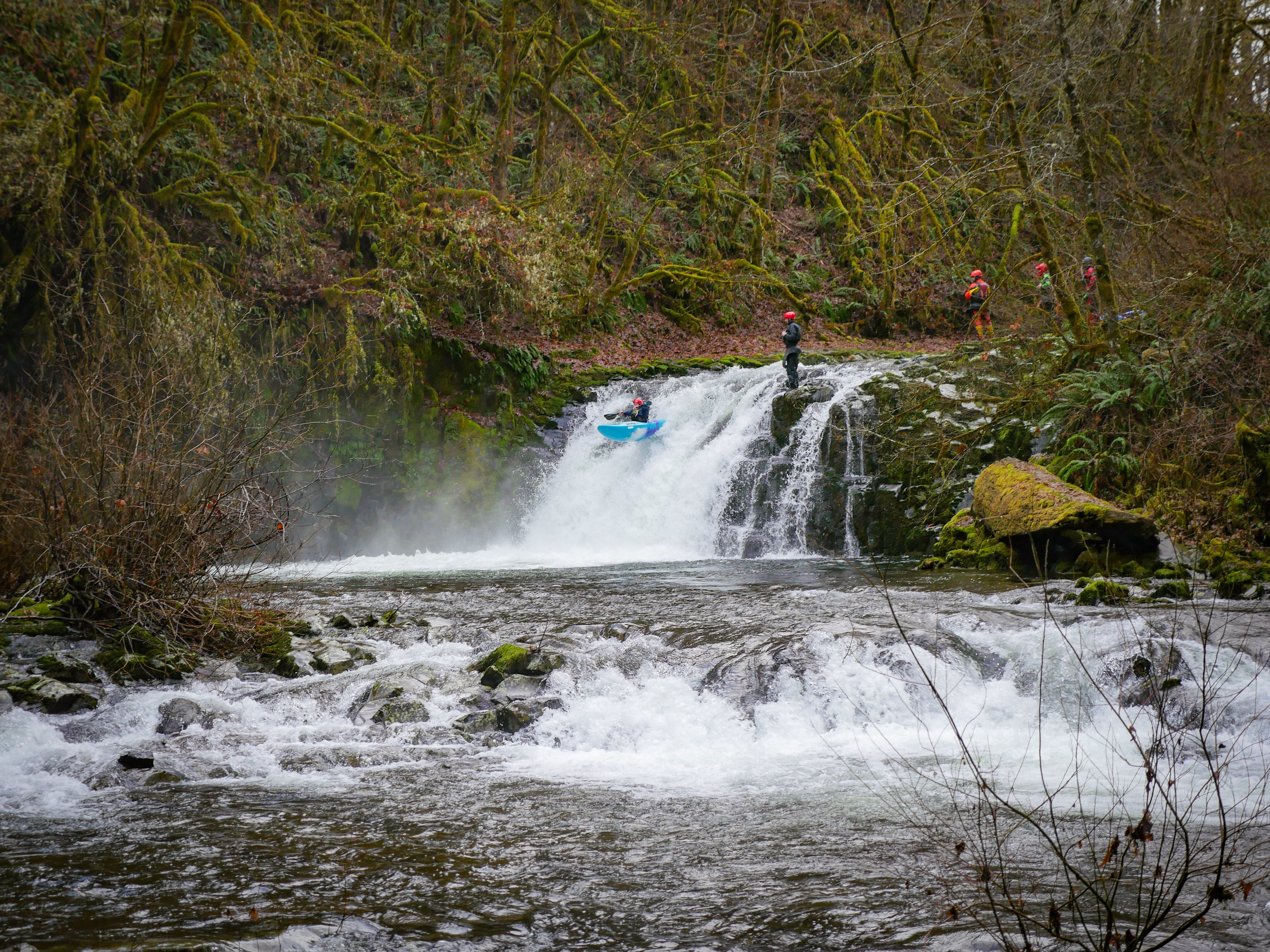
People have been running the half mile section above Abiqua Falls in recent years. This provides a short section with two waterfalls, about 10 (Momma Duke's) and 20 feet high (Peony Falls) followed by a class III(IV+) bedrock section. The two waterfalls are forgiving and fun. They can be lapped.
Care must be taken above Cattle Ramp, it would be easy to go an eddy too far and be committed to this narrow chute that sometimes has wood issues. With some recent movement of wood, there is a small last chance eddy just before the point of no return. However, the normal manuever is to have one person go first and grab onto the bank and hop onto shore in the moving flat water as soon as possible above Cattle Ramp. That person can then catch the rest of the team. Check the photo page for land markers. The portage is along the left bank, the longer you stay on the bedrock, the more devils club you will avoid.
At the recommended flows it is not an issue getting out on the right above Abiqua Falls, but that may change if flows are high. Get out on the right and take the trail up to a short cliff band. There is typically a fixed rope here to help pull boats up with. From the top of the cliff band it is a short hike out along a trail to the road.
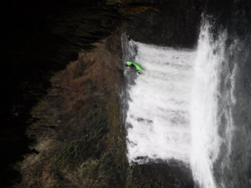
The 95' Abiqua Falls at the take out has been run a few times. The only injury free descents of this drop have occurred when the gauge read over 1,000 cfs.
Trip report of the Silverton Plateau trifecta, which includes this run.
Directions:
High clearance is recommended, but not essential.
To get to the take out from Scotts Mills. Drive south on Crooked Finger road (it turns to gravel at mile 9.4) 10.8 miles to a spur rd on the right. Take that spur rd an
...Feb 21, 2018
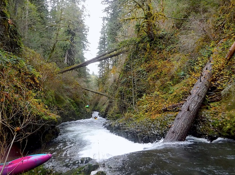
This photo is a good one to sear into your brain if running Abiqua Creek. Note the sliding ledge in the foreground. This means you are just above Cattle Ramp. Looking downstream, the paddler in the yellow boat is about to the point where he needs to grab the bank and hop out. You can also see the paddlers portaging along the left, don't go any further downstream of where they are before getting out of your boat. Then scout and portage down the left bank, heading into the woods if you feel too exposed.
If you go past the furthest point you can see the stream in this photo, and there happens to be wood in the drop, your fate will no longer be in your hands. There was wood in 2017. Don't push it, take out where the boaters are visible in this photo.