| Difficulty | I-II |
| Length | 8.1 mi |
| Avg Gradient | n/a |
| Gauge | Tomorrow River Near Nelsonville, Wi |
| Flow Rate as of 27 minutes | 26 cfsbelow recommended |
| Reach Info Last Updated | March 4, 2025 |
River Description
Much less paddled section than the upper reach due to relatively lesser scenery (no dells), but still containing fine low-igrade rapids.
The USGS gauge for the Little Wolf went unfunded June, 2020, disabling our virtual gauge. Oddly, the virtual gauge continues to show the final reading from before the gauge was disabled!
Click this link for the NOAA gauge: https://water.noaa.gov/gauges/ROYW3.
River Features
Put In
Access PointDistance: 0 mi
Rock Dam
OtherDistance: 0.44 mi

It appears there is a minor rock dam at this point, which (at some flows) may create minor wave/hole and some play potential.
Minor rock garden
OtherDistance: 0.8 mi
There is a somewhat lengthy/extended area of rock garden in the river. Much of this may be not so much a 'rapids' as just a rock-dodge in current.
Bridge?
OtherDistance: 1.24 mi
There is some sort of bridge or other structure (visible on satellite/aerial views) across the river here. It is unknown (by us, at this time) whether this allows adequate clearance at likely boatable flows.
Little Falls
OtherClass: IIDistance: 1.35 mi
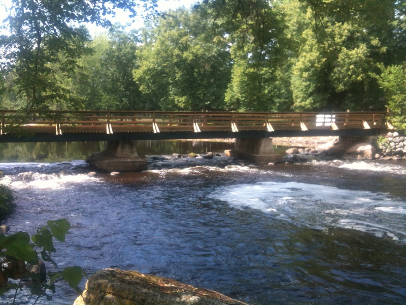
'Little Falls' is marked on maps near here (and I believe this community takes that name). Little Falls is merely a minor rock-dam hiding under a footbridge. (Maybe barely almost class II under some ideal conditions.) Almost immediately downstream (just around a bend) there's a wealth of boulders to thread through.
CTH.C
OtherDistance: 1.63 mi
The boulder garden (which started in Little Falls) continues on and off to this bridge and nearly 0.2 mile beyond (until you reach a large island).
Brief minor rock garden
OtherDistance: 4.2 mi
Just before Kretchner Road, a very brief minor rock garden is encountered.
Boulder bed
OtherDistance: 5.04 mi
After a long flatwater stretch, some welcome boulderbed resumes (just after a horseshoe bend).
Boulder bed
OtherDistance: 6.27 mi
As you encounter a little 'S' turn, minor boulder bed crops up again.
Ford?
OtherDistance: 6.48 mi
It appears there may be a low water drive through (a ford) of the stream at this point, which may create some minor waves. The bouldergarden continues on and off as well.
Take Out
Access PointDistance: 8.2 mi