Klamath
06. K’utárawáx·u / Grizzly Hill Access to K’účasčas / Fall Creek Access(K’íka·c’é·ki Canyon)
| Difficulty | IV |
| Length | 2.7 mi |
| Avg Gradient | 73 fpm |
| Gauge | Klamath R Bl Iron Gate Dam Ca |
| Flow Rate as of 56 minutes | 885 cfslow runnable |
| Reach Info Last Updated | August 25, 2025 |
Restoring the Klamath River: A Historic River Reborn The Klamath River now flows freely for the first time in more than a century. The removal of the four lower Klamath dams—J.C. Boyle, Copco 1, Copco 2, and Iron Gate—marks the most ambitious river restoration effort in U.S. history. For [...]Read More
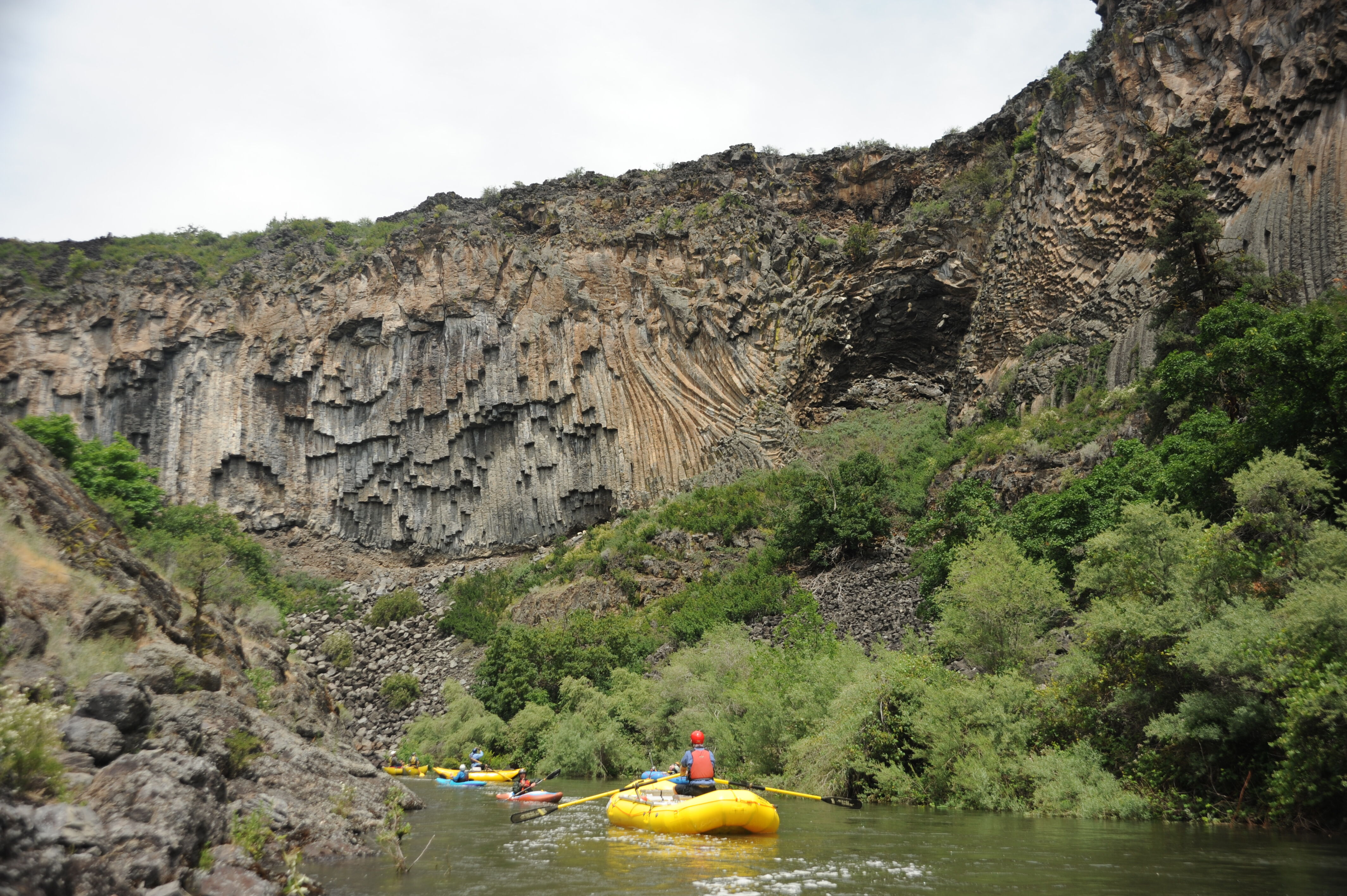
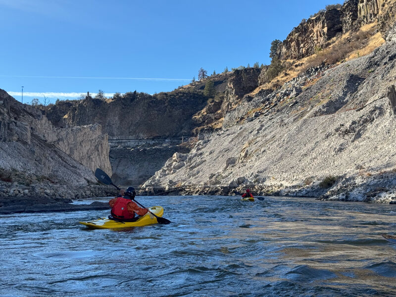
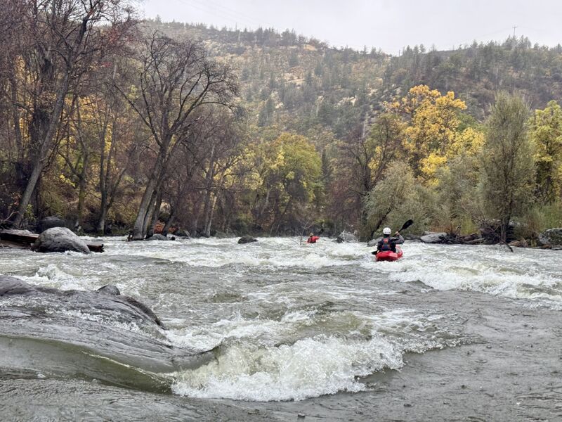
The 2.7-mile K’íka·c’é·ki Canyon Run is a high-gradient (78 ft/mi), Class IV whitewater stretch featuring continuous, challenging rapids and dramatic scenery with columnar basalt cliffs. Once dewatered and inaccessible due to hydropower dams, the canyon now offers summer-long flows, a short shuttle, and an accessible location near I-5, making it an appealing option for advanced boaters and guided trips. K’íka·c’é·ki is the Shasta language place name for the greater landscape of this area, pronounced phonetically as K’-EE-kah-ts’EH-kee.
K’íka·c’é·ki Canyon
K’utárawáx·u (Grizzly Hill) Access (2,515 ft. elev.) to K’účasčas (Fall Creek) (2,304’ ft. elev.)
Length: 2.71 miles; Gradient: 78 ft/mi; Difficulty: IV/IV+
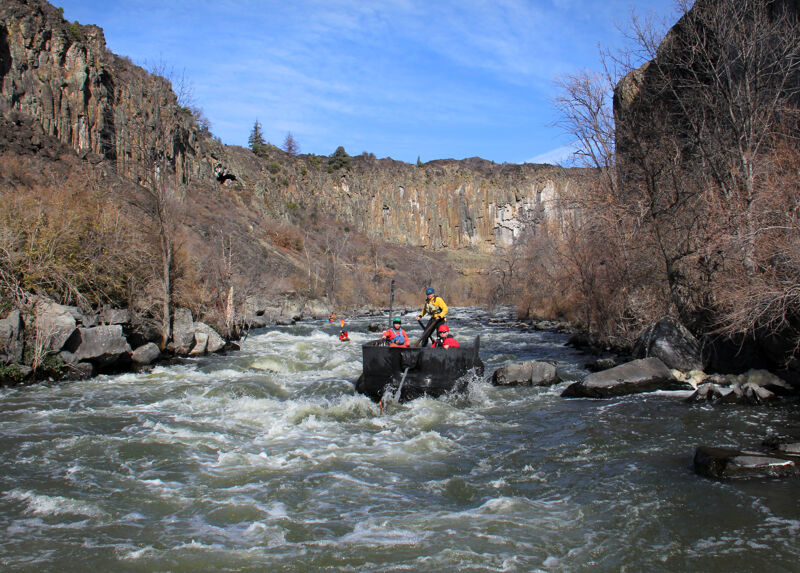
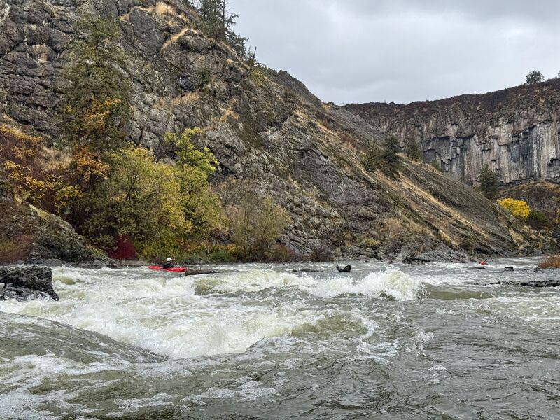
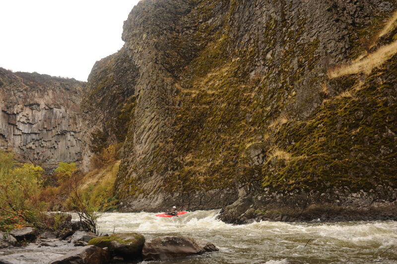
K’íka·c’é·ki Canyon is a whitewater gem with seven rapids. Bookended by the peaceful K’íka·c’é·ki Valley upriver and the gentle Iron Gate Run downstream, K’íka·c’é·ki Canyon is an intense clash between the irresistible force of the Upper Klamath and the immovable object of a relatively recent lava flow. The Klamath wins this geologic fracas by slashing a deep cleft through the lava flow, but the lava gets enough licks in to churn the river in the turbulent passage. It’s a natural collision guaranteed to quicken the pulse of advanced boaters.
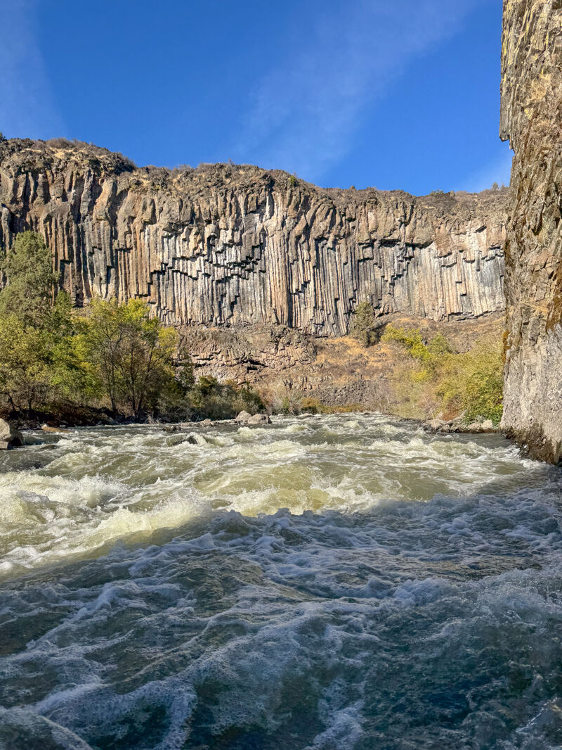
K’íka·c’é·ki Canyon is more than just big whitewater: it is a scenic and geologic wonder with the utmost cultural and spiritual significance to the Shasta people, a 300-foot-deep defile bounded by sheer palisades of columnar basalt unlike any other on the Klamath River. On June 18, 2024, the State of California announced that after completion of dam removal, it will transfer ownership of 2,800 acres of land--including K’íka·c’é·ki Canyon and its access points--to the Shasta Indian Nation.
Dam History
K’íka·c’é·ki Canyon was an engineer’s dream: two easy dam sites, a steep descent, and abundant flow
...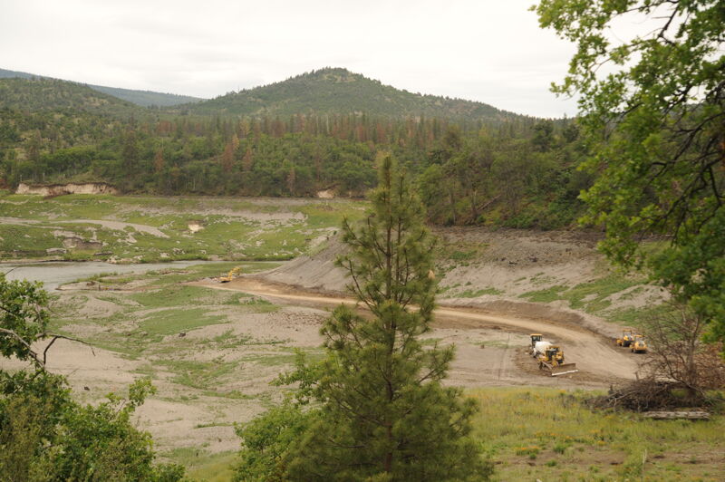
The K’utárawáx·u (Grizzly Hill) Access on river right is named for the Shasta Indian place name (pronounced K’oo-TAH-rah-WAH-xoo). The site is managed by California Department of Fish and Wildlife on land set to be transferred to Shasta Indian Nation. The Shasta people have lived here since time immemorial and were stripped of their land through violence before hydropower dams took the last of their ancestral territory along the river. American Whitewater has worked with the Shasta Indian Nation to educate the public on respectful visitation in this culturally and spiritually significant landscape. American Whitewater helped secure $3.5 million from the State of California to design and construct this and two other sites to serve boaters and fire management crews. Amenities include an access road, boat launch and turnaround, staging and parking areas, bike rack, accessible vault toilet, garbage facilities, picnic spots, river viewing area, and multilingual kiosk.
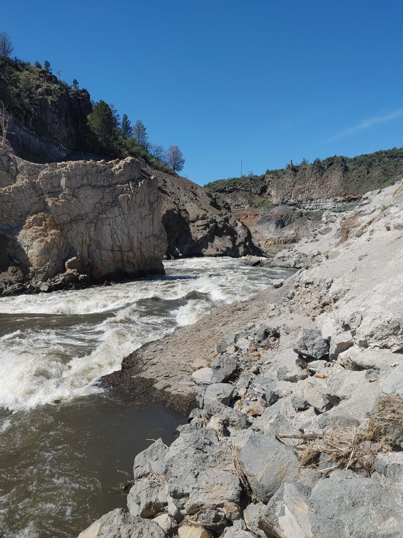
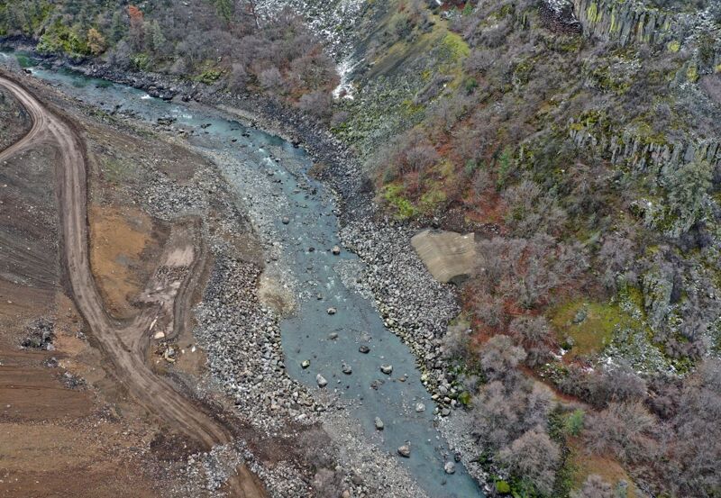
The Klamath bends right at the western end of the alluvial K’íka·c’é·ki Valley that was flooded beneath Copco Reservoir for 106 years and abruptly enters the narrow-walled confines of K’íka·c’é·ki Canyon, also known as Wards Canyon. A striking, light-colored rock wall rising from the left bank marks the traditional fishing site known to the Shasta people as Ìk·wì·k. It also marks the originally proposed location for the Copco 1 Dam, which was ultimately built about 1/4 mile downstream where the canyon walls contained more solid rock on the north side of the river.
Ìk·wì·k (pronounced EEK-kwee-k) is the first rapid in the canyon and is located directly at the light-colored rock outcrop that rises prominently from the river left bank. The dominant feature of this rapid is the large wave located in the center of the river, which is pinched narrowly between big rocks on river right and the rock spire on river left. Others waves follow. The prominent rock wall here is known as Ìk·wì·k and is a traditional Shasta salmon fishing site. Bogus Tom and Moffett Creek Jake were among the last Shastans to fish here before it was flooded by Copco Reservoir, and both interacted with John C. Boyle, the dam's construction manager as the dam was being built. This name was chosen because it is the existing place name and honors Shasta culture and connection to the river.
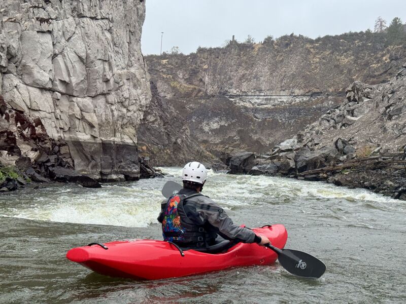
Just around a sharp left flatwater bend below Ìk·wì·k, Bogus Tom Rapid charges straight ahead with an almost 0.4-mile-long long continuous set of waves and small holes. The rapid is very long but is a read-and-run affair. This rapid begins just upstream of the site of the Copco 1 Dam (removed in 2024) where the river was flooded by the 132-feet deep Copco Reservoir for 108 years. The rapid drops through the dam site, where stripes of concrete on the canyon walls are all that remain, and continues downriver, around a slight right bend, and through the site of the much smaller Copco 2 Dam (removed in 2023) before ending in a short slackwater pool just upstream of the next rapid. Coming out of the pool, the river turns sharply left and the real action of the canyon begins: Ìk·wì·k and Bogus Tom Rapid are the preludes. If you've found the whitewater in the canyon too challenging by the end of this rapid, you should exit the canyon here by hiking out the steep, switchbacked road on river right (the road is gated and closed to vehicles). Starting with the next rapid, the river is significantly more difficult and the only reasonable way through the heart of the canyon is by boat. The name for this rapid honors Bogus Tom, a Shasta leader who emerged as a key figure following the upheaval and displacement of the Shasta people wrought by the Gold Rush and the subsequent construction of the Copco dams.
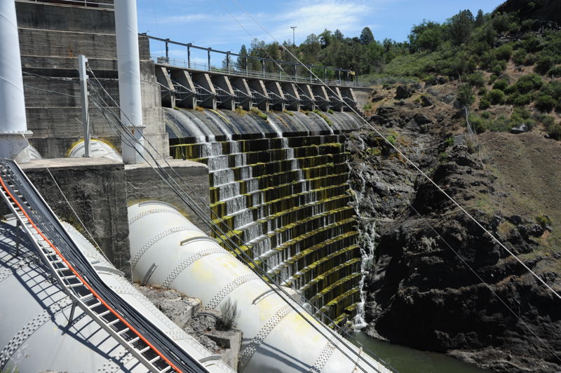
The Copco 1 Dam was completed in 1918 (and raised higher in 1922). It was a 120' high concrete gravity dam. The dam began blocking anadromous fish passage around 1911 during its construction. The dam was breached with the blasting of a tunnel at the base of the dam on January 23, 2024 and fully removed by August of 2024. All that remains now are light colored bands of concrete on the canyon walls marking where the dam once spanned the river and, on river right, some log cribs just upstream that were the foundation of the cofferdam used to divert the river during dam construction.
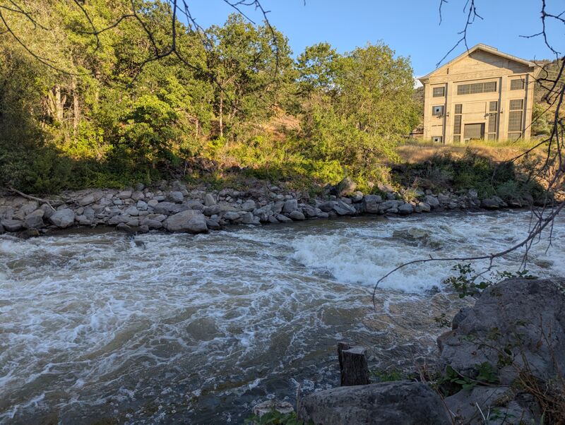
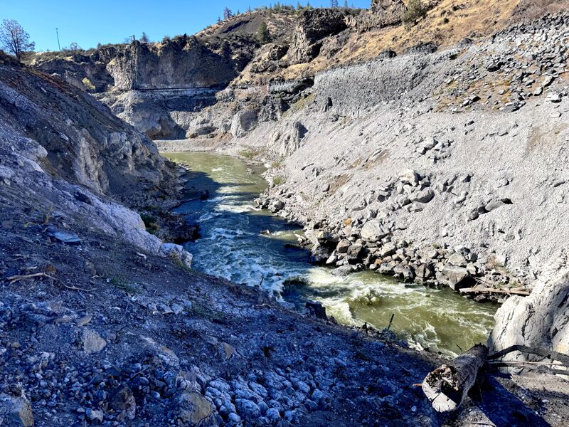
At 33' high, Copco 2 Dam was the smallest of the four Klamath River hydropower dams. It was constructed in 1925 and served as a diversion dam that sent the entire flow of the Klamath River through two tunnels and a wood stavepipe to the Copco 2 Powerhouse that was at the downstream end of Wards Canyon (the building still stands). Consequently, the natural river bed below Copco 2 Dam was dewatered throughout the remainder of Wards Canyon. In the 99 years that Wards Canyon was deprived of its river, an alder and cottonwood forest took root in the middle of the nearly dry riverbed. To restore the river to its pre-dam condition and to reduce the hazard potential of a Class IV whitewater run full of standing dead (flooded) trees, nearly 1,000 of these trees were removed from the river channel and helicoptered out of the canyon before Copco 2 Dam was removed and river flows restored. This work was the direct result of American Whitewater's advocacy and was done in collaboration and consulation of the Shasta Indian Nation, Klamath Tribes, state and federal agencies, and other partners. The Yurok Tribe's construction crew performed the tree removal work in early summer 2023. Copco 2 Dam was fully removed from the river between July and October 2023.
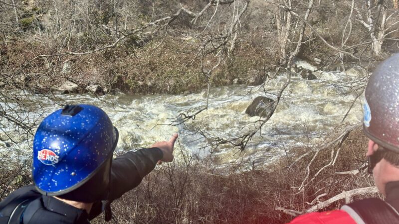
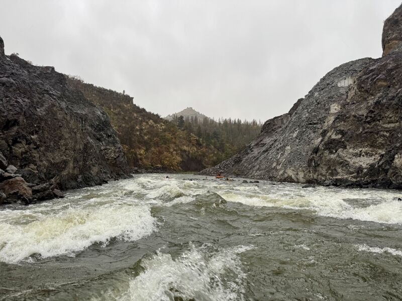
Below the former Copco 2 Dam site, the canyon bends sharply left and the gradient increases. Kwá·n·a·tuk (KWAH-nah-took), also known as Forgotten Forest, is a long, continuous rapid with numerous rocks, holes, and waves. Mid-rapid eddies are limited to the banks at low flows, an even then shoreline tree may present hazards. A swim here can be long and rocky, potentially extending into the next rapid—one of the primary hazards.
Scouting is best from river right at the top, where there is a a long downstream view. Scrambling higher up the bouldery slope reveals a bit more, though the end of the rapid remains hidden around a slight bend.
The end of Kwá·n·a·tuk is indistinct, as it flows directly into Kit·árʔ (Salmon Slapper) without a significant pool or break. At low and medium flows, a river-left eddy offers a regrouping spot, but at higher flows this disappears, fully merging the two rapids. Many raft groups choose to run them together at all flows.
About the name: Kwá·n·a·tuk is a Shasta word meaning “lost place.” The alternate name “Forgotten Forest” recalls the trees that grew in the dewatered riverbed during 98 years of Copco 2 Dam operations. These hazardous in-channel trees were removed during dam deconstruction due to American Whitewater’s advocacy and involvement, restoring the river to a natural, navigable state.
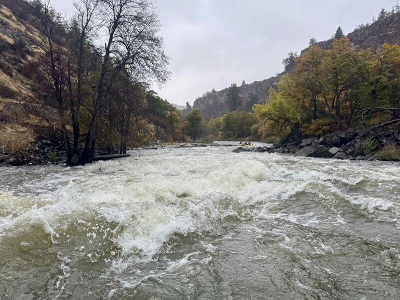
There's not much more than a brief pause at a river left eddy at the end of Kwá·n·a·tuk before the river pitches over a rock ledge and into Kit·árʔ (pronounced kee-TAHRʔ) which translates as summer salmon. The rapid is also known as Salmon Slapper. To scout, eddy on river left before the steep entry to the rapid and peer over your shoulder or hop out on to the rocky banks for a much better view. Rafts may opt to run the two rapids as if they were one. The top half of the rapid is steep as the river drops over a rock ledge with large breaking wves and holes, mostly onthe left half of the river. The second half of the rapid is continuous gradient. There's a good surf wave near the bottom; to get it, eddy out on the right while in the continuous gradient section and ferry out onto the breaking wave. The runout continues for a good distance.
Wát·á·ki (prounced WAH-tah-kee), the Shasta word for a collection of willows, is a long rapid on a right hand bend in the river at the southeastern base of K'uc'awa·k, the large rock dome on river left, around which the river has carved a horseshoe bend. The rapid, also known as Weaving Willow has two stages. The first is a sloping drop over bedrock and boulders. There are multiple line options here and some brush and wood, so choose your line appropriately. The second stage longer. The multiple channels merge back togethers around a mid-river rock shelf that provides an eddy at lower flows. With most of the flow then back together, the river goes over another bedrock drop and the current splits again. The left line is the best here but there's also a sporty line for kayaks in front of a frothy pillow rock on the right. After Wát·á·ki, the river flattens completely in a long pool with the most sublime scenery.
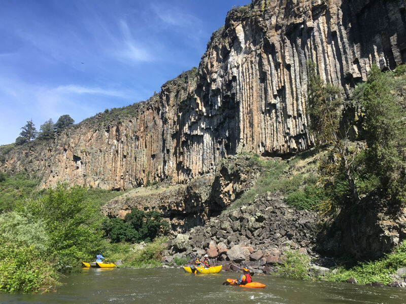
For a third of a mile the Klamath arcs through a dramatic 180-degree bend to the left around K'uc'awa·k, completely reversing its course as it sweeps past spectacular cliffs of columnar basalt rising above the right bank. If you look closely at the talus slopes at the foot of the cliffs, you’ll see that many of the seemingly randomly shaped boulders are actually hexagons that broke off the basalt columns. Although very unique for its columnar perfection in an area with relatively little similar outcroppings, compositionally this basalt is similar to others in the region, such as those at Pluto's Cave, Butte Creek, and Butte Valley. It has olivine and plagioclase crystals and is classified as a fluidal, intergranular olivine-augite basalt. Small voids within it are sometimes filled with with opal or cristobalite.
After a stunning flatwater pause as the river arcs around the tip of K'uc'awa·k (KOO-chah-wahk), the prominent rock outcrop on river left, the gradient picks up again. It eases into this rapid for a while before it gets steeper and boulders begin to force meandering lines in order to avoid tight slots or potential pins; river left is the clearer line. The defining feature of K'uc'awa·k comes about halfway though when the current slides along the vertical cliff on river left, richoeting off and over a steep pitch before continuing in constant gradient form for an extended length. It is a long rapid. At lower flows, kayakers and small craft can catch a small corner pocket eddy along K'uc'awa·k's cliff wall, then peel out to complete the drop. The scenery is absolutley stunning in all directions, but don't forget to look back upstream from the bottom and also notice the unique basalt pinnacle on river left. The name for this was rapid was chosen because it is the existing place name and honors Shasta culture and connection to the river.
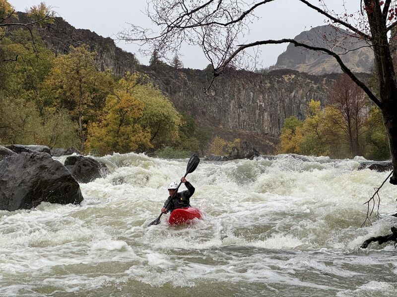
K’íka·c’é·ki Canyon is spectacular start to finish, and it crescendos before its walls part and the river relaxes. K’íka·c’é·ki Falls is the final and most challenging rapid in the canyon. Scout from river left (also portage on the left, although there is no defined path and some blackberry brambles to avoid: go high). K’íka·c’é·ki Falls has two parts: an upper ledge followed by a steep, hole-studded rocky drop. A short pool separates the two. The upper ledge can be run left of center where it is a true ledge about three feet high. It can also be run on the river right where the drop is more gradual and feeds into the same pool formed by the ledge. No matter which line you take, get yourself lined up to exit the pool and head into the steep crux drop below. The defining visual feature of the drop is a large, round-topped boulder right of center near the bottom of the rapid. Obviously, you'll want to avoid this rock and you'll need to be to the left of it (the far right channel is junked out rock). The best line is generally down the center of the drop, avoiding the rooster tail rock on the far left that's visible only at low flows. There's a decent hole in the middle of the drop that will tail-stand a kayak and even give a raft a hard hit. It's more or less unavoidable, so line up for hit, maintain control, and regain speed on exit. There's a bigger and sticky hole just ahead, and it spans most of the river. Options are to break through the hole or try to quickly head right to avoid it; this will have you driving very close to the round-topped boulder that is so prominent. No matter the outcome, you'll be dropped into the runout pool and will have exited K’íka·c’é·ki Canyon. K’íka·c’é·ki is the Shasta name for the larger region through which this section of the Klamath flows (it is also sometimes called Bogus Country, named after headman Bogus Tom). The rapid is the shortest but steepest of all the rapids in the canyon--and perhaps in all of K’íka·c’é·ki--earning it the name K’íka·c’é·ki Falls.
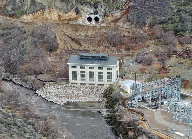
The large concrete building on the left is the former Copco 2 Powerhouse. Here water diverted from Copco 2 Dam upstream was directed down penstocks (now removed) and through turbines to generate hydropower. This is the only significant piece of infrastructure that is left from the Klamath Hydroelectric Project. It will be owned by the Shasta Indian Nation when the surrounding 2,800 acres--including K’íka·c’é·ki Canyon and its bookended river access faciltiies--are returned to the tribe.
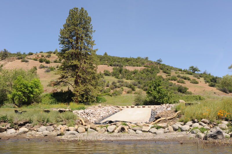
The river access site at K’účasčas (pronounced K’OO-chahs-chahs), just downstream of Fall Creek on river right, is currently managed by California Department of Fish and Wildlife on land set to be transferred to Shasta Indian Nation. Located at the end of K’íka·c’é·ki Canyon, this site was once the start of Iron Gate Reservoir. K’účasčas was a Shasta Indian village and remains sacred. Please stay on developed areas and show respect. American Whitewater secured $3.5 million from California to build this site and two others, also used for boater access and fire management. The site is available for day use from dawn to dusk. Amenities include access road, boat launch, turnaround, staging area, parking, bike rack, accessible toilet, trash, picnic table, fire pit, and a multilingual kiosk.
Nov 30, 2025
Sweep boaters looking to up their game will find this section to be a moderate step-up from other popular sweep boat runs in the region.
1040 CFS was ideal, but not without unnecessary drama at Forgotten Forest / Wild Horse / Bogus Bend.
Beware medium hanging tree limbs that offer a unique challenge to sweep boat drivers at their elevated height of choice.
The newly developed access points at Grizzly Hill and Fall Creek are excellent for unloading and loading sweep boats.
Jul 10, 2025
We put in at Access 1 since the access at the entrance to the canyon was under construction. The six miles of class I/II had no real rapids but a steady current which helped us cover the distance in a little over 1.5 hours.
Once in K’íka·c’é·ki Canyon the river changed character instantly and the flow (1200cfs) suddenly seemed a medium flow with a bit of push to it. Overall the flow seems on the low end of medium. I think under 1000 it would be ok but start to get a little manky in some of the rapids.
The rapids were mostly class III but often hard to see the end from the beginning, so hard to recognize when they were a little bit harder (class IV). Scouting was OK but some were a little challenging due to brush/canyon walls. Some rapids were solid IV and the final drop on K’íka·c’é·ki Falls borders on class V at these flows.
Overall it was some really good whitewater in a super cool canyon that we were all really happy to get on.