Skagit
1. Gorge Dam to Goodell Creek
| Difficulty | V |
| Length | 3.9 mi |
| Avg Gradient | n/a |
| Reach Info Last Updated | June 2, 2024 |
Beginning high in the North Cascades, the Skagit Wild and Scenic River winds down steep slopes, through forested hillsides and wide open valleys, eventually reaching Puget Sound. The rivers of this system – the Skagit, Sauk, Suiattle, and Cascade – flow through rugged wilderness, forestlands, rural communities, farmlands, and [...]Read More
This 2 mile reach of the Skagit River between Gorge Dam and Gorge Powerhouse is typically dewatered by the Skagit Hydroelectric Project and is closed to public access. This stretch of the Skagit River and surrounding lands is the place where all life began for the Upper Skagit Indian Tribe and they refer to it as the 'Valley of the Spirits.'
With Skagit Hydropower Licensing underway, American Whitewater advocates for returning flow to the river channel here and exploring the feasibility of providing opportunities for whitewater recreation subject to permission from the Upper Skagit Indian Tribe. Seattle City Light has studied the feasibility of providing these opportunties as part of the relicensing process for the Skagit Hydroelectric Project. The study report from a July 2023 study evaluating four different flows (750 cfs, 1000 cfs, 1250 cfs, and 1500 cfs) can be found on the FERC website here: < https://elibrary.ferc.gov/eLibrary/docinfo?accession_number=20231128-5047 >.
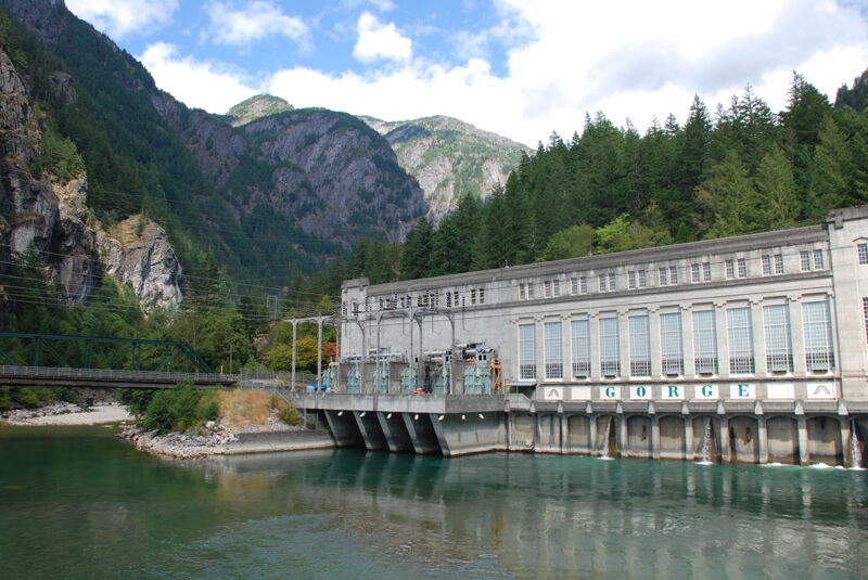
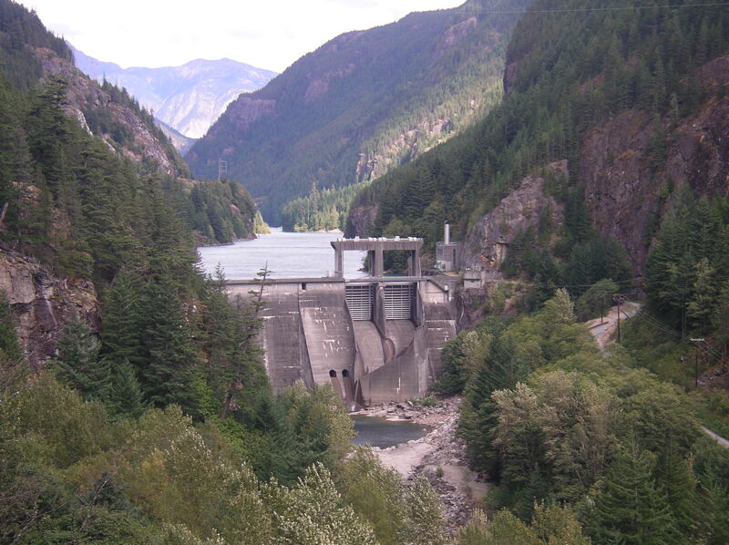
Construction of the original wooden dam began in 1921 and the generators were placed into service in September 1924. In 1961 a new concrete dam was constructed to replace the original structure. The dam is 300' high and is used to divert flow from the dam down to the Gorge Powerhouse through a tunnel in the bedrock on river left. As a result, this segment of the Skagit River is dewatered for much of the year except for spill events when flow exceeds the capacity of the tunnel or during periods of project maintenance.
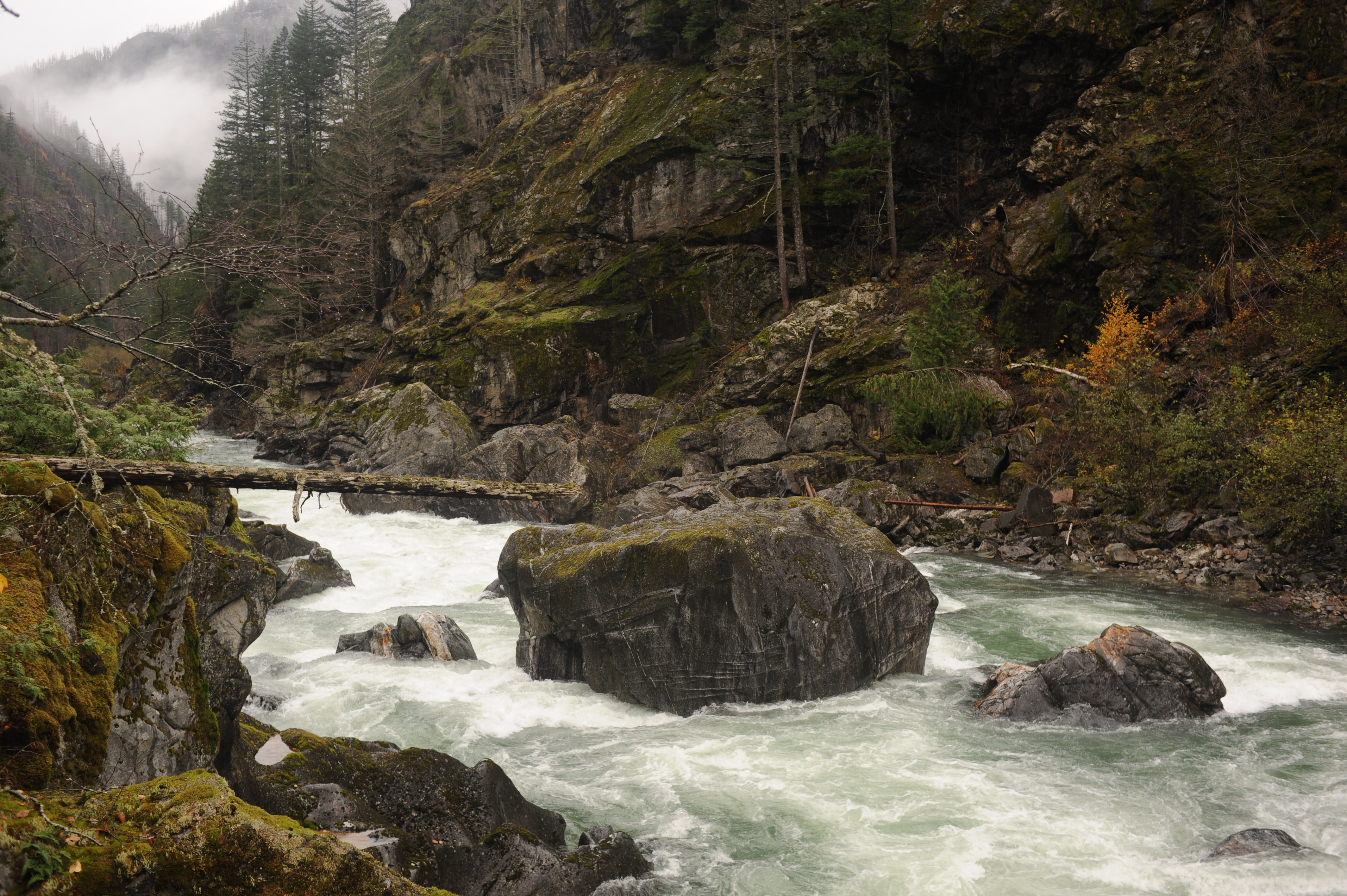
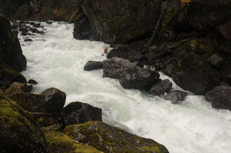
This is an approximately half mile sequence of rapids in the first part of the Skagit Gorge that were identified in the whitewater study as Key Observation Point B (KOP B).
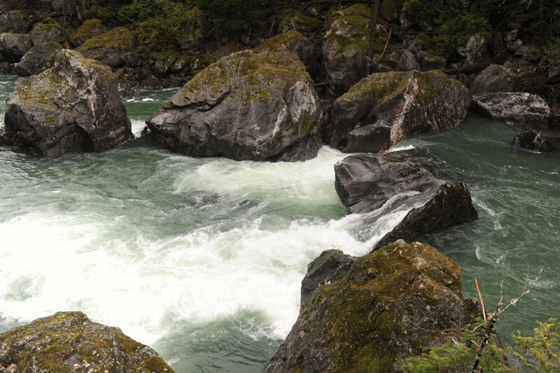
This featured is known as 'Existing Feature 2' to fisheries scientists and was identified in the whitewater study as Key Observation Point D (KOP D). It is the largest cascade in the Cascade Gorge visible as a series of drops from a pull-out on the highway just downstream of the tunnel.
This featured is known as 'Existing Feature 1' to fisheries scientists and was identified in the whitewater study as Key Observation Point F (KOP F).
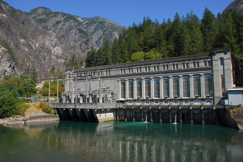
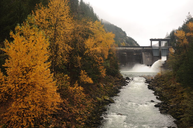
The river flow returns to the river channel downstream of the Gorge Powerhouse in the town of Newhalem.
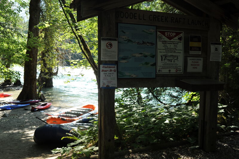
The Goodell Creek access is located adjacent to the Goodell Campground on river right and is the first public access downstream of the hydroelectric project. It represents the end of this segment that is closed to public access.
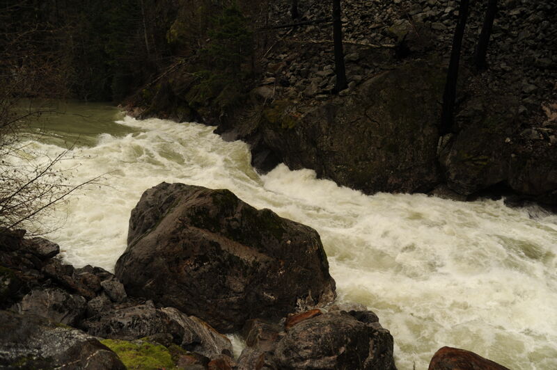
Dec 1, 2021
High water during a rare spill event when the Skagit River flows through the Skagit Gorge. On an escorted tour with Seattle City Light.
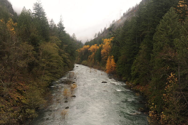
Nov 7, 2021
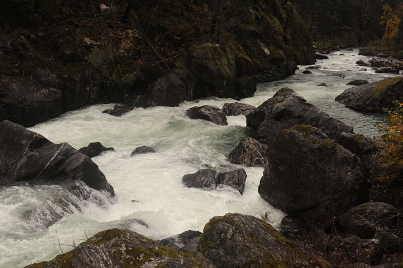
Field trip to the Skagit Gorge with American Whitewater and Seattle City Light and with the permission of Upper Skagit Indian Tribe. The gorge is not open to the public, other than what can be viewed from the highway. These photos are of the gorge at 1200 cfs.
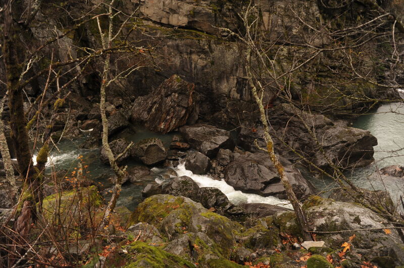
Nov 6, 2021
Field trip to the Skagit Gorge with American Whitewater and Seattle City Light and with the permission of Upper Skagit Indian Tribe. The gorge is not open to the public, other than what can be viewed from the highway. These photos are of the gorge at 0 cfs (i.e. with the full flow of the river diverted from Gorge Dam to Gorge Powerhouse).