Whitnall Park Creek
116th and Janesville Road to S.92nd Street (0.72 mi.)
| Difficulty | I-II(IV) |
| Length | 2.2 mi |
| Avg Gradient | 36 fpm |
| Gauge | Wilson Park Creek @ Gmia Outfall 7 @ Milwaukee,wi |
| Flow Rate as of 24 minutes | 0 cfsbelow recommended |
| Reach Info Last Updated | October 13, 2025 |
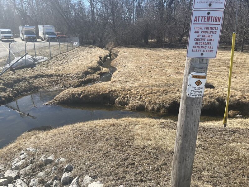
Location: Hales Corners (S.W.Milwaukee County)
Put-in: W.Ben Hunt Cabin / Hales Corners Library (42.9378, -88.0588)
Take-out: 6080 S 108th St (42.9343, -88.0473)
Shuttle: 0.9 miles/~3 minutes Shuttle Route link
Character: Microcreek (tiny tiny tiny), wooded, backyards and businesses, leading to a brief pitch and a weir.
River banks: Eroded grassy banks.
Typical width: 5-10 ft.
Drainage area at put-in: 2 square miles
10/85 Gradient Upstream of Put-in: 30 fpm
Percent Developed Upstream of Put-in: 92.2 %
(Based upon the above three values, with this small a drainage, that much development, and that much upstream gradient, this will flash up and down extremely quickly.)
General Overview
Whitnall Park is one of the gems within the Milwaukee County Park System, especailly since it is home to Boerner Botanical Gardens. Anyone driving through this largest MkeCo park has no doubt seen the two short dams on the creek which meanders through the park.
Whitnall Park Creek (a tributary of the Root River) has a few areas of interesting gradient (besides the two dams). Unfortunately, considerable deadfall (especially as it goes through Whitnall Park) makes it so impassible in enough places as to make it not worth the bother.
Stopping short of the park leaves a mere 0.7 mile reach, with a few swiftwater sections, and one hydraulic of note.
The best thing that can be said for the run is that in summer there's a beer garden in Whitnall Park. (Though if there's water in the river, it's likely an unpleasant day to sit in a beer garden.)
This would be a great place (with an 'out-of-the-way', neighborhood park parking lot) to put in from, and to catch a bit of gradient through the park. However, the creek through Hales Corners Park is so tiny and so obstructed (you'll be out of your boat more than in it), that we cannot recommend putting in here.
Looking upstream the creek looks pretty cool, too, but it's all residential, boating through backyards.
Since the creek through Hales Corners Park is so tiny and so obstructed, this is the uppermost 'reasonable' put in for this short creek run.
Since this is the uppermost realistic put-in, here's some relevant stats (for the dataholics):
Drainage Area: 2 square miles
Development Upstreeam: 92.16%
Upstream Gradient: 29.7 FPM
While there definitely is evidence this comes to boatable flows with heavy rains, the combination of the tiny drainage area, along with pretty solid gradient upstream says boatable flows will not last very long ... often measured in hours rather than days.
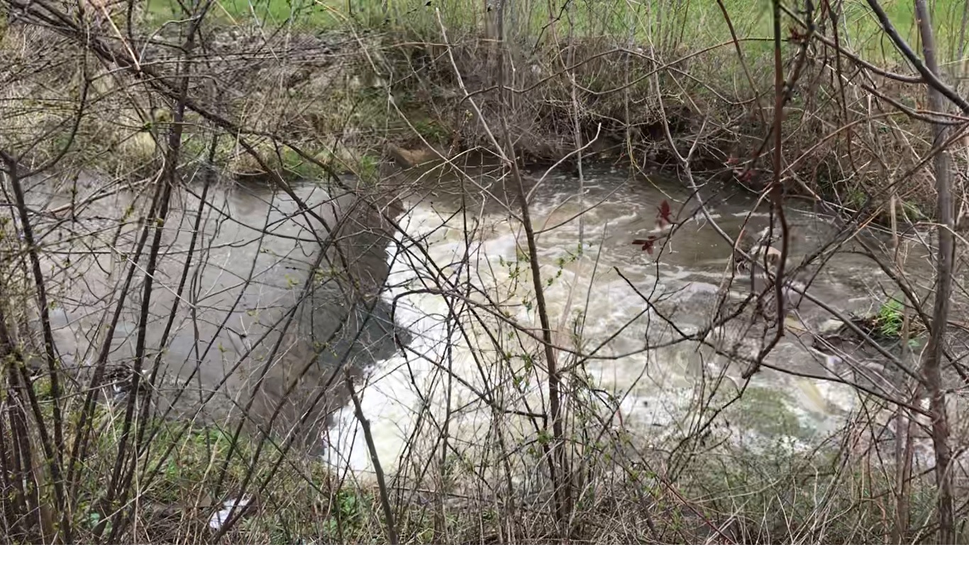
(NOTE: Photo is looking upstream at this confluence.)
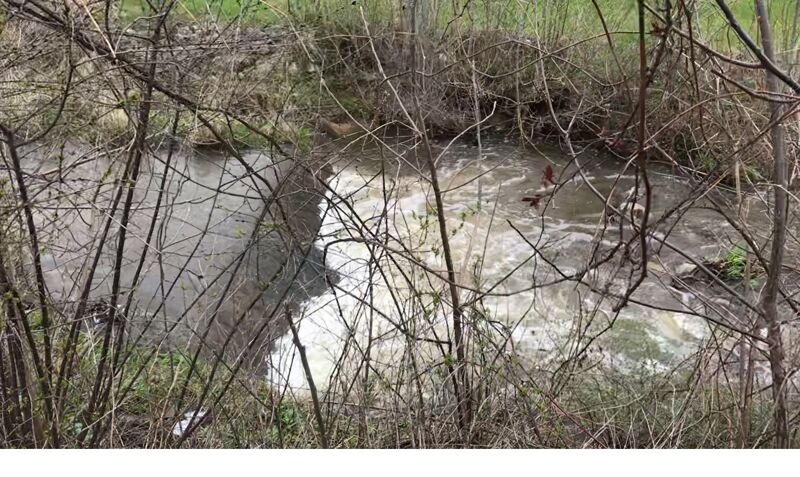
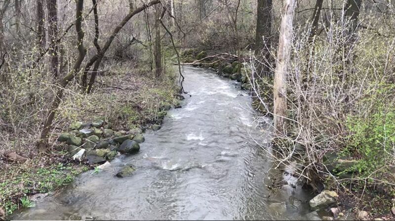
A tributary from your left (right in photo) will make a nice addition to flow (with drainage area now totalling 3.4 square miles). Just downstream you encounter the Holtz Chevrolet lots, and the creek passes under two bridges (between the car lots), through a short bit of swiftwater and heads toward W.Forest Home and S.108th Street.
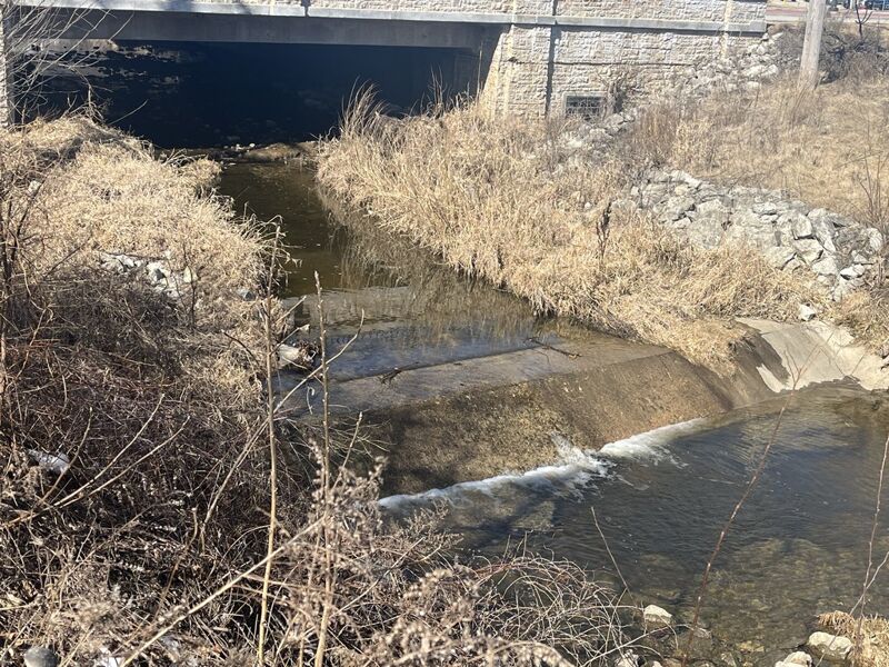
Almost immediately after passing under Forest Home Avenue (the last of four bridges in quick succession), a concrete structure (likely a utility conduit) has a smooth top and sloping face, acting as a small dam, creating a very uniform hydraulic.
This should be scouted from the parking lot at Jetz gas station (where there is also a Culvers, and a Subway) before putting on anywhere upstream.
It is possible that (at some ideal flow) there could be some play possible here, however: (1) there's not likely to be much of an eddy for repeat play, and (2) at least as often you will just need to 'punch' it to keep from being recirculated in the hydraulic.
Also note: nearly 3/4ths the width of this conduit/dam has coarse cement extending horizontal off the base, missing only from the left-of-center quarter. Thus, running just left of center may avoid a piton onto or scrape across these slabs.

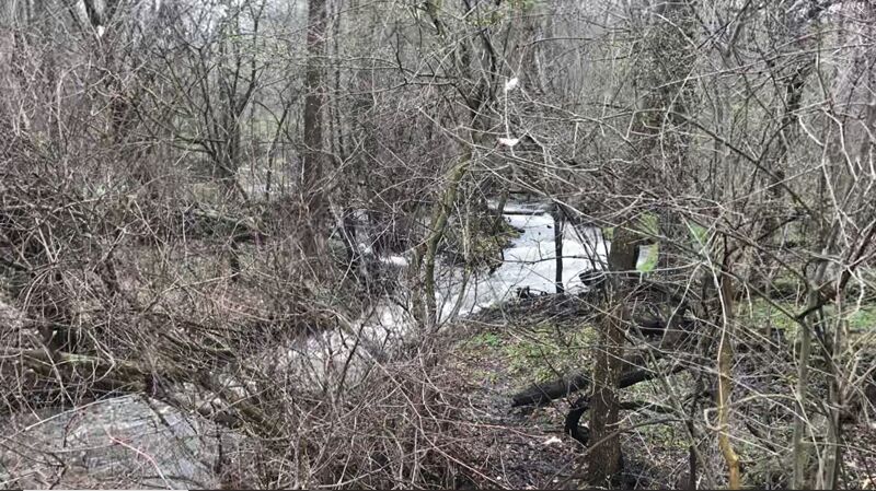
After you pass under S.108th Street, you enter Whitnall Park. As of winter 2025, there is a jumble of downed trees just downstream before getting to the first crossing under the park road.
A parking lot for a Salon and Spa lies immediately south of the creek, and is likely the best choice to end your trip, since (through Whitnall Park) you will likely be out of your boat almost as much as in it due to significant amounts of wood in the stream.
The west entrance to the park (for vehicles) encounters a triangle. As the creek passes through this triangle, there are minor riffles.
A north/south connector street crosses the creek midway through the park. Upstream of this crossing, a massive accumulation of woody debris blocks the channel so thoroughly that flow diverts briefly around it (to the left) before rejoining the regular channel. Just downstream, additional (lesser amounts) of blockage also occur. There is no parking along this connecting street, so the only way to have a look here is to park in a lot elsewhere in the park and take a long walk through the woods along the creek.
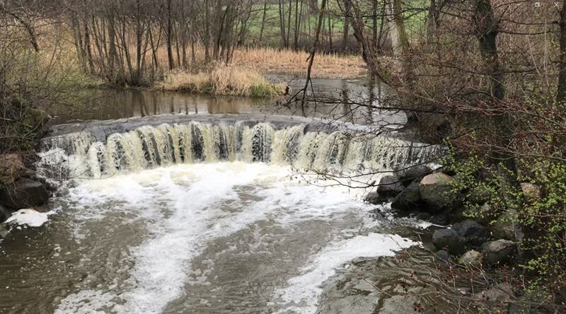
As you encounter a backwater in the park, you will approach the first of two dams. At low flows, a boat would likely grind to a stop on the lip, making it necessary to use hands or paddle to push across the brink of the dam, or 'throw' your weight back (on approach) then forward (as your boat encounters the dam) to scrape across it and drop into the pool below. At flows high enough to not scrape across the lip, there will be a nasty uniform boil at the base that it would take a well-timed and excuted 'boof', and strokes to paddle out of the boil here.
This is very much in sight of the park road just downstream, so it is a fairly 'high visibility' location where one should not dawdle, as your presence may draw attention and result in an encounter with authorities.
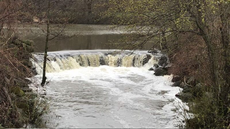
Immediately after the prior dam, you cross under the park road and encounter the second backwater in the park, and approach to the second dam. This is very much like the first regarding form, function, and strategy. Which is to say a grunge at low flow, and a massive recirculation a higher flows, and within sight of another crossing by the park road, so the same concerns apply as mentioned above.
Almost immediately after the prior dam, you cross under the park road and quickly also pass under S.92nd Street. Look for a place to exit the creek.
Streetside parking is available on N.Root River Parkway (aka W.College Avenue just west of 92nd Street).
During summer months, in afternoons and evenings, parking may be filled up, as there is a beer garden just east of here within the park.