Little Colorado
03. Cameron to Colorado River
| Difficulty | I-IV |
| Length | 56.8 mi |
| Avg Gradient | 23 fpm |
| Gauge | Little Colorado River Near Cameron, Az |
| Flow Rate as of 21 minutes | 0 cfsbelow recommended |
| Reach Info Last Updated | October 13, 2019 |
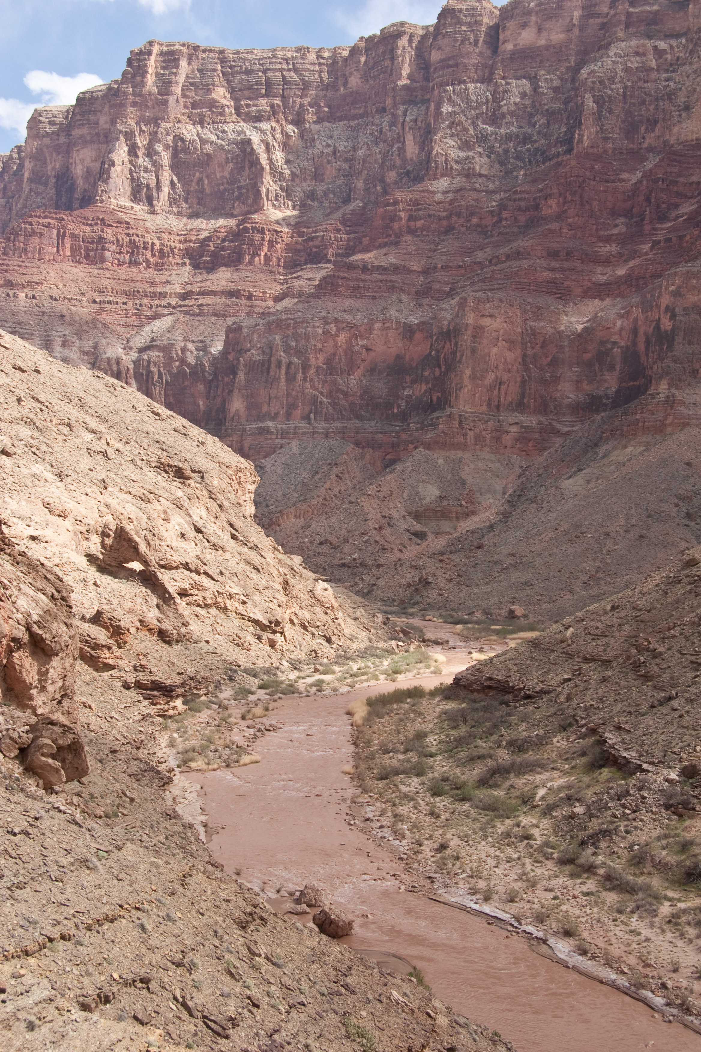
Below Cameron, the Little Colorado River flows towards the Grand Canyon through an impressively deep and narrow canyon of its own. The distance from Cameron to the confluence with the main Colorado is approximately 55 miles, so boaters must expect to take several days. The steepest 3 miles are reported to be class 4+ in difficulty. Class 3 and some 4- rapids may be encountered throughout the rest of the canyon.
All but the last 3 miles of this section are within the Navajo Tribal Reservation. The last 3 miles are within Grand Canyon National Park.
Take out: Since flows in the Little Colorado are unpredictable, but permits for the Grand Canyon must be obtained far in advance, it is highly unlikely that boaters can coordinate a trip down the Little Colorado with a trip through the Grand Canyon. So, boaters are faced with the dillemma of climbing out of the canyon at the end of their trip. There are dirt roads along the rim in several areas and probably trails leading out of the canyon to those roads in some spots. It is unclear what take out strategies have been used by boaters doing this section.
Elevations and gradient:
Cameron 4120 feet.
Confluence with main Colorado, 2720 feet.
Total drop is 1400 feet over 55 miles, creating an average gradient of about 25 feet per mile. Much of the early distance appears to be very flat. In the heart of the canyon there are sections of 30 to 40 feet per mile and one mile appears to drop about 80 feet.
Permits are required from the Navajo Parks and Recreation Department for all trips on the Little Colorado River. As of 2009, the backcountry permit fee is $5 per person, plus $5 per person per night camping fee.
Cameron Visitor Center is located near the put in.
P.O. Box 459
Cameron, AZ 86020
tel : 928.679.2303
fax:9
...Mar 22, 2009
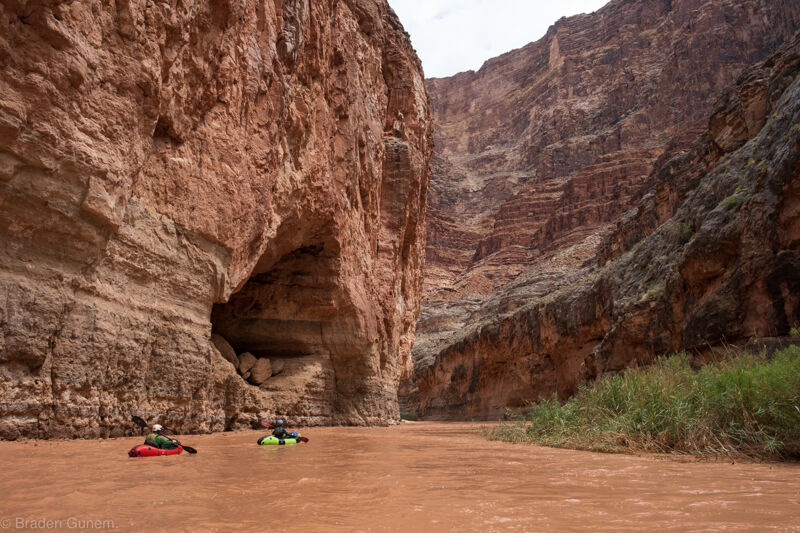
The Little Colorado a few hundred yards upstream of the confluence with the main Colorado.
Flow was 669 cfs at Cameron, and 825 cfs at the gauge near the mouth.
Mar 11, 2009
Thank you for these recent comments. I am correcting the description as best I can (without having done the run) and eliminating the hyperbole. Any additional information would be appreciated.
Looks like somebody copied the previous description straight from the Southwest Paddlers website which appears to be canoe oriented.
http://southwestpaddler.com/docs/coloradoaz12.html
Feb 26, 2009
I aborted a trip here with a planned hike out option, as did many others, because it is NOT class V. According to reliable sources, it's about 3 miles of good class IV+, and the rest is painfully flat. Beautiful, but the 12 hour hike out was not worth it. Paddling AZ calls it class IV, and unlike the one here, the description in Tyler's book is trustworthy.