Gila
01. Grapevine to Box Canyon (Wilderness or Upper Box Run)

| Difficulty | III |
| Length | 42 mi |
| Avg Gradient | 25 fpm |
| Gauge | Gila Near Gila |
| Reach Info Last Updated | August 8, 2023 |
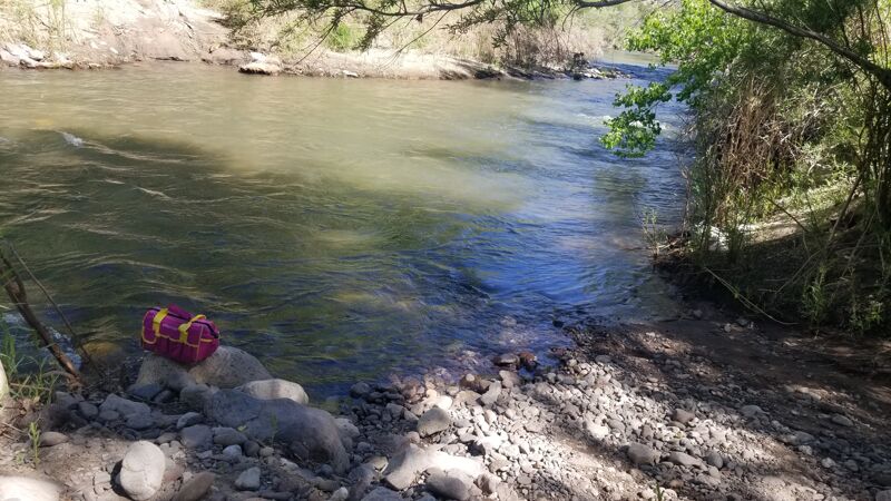
This is a very scenic run with moderate rapids, relatively clear water, and excellent camping. Old guidebooks warn of barbed wire in the river, but we encountered none.
A hiking trail follows the river for the entire distance, crossing from bank to bank. The only emergency exit is at Sapillo Creek, where a trail leads many miles to Highway 15.
Put in at Grapevine Campground on the East Fork, or at the highway bridge near the confluence with the Middle Fork. You might want to visit Gila cliff dwellings national monument before launching. The normal take-out is at a campground just past the mouth of Mogollon Creek. It is possible to take out upstream, where the dirt road that reaches Turkey Creek changes from 2WD to 4WD, but this makes your shuttle worse.
Usually boatable during a brief period of peak snowmelt in normal years, or for a longer period in years with above-average snowpack. Minimum flow is around 200 cfs, same class at 1200 cfs, measured near takeout on the Gila gauge.
May 16, 2023
May 4-6, 2023 – 3 full days, 2 nights
Flow: 205 cfs at Gila River near Gila on May 4
Two “Yakboard” Sit-on-Top Ocean kayaks, 58 year old female (intermediate) 23 year old male (expert)
Although this is rated as a II/III, I would characterize it more difficult and dangerous now, especially since the extensive flooding in 2022. The river has changed such that earlier trip reports may not be as relevant. Even experiencing this at minimum recommended flow of ~200 cfs, we found very frequent scouting essential, had to portage often, and had challenging rapids. There are many cross channel strainers, more than was reported a month prior, and several more seem immanent - large trees balancing just above the river barely hanging onto deeply cut river banks. There are strainers in many places that can surprise you after blind turns, many root balls, partial river obstructions, log jams, etc. along the way. So scouting and planning your navigation through all the normal river rocks/walls/turns along with these obstacles in the rapids was needed often.
After news of the recent March 27, 2023 fatality and Forest service report (link below), we were hesitant, but decided to go waiting until the river was at 200 cfs with no rain in sight. There was plenty of water at this flow for small sit on top kayaks, and we never had to portage due to low water.
I shared a Google Earth trip below along with GPS tagged photos of some obstructions and where they occurred on the river. But note there are several more obstructions not photographed, conserving battery life and time, especially on day 3.
Some of the more notable places or different info from previous reports:
Alum Mountain – Two cross channel strainers about 1/3 of a mile from one another
Mile 10 – There is a 90 degree left turn into a rock wall that pins you for a bit, then unavoidably leads you into a strainer that capsized and pinned both of us in shoulder deep water, luckily not head down. This was the only time during the trip we both lost it simultaneously unable to help each other, and taking so long to recover we both risked hypothermia - were certainly more careful afterwards. This combo could and should be avoided by better scouting and lining on the left.
Mile 12 – Fatality Location - Although previous trip reports had this at mile 14, we tracked it at mile 12. I posted the image of this location on the Google map below along with gps, you can be the judge. Coming up to this location there are steep banks on both sides of the river (unlike many other locations) which makes stopping more difficult here, especially as would be in higher flow. As previously reported, there are red streamers on the left, and also a tin pan on a tree river left near the location (though that could be too late).
Just before Utah Bill canyon- previous reports are correct with two cross channel strainers. There are some green streamers in the trees on the left, but these show pretty late.
Aside from the trees and flooding result, this route had a few more I would consider dangerous curves into rock faces or rock cervices without exits where if you are not careful the flow of the river would drive you right into… With my skill, I lined these, and with my son’s skill, he navigated these.
On night 2 there was a black bear hanging around our camp, but he never bugged us or our hanging food. We saw several hikers on the Gila river trail, but no other boaters. We navigated the river from day light ‘till dusk each day with only a short lunch break and no side hikes or activities. It took all of 3 days even in these pretty quick kayaks due to all the scouting, lining, and portaging, and we arrived at Turkey Creek at dusk on day 3.
Our take out spot is pictured on the map at Turkey creek, very near the Turkey creek trailhead – our planned takeout spot was inaccessible by vehicle as the road is washed out and now a cliff. It took a 4 wheel drive vehicle 1 hour to get to the take out spot from the nearest main road, pretty rough terrain. But it is easy open camping once you get to Turkey creek, used by ATVers. The day after arrival we hiked the ~11 mile round trip to Turkey Creek hot springs - a lovely hike, but hard to find the springs/scrambling, and better done as an overnighter.
All-in-all I would skip this boat trip unless you thrive on adrenaline and unnecessary, surprise danger, and dragging your stuff around obstacles. Though the absolute rugged and spectacular natural beauty of the Gila Wilderness is unmatched, might be better to hike it.
Forest Service Trip Report (April 2023):
https://www.fs.usda.gov/Internet/FSE_DOCUMENTS/fseprd1102003.pdf
Gila River Near Gila Gauge (near take out):
https://waterdata.usgs.gov/monitoring-location/09430500/#parameterCode=00065&period=P7D
Gila River near Gila Hot Springs (near put in):
https://waterdata.usgs.gov/monitoring-location/09430030/#parameterCode=00065&period=P7D
Fatality News Article:
https://www.grantcountybeat.com/news/news-articles/77426-update-fatality-on-the-gila-river
Nov 10, 2020
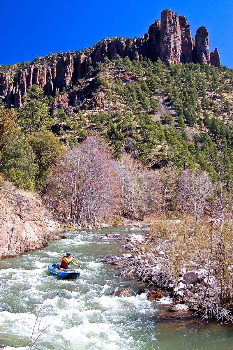
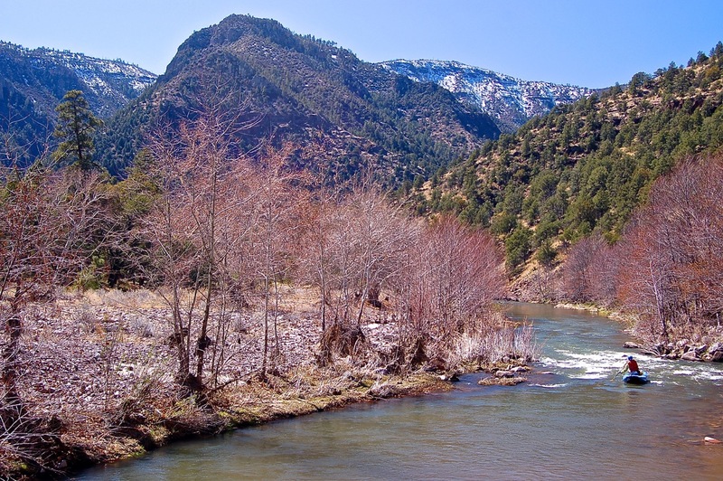
Myself and two others ran this stretch March 16-17, 2019 in ww kayaks at ~850-900cfs. This was an excellent flow to paddle this stretch. We put-in at the Gila Hot Springs Campground (private campground). The Campground owners were nice enough to let us leave our vehicle there for the days we were on the river without charging us. I highly recommend taking 4-5 days, though (instead of two) to really take in the absolutely breathtaking sights and side-hikes. We encountered no barbed-wire or other man-made hazards. Lots of tight/blind turns, though, and we did come across two river-wide strainers that would absolutely pin your boat (both within a few miles either side of Turkey Creek). Because of the nature of this river with flash flooding and potential high spring runoffs there is a good chance of those logs will shift/move/build up and other hazards flush in and out. At the 850-900cfs range it's solid class II boating with some III- turn-or-get-smashed-into-walls stretches. For more information on this run I suggest reaching out to the Adobe Whitewater Club of New Mexico, and checking the local fb paddling groups.
This run is really remote, as the description mentions. Bring a spare paddle (or two) and I recommend a satellite communicator - there's no cell service at the put-in or the take-out. We arranged for a local acquaintance for shuttle, however the last I heard Wilderness Lodge (near the put-in) will run shuttle for you for a fee.
Nov 21, 2014
Upper Gila
Nov 21, 2014
In the Gila Wilderness, the nations first wilderness.