Gila
02. Iron Bridge to Redrock(Middle Box)

| Difficulty | II-III(IV) |
| Length | 26 mi |
| Avg Gradient | 20 fpm |
| Gauge | Gila River Near Redrock, Nm |
| Flow Rate as of 43 minutes | 18 cfsbelow recommended |
| Reach Info Last Updated | August 8, 2023 |
Lat/Longitude data are very approximate.
Gage: Redrock
SR 464 turns into Game Department Road (CR), near Redrock. Take-out and park only within CR easement; best egress is on southeast apron of bridge.
The Gila River Bird Area is wildlife viewing and birding area adjacent to the Gila River. River access is 8.4 miles south of Highway 180 along Bill Evans Road. No camping in the trailhead parking area. Site has a vault toilet.
https://www.fs.usda.gov/r03/gila/recreation/gila-river-bird-area (July, 2026)
Apr 30, 2024
Put In: Tried to put in at Iron Bridge but there is a dam/barbed wire at 32* 53' 43'N/108* 35' 48'W that makes it difficult for a large raft to traverse. We entered on the west side of the river at 32* 52' 58'N/108* 35' 47'W where we launched our raft down an 8' wall and found a small path down to the side.
Camped: 32* 49' 57'N/108* 36' 39'W last access to our vehicle/river and only campground close to the river.
At this flow rate, two areas were too narrow for the raft (15') and we have to all get out and push it through.
Barbed wire at RedRock bridge and a couple of other spots after you get out of the canyon.
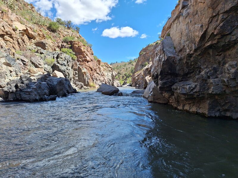
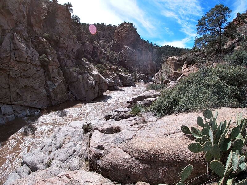
I don't know about the classification of this river. Felt like a Class 2 to me the whole time but quite a bit of rapids in the canyon.
Some of the people in the RedRock community seemed hostile to watercraft. One resident (supposed ex-law enforcement) stated all was private property (even the river) after the canyon.
Apr 28, 2023
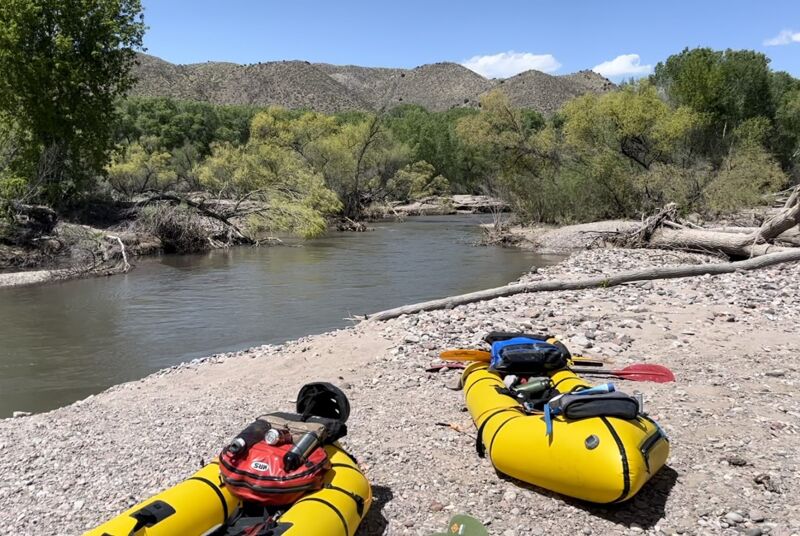
Packraft trip through the Gila Middle Box at 370-360 cfs (Redrock Gauge) as an overnight trip (April 25-26, 2023). We started at 32.8321, -108.6115 (photo, a short walk from the USFS River Vista Birding Area parking), camped on a small gravely terrace about half a mile before the USGS river gauge, and took out at the Redrock Bridge (~16.5 miles total). Float time was around 3.5 hrs for first day’s 10.3 miles and 2 hrs for the second day’s 6.2 miles. The flow was great for packrafts.
There are no strainers of note in the canyon. There are a bunch of strainers before and a few after. We portaged around a couple before the canyon and one close to the takeout, but generally were able to see them coming to avoid, navigate, or scout. I had GPS points for each stream coming in and it corresponds well with the rapids, read-and-run. Everything in 'The Narrows' comes at you really quick. Some of those rapids were challenging.
Timothy Scofield's March 13, 2023 report was very helpful. (https://www.americanwhitewater.org/content/River/view/river-detail/1209/reports/opevxSTiJBnnOs1GJ5hVE)
Mar 13, 2023
Ran this in kayaks with my daughter. Lots of strainers in the upper section before it canyons up, and a fair number after it opens up above Redrock. No strainers of note in the canyon. Took out at Redrock bridge.
There are sections with a lot of rock walls and limited ability to get out.
Scouted two rapids due to limited visibility, everything else we could see and just ran.
Scout01 N32.760354 (W)-108.630937
Scout02 32.758336 -108.633249
irrigation grate in cliff wall, not hard to avoid - 32.724958 -108.678816
Cable at low chest height - was able to push up - 32.709297 -108.714636
Put in near 32 48'44.6144' , W108 35;56.1140'. Loop at very end of road. Short walk to river.
May 8, 2017
We did this section in IK's at 1000 cfs on Feb. 19th, 2017. The run started in a cottonwood valley with class I-II water. Lots of huge trees had fallen in from the banks but were easy to avoid. We worried about logjams in the box but it turned out to be clear. We would have been in big trouble had a tree somehow managed to get into the box. Fortunately, enough turns with gravel bars and tree combs strained out all the wood at high water level by the time we got to the box. The canyon begins to constrict in about seven miles down, building up to class II+/III- rapids, and then the box--sweet class III+ continuous pool-drop for about two miles, with perhaps one class IV drop. The box was made interesting by boulders. Once out of the box, it is more open river through a cottonwood valley to Redrock.