Salmon
7 - Carey Creek to Riggins
| Difficulty | III-IV |
| Length | 23 mi |
| Avg Gradient | n/a |
| Gauge | Salmon River at White Bird Id |
| Flow Rate as of 1 hour | 6530 cfsrunnable |
| Reach Info Last Updated | March 2, 2023 |
This is a wonderful section of river immediately downstream of the more well-known Main Salmon which is the classic multi-day trip. This river segment flows for 28 miles among pine forests and granite walls with the Salmon River Road (Forest Road 1614) paralleling the river. It provides great opportunities for day trips with easy logistics and good camping (either in campgrounds or on one of the many sandy beaches) with no permits are required.
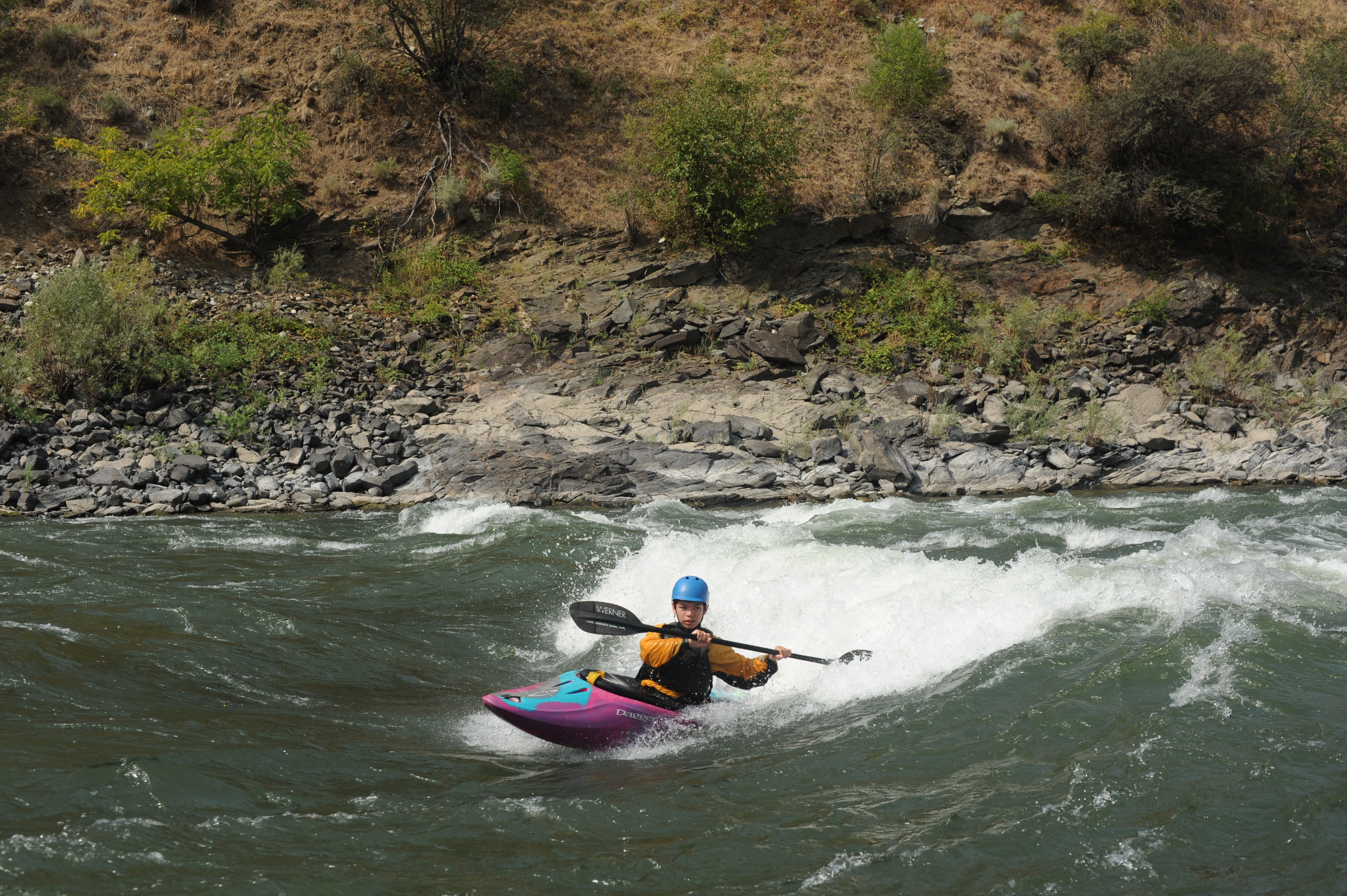
While the high flows of spring can create hazardous conditions (experts only), mid-summer brings more moderate flows and classic pool-drop rapids with good flatwater recovery sections in between. Some nice beaches provide places to hang out for lunch or engage in water play.
Local outfitters provide options for less experienced paddlers who have interest in a day trip (check with outfitters in Riggins).
Logistics:
A Salmon River Road (Forest Road 1614) offers multiple access points. In addition to the formal sites below there are a few beaches that can be accessed from the road and are enjoyed when they emerge during the later half of the summer.
The turn for the Salmon River Road (Forest Road 1614) is at Highway 95 mile 194.4 at the south end of town in Riggins. The road heads east for 26 miles where it ends at Vinegar Creek. Access points and features along the way include:
Mile 1.4, Shorts Bar: This primitive campground (no fee) and boat launch is administered by the Bureau of Land Management.
Mile 2.3, road becomes single lane
Mile 4.0, Island Bar: This primitive campground (no fee) and boat launch is administered by the Bureau of Land Management.
Mile 6.6, Lake Creek Bridge (aka Yellow Bridge)
Mile 9.8, Allison Creek Picnic Area: Picnic site along the Salmon River administered by the Forest Service.
Mile 10.5, Spring Bar Campground: This fee campground administered by the Forest Service offers a boat launching ramp and 18 tent campsites that are open ye
...
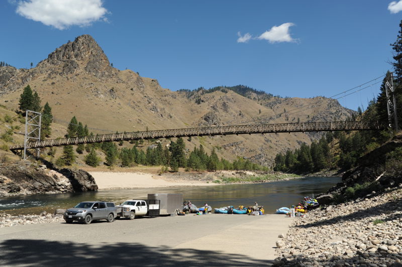
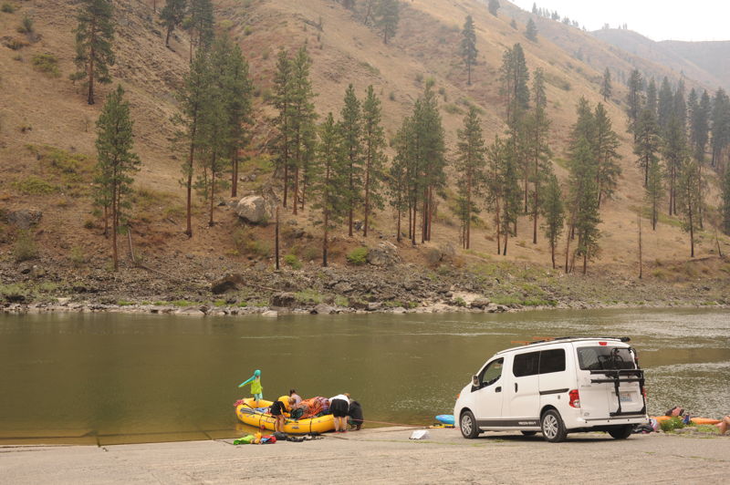
This access is a popular alternative take-out for the Main Salmon and a put-in for trips on the roadside run down to Riggins. The site has a large parking area and paved ramps providing easy access to the river. It is located at river mile 109.8.

A mid-river rock that creates a hidden hole at flows above 30,000 cfs.
This rapid gets bigger at lower flows. River mile 97.8.
Class II rapid near Van Creek Campground that is a small camping area with toilet facilities. River mile 97.6.
Forest service campground with water, toilets, and paved boat ramp located at Salmon River Road mile 10.5. This is a good access on the paved portion of the Salmon River Road. It is located at river mile 96.9.
Large irregular waves at high water. River mile 94.1.
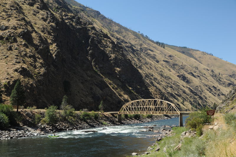
Easily recognized by the large yellow bridge over the river just below the rapid. There is a large rock on the top left side of the rapid. At flows above 60,000 cfs this rock creates a large wave called the 'Big Easy' or 'Haystack.' At flows below 20,000 cfs, the wave disappears and a large hole forms. At the low flows (around 3000 cfs) of late summer when the rock is fully exposed, the easy line is to the left of the rock. Located at river mile 93.0.
This short wave train is a popular location for kayakers at lower flows. River mile 92.1.
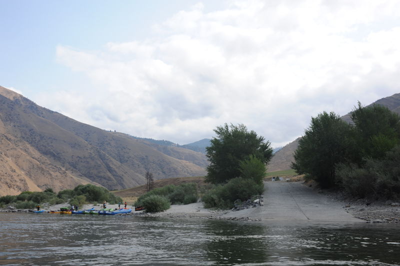
Island Bar Recreation Site is a recreation site administered by the Bureau of Land Management. It is accessible when flows are below 35,000 cfs (at higher flows the site becomes an island). The site is largely undeveloped with dispersed camping and a rough gravel access down to the river at the upstream end of the island. It tends to be a little less busy than the more formal access site at Shorts Bar just downstream. It is a good put-in for those running the town run through Riggins who want to camp the night before.
Shorts Bar is a BLM recreation site with toilets, paved boat ramp, and camp sites (popular with RVs). The large beach is popular for day use. River mile 87.8.
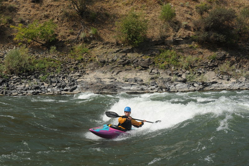
At flows of approximately 3000-5000 cfs Mill Wave comes in creating a fun play feature just outside Riggins.
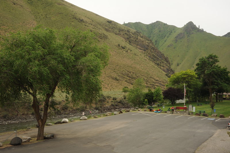
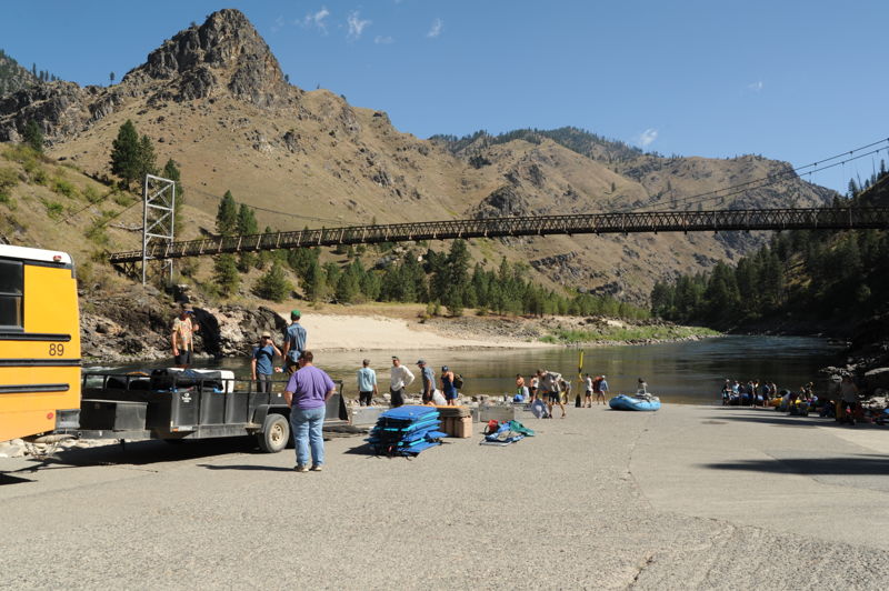
Located at Highway 95 mile 195.7 in Riggins City Park recognized by the historic wooden scow, used for one-way trips down the river, that marks the entrance to the park. A ramp provides access to the river. River mile 86.0.
Aug 18, 2021
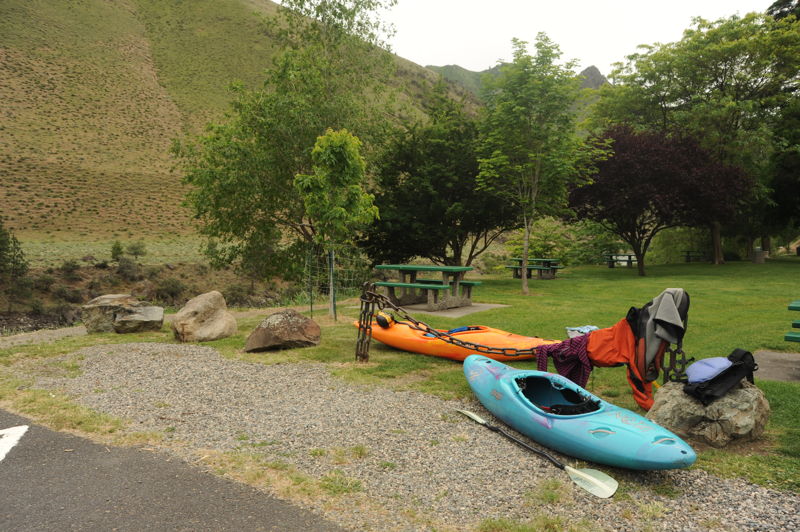
We boated the section from Spring Bar to Riggins at the end of August as part of a longer 9 day trip that continued on down to Heller Bar on the Snake. Flows were around 3000 cfs which was plenty of water for a great trip (and a great level for Mill Wave). We launched at Spring Bar on a Wednesday and were the only group at the campground. Originally we had planned to launch from Carey Creek but the French Fire was active preventing us from accessing Carey Creek. Our first day was a short day from Spring Bar to Island Bar where we camped and met friends who joined us for the next day's float through Riggins. Shorts Bar was relatively full with RVs and Island Bar was considerably less crowded. It was a weekday evening so probably not as busy as a weekend but Island Bar was a good place to rendezvous with others. I would recommend it as the place to camp and launch for anyone driving in the night before to do the run from Riggins to Lucille. Had we not been meeting friends there were several beaches that would have provided good camps that are less accessible from the road.
Aug 30, 2020
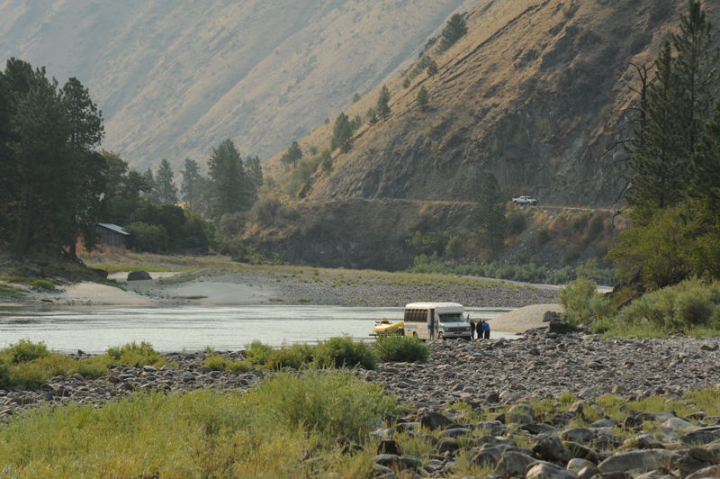
Rapids and access points on the drive out to Riggins after a run on the Main Salmon.