Sandusky
1. Pioneer Mill Dam in Tiffin to CR 38(Huss Street Wave Section)
| Difficulty | III |
| Length | 3.2 mi |
| Avg Gradient | 12 fpm |
| Gauge | Sandusky River at Tiffin Oh |
| Flow Rate as of 26 minutes | 142 cfsbelow recommended |
| Reach Info Last Updated | July 31, 2025 |
About the Class III Rating
The Class III rating for this section is primarily due to the potential for swamping open canoes in the larger features—particularly at Huss Street. It's worth noting that the rapids here don’t require much maneuvering. Any finesse tends to come from surfing opportunities rather than technical navigation.
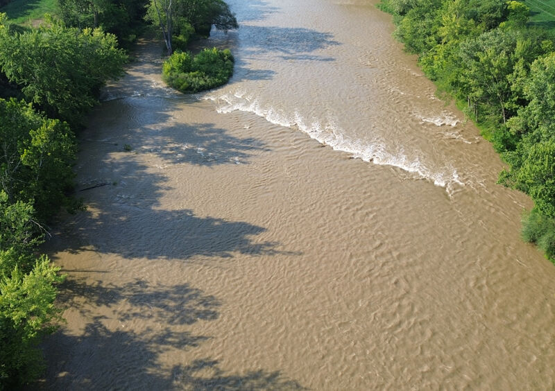
At higher water levels, swims can be long and hazardous. The river begins to flood its banks, which limits your ability to exit safely. In these conditions, strainers and trees along the edge become serious hazards, making self-rescue or assisting others more difficult.
Note: Downstream of the Rt. 38 bridge, there is a single river-wide wave about a mile downstream—and that’s the only feature of note. This rapid is not included in the details below because running it would require taking out at a canoe livery, which has been closed since approximately 2018.
The Sandusky River by the Haunted Hydro is only 15 minutes away. It can be a fun surf area at the right levels
The Maumee River is another local run 45 minutes away. It is a lot easier than this section, but it can be fun.
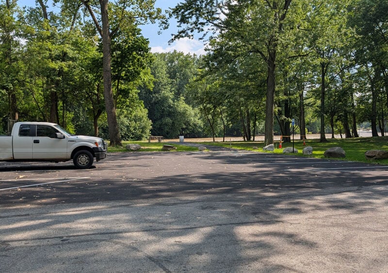
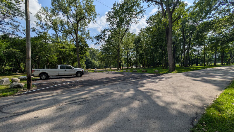
Put in at Nature Trails Park: 220 E Davis St, Tiffin, OH 44883
GPS Coordinates for River Access Parking: 41.1262382558504, -83.16870125127963
At high water, there's some gentle surf waves to warm up on.
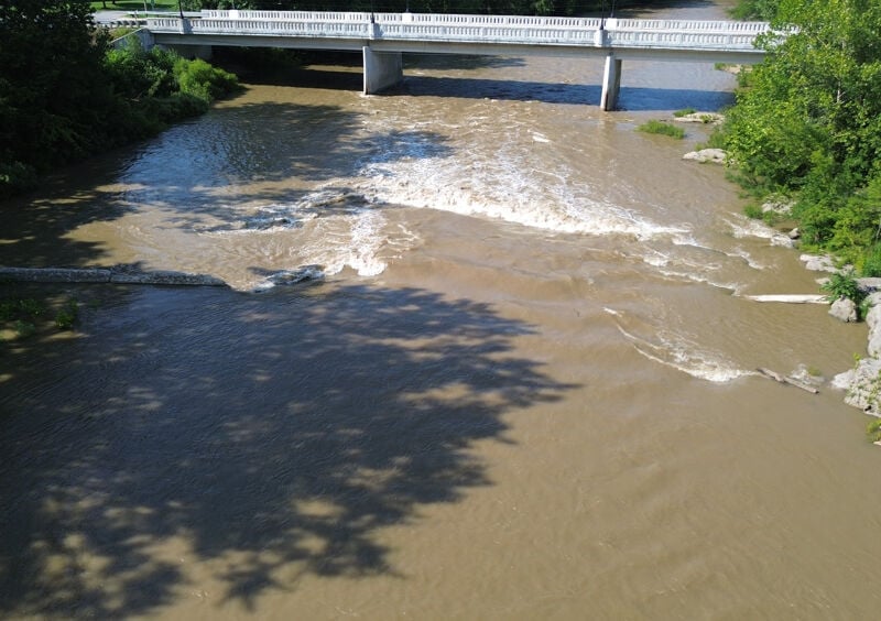
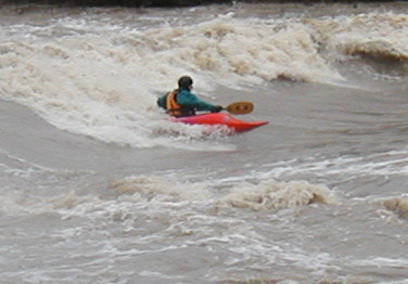
This feature is formed by a broken dam near Huss Street and offers dynamic paddling conditions across a wide range of water levels. At low flows, it provides fun eddies and playful hydraulics. Around 5.5 ft (4000 CFS), the central hydraulic becomes deep and powerful—if you hit it head-on, it will likely flip you, but it won’t hold you once you’re upside down. As the river rises to around 6.5 ft (6000 CFS), the rapid transforms into a large, glassy surf wave that forms on the tongue of current flowing through the broken section of the dam. This wave is local favorite park-and-play spot during wet springs.
Only the river right side of the dam was removed. The river left half remains intact, creating changing dynamics as levels increase:
At high flows, start right of center as you approach Huss Street. Your target is the gap between the two bridge supports. Once committed to the rapid, you'll spot the line: a diagonal move from right of center toward the left corner of the hydraulic.
Scout from the bridge above when levels are high—it’s the best way to evaluate the current line and assess wood or other hazards before committing.
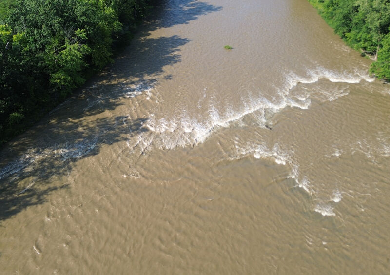
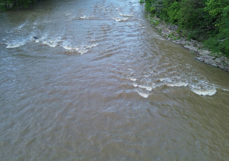
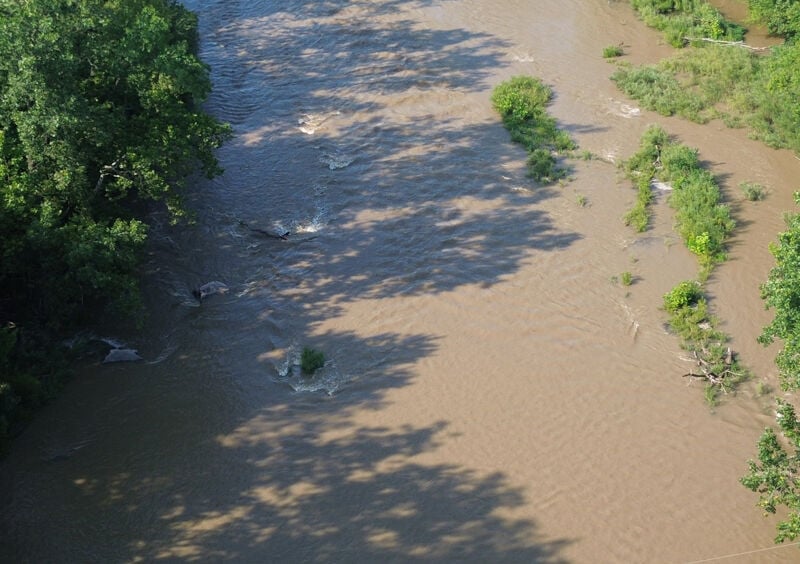
At higher flows, the reason for this rapid’s name becomes obvious—a large, turbulent 'fireball' of water forms where multiple currents converge over a ledge about one-third of the way from river left.
Experienced paddlers can punch directly through the center of the fireball without much trouble. If the river rises above 5 feet, inexperienced paddlers will want to stay within the leftmost quarter of the river. River right of the fireball, the ledge drop creates a series of intermittent pour-over holes that can get sticky depending on flow.
At moderate flows (around 3.5 to 4 feet), an eddy forms behind the fireball in the center of the river. This makes a great spot for ferrying up and catching a surf on the fireball.
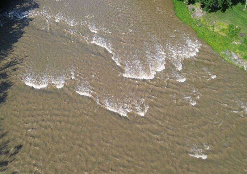
On river right, near the houses, there’s an excellent surf wave that becomes a local favorite at the right levels. While it can be tricky to catch due to limited eddy service, once you’re in, the ride is smooth and rewarding. The wave sits next to Rivers Edge Executive Suites, where guests often watch from the shore—giving you the perfect audience to show off your super skills and be the star of the show.
At lower flows, three rocks on river left create a great spot to practice essential skills like eddy turns, ferries, and attainments. It’s a fun and accessible area for newer paddlers to build confidence. Once the river rises to levels most paddlers consider “fun,” these rocks become submerged and the feature disappears.
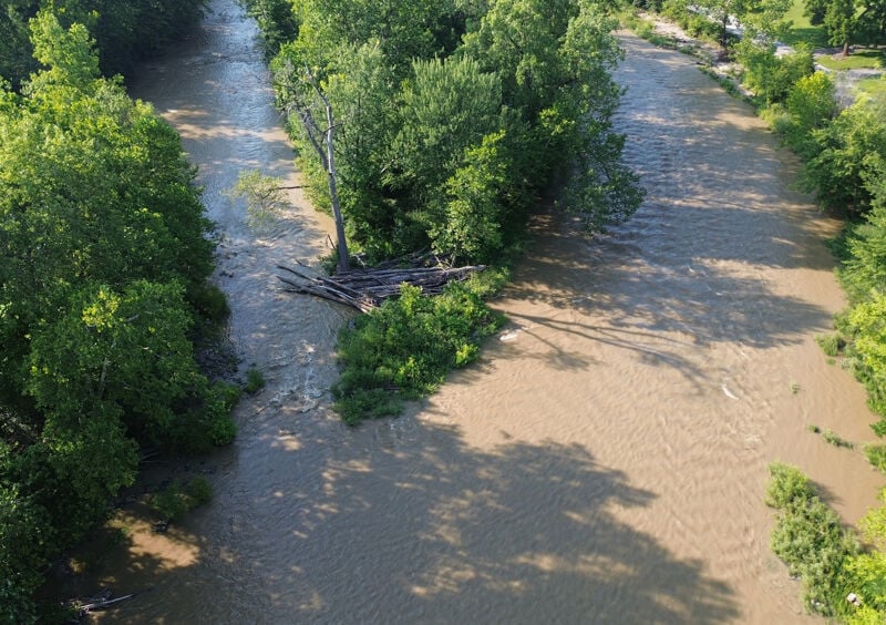
As the river splits, you’re coming into Bend. The left channel is boring and tends to collect strainers at the entrance—best to avoid unless you're desperate to change it up. The right channel is where the action is, featuring a series of compression waves formed by a sequence of ledge drops. Surfing opportunities abound along river right, but eddies are scarce, so grab what you can on the way down!
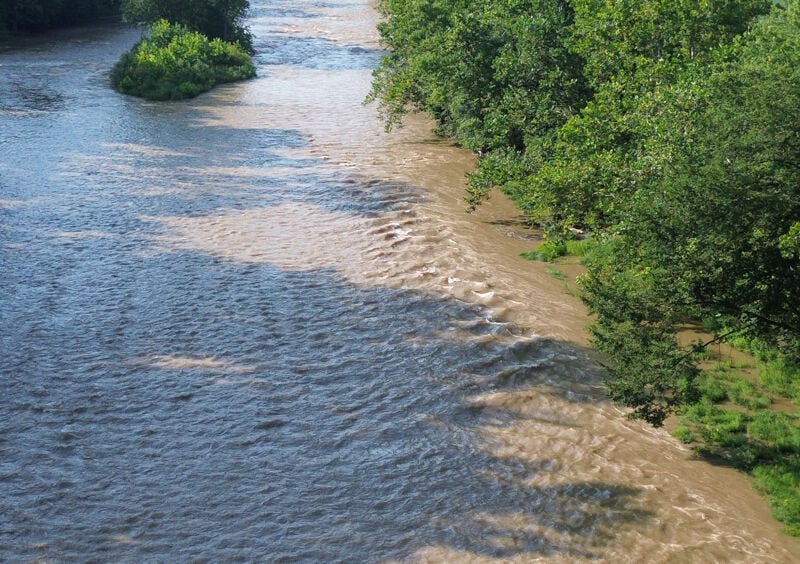
When you spot the island, make your way toward the river right shore. As the bank squeezes the current, it creates a lively series of reactionary waves. Expect a fun, bouncy ride—like a rubber duck in a bathtub. Let the river toss you around with a smile.
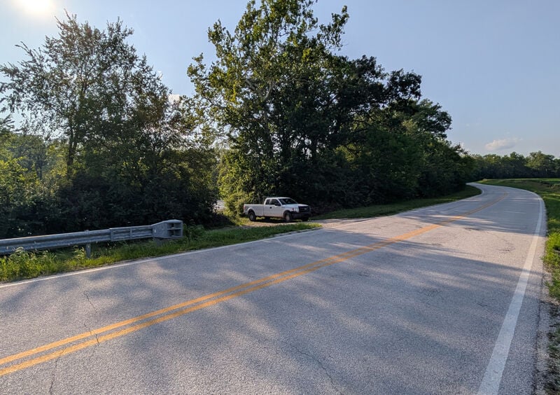
The take-out is a small river access point located at: 3408 N County Rd 33, Tiffin, OH 44883
If you're not familiar with the area, it may look like just a roadside pull-off—keep an eye out so you don’t miss it!
GPS Coordinates for River Access: 41.16864616328115, -83.16254382147336
Aug 2, 2025