| Difficulty | III-IV(V) |
| Length | 3.7 mi |
| Avg Gradient | n/a |
| Gauge | Fish Creek Near Three Lynx, or |
| Reach Info Last Updated | July 23, 2026 |
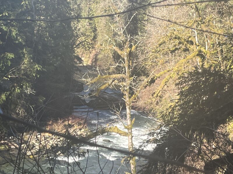
The lower section of Eagle Creek is a favorite with Portland locals for its technical character and fun surfing. The rock is the same volcanic duff seen in the Sandy gorge and along the Bull Run.
Runnable flows usually occur when the Fish Creek gauge is between 300-1,500 cfs, and there has been recent local rain or low-elevation snowmelt. The correlation isn't always perfect, and also factoring personal preferences this gauge could be at 250 and Eagle Creek can still be runnable, or 2,000. Due to the imperfect correlation, there is a painted gauge on the take out bridge under Eagle Creek Rd, visible across the river from upstream of the bridge on river right. Two feet there is a healthy medium flow. Six inches is minimal and only the lower section below Eagle Fern is doable, 1 foot is low but fun, and 3 feet is high but still good, so long as you can avoid the wood.
Access for this run is within the vicinity of Eagle Fern County Park, which is a fee area. There are multiple pullouts where you can access the river both upstream and downstream from the park. The small dam that was formerly located in Eagle Fern park was removed in fall 2021.
Downstream of the NF confluence the run is class II with one class III rapid before reach The Falls, catch the small-ish eddy on river-right just upstream of the fish ladder intake.
The Lower Falls with its fish ladder comes up within 10 minutes. Land on river right above the first concrete structure to scout or portage. The falls is more runnable with more water, generally down the right low and medium flow and middle at higher flows. The left looks frightening at most levels. The portage involves climbing up to an almost level carry or drag through the forest then descending one of several steep trails down to the river. It is recommended to scout your descent before taking your boat--some of them drop off precipitously at the end. Some boaters who know they are not run
...Put in just downstream of the NF Eagle Creek confluence.
Boaters who want to skip either running or portaging the falls can walk 100 yards in to just below the falls from a trail at this gravel pull out.
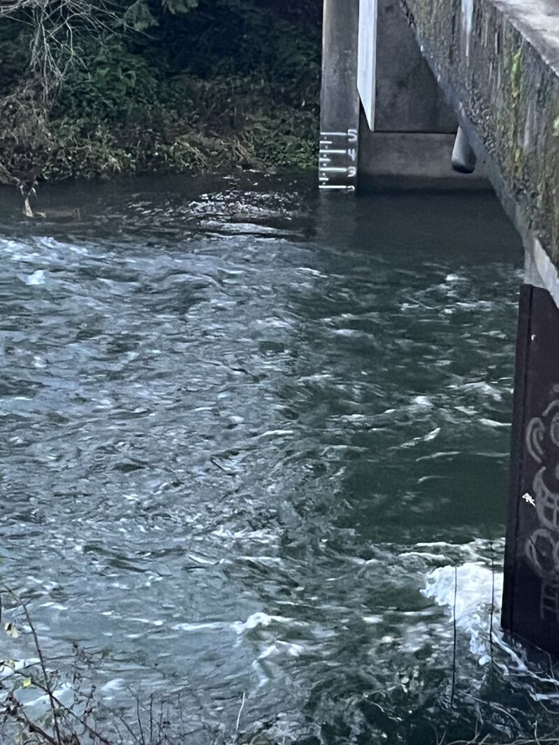
Take out at the bridge on river-right, there is plenty of parking on the north side of the bridge.
Jan 9, 2026
Jan 9, 2026 The only notable log hazard remaining in Lower Eagle Creek was on the left side of Elbow Rapid, we were able to run middle. The big news is the log jam at the Cave Rapid flushed out in the winter floods, as well as the stuff in the rapids just above it. Another log that would have been a portage at higher flows on our trip flushed free the next high water after our trip as well, meaning once past Elbow Rapid it's pretty smooth sailing.
Apr 10, 2025
The painted gauge at the takeout read 1.4 and we went ahead and launched upstream from Eagle Fern park. We've run it a lot higher but we wanted to see it at low flows to check out the wood situation which is a moving target.
Between Eagle Fern and Fish Ladder Falls there's a long section that I would rate class 3 at this flow because it's technical with rocks and hole that just don't let up for a half mile or so. It would suck to swim in that one. At least it's easy to get back to the road at the Fish Ladder.
The approach to the portage of the Fish Ladder is relaxed at this flow and the eddy on river right above the wall is easily big enough for two boats. The portage is longish but easy walking. It helps to know which trail to take, both going up from the Falls area, and down to the river. Fish Ladder Falls is much more runnable with more water.
Launching below the portage you are immediately into the lead-in to the Elbow. Several horizons reveal easy enough lines, but then when you get to the Elbow the bottom drops out and it is not obvious where to go. Sure hope you scouted ahead of time.
Even if you did scout it's not easy to pick the right spot to go over the edge. If you are reading water you'll be tempted one channel too far to the left, putting you in danger of dying under the log jam on the left. The best channel to approach the double drop center channel in the Elbow is blind and I missed it, again, went too far left, and had to scramble back to the right through a pile of rocks. Thankfully all three of us made the scramble but a drone scout might help me locate that straight shot line that is so blind.
We went on both sides of the Island rapid below the Elbow and both went fine. Below that is Cave, which still has a log jam across 2/3 of the river. You can run left then exit via the far left channel IF YOU CAN MAKE IT UNDER THE LOGS OVERHEAD which wasn't hard at 1.4 but will obviously get harder with more water.
Not too far below there is place where the current goes far left around a small island, and a bony right line is also possible. We took the bony right line and looking back upstream you can see there is still a giant log bridging the left line: still no go. After this island the gradient picks up and it's class 3 for a while, then back down to class 2 with lots of great play waves all the way to the takeout.
Still a favorite creek, and 1.4 was plenty spicy.
Jan 9, 2022
We've run Lower Eagle from Eagle Fern Park to Eagle Creek Road 3 times in the last 2 weeks--we find it worth the effort. The giant logs which obstructed the Elbow section (steep continuous part after the fish ladder) have both been swept to the sides by high water. Cave rapid is passable on the far left, and no portages for wood have been required. With that said it is NOT a clean section of creek, there is a lot of dangerous wood. Using the painted gauge on the takeout bridge we've run it at 2.25 and rising to 2.5, then 1.75 and steady, and 2.75 and steady. We use the 3 Lynx gauge (Clack) as our main guide to know if this is in. Over 3,000cfs on that gauge means Eagle will be high enough. On the 2.25 and rising day 3 Lynx peaked just shy of 5k. On the 2.75 and steady day 3 Lynx was at 6k dropping to 5k with snowmelt continuing, and no rain for 2 days. All of those levels are in what I would call the medium to high range. First time runs would be most reasonably accomplished below 2 feet. I would not launch on this section without local guidance or lower water or both. It is definitely *not safe*. With that said it is a blast! Really great play if you're comfortable enough to bring a surfy boat. So far I think the surfing is best at 1.5 to 2.5 though there are a few beauties out there when it's higher, they're just getting harder to catch. The Fish Ladder Falls is definitely more runnable at higher flows. Here's video of an R2 running it at 2.75: https://vimeo.com/663831590 and here's video of the same R2 running the entire Elbow section on the same day: https://vimeo.com/663821726.