Santiam, Middle
2. Green Peter Dam to Foster Reservoir (The Concussion Run)(Concussion Run)
| Difficulty | III-IV |
| Length | 2.1 mi |
| Avg Gradient | 36 fpm |
| Gauge | Middle Santiam R Blw Green Peter Dam Nr Foster, or |
| Flow Rate as of 12 minutes | 695.90 ftbelow recommended |
| Reach Info Last Updated | July 11, 2025 |
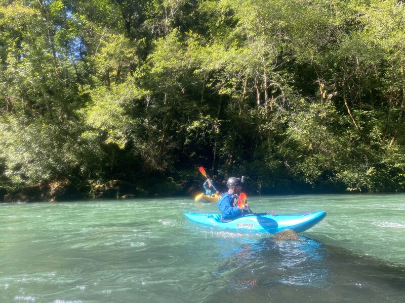
Short dam controlled run between a couple of reservoirs.
Check out descriptions at
This stretch is generally done in the Summer at either 1 or 2 units.
1 unit is usually between 1,000-2,000 cfs
2 units is usually 2,500-4,000 cfs.
Check out this gauge (third graph down) or this other one and try to figure out what the schedule is. It often releases in the evening, so after work runs are practical. You can also try calling the dam operators to get the release schedule.
If it is all a big headache, try getting in touch with a local boater, someone will probably know what the deal is. Eugene Kayaker on Facebook is a good bet. Or Team Tanhands (also on facebook).
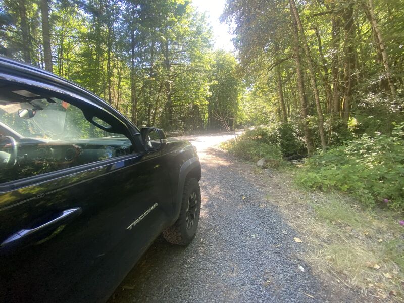
There is a short walk in along a road to a gate and fence. A steep fisherman's trail to the right of the fence leads down to the river.
Note: in recent years there has been more than a few interactions with Linn County Sherriff's office when boaters walk the road to put in at the base of the dam. While the top few warm up rapids below the dam are nice, the long walk down the road and possible for run ins with the fuzz mean that most folks put in downstream. Access Point 2 is easiest and fastest to the water and although you miss the top 0.5 mile of the run, it's much more efficient for multiple laps and it puts you in the pool just above Swiss Cheese.
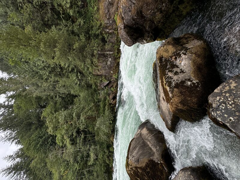
From the base of the dam: the run starts off as moving flat water and builds towards class III as it reaches the three named rapids 1.4 miles after putting on. This wa
...Historically you could walk passed a simple vehicle gate and walk to the base of Green Peter dam to put in. A few years ago the Linn County Sheriff would show up whenever this happened - presumably an alert from the remote operations of the dam. In recent years more robust gate and wire has been erected as well. While a trail exists straight down to the river behind where the chain link ends and over a scree slope and poison oak, it's sketchy and at minimum it feels like you're doing something wrong. Lately most people have been putting in at one of two access points downstream, which misses a warm up and some time on the water, but quickens the pace of resetting for multiple laps and avoids negative interactions with law enforcement.
Near the downstream end of a guardrail is a pull off and a very steep trail down to the water. This access point is the highest feasible put-in without walking the road to the base of the dam. You sometimes feel like you want a rope - and it might be a good idea. More than one boat has made its way to the river without their owner over the years.
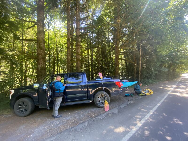
A very chill walk to the river with some minor blackberry encroachment. There is parking for 2-3 vehicles and this puts you in the pool about 50 yards above 'Swiss Cheese.' These days, this is the most common put in.
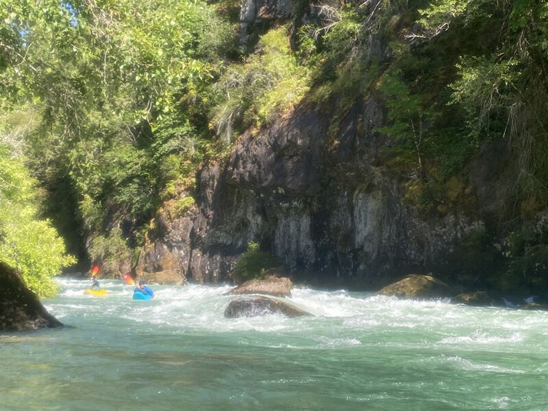
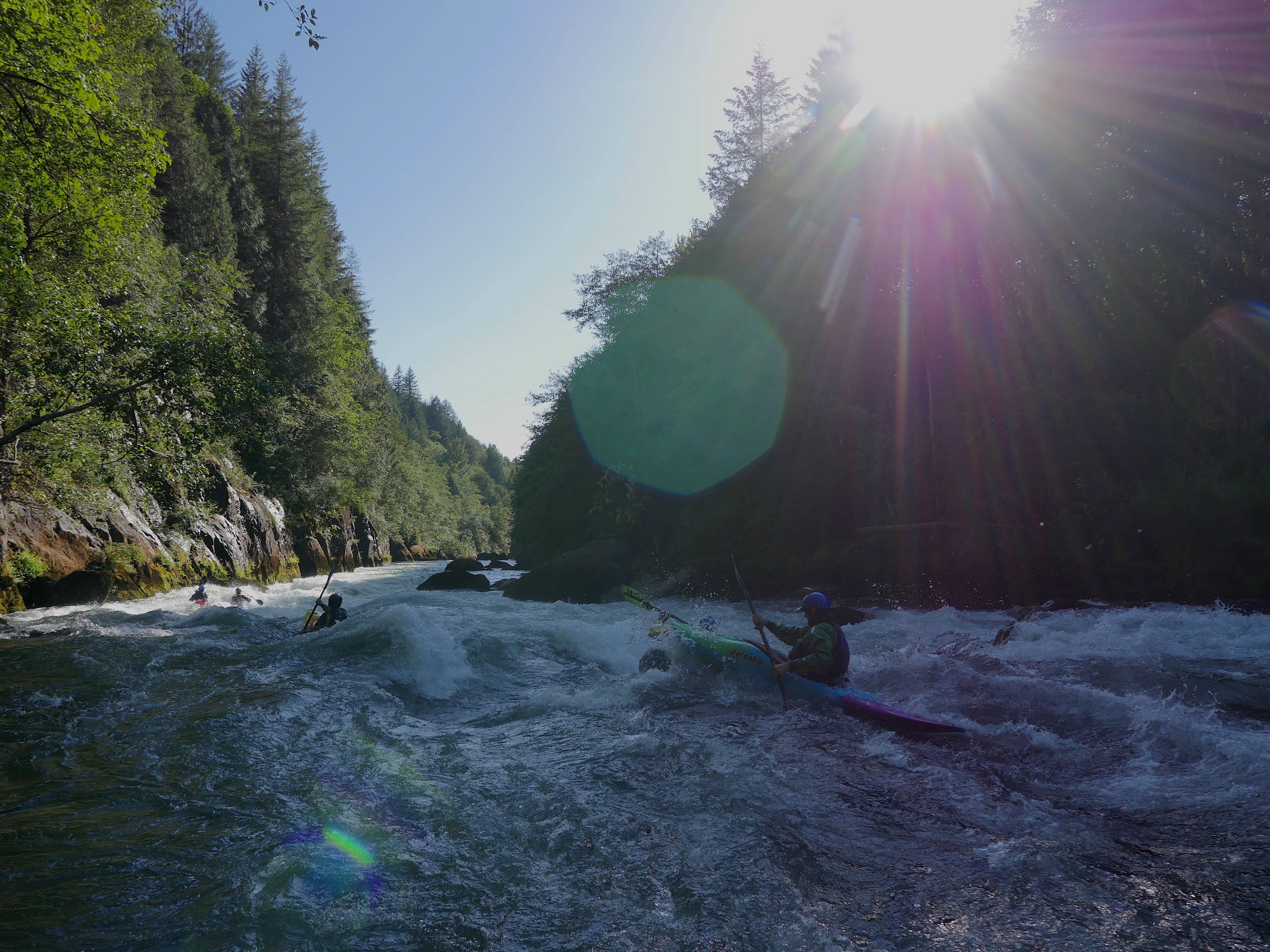
A fun class III-III+ with a great, glassy, surf wave at the top at most levels.
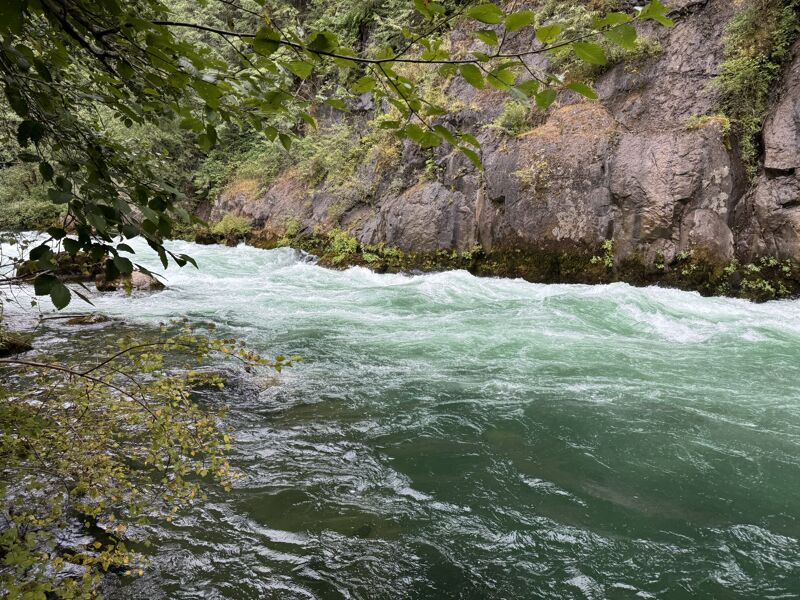
Lots of possible lines depending upon the flow. The easiest is to enter left and work right. The wave train along the river left wall tends to want to push you into the left wall.
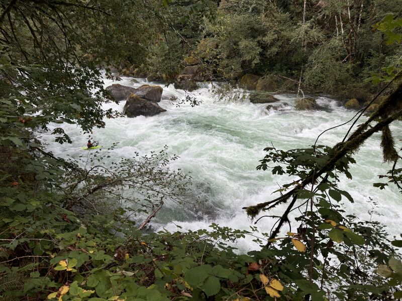
The namesake rapid of the run. While absolutely possible to scout and portage, neither is easy.
The takeout is on river right near a large rock outcropping. A small stream comes into the river here and during releases this is part of Foster Lake. When meeting a crew and looking for the takeout, the parking is on the opposide side of the road from the river. Look for the small creek. You can take a short hike upstream and sit beneath a small falls while you wait for your crew.
Jul 10, 2025
Some road maintenence over the last couple of years has improved parking along the road at various access points. It's still not great, but there are improved pull offs for 2-3 vehicles in places where there used to be 1 truck pothole parking. An improvement indeed. The put in trail we used (the downstream most access point on the map) had some blackberry encroachment. It's fine, but ocassional clipper maintenence would be appreciated. The takeout trail had minimal (but not zero) poison oak. Nice day with more water than expected.