Willamette, N. Fork of Middle Fork
1) Top of the Miracle Mile through The Gorge

| Difficulty | IV-V |
| Length | 5.2 mi |
| Avg Gradient | 106 fpm |
| Gauge | N Fk of M Fk Willamette R Nr Oakridge, or |
| Flow Rate as of 8 minutes | 1.23 ftbelow recommended |
| Reach Info Last Updated | May 22, 2024 |
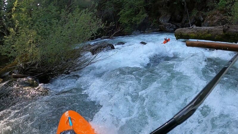
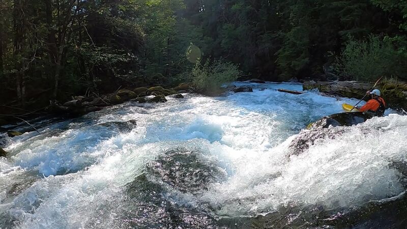
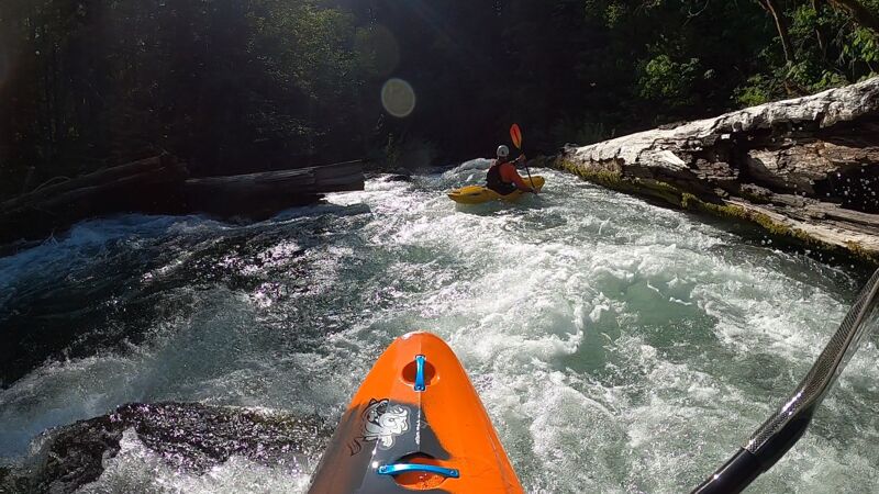
The River: Just 45 minutes from Eugene and with easy access to one of the most outstanding sections of whitewater in the region, the North Fork of the Middle Fork of the Willamette is truly one of the nation's most valued Wild and Scenic Rivers for whitewater paddlers. Well known for the 'Miracle Mile', a one mile section of continuous boulder gardens, this reach changes in personality over a range of flows that create a highly technical slalom course through a boulder maze at low flows and a stomping class V at high flows. Below the Miracle Mile the river provides great intermediate whitewater with some fun drops and finishes off with the Gorge which provides some good fun a half notch below the Miracle Mile.
The Miracle Mile: Oregon does not have a finer one mile section of continuous, roadside boulder garden rapids. For this reason you find that many with the skills to enjoy this run are more than content to just run laps. To check flows peer under the Christy Creek bridge at the take-out to the paddler's staff gauge on the bridge piling. Medium flows are around 1 to 1.5 feet or around 0.5 feet if you are looking for a more technical run.
The run begins with easy warmup as you navigate an easy entry rapid and then pass under the FR 1926 bridge. The fun starts right away with Initiation. From this point on it is pretty much continuous whitewater with named sections separated by small eddies. Next up is Ricochet followed by Confusion which is the longest section on this reach. Once you have made it through Confusion you should have a pretty good idea of the character of the run--there's plenty more to come. Sharks Tooth is next followed by Whoop-de-do one place where we you want to be sure to be on the right to avoid the nasty stuff over on river left. One option is to go way far right down a narrow channel separated by the main channel by an island that allows you to sneak the drop. Silly Putty awaits below and th
...
Take-out for the Miracle Mile or put-in for those accessing the section downstream. Located at USGS river mile 14.6.
Access above The Gorge which can be used as a take-out for those who do not want to run it or as a put-in for those who just want to run this short section. Located at USGS River Mile 11.8.
Take out where the bridge crosses the river.
May 26, 2023
About 10' bridge gauge, 995 cfs online
05/2023