Carson, East Fork
1. Wolf Creek Road to Hangman's Bridge

| Difficulty | III |
| Length | 7.3 mi |
| Avg Gradient | 60 fpm |
| Gauge | E Fk Carson Rv Blw Markleeville Ck Nr Markleeville |
| Flow Rate as of 11 minutes | 115 cfsbelow recommended |
| Reach Info Last Updated | September 2, 2023 |
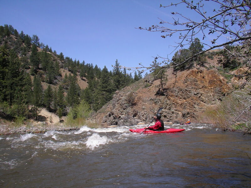
The Upper EF Carson is a roadside run that is steep and continuous class III (or harder at higher flows). Trees and strainers are a frequent problem, so scout thoroughly and be careful.
Put-in:
Above Hangman's Bridge, Highway 4 follows the river for six miles to near the junction of Silver Creek. It then goes up Silver Creek. Wolf Creek Road heads east up the EF Carson. There appears to be a good launching area in about one mile, just before Wolf Creek Road leaves the river. There are a number of other turnouts and good launching areas whenever the roads are near the river. Scout and take your pick. With investigation, boaters could probably launch even further upstream.
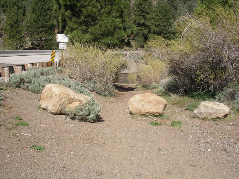
Take-out:
There is a small take out area on river right on the downstream side of the bridge. There are some other options nearby, so scout carefully.
Other Information Sources:
Check out the description in Bill Tuthill's California Creekin.
Holbeck and Stanley
East Fork Resort is just upstream of Hangman's Bridge. Call ahead for camping or to take out or launch at the nice beach there: (530) 694-2229.

There is good river access below this bridge.
East Fork Resort has two big campsites. They request that boaters call ahead to camp or to use their river frontage for boat launching/ take out. Their river frontage is not available to boaters who do not call ahead. Call (530) 694-2229.
Jul 1, 2005
Flow for the Upper is approx. 1/2 Flow as measured on Markleeville gauge. example: flow measured at 1400cfs,upper flow more like 700cfs. reason Markleeville creek almost doubles flow and it is below upper run take out. Happy Boating!!!!
May 14, 2005
With the American Whitewater board meeting in Reno, a few of us came in a day early to explore the rivers in the area including the East Fork Carson.