| Difficulty | I-III |
| Length | 4.7 mi |
| Avg Gradient | n/a |
| Gauge | Wapwallopen Creek Near Wapwallopen, Pa |
| Flow Rate as of 1 hour | 19 cfsbelow recommended |
| Reach Info Last Updated | July 9, 2026 |
River Description
Kevin Colburn posted an Access Alert:
The putin to the Nescopeck is on Whitewater Lane just west of the junction with N. Main St (T388). Whitewater Lane is a private dirt road in Drums, PA. Park on the river side as close to the junction as possible, don't park below the big tree on the left. Parking can be tight at the Putin and we need to be considerate of the landowners. Always get out of the way of local people using the dirt road and don't block it.
Let's be good neighbors.
There is a physical gauge on the river right side, just above the T388 bridge. Go to the Nescopeckers Facebook page for stick pics. 0” – barely runnable, 2-6” low runnable, 6”-14” low, 14”-20” – great level, 20” – 28” – high, >28” eddies disappear, new holes appear, exercise skill and caution (https://www.facebook.com/groups/357799918062599).
Gauge correlations above are from the Lehigh Valley Canoe Club, whose message board can be an excellent source for info on current levels in the region.
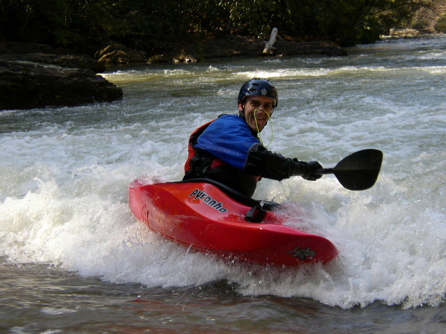
The Nescopeck Creek, or Nesky, is a very pretty Class II – III playground nestled in a hemlock and rhododendron-lined valley. Surf waves, eddies, holes, and splat rocks abound. Many of the features are formed by river-wide ledges, boulders and very distinctive monoliths. Water quality is poor– acid mine drainage pours into the Nesky from the infamous Jeddo Mine tunnel which drains old abandoned underground coal mines. So, it’s best not to flip or swim, but on the plus side, there’s no fishing on the Nesky, so if the water’s up on the first day of trout season, it’s a good choice.
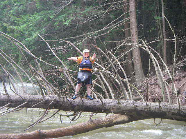
Hazards – Strainers, formed by downed trees, can be river-wide. The Nesky gets a lot of attention from the Nescopeckers Facebook page. Check the Facebook page for stick pics and strainer warnings, bu
...River Features
Put In - Main St. just below PA 93
Access PointDistance: 0 mi
Short Take-out - Mill Hill Rd.
Access PointDistance: 2.35 mi
Take Out - Hollow Rd.
Access PointDistance: 4.74 mi
Trip Reports
Log in to add a reportDS
David Su
Apr 15, 2013
There is a shorter 2.5mi. Class I-II fun run from Route 93 to the new bridge (under construction as of 3/20/13) where the Nescopeck crosses under Mill Hill Rd (at the end of Pecora Rd) which gets all the play shown in the site photos and without strainer per photo (@1.75' on the Wapwallopen gauge). Parking and access are easy near the construction site. River run map is here: http://www.gmap-pedometer.com/?r=5891368
LAND-OWNER ADVISEMENT: as we prepared to put in on the river-left bank of the Nesco on the upstream side of the bridge over Rt.93, where the obvious pull-off is, a gentleman claimed it was his property and advised us to put in at another place. The site is NOT posted. Instead we accessed on the right-bank downstream of the bridge, nearer the N.Main St. bridge.