Town Creek
1. Chaneysville, PA to Old US 40, National Road bridge (Maryland)

| Difficulty | I-II |
| Length | 16 mi |
| Avg Gradient | 12 fpm |
| Gauge | Town Creek Near Oldtown, Md |
| Flow Rate as of 55 minutes | 2.14 ftbelow recommended |
| Reach Info Last Updated | March 9, 2026 |
For more information, consult local expert, Ed Gertler
Ed Evangelidi testifies:
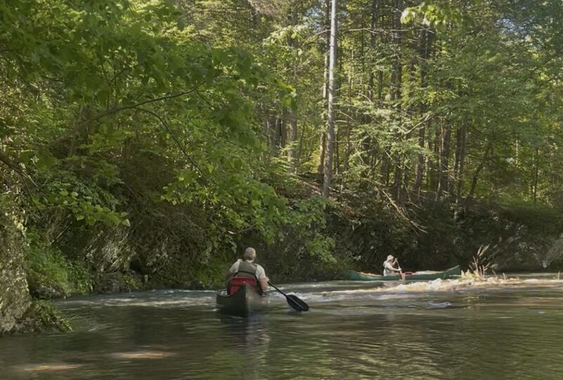
This is a quiet gem in Maryland. Not much is said about this creek but those who know it return to it often. The upper stretches above I-68 have better rapids and require more water to float a boat.
Access points from John Duke
Mile -0.3--- Road to the east of Chaneysville: You could put-in on either the Bridge over Wilson Run or Elk Lick creek. Wilson is posted but has good parking, Elk Lick has little parking, either way ask permission!
Mile 0.0--Confluence of Elk Lick and Wilson
Mile 3.5---Along Route 326: There is a nice pull-off on river right
Mile 4.7---Blues Gap road bridge: Nice put-in
Mile 7.8--covered bridge road bridge: You may pull right down to the river to put-in.
Mile 11.0---Mason Dixon Line
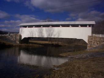
Mile 16.3---Old Rt. 40 bridge: Take-out at the sewage treatment plant but park on the other side.
Note---Most if not all access points are on PRIVATE property and permission should be granted if possible!
For downstream mileage see the Maryland section of Town Creek..
Camping areas:
Buchanan State Forest allows roadside camping with a permit.
Blues Gap Rd. River Access: Nice put-in.
Covered Bridge Rd. River Access: You may pull right down to the river to put-in.
Take Out - Old US 40, National Road bridge: Take-out at the sewage treatment plant but park on the other side.
Jun 3, 2026
Excellent access one mile below Chaneysville. Ask permission from property owners on other side of bridge. The flow was 400 cfs at USGS gauge, and sufficient with some scrapping for canoes loaded for camping out. Did approximately two miles an hour with portages at bridges and strainers. Nice steep creek. Just gorgeous rocks, flora and fauna. After the portage at Deerwood Lane NE (mile 10.5 for us) there is a surprise dam that is runnable best on the right.
Apr 15, 2024
We paddled the upper section of Town Creek. We put in at 39.79361, -78.50525 . (Good parking about 1 mile south of Chaneysville) and took out at 39.69550, -78.54853 about 1 mile east of Flintstone . The level was 4.4 ft which was good medium flow, There are 3 bridges and one strainer requiring that you get out of your boat. It took us 4.5 hr.
Jan 1, 1900
This bridge is a good put-in for the upper creek