Clear Creek
4. Lilly to Nemo (Clear Creek Gorge)
| Difficulty | II-IV |
| Length | 7.2 mi |
| Avg Gradient | n/a |
| Gauge | Clear Creek at Lilly Bridge Near Lancing, Tn |
| Flow Rate as of 1 hour | 75 cfsbelow recommended |
| Reach Info Last Updated | September 26, 2024 |
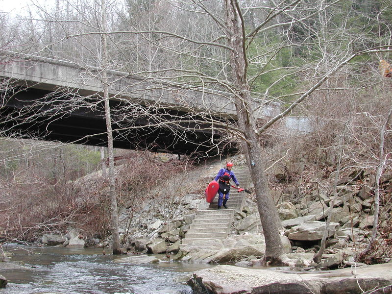
Logistics: The take-out for Clear Creek is actually on the Emory River at the old Nemo Bridge. From the town of Wartburg (willl find a National Park visitor center here), follow the signs to the Nemo Access from Old Highway 27 and head out the southwest corner of town and continue 6.0 miles down to the river. Ample parking and a nice day-use area with changing area and picnic tables can be found upstream river left of the old Nemo Bridge. This is a great meeting point and place to hangout after your run. To reach the put-in, head back up to Old Highway 27 and go west 1.9 miles and turn up onto Highway 27 and after 3.3 miles turn left onto Highway 62. Follow this road 9.1 miles to the turn for Lilly Access (marked by a sign). The road to this access winds 3.3 miles down to the river. You will find parking downstream river left of the bridge.
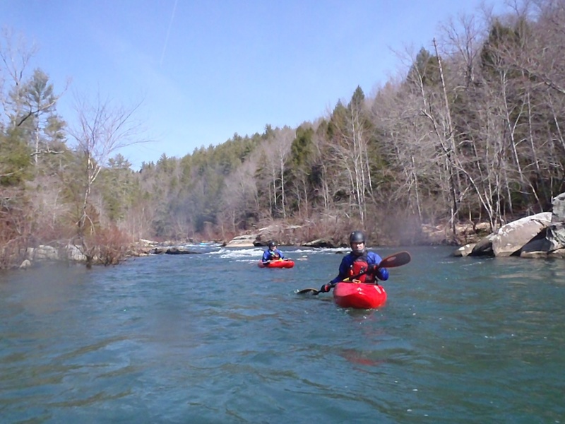
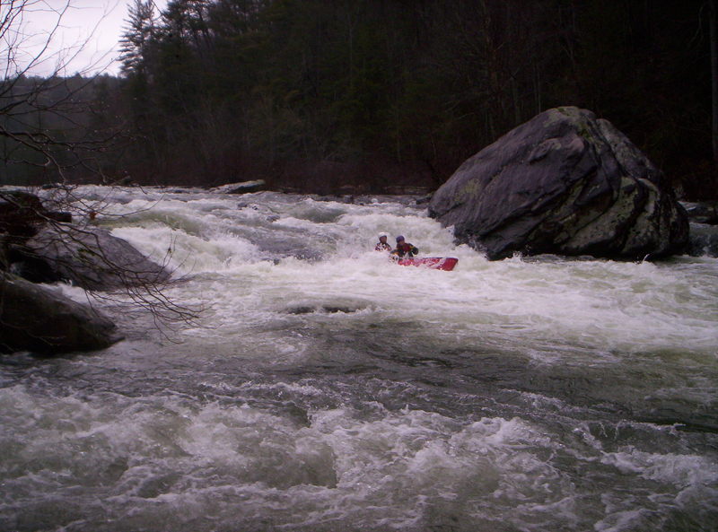
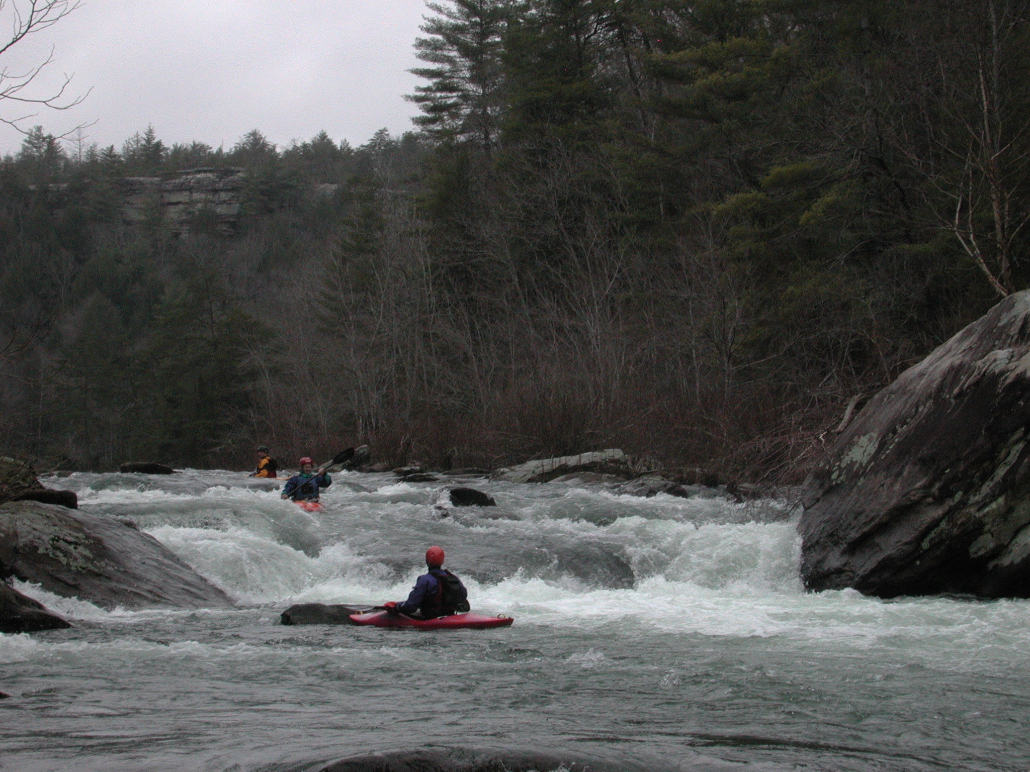
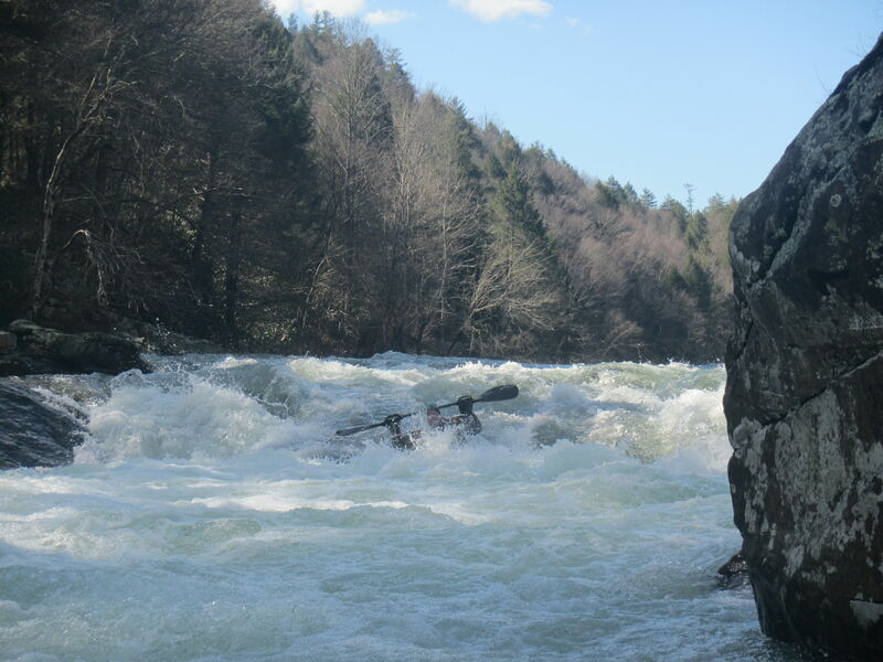
Description: The Clear Creek Canyon from Lilly Bridge to the Obed River confluence is only 1.5 miles but the run continues on the Obed and then the Emory River for a full 7.5 mile run. At moderate flows this is a good intermediate run for those who also appreciate the scenery of the undeveloped river canyon. The pools between rapids are a little long in places, but there are several good class III rapids. Just be aware of the undercuts as there are a couple bad ones on this run.
Downstream of Lilly Bridge, the river flows through Jack's Rock, Camel Rock, Wooten's Folly, Rock Jumble, and Focus Falls. These are all pool drop class III rapids with long recovery sections in between.
Once you reach the Obed River confluence you will be on a medium volume river. Here you willl encounter four more class III rapids. the last two are Keep Right and Widowmaker. You will find some fun surfing waves in this section.
See Obed River (Obed Junction to Nemo).
For more great photos of Clear Creek see (
...
At the listed put-in drainage area is ~171 square miles (as calculated by USGS StreamStats 4.2.0 software).
After 1.6 miles, at the confluence with the Obed, the combined drainage becomes ~514 square miles (meaning likely very nearly three-times the flow).
After 4.3 miles (total of 5.9 miles), at the confluence with the Emory, drainage becomes ~613 square miles for the final mile to the listed take-out.
Easy class III drop of about 8 feet. Slide five feet down a slide then 2-4 ft drop into a hole (easily punched). Boat scouting is difficult because you can't see much from the last eddy on the right.

Run the Camel far river-right. The middle should be avoided because of a nasty undercut called the Camel's Hump.
From 900 to 2000 there's a killer boof center left at the top.
The longest stretch of rapids, this long stretch of rocky rapids runs nearly a half-mile.
River steepens in a narrow channel then pours over a rock pile at the bottom. Eddies exist top right and middle left. Center left over the rock pile at the bottom is blind but goes.
At the confluence (as Clear Creek merges into the Obed) flow typically triples in volume.
Big long pool. If you don't paddle across it you might never get to the takeout.
Or if you prefer getting beat down in huge holes, go the other way at high water.
The location marked on various maps emphatically does not appear to be the site of anything which merits a class III rating (much less to be named 'Widow Maker'!!!) based on satellite views. Can anyone give us accurate coordinates for this rapids? Or do the satelite views not accurately reveal the nastiness?
Note added 3/1/19: I'm told by my father that Widowmaker rapid is named for a mine up on the slope, not for the nastiness of the rapid. I remember it as a long rapid on a left bend with big waves mainly at high water. Probably does not deserve the class III rating at medium or low flows, and may never deserve it with modern decked boats. In aluminum canoes it was a big deal. There used to be a camp on river right at the rapid. I ran this section just the other day and could not detect a rapid that resembled Widowmaker so perhaps it has washed out/changed.
The Obed ceases to exist as it merges with the (MUCH SMALLER!!!) Emory River for the final ~mile of your run. In mapping the straighter river keeps its name. A few (very minor) rapids populate the first half, then flatwater to the take-out.
Dec 10, 2022
Was paddling potters Ford to obj @700 CFS (awesome level) when I dropped my paddle getting out of my play boat to scout a rapid. If anyone hears of a camo Werner Sherpa found in the Obed let me know @931 252 7843.
Thanks
Mar 18, 2022
March 17, 2022 run in the Star Slice cataraft at approx 430cfs. This gave enough water to run down to the Obed without any problems with shallow water. 400cfs will be my new minimum flow for this section in the Star Slice Cataraft.
Mar 21, 2020
Using the Oakdale gauge 1000 is low but doable, 3000 is plenty, a lot of the Clear Creek rapids start washing out.
Using the Lilly gauge, 200 is pretty low. If it gets over 1200 you will be running something else.
430 on the Lilly gauge is nice class III.