Eel
3) Van Arsdale Dam to Dos Rios
| Difficulty | II-III |
| Length | 37.7 mi |
| Avg Gradient | 27 fpm |
| Gauge | Eel River Below Van Arsdale Dam 24hr Avg |
| Flow Rate as of 22 days | 43 cfsstale data |
| Reach Info Last Updated | January 31, 2024 |
This part of the middle Eel is commonly split into three sections:
Some of these sections will likely change when the Potter Valley dams come down in 2028 or later.
Jun 4, 2025
This report describes the Outlet Creek to Dos Rios section at low flows. Don't miss out on this run if you're in the Willits, Ukiah, or Fort Bragg areas or on your way north to Eureka/Arcata. Total time at lower flows, including drive in from U.S Highway 101 and shuttles: 4 hours, add a half hour longer with bike shuttle. (Running at high flows my first time down – 1/3/2024 – this report is on the second and third runs at a similar time of year (1/14 and 1/16 2025) but rainfall was minimal. These second and third trips were done two days apart, at 880 and 697 cfs.) The sun was out, the run was boney in places but the class II+/IIIs still had some thrill to them. Scenery is excellent despite Covelo Road running alongside. It would be wonderful to take a longer day to explore the land on river left where the decommissioned Northwest Pacific Railroad lies in a state of arrested decay. If you do so, please use discretion as I don't know who owns the property across the river, whether the railroad or not. The photos with more daylight are from the third trip (slightly lower flow), the darker photos were from the second trip at 880 cfs. Bike shuttling is totally possible, local drivers were friendly and Covelo Road only has a few sketchy sections. At these low flows consider the run as equal in difficulty to the Gorge run of the South Fork American at 600-1000 cfs, with a couple of the II+/IIIs requiring quick technical moves around large rocks (less of an issue in the SF American Gorge run).
Jun 3, 2025
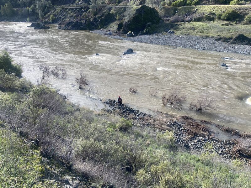
This is a scenic run and class III, even at low flows. It requires technical boating of four bigger rapids. Recovery pools are present after these class IIIIs. At high water, class IV boating skills are required. When I first ran it, on January 3, 2024, one friend couldn't make it so two of us showed up to a chocolate-brown river that I discovered afterwards was flowing at 4500-5000 cfs. This is a hefty flow that requires class IV skills. Within the first mile I had a swim. I saw an almost covered top of a boulder too late and dropped sideways into a reversal backing up the boulder. I was worked for about 4 seconds, then spit into the main current where I remained about 4 feet underwater couldn't get purchase to roll after another 4 seconds and had to exit my large Scorch. With a newfound respect for the the stretch, my paddling partner and I continued downstream with trepidation. Between large ponds with massive boils, we ended up portaging three class IIIs, which were firmly IV/IV+ at this flow, as the main middle channel flowed right into sieves created by broken boulders, not a place to wind up, especially with one friend to count on and dark water where you couldn't register a throw bag. To avoid the sieves would involve paddling for your life to the left, where one would drop into offset holes. No thanks, we said. I returned to the run twice more since, same time of year but on sunny dry days at low flows (880/697 cfs). At these low flows the IIIs are technical, with rocks to avoid and preceded or backed by holes but forgiving. Enjoy the long ponds. The scenery is excellent, with the decommissioned Northwestern Railroad in a state of arrested decay on river left. If I give myself more time on future trips, I'd like to explore this, provided it's not on private property. Dan Menten's 'The New School Guide to Northern California Whitewater' is an excellent read and a fascinating and illuminating guidebook on runs that were formerly undocumented or scantly documented. His Outlet Creek to Dos Rios writeup is vague. For a more detailed and helpful writeup please see Cacreek's website, where local boater Paul Futscher gives a thorough description: https://cacreeks.com/eel-outa.htm. I only found it after my initial run. This is a must if exploring the Ukiah/Willits/Fort Bragg areas or Eureka/Arcata. The run is off of Highway 101 and down Covelo Road (Highway 162) a 20-minute drive, some of it windy. The shuttle is 6 miles long. The run can be done in just over an hour on river if you're fast.
The takeout (N.B. an approximate pin) is at: https://maps.app.goo.gl/6tcop4vg38bbCYkE6?g\_st=com.google.maps.preview.copy
The put-in (right by the ubiquitous (?) 'Eel River Bridge'): https://maps.app.goo.gl/jdMhEy7PirFNCNC69?g\_st=com.google.maps.preview.copy
The initial set of photos is from the first run described, at 4500-5000 cfs, the others a combination of photos from two runs two days apart at 880 or 697 cfs respectively.
Jan 29, 2024
Absolute gem. What a great season opener. Beautiful enough to keep the advanced boaters happy, plus one fun class III after the Hearst bridge, and the option for the less advanced boaters to take out before the Outlet Creek section. We put in at Van Arsdale, and were immediately in some brush that looked like small trees growing out of the river. At 2k, a swim here would have been scary. Make sure you have a good safety talk about this kind of wood hazard. The key would be just swimming in the channel, rather than trying to get out prematurely or self-rescue and ending up ensnared in the brush where rescue would be extremly challenging. After that all class II to Hearst. Scenery was nice but unspectacular. Things get dramatically more pretty on Hearst to Outlet run, with very little brush, but some fun rapids including one class III that requires a couple cross current move soon after the bridge. The rest of the one was class II, with some flatwater paddling even at 2000cfs. We saw 2 river otters, deer, and 3 bald eagles. Outlet Creek section was fun, as usual, and a great way to end an overnight trip for those of us who wanted more action.
Mar 21, 2021
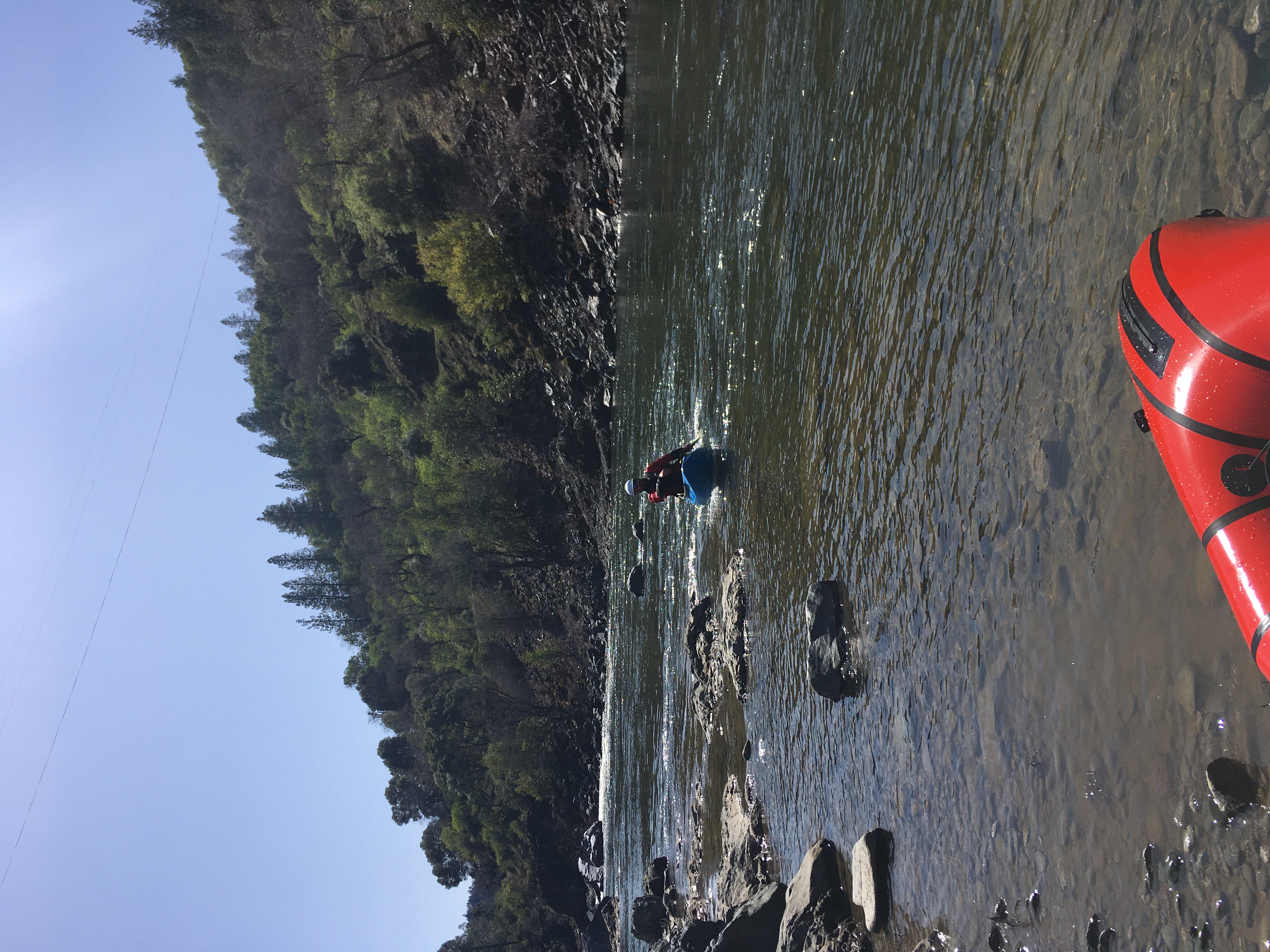
A novice yakker, a canoer, and a packrafter had a splendid, mellow run on this today in preparation for our big Dos Rios-Alderpoint trip. It's like a calmer Cache Creek at low flows.