Sevier
US 89 to US 89

| Difficulty | II(III) |
| Length | 5.8 mi |
| Avg Gradient | n/a |
| Reach Info Last Updated | September 27, 2023 |
River Description
The Sevier is the longest river that begins and ends in the state of Utah, terminating in Sevier Lake, an endorheic lake which lies in the lowest part of the Sevier Desert and, like the Great Salt Lake, is a remnant of Pleistocene-epoch Lake Bonneville.
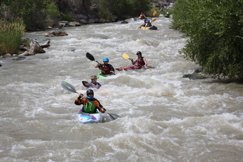
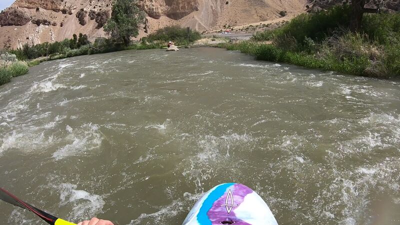
This run is a fairly short section of the Sevier (~6 miles) that flows through the narrow Marysvale Canyon between Marysvale and Sevier, Utah where the Tushar Mountains and the Antelope Range squeeze the river. Upstream and downstream of this canyon, the river is nearly flat and meanders through broad valleys. Within the Marysvale Canyon, the run begins with a swift flatwater section that transitions into a class II run that reaches class III difficulty at a few rapids, especially as flow increases.
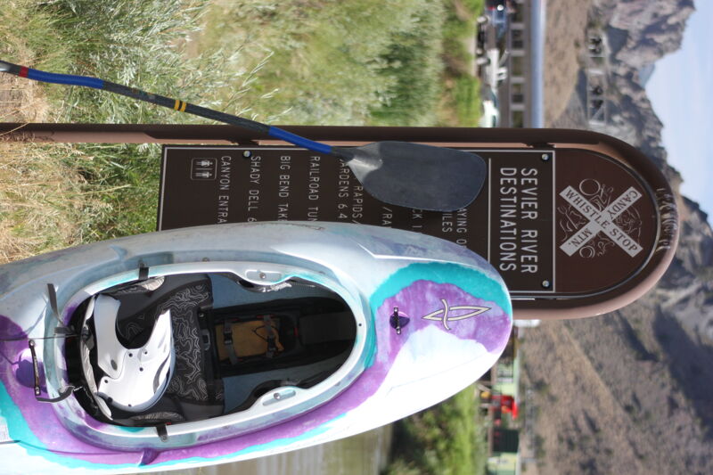
The old the Denver and Rio Grande Western Railroad tacks on river right have been converted to the paved Candy Mountain Express Bike Trail for the length of this run. The trail is inconveniently located on the opposite side of the river from the put-in and take-out, but it could be used for bike shuttling by lengthening the run on both ends to use an alternate put-in and take-out where the trail crosses the river.
Real-time Sevier River flows are available at this link: http://www.sevierriver.org/rivers/central/. The flow at Clear Creek is the amount of water that will be in this run. There is sufficient water for packrafting, tubing, paddleboarding, and kayaking at 200 cfs, although 250 cfs provides a bit more padding on the rocks. Anything above 300 is good for rafts. The sweet spot is 500 cfs. From 700 cfs on up, this river turns into a class IV. At levels over 800 cfs, the low bridge after the take-out becomes unpassable by any craft, so be warned don't miss the take-out. Also
...River Features
Put In
This is a big parking (dirt) lot with a pit toilet. The ramp into the river is dirt with plenty of room.
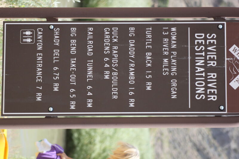
Women Playing Organ
Turtle Back
The slope on this boulder garden gets greater, and is the just before you come into Rambo. So keep your eyes open.
Big Daddy (Rambo)
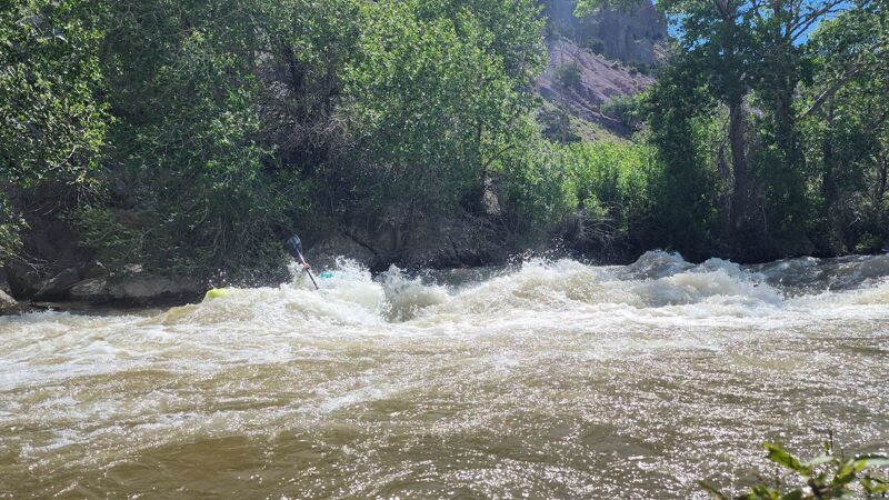
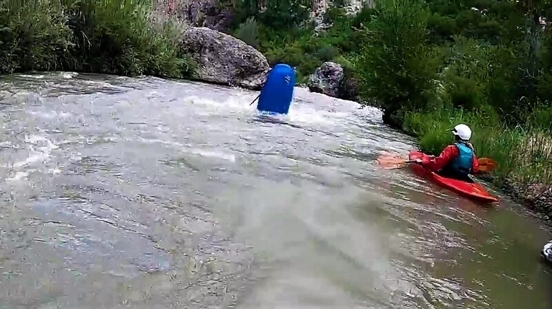
This is a pretty significant drop into a pool. It gets shallow pretty fast after the drop, get a good roll on the first attempt. At certian flows a boof on the left side comes in.
Bridge
A bridge, I believe at high flows a portage may be needed.
Come a Long
The river makes a sharp right turn here, Some years wood has gathered here so watch this corner. It also gets narrow and pushes through a slot into a pool.
Duck Rapids
The last rapid before the take out. This is a steep long boulder garden, Watch for the holes on the left. A swim here could make you miss the take out. Road scout...
Take Out
This is a private take out, if you take out here please park across the street and do not block this exit.
Trip Reports
Log in to add a reportYears past - Cody Redmond
Jun 15, 2023
I was just adding photos for the page. Here is a video of the section. Believe this was 2020! flow in the Video is around 575cfs.
Daniel Cottam
May 26, 2021
Anything above 250 on the gauge is good for kayaks. Rafts need at least 300. At flows above 800 don't miss the take out since there is no space under highway 89 bridge at these levels. The sweet spot on the river is 500. From 500 to 1300 this is a Class IV. All this info I got from someone who did commercial guiding on this river for 4 years.
Daniel Cottam
May 24, 2021
To check the flow on this river go to the Sevier River Water Users Association link http://www.sevierriver.org/rivers/central/ and look at SR above Clear Creek. This is the gauge after the last canal takes out water. Whatever is on the gauge is what the river is running at. y Anything above 150 is runnable in a duckie or kayak. Also there are usually three pulse flows a summer for two weeks each. One in June, July and August. Will post more as I find out more.