Aniakchak
Surprise Lake to Aniakchak Bay
| Difficulty | I-IV |
| Length | 35 mi |
| Avg Gradient | 30 fpm |
| Reach Info Last Updated | March 28, 2026 |
The Aniakchak River, a Federally-designated Wild and Scenic River, is located within the Aniakchak National Mounment and Preserve providing an opportunity for a remote river expedition on the Alaska Peninusla. Trips usually take place during the month of July. Plan for 3-4 days but be prepared for longer as weather conditions often dictate the schedule.
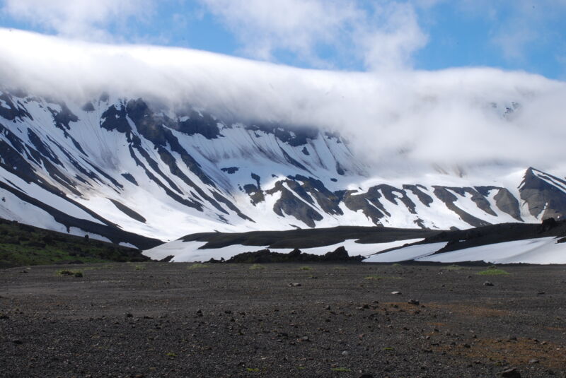
The Aniakchak Volcano underwent a catostrophic explosive erruption approximately 3400 years ago that formed the current caldera. Smaller erruptions have occurred more recently, with the last one in 1931. Surprise Lake, located within the 5.9 mile diameter caldera, is the source of the Aniakchak River. This caldera has its own microclimate marked by consistently wet weather and harsh winds. Despite this, it offers opportunities for exploration and hiking across the volcanic landscape.
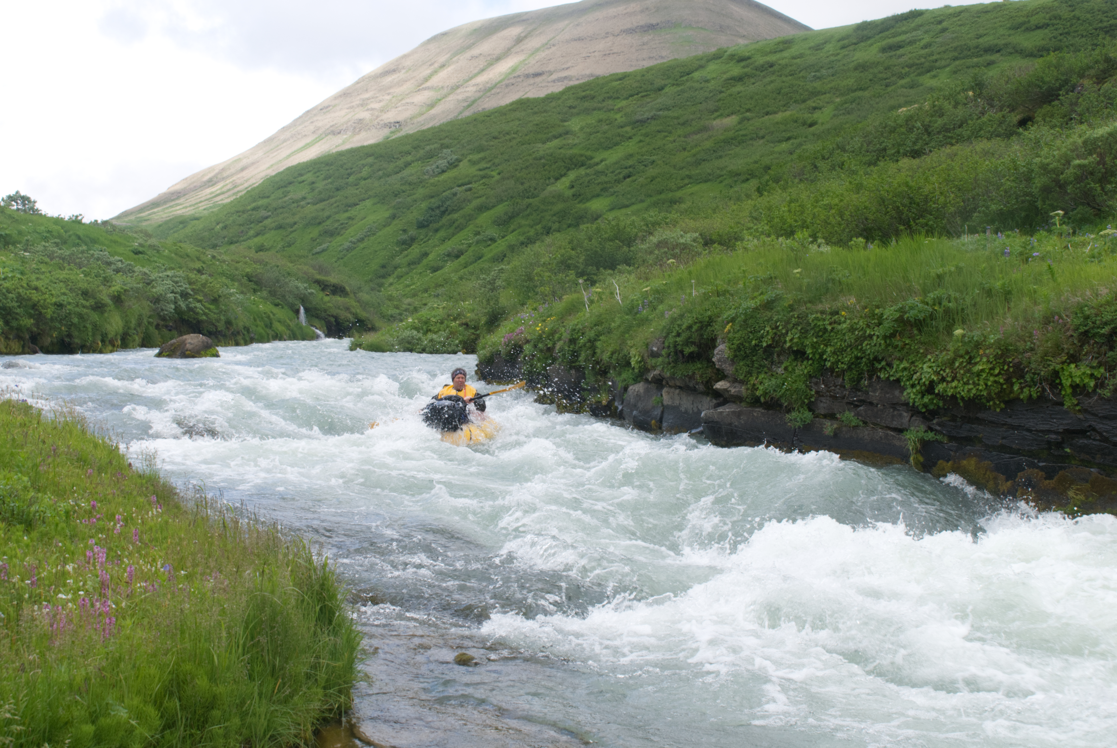
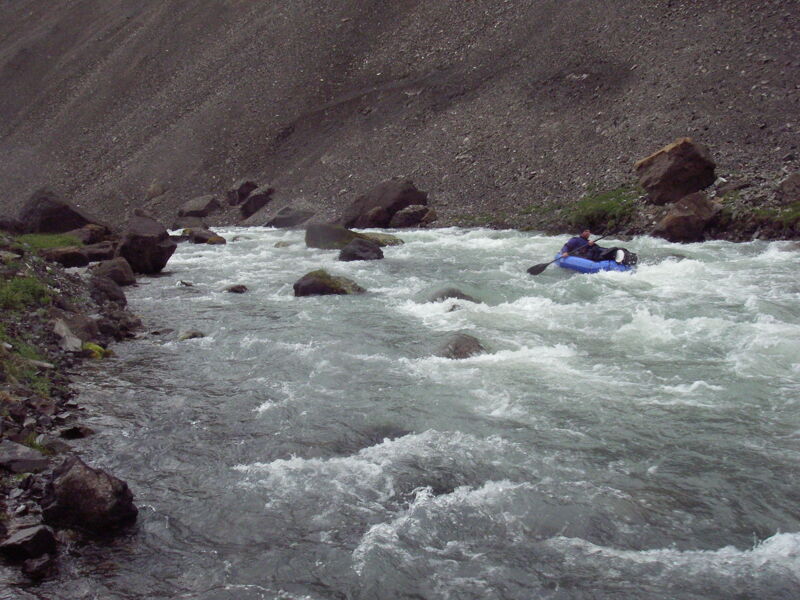
From the lake the river begins at a slow pace for the first mile before entering the 'Gates', a 1500 foot gash in the caldera wall. Here the river drops at a rate of 73 feet per mile with class IV whitewater. The river remains class II/III for the next 10 miles (if you're in an inflatable be sure to pack the patch kit as the sharp volcanic rocks can puncture your boat). At the confluence of Hidden Creek the river enters the steep 83 feet per mile section where volcanic bedrock on either side and boulders in the channel constrict the flow. The pace of the river begins to slow considerably over the nextfive miles as you leave this section and continue the remainder of the journey on a low-gradient alluvial river that takes you to the ocean.
The river system supports all five species of salmon and Surprise Lake provides spawning habitat and a nursery forsockeye salmon and artic char. Dolly Varden are also present. Wildlife are abundant and brown bear are common along this river so be sure to take proper precautions and be prepared for encounters.
Logistics: T
...
You can either charter a float plane or hike in to Surprise Lake.
This is the most challenging whitewater on the run. It can be portaged on the right.

The approximate exit point for the portage over to the Meshik River. Expect the portage to take half a day. It requires cross-country navigation skills through dense vegetation.
Jul 15, 2010
We originally came up with the idea of an Aniakchak-Meshik loop that could be done as a packraft trip and attempted it in 2009. An intense storm foiled that first attempt, so we returned in 2010 and successfully completed the loop. At first, I had considered flying into the caldera and getting picked up at the river’s mouth, but by doing the trip as a loop starting and ending at Port Heiden, we could complete the journey without chartering any planes.
We flew into Port Heiden on the morning flight of July 15 and arrived around noon. We caught a ride from a local to the end of the road and were hiking by 2 p.m., with camp set by 8 p.m. on the vegetated lower slopes of the volcano. On July 16, we had a big push under beautiful weather, leaving camp around 8 a.m. and reaching the rim of the caldera around 2:30 p.m. Camp was set at Surprise Lake by 10 p.m. We spent the next three days—July 17, 18, and 19—fully exploring the caldera.
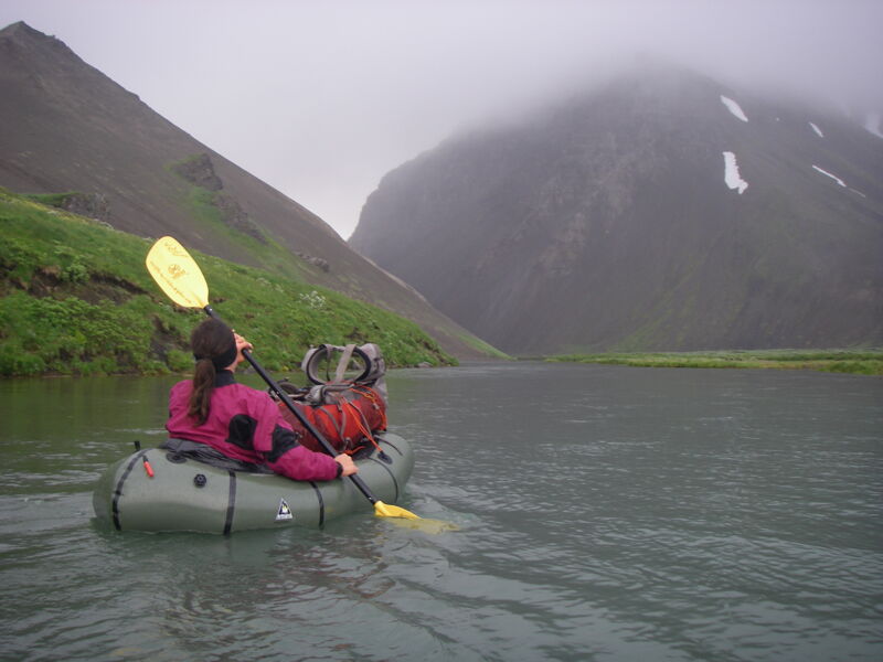
On July 20, we inflated our packrafts and spent two days descending the Aniakchak River, spending the first night on the river. Around 1 p.m. on July 21, we reached the point we had identified to hike over to the Meshik headwaters, where we camped on a lake at the river’s start.
We spent July 22 at the headwaters of the Meshik and began paddling downstream that afternoon. After two nights on the Meshik, we reached a cabin near the mouth on the evening of July 24, where we had planned to begin hiking north. The morning of July 25 included some paddling to reach the shortest hiking route, and we packed up the boats that afternoon. We continued hiking through July 26 and 27 across tundra, eventually reaching a road and the end of our journey in the late afternoon.
In total, the trip included two days hiking into the caldera, three days exploring the caldera, two days paddling the Aniakchak River, three days paddling the Meshik River, and three days hiking back across the tundra to complete the loop.