| Difficulty | III-IV |
| Length | 4.5 mi |
| Avg Gradient | 63 fpm |
| Reach Info Last Updated | April 30, 2018 |
River Description
Hurricane Irene Changes: This section of the Rock River changed because of the flooding of August, 2011. The flood was so violent in the section a half mile upstream that houses were washed away. This section is still runnable, but most rapids have changed. The river has changed course completely in the section between the dam and the cement bridge.
The river is still a class 3/4, but please scout it carefully, because the riverbanks have yet to stabilize as of 2016, and stariners are still developing. Also, all of the rapids differ somewhat from the old description, which is below.
Pre Hurricane Irene River Description:
The river starts out gently, with some surf spots and a few rapids. Watch out for strainers which often fall down the steep side hill on the right hand side. You'll reach the old dam (now broken), the first major rapid, about a half mile down river. This is described as a class 3 or 4 rapid, depending on whom you talk to and the water level. This rapid, like most on the Rock River, changes from time to time, depending on where the rocks have moved during the last storm. The rest of the section through Williamsville is straightforward fun, with some splashy waves and rocks to dodge, but no difficult rapids. At the bottom of this section, you'll reach the cement bridge and the beginning of the ledges.
About 200 yards below the cement bridge, you'll reach Double Drop. The top drop plunges over a blind ledge, and then slides down to the second, smaller drop. There is a pool below the second drop if you miss, so hold on and you can roll at the bottom. Run the first ledge of Double Drop right middle or left middle, but avoid running it down the center. Also, avoid the far right. There is a hole at the bottom of the first drop that can hold you for a whilebut will usually spit you out, butitcould hold you at high water.
Down river is a neat ledge which you can barrel over on the left side or sneak around on the right s
...River Features
Put In
Access PointDistance: 0 mi
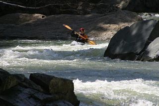
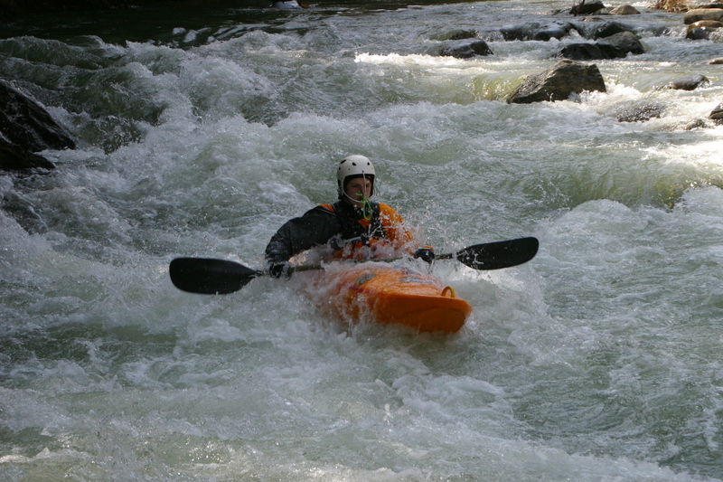
Rapid Above the The Dam in Williamsville
PlayspotClass: III+Distance: 0.4 mi
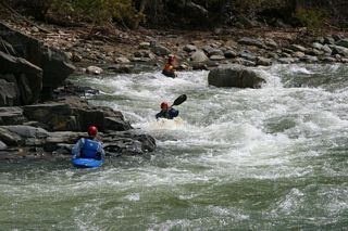
Broken dam in the center of Williamsville, about .4 miles downstream from the covered bridge. Rated at Class 3 or Class 4, depending on water level and who you talk to. The photo is of a two-drop rapid just above the dam. It's generally recommended that you don't run the top drop backward.
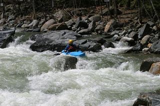
View of Dam and the Rapid Above It
PlayspotClass: III+Distance: 0.41 mi
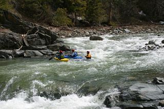
If you eddy out river right after running the second drop of the rapid above, you can position yourself to run the Dam.
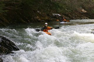
Running the Dam
PlayspotClass: III+Distance: 0.42 mi
The dam can be run in many spots, depending, once again, on water level, and where the last deluge has moved the rocks.
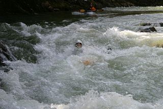
Another View of Crossing the Dam
PlayspotClass: III+Distance: 0.43 mi
Although the Dam is clearly visible from the center of Williamsville, please don't attempt to park here or access the river here - it will annoy the landowners.
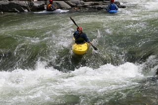
Double Drop
RapidClass: IVDistance: 0.8 mi
Double Drop is located about 200 yards below the cement bridge in Williamsville. This is the second hardest rapid on the river. The top drop plunges over a ledge, and then slides down to the second, smaller drop. There is a pool below this rapid if you miss, so hold on and you can roll at the bottom. Run the top ledge of Double Drop right middle or left middle, but avoid running it down the center. Also, avoid the far right.
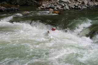
Triple Drop - Top
Access PointClass: IVDistance: 1.1 mi (approx.)
Top of Triple Drop - pull into the eddy behind the big rock on river right to get into position to cross the 2nd ledge.
NOTE: Triple Drop has changed since Hurrican Irene and is more difficult now. The biggest warning is BE WARY OF GOING RIGHT. At the bottom of the right side, it is pretty manky - the rocks won't be friendly if your line isn't right, and this will vary by flow. Scout this rapid carefully if you don't know it.
Triple Drop - Sneak Route Left
Access PointPlayspotClass: IVDistance: 1.12 mi
If you take the second ledge middle left, you can pick your way through rocks below at medium and lower water levels, missing the main flow below the second drop.
The Chute
RapidClass: IIIDistance: 2.21 mi
Chute, located about a mile south of Triple Drop.
Take Out
Access PointDistance: 2.6 mi