American
2. Hell's Crossing to American Forks

| Difficulty | III-IV |
| Length | 5.4 mi |
| Avg Gradient | 82 fpm |
| Gauge | American River Near Nile, Wa |
| Flow Rate as of 43 minutes | 54 cfsbelow recommended |
| Reach Info Last Updated | March 7, 2026 |
The Okanogan and Wenatchee National Forests encompass more than four million acres and are jointly managed with headquarters in Wenatchee, Washington. The rivers flowing through these forests are essential to the whitewater paddling community—both as close-to-home runs for Washington residents and as classic objectives for paddlers traveling from across [...]Read More
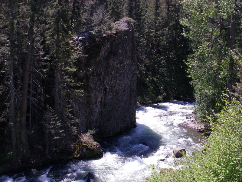
This is a great run that features nearly continuous class III/IV whitewater from start to finish. The river originates from the headwaters in Mt. Rainier National Park and is one of the few rivers in the Yakima drainage without a dam. While Highway 410 runs along the entire length of the run, the river holds your attention making the road only a minor distraction. Dispersed campsites are located along the run and towards the end you will pass a few cabins. The most distinct drop on the run is the big headwall rapid but there is plenty to keep you busy the whole way. The main hazard is wood and you can expect to come up to a few logs that can span the channel. Eddies are few and far between so be prepared and it's a good run to have a skilled probe who can sniff out the wood hazards before you're on top of them.
While this run ends at the confluence with the Bumping River you can continue on downstream to enjoy the Bumping from American Forks down to Sawmill Flat or beyond on the Naches.
The put-in for this section is at the Forest Service Hell's Crossing Campground at Highway 410 mile 83.5.
To reach the take-out, drive along the river to Highway 410 mile 88.4 and turn south onto Bumping River Road. You will immediately come to a bridge across the American. This is a potential access or you can continue on in to American Forks Campground and take out at the confluence with the Bumping River which is just downstream of the bridge on river right.
May 16, 2026
We only had 460 cfs on the gauge, but the three of us thought it was good enough when we ran it on May 14, 2026, a few days before Chinook Pass was opened. After scouting the upper couple miles that had several wood portages, including the undercut headwall rapid featured in Tom's photo, we launched at the first pullout downstream and paddled to the lower Bumping River and on to Sawmill Flat on the Naches River. There was some wood in play most of the trip but we only portaged logs twice, including one with small tricky eddies. There were a few fun Class III rapids and the current was continuous so we completed the run in a little over two hours. This is not a destination run, but if you are in the area offseason before the highway gets busy, it's a pleasant place to paddle 3 rivers for the first time.
May 12, 2025
Scouted the run from the road and walked around a bit. Saw nearly 10 riverwide logs requiring portages. Most in swift locations with tough eddies. Decided against paddling it.
Jun 2, 2020
The log blocking at the Wall has washed out and moved about 200 yards down stream. It's now part of the larger log jam that has been there for several years.