Chewuch
2. Camp Four to Five Mile Bridge (The Middle)
| Difficulty | II-III |
| Length | 13 mi |
| Avg Gradient | 32 fpm |
| Gauge | Chewuch River at Winthrop, Wa |
| Flow Rate as of 1 hour | 103 cfsbelow recommended |
| Reach Info Last Updated | May 30, 2024 |
The Okanogan and Wenatchee National Forests encompass more than four million acres and are jointly managed with headquarters in Wenatchee, Washington. The rivers flowing through these forests are essential to the whitewater paddling community—both as close-to-home runs for Washington residents and as classic objectives for paddlers traveling from across [...]Read More
The Methow Valley is one of the most important landscapes in the state of Washington and of national significance for outdoor recreation with a diversity of opportunities for the recreational pursuits our members enjoy. Every spring, whitewater boaters enjoy the experiences on the Methow River, Chewuch River, and Twisp [...]Read More
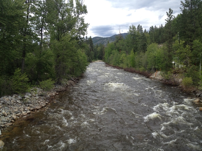
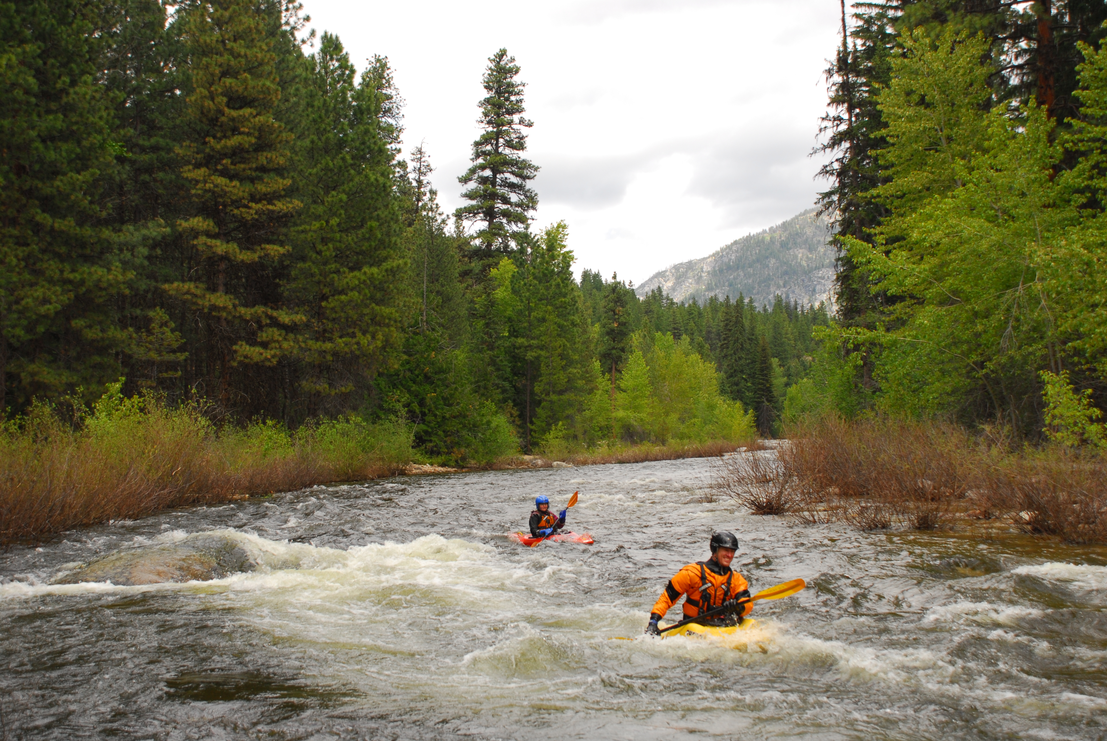
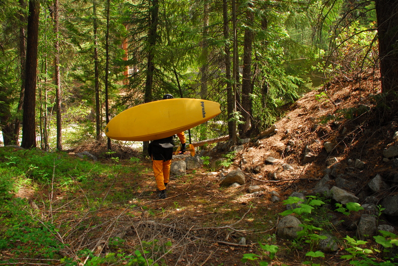
This run flows through pine forests in the Chewuch Valley, with only a few distractions of civilization that are mostly near the end. You will find plenty of camping at one of three Forest Service Campgrounds or at any of the dozens of dispersed camping areas along the river. Expect a lot of campers along the river Memorial Day weekend, when flows are typically ideal.
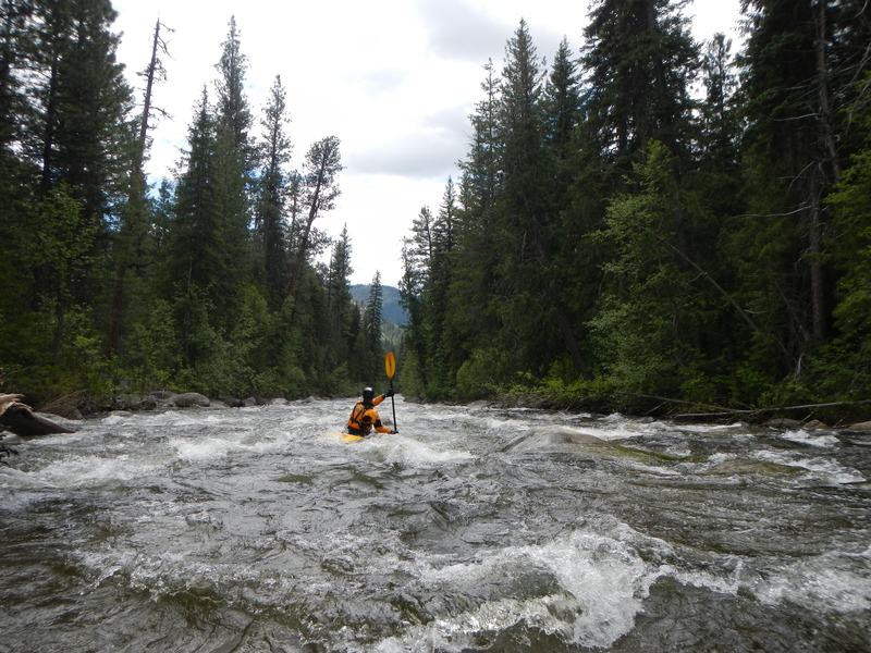
Most of the run is swift-moving class I-II with some braided channels but there are three good class III rapids at the start, middle, and end of the run. Don't come looking for continuous whitewater but if you enjoy a nice float with some good picnic spots along the way, this is a beautiful river. With some effort, the class III rapids can be scouted on the shuttle, but confident intermediate paddlers will be able to boat scout them.
After a mile of intermittent class II, you will reach the first class III rapid, Twentymile Creek Rapid, which is a narrow, straight boulder garden. You will catch a glimpse of this rapid on the shuttle between Chewuch and Camp 4 Campgrounds. Although trees partially obstruct the view, the river runs along the road.
The next class III- is Fall Creek Rapid at Fall Creek Campground, which is about 6 miles into the run. Look for the campground fences on the right. The rapid starts around a blind curve, but it is easier than it looks from the scout.
After this rapid, the paces again slows down to a nice float. Continue to stay alert for wood hazards. Some private lands start to line the river bank and you will begin to encounter riverside cabins.
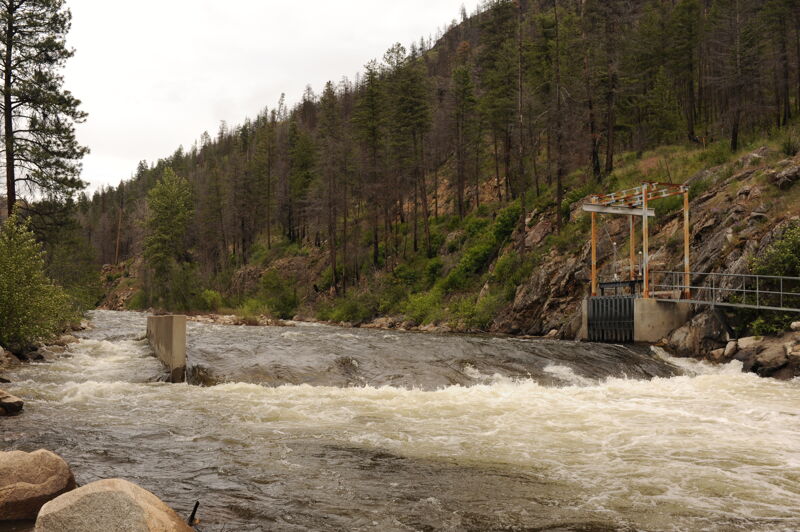
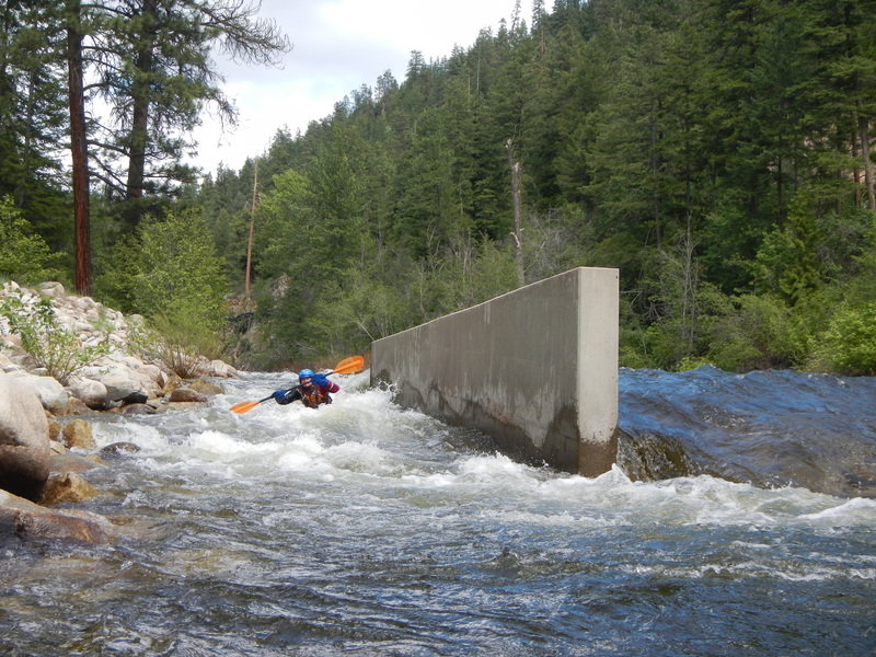
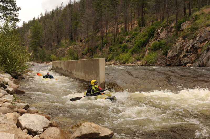
The final class III+ rapid, Boulder Creek Rapid, comes just below some old bridge abutments. This rapid is a continuous boulder garden rapid that is nearly a mile long with an irrigation dam near the end. At lower flows the rapid is more of a sequence of rapids with short recovery pools in between but at higher flows it is more continuous. Confident class III paddlers should not have a problem boat sco
...
Access on the upstream river right side of the Forest 5010 Bridge. A nice beach access is available on river right downstream of the bridge at the first campsite in the Camp 4 Campground, but it may be occupied on a busy weekend.
A fun class III boulder garden rapid that is a long read and run.
Located at USGS River Mile 19.5.
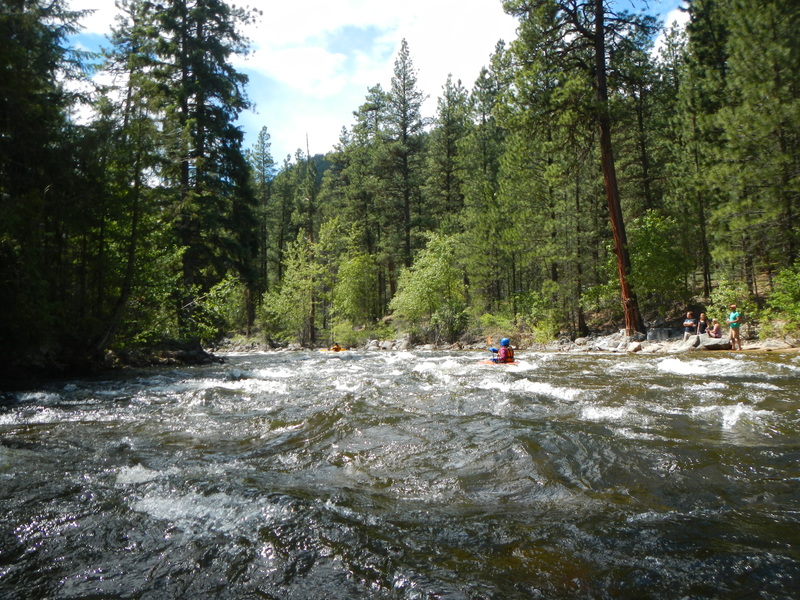
Fall Creek Rapid is a class III- and shorter than the other two class III rapids on the run. The rapid bends around to the left as you pass the Fall Creek Campground.
Located at USGS River Mile 13.7.
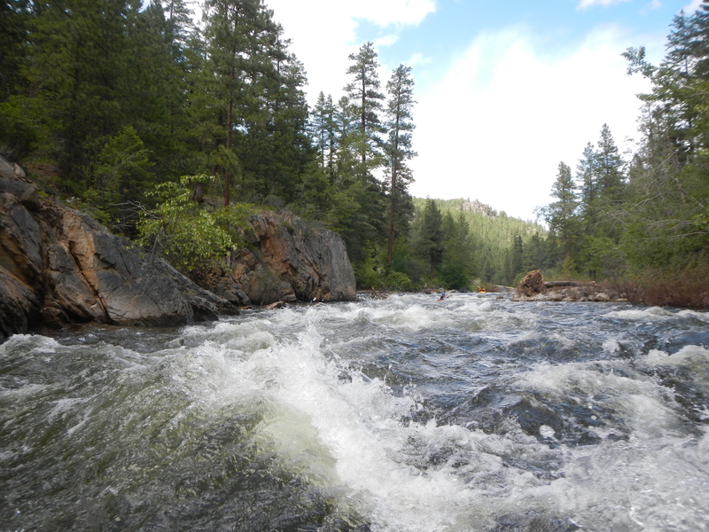
The longest and most challening rapid on the run, Boulder Creek Rapid begins at a pair of old bridge abutments and continues for nearly a mile to the take-out. This section is really a set of several rapids stacked together.
Located at USGS River Mile 9.0.
Towards the end of Boulder Creek Rapid and just barely visible from the take-out bridge. Hit the fish passage channel on the right to avoid the dam which is easy to see as you approach it.
Located at USGS River Mile 8.1
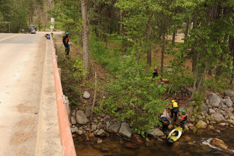
Take out at the bridge where the East Side Chewuch Road crosses the river. Parking is available on river left approximately 100 yards from the bridge at the Y in the road. The best access is at the beach on the downstream right side of the bridge but it is private property. Downstream river left is a feasbile access that is also private property but you may be able to find away to stay off private property. The upstream river right side of the bridge is Washington State land and would be worth exploring for improved access on public land.
May 26, 2024
Trip with Tom, Bill, Kanako, Aaron, Jim, and Hieu. The run time was 3.5 hours that included a half hour stop for lunch. We had no riverwide wood and no portages, as has sometimes been the case in prior years, although there were a couple places where wood hazards had to be avoided. GoPro Video of the trip: < https://gopro.com/v/0woW5LoEVlMEb >.
Jun 14, 2022
After a fun float on the lower, we went up to scout some of the upper run. While scouting from the road, we saw a very nasty riverwide strainer just after the beginning of the Boulder Creek rapid. This wood is a serious hazard and should be avoided at all costs. We found a put in on the west side of the river just upstream of Falls Creek campground. We floated down to a dispersed campsite we had claimed for the night just across the river and slightly upstream of where Eightmile Creek pours out.
The Falls Creek rapid was a lot of fun, fairly continuous long class III boulder garden with a few decent holes here and there. There was no wood in the rapid at the time and we didn't find any that blocked the entire river for the whole float. After the Falls Creek action, the river really settles down to class I with the occasional class II rapid or wood move. We would've preferred to takeout right above the Boulder Creek rapid to add a little more to the float but someone was camping there so we couldn't use it as an access point. We would've extended the run further upstream but were running fairly low on sunlight. Boulder Creek rapids looked awesome, super long continuous waves with a meaty looking dam just after the rapid ends. The dam looked slightly retentive in the middle but if swam, you'd more than likely flush out although your boat might get surfed for a minute. The sneak line is so narrow even at this flow it wouldn't be practical for all but kayakers to get into, rafts probably wouldn't even fit.