Cowlitz
2. Cispus River to Barrier Dam(Scanwea, Riffe, and Mayfield Reservoir)
| Difficulty | III |
| Length | 35.8 mi |
| Avg Gradient | 16 fpm |
| Reach Info Last Updated | May 31, 2019 |
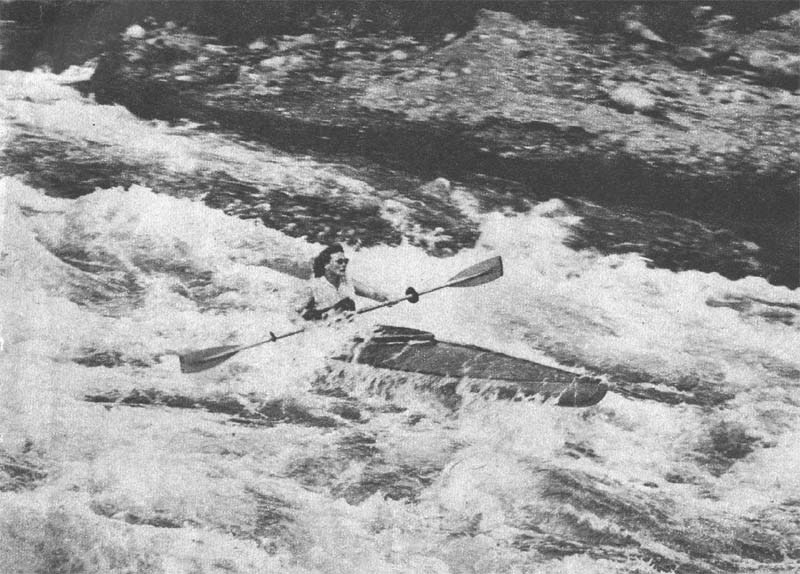
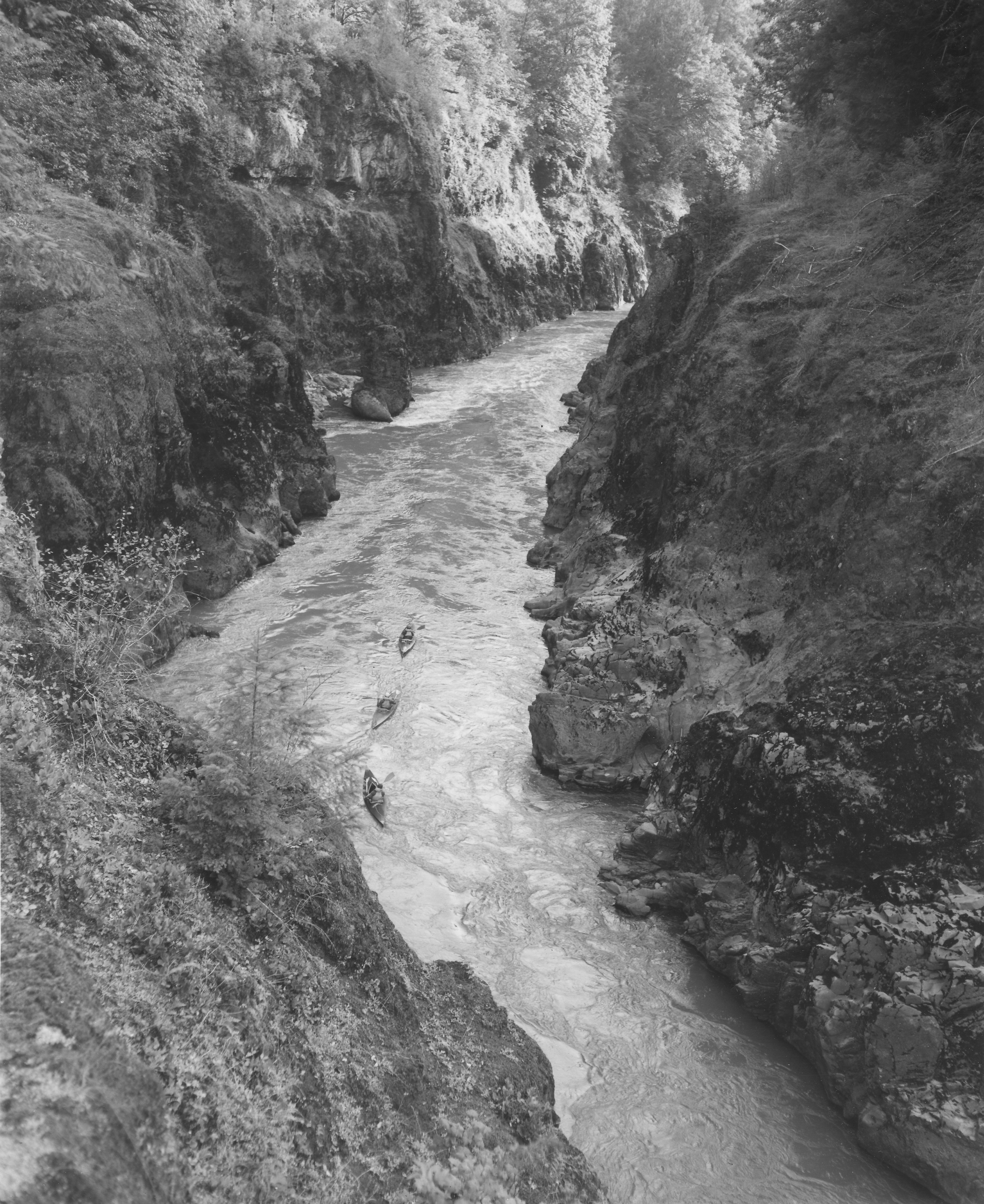
The Cowlitz was arguably one of Western Washington's best river trips prior to
construction of three dams that flooded scenic canyon sections that were first explored for their
whitewater recreation potential by Wolf Bauer and members of the Washington Foldboat Club (now
Washington Kayak Club) as early as the mid-1950's. During the legal battle over the construction of the
first dam on the river in 1956, Mary Kiona, a 93 year-old Native American, testified that she had
traveled down the river by canoe and that it was used for navigation.
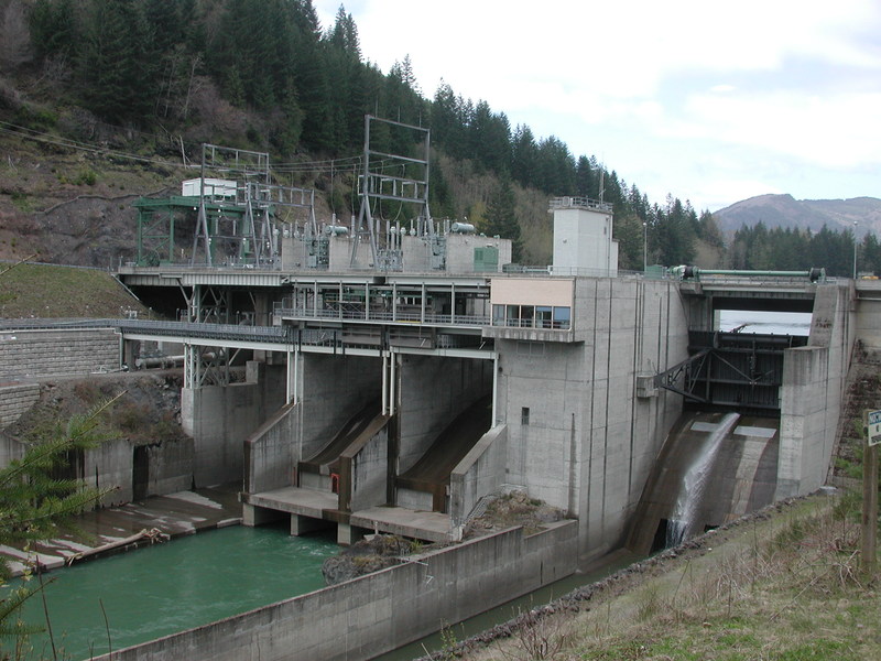
The canyons of the Cowlitz River are now buried beneath three reservoirs. Starting from
the upstream end at the confluence of the Cispus River the Cowlitz Falls project was completed in 1994
and now floods the confluence area up to approximately river mile 92. The next project downstream is
the Riffe Reservoir which was created by the City of Tacoma's Mossyrock Dam completed in 1969.
Immediately downstream of this dam is the remains of Dunn Canyon which is now flooded by the
backwaters of the Mayfield Reservoir. This reservoir was formed by the construction of Mayfield Dam
which was completed in 1963 by the City of Tacoma. A short distance downstream of this dam is the
Barrier Dam at river mile 49.6 which is used to direct fish into the fish hatchery. The [Lower Cowlitz](http://
www.americanwhitewater.org/content/River/view/river-detail/3481) continues from this point down to
the confluence with the Columbia River.
The first published account of middle reaches of the Cowlitz at its confluence with the
Cispus appears in the Washington Standard (Vol. XI, No. 41, page 1, August 12th, 1871) that describes
a trip to the site in the summer of 1871.
Standing upon the high bank of the upland that overlooked the bottom below, we
discovered t
Jan 1, 1900
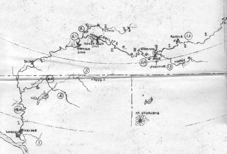
Whitewater river map of the Cowlitz River drainage
published by the Washington Kayak Club (1965
edition). Recommended flows for each section are
circled numbers (in units of 1000 cfs). At the time
this edition of the map was published, Mayfield
Dam had been completed and construction of
Mossyrock Dam was underway. With the completion
of these dams and the construction of Cowlitz Falls
dam in 1994 42.4 miles of intermediate whitewater
through scenic class III canyons were lost.