Cowlitz
1. La Wis Wis Campground to Packwood

| Difficulty | III |
| Length | 7.7 mi |
| Avg Gradient | n/a |
| Gauge | Cowlitz River at Packwood, Wa |
| Flow Rate as of 1 hour | 534 cfsbelow recommended |
| Reach Info Last Updated | March 3, 2023 |
Washington’s legendary volcanoes – Mount Rainier, Mount St. Helens, and Mount Adams – are the source of wild, free-flowing rivers and streams that cascade over big drops and through deep basalt canyons on their way to the Columbia River. Rivers like the Clear Fork of the Cowlitz, Cispus, Green, [...]Read More
Logistics
The put-in access for this section is also the take-out for the much more challenging Ohanepecosh
and Clear Fork Cowlitz runs. The turn-off for the La Wis Wis Campground is located along Highway 12
at mile 138, just west of the junction with Highway 123. Follow the campground road 0.5 miles down
the hill, but instead of entering the campground turn right and then take an immediate left to the
day-use picnic area right where the Clear Fork of the Cowlitz joins the Ohanepecosh (Northwest Forest
Pass required). If you are paddling this run in the off season the campground may be closed.
Jun 29, 2026
Awesome little hour and 15 minute run from La Wis Wis to around Packwood (We took out maybe a mile above the bridge at a private residence) Overall the canyon section was amazingly beautiful, one small portage about 5 minutes into the float. See pictures. Class II little wavetrains and gravel bar runs made the trip interesting but not spicy. Would go back and do again especially if the mountain is out!
Aug 22, 2025
Jun 7, 2025
14' Oar Raft
**NO BOAT RAMPS at put-in or takeout**
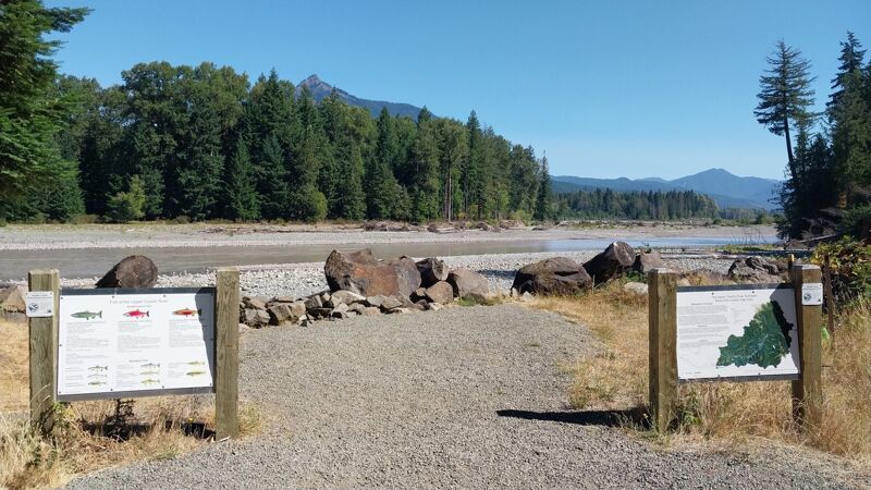
After discovering there were no boat ramps, we launched from a campsite with a 40' yard carry. This stretch of river is beautiful, but be prepared for lots of wood in play. The water is a deep emerald color in a beautiful drainage with great mountain views. Several splashy rapids in the first couple miles and then it turns into a meandering float through braided channels. The takeout is a public access point just upstream of Skate Creek Bridge in Packwood. The parking area is a good distance away from the river with a wooden bridge crossing to portage. Our crew of four did it with no problems, but would have been near impossible with just two of us.
Jul 4, 2023
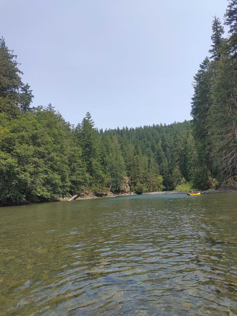
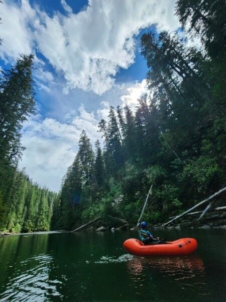
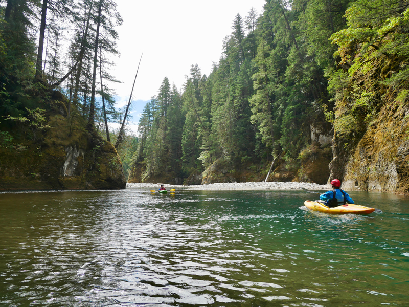
Took two packrafts out on the Cowlitz. Flow was pretty low and shallow in a lot of places, but never so shallow we had to leave our boats. There were a few moments we scraped bottom but never enough to full stop us. I wouldn't run this lower than 900cfs. Most of the rapids are in the first couple of miles of Wis Wis Campground. At higher flows these might be more intimidating rapids but at lower flow they were beginner friendly. Only one rapid felt like it might warrant the class 3 distinction given to this stretch on the American Whitewater site. Nonetheless we were able to read and run down an easy line through the middle. Overall this run felt a lot closer to class 2 than 3. The beauty in the initial canyoned area was spectacular. Deep blue and turquoise pools against towering bedrock was spectacular. The silty braids of the flood plain provided a sense of the landscape's scale. Really beautiful area.
Once you left the intimacy of the initial couple of miles and opened up into the larger flood plain, the river braided. We were able to read and run all of this section. Plenty of gravel bars to pull over to if there was a need to scout at all. We did encounter one river wide log at 46.64140, -121.63734. Part of the river flows through a jam on the right,but you can approach the jam as a nice pool forms. The adjacent bend to the left saw the river wide log. It's easy to pop out of your boat here and use the gravel bar to walk around the log to put in on the other side. The remainder of the run was easy to read and pick the appropriate braids. Take out was easy with a gravel bar next to the parking lot adjacent to the recommended pull out. There's a convenient parking lot there for day use where you can leave a car.
We did a bike shuttle since La Wis Wis campground is closed for the year. There's a bunch of no parking signs on shoulder adjacent to the entrance so there's not a great place to park a car. It was a holiday so we didn't encounter any work or construction crews. Nonetheless it was easier to leave a bike rather than a car at the put in. So we dropped boats at the campground, one of us took the car to the take out, parked it there, biked back along highway 12, and stashed the bike near the put in.
Jul 7, 2022
Decided to do this as I am new to captaining a 12ft cataraft after many years of being a whitewater passenger. The other boat in my group was a 14ft self-bailer. We wanted a chill low stakes day float that included a bit of white water and mountain river views. Most white water was within first couple miles of put in, read and runs in beautiful moss covered mountain canyons with forest above. There were two class II rapids then another II+, which was a wave train after a drop on river left that piled off a canyon wall as the river bent right. Nice eddy above this rapid for any vessel to scout, and there were some alternative routes, though bony. The glacial valley has shallow parts yet there were many winding splits to choose from. We took out at the bridge at Packwood on river left. With the bridge in sight, we were on river right and came upon a strainer in slow water with an easy eddy above it. We had to portage around, which wasn't bad for a day trip. Getting to the beach at takeout required getting out of boats and lining them over in shallow water.
At put in we had to walk through a campground in La Wis Wis, which if we didn't find an unoccupied camp to walk through it would have been an issue. Camphost said A-loop and D-loop are next to river. We had to walk boats and gear up, over, and around a log. Luckily we found an eddy and nice beach to launch from.
Take out was unpleasant. Some cool restoration work is happening on the river, so there's no boat ramp. You have to walk everything to parking lot up a rocky sandy beach and across a narrow wooden bridge.
My more experienced companion and other boat captain said they really enjoyed the float though it was low key as it still required some technical maneuvering and there was good opportunity for guest passangers to take the oars. In a raft, not sure I would want to run lower than 2000 cfs. Looks like it would be really fun for smaller craft. Cold water!
Jul 28, 2020
Ran this July 24 around 900 cfs or so. It was boney in a lot of spots with a few walks around a log jam and shallow water. Pretty nice part of the river. We put in below la wis wis campground and ran all the way down to cowlitz falls boat launch for a multi-day trip. The take out at Packwood looked accessible although I floated right by it.
Jul 27, 2020
We ran this July 26, 2020 around 850 cfs, with one hardshell and one IK. We had to walk our boats in a few times in the braided section, both because of shallowness and also because of wood and strainers. If you can't see around a corner, please stop to check. It was totally worth it though, for the gorgeous clear water up top, incredible glacial-fed tributaries, and token view of Mt. Rainer from the last mile or so above the bridge.
We put in at La Wis Wis Campground and took out at the Packwood bridge, directly downstream of it on river left. Please note and respect private property and no trespassing signs.
Overall: a scrapy but lovely run, and a beautiful time on the water!
Sep 10, 2018
Float trip on the Cowlitz at low flows near La Wis Wis Campground.
May 27, 2005
This run can be divided into 2 parts. The first 2 miles down to Jody's Bridge (FR1270) consists of relatively steep class II rapids, with steep walls in the last half mile. The next 5 miles is a broad glacial valley with the usual shallow braids and logs. Expect a portage or two in this lower section.
Either the recommended flow range or the gauge reading is questionable. I did this run at 1520cfs in an inflatable kayak, and it was shallow from beginning to end. In the canyon section, the rapids were shallow and scrapey. In the braided section, there were parts where none of the braids had enough water to make a completely clean run.