Foss
FR 68 Bridge to Highway 2 bridge
| Difficulty | IV+ |
| Length | 2.6 mi |
| Avg Gradient | 104 fpm |
| Gauge | South Fork Skykomish River at Skykomish, Wa |
| Flow Rate as of 24 minutes | 375 cfsbelow recommended |
| Reach Info Last Updated | December 26, 2025 |
The Skykomish River is one of the nation’s premier whitewater destinations. Rising in the high country of the North Cascades, the river and its tributaries attract paddlers from across the country and around the world. The Washington State legislature recognized the river’s outstanding qualities by designating the Skykomish as [...]Read More
The Foss is a popular creek run in the Skykomish drainage and a dependable option during spring snowmelt. It is sometimes possible to run the Foss during an early fall rain event, but it is typically snowed in during the winter.
You could put in as high as the bridge across the river at Forest Road 68 mile 5.0, as described in the Bennett guidebook, but this option is not recommended due to the low-gradient, braided channel and the likelihood of log jams. Most boaters put in at the start of the whitewater at Forest Road 68 mile 3.5. This access is at the turnoff to Forest Road 6830, where a decent trail leads down to the river and puts you on the water just upstream of an island.
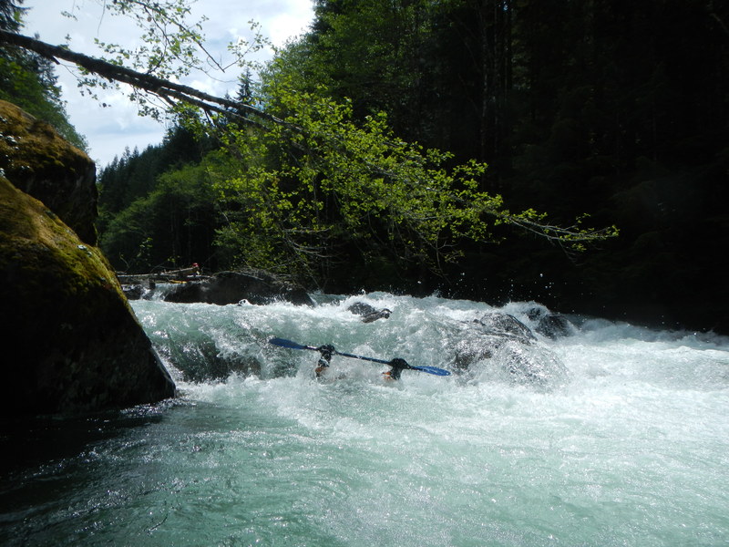
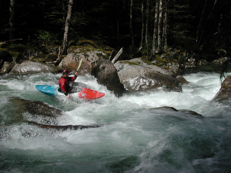
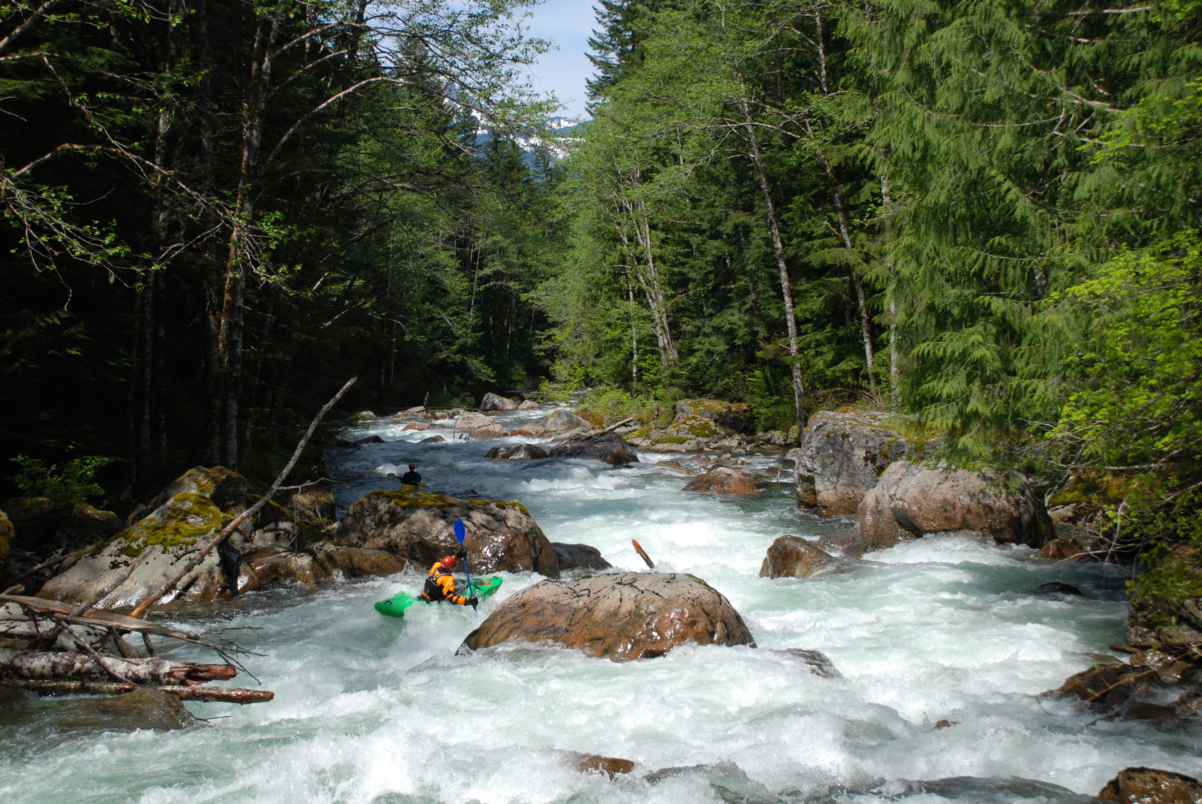
From this point downstream, the rapids are Class III+ until you encounter larger boulders and a horizon line a few short minutes below the put-in. This marks the beginning of a couple hundred yards of Class IV action, ending at an eddy upstream of Ken and Barbie. On river left, a talus field slopes down toward the river, and several very large boulders extend into the channel. Ken and Barbie can also be partially scouted during the shuttle by scrambling down toward the river near the mile 3 marker on Forest Road 68, though trees make scouting from the road difficult.
At Ken and Barbie, the river splits left and right around a midstream rock, with the two pourovers rejoining in a hole at the bottom. The primary hazard here is wood, which can easily wedge between the boulders (this drop can push V- particulary at higher flows). Catch an eddy below Ken and Barbie and stay in control through continued Class IV action for the next several hundred yards. Stay alert for logs and enjoy the ride. Most rapids from this point downstream are straightforward, though you may want to get out and check a few drops to confirm they are clean. Shortly after this section, the river begins to mellow, lines become easier to read from the boat, and within a few minutes the railroad bridge app
...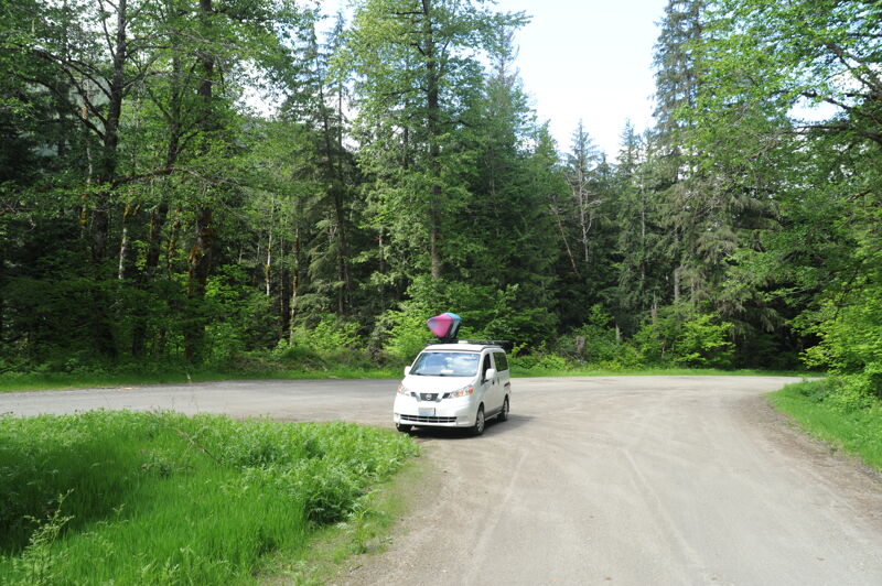
Although the river can be accessed farther upstream, the standard put-in—used to avoid the low-gradient, braided channel—is at the junction of Forest Road 6830 and Forest Road 68. This access is located at mile 3.5 on Forest Road 68 (the Foss River Road), where Forest Road 6830 branches off to the left. From here, it is a short hike through the woods down to the river. A faint social trail, worn in by kayakers, may be visible, though it is not always easy to find. If no clear path appears, continue working your way downslope toward the river; the Pacific coastal rainforest is quick to reclaim any trace of past travel.
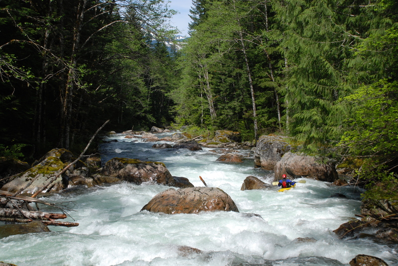
The most significant drop on the run recognized by the talus field on river left that marks the approach. A couple different options are available depending on flows, any wood hazards which often lurk in this drop, and what you identify as your preferred line. Scouting is genearlly recommended. Below this drop the river continues with great class IV action that gradually mellows out as you reach the railroad bridge where the river transitions to class III.
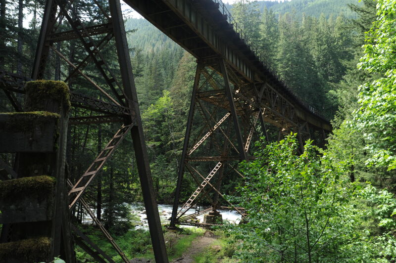
A short trail at mile 3.0 on Forest Road 68 leads down to the river beneath the railroad bridge on river right. This access is a good option for paddlers seeking 2.2 miles of intermediate creeking, continuing downstream onto the Tye River. From this point down, wood can be a persistent hazard, though the rapids generally do not exceed Class III.
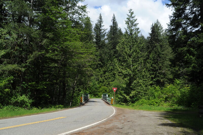
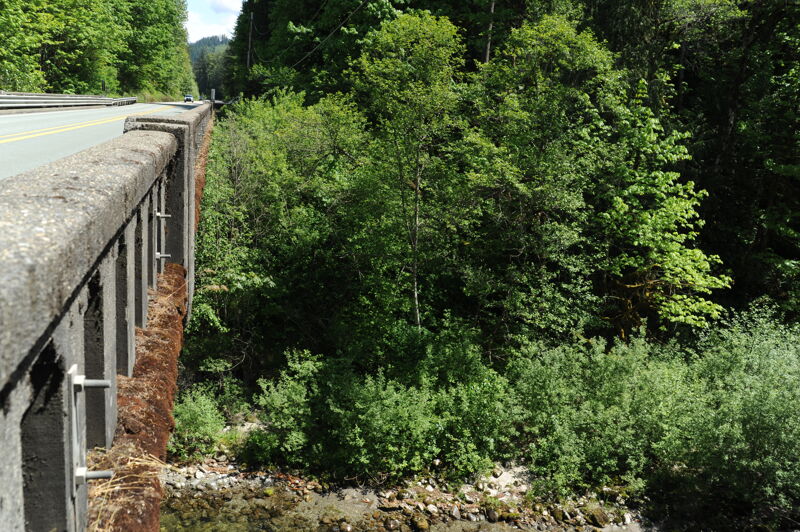
Although many continue downstream onto the Tye River for another 0.8 mile, the bridge across the Foss River at mile 1.0 on Forest Road 68 serves as an alternate takeout. It is located immediately upstream of the confluence with the Tye River. The land here is all private so be sure to stay within the bridge right-of-way if using this as an access point. Forest Road 68 (the Foss River Road) begins at Highway 2, mile 50.6.
From the confluence where the Foss River joins the Tye River, continue 0.8 mile down the Tye River to the Highway 2 Bridge.
The take-out on the Tye River is located at Highway 2, mile 51.0 (elevation 990'). There is limited parking for one or two vehicles and a reasonable take-out on river right, just upstream of the bridge.
Jun 3, 2025
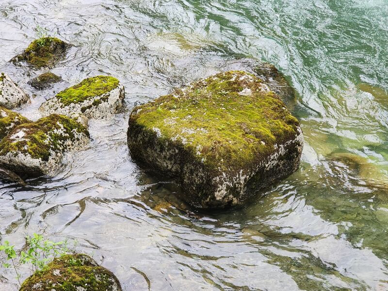
Caught a quick low flow run 5/31/25 on Lower Foss from RR bridge to Hwy 2. Still fun if you like a manky minimum flow run, and upper class 4 rapids looked low-but-goes as well. Only bad wood was visible from Foss Rd bridge downstream on river left. S Fk Sky at Skykomish USGS gauge was at 2100-2200 cfs, should correlate much better than main Sky gauge. Moss covered flat 'table' rock downstream left of Foss Rd bridge is good indicator, see photo for minimum flow level. Prof Paddle says 3-6 inches of rock sticking up is medium-high. If rock is covered, things will be frickin rippin for sure!
May 21, 2013
Foss was good to go and relatively clean. One piece of wood in play in the left chute of Ken and Barbie but possible to get around. The center slot (where most of the current goes) in the drop just below Ken and Barbie was also blocked with wood.
May 19, 2002
We chose this run because it offered a rare combination: a challenging creek section up high and an easier lower stretch where additional paddlers could join. The Skykomish at Goldbar was at about 7,100 cfs, which translated to lower-than-ideal water for the Foss. Still, it was the best option we could think of that day, so we decided to put on and see how it went.
The upper section immediately felt thin. Progress through the boulder gardens was more about precision than momentum, with constant pinballing between rocks and very little margin for error. Pin potential was everywhere. Ken and Barbie, the signature drop on the run, was partially blocked by a log, forcing a portage. Not long after, a paddler attempted to catch a left eddy, slipped back over a shallow ledge, and became pinned. As weight shifted during the initial response, the pin worsened and the paddler exited, sending the boat downstream without its occupant.
While one paddler carefully continued through the next drop—which was awkward to scout from the boat—others repositioned downstream to deal with the now-unoccupied boat, which had lodged against a rock at the base of a ledge. After several tense minutes, the boat was finally worked free. The recovery wasn’t without drama, as the boat briefly flushed downstream again, but everyone eventually regrouped with no injuries and intact gear.
Not long after, we reached the railroad bridge, where additional paddlers joined for the lower section. With the flow still low, there was some concern about whether this stretch would be enjoyable. Although the rapids were nominally class III, the technical nature of the boulder dodging made them feel more serious than the rating suggested. Very precise boat control was required to avoid pins, and the consequences of small mistakes were immediate.
One paddler in our group was understandably tense, and the group tightened up spacing to provide support. There was a moment where walking out seemed like a real possibility, but with a bit of assistance to get unstuck, the group continued downstream to the confluence with the Tye River. There, the character of the run changed noticeably as the flow picked up and the rapids opened up.
The Tye delivered a few fun, splashy rapids to finish things off. On the last one before the takeout, a paddler got knocked offline and swam. Another paddler briefly found themselves out of position while setting up for the rescue, but the group recovered efficiently. Everyone and everything was accounted for before reaching the takeout.
Overall, the day was a reminder that low water can make even familiar runs feel sharp-edged and unforgiving. While the Foss delivered technical interest, it demanded constant focus and conservative decision-making at these lower flows. The Tye provided a welcome, higher-flow finish and a chance to relax just a bit before calling it a day.