Hamma Hamma
1. Hamma Hamma Falls to Hamma Hamma Campground (Upper)

| Difficulty | V+ |
| Length | 7.8 mi |
| Avg Gradient | 200 fpm |
| Reach Info Last Updated | July 21, 2024 |
American Whitewater is proud to be a leading partner in the Wild Olympics Campaign, a collaborative effort to protect the wild rivers, ancient forests, and salmon habitat of Washington’s Olympic Peninsula. Working alongside conservation and recreation organizations, American Whitewater helped launch this campaign with the leadership of our local [...]Read More
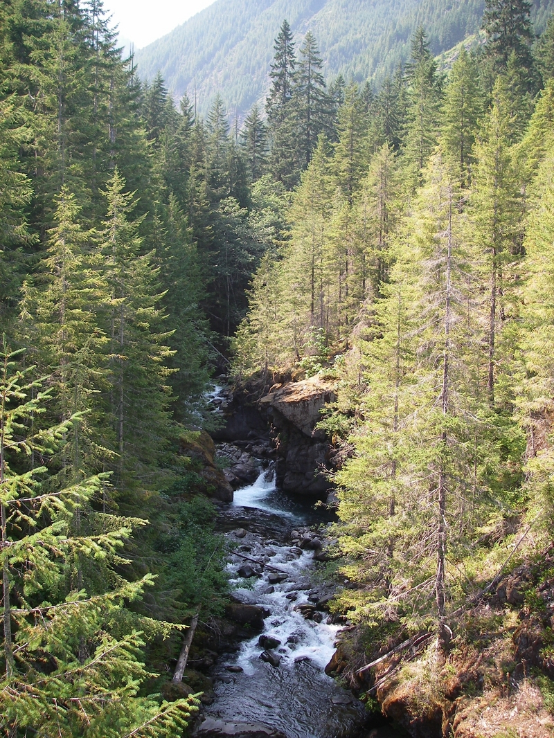
An extreme Olympic Peninsula creek with several technical drops and some mandatory portages. The river is for experts and this segment should be approached with extreme caution with paddlers carefully choosing the section appropriate for flows and their skill level. The season typically begins with fall rains in November and continues throught the winter and then into spring with snowmelt that depending on snow pack can last into early July. Not recommended during high flows (above 250 cfs).
Some come for the whitewater run but the real draw for some of the world's top paddlers is the double tier drop (20' and 60') of Hamma Hamma Falls at the start.
ACCESS: At Highway 101 mile 317.9 Take FR 25 (Hamma Hamma Road) as it runs west into the National Forest. Head up this road past Hamma Hamma Campground. Contine on FR 25 as it winds along the river to a take-out at Lena Creek (or find a spot anywhere along here between Lena Creek Campground and Hamma Hamma Campground with goood roadside access). The standard put-in is another 5 miles or so up the road where you can find river access. Continue on up to Mildred Lakes Trailhead and the end of the road if you are seeking out Hamma Hamma Falls. The road will likely be snowed in through the winter. Check road reports under Recereation, Current Conditions, Hood Canal South, on the USFS Olympic National Forest web site.
for additional information see:
Uppermost access point for those interested in running the big waterfalls.
A two-tier falls (20' and 60') immediately downstream of the Forest Road 25 Bridge at the Mildred Lakes Trailhead that attracts some of the world's top paddlers looking for big waterfalls.
Approximately 20' falls as identifed as Middle Hamma Hamma Falls https://www.waterfallsnorthwest.com/waterfall/Middle-Hamma-Hamma-Falls-27036 in the Northwest Waterfalls Survey.
Approximatley 20' waterfall as identifed as Lower Hamma Hamma Falls https://www.waterfallsnorthwest.com/waterfall/Lower-Hamma-Hamma-Falls-3275 in the Northwest Waterfalls Survey.
Approximate location identified as the put-in in Gary Korb's guidebook to the Olympic Peninsula. He describes it as 'about five miles to where you can see the river alongside the road.'
Put-in identified in Paddling Pacific Northwest Whitewater
Gary Korb advises that once you hit the flat stuff near Lena Creek you can take out and walk to the road or fight your way through to where the road comes along the river.
Take-out identified in Paddling Pacific Northwest Whitewater
Access at the bridge upstream of the Hamma Hamma Campground more typically used as a put-in option for the easier run that continues downstream.