Humptulips, E. Fork
2 - FR 22 Bridge to Gorge (Falls Section)
| Difficulty | III |
| Length | 5.5 mi |
| Avg Gradient | 23 fpm |
| Gauge | Humptulips River Below Hwy 101 Nr Humptulips, Wa |
| Reach Info Last Updated | April 29, 2026 |
SEASON: November to May.
ACCESS: At US-101 mile 112.6 (~4 miles north of the bridge across the Humptulips River) look for the sign to Wynoochee Lake Recreation Area, and drive Donkey Creek Road (Forest Road 22) east 12.2 miles to a spur road that leads down to the river. The road ends in 0.4 miles at a nice campsite and river access at a fun rapid.
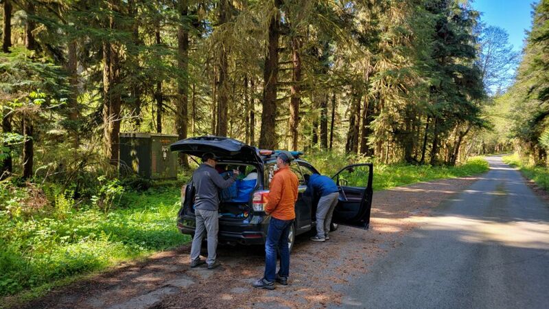
To shorten the run a bit, there is a good pull-out at Forest Road 22 mile 12.6 where the river comes up near the road. There's a green electrical box just off the road and an easy (~200') trail through the woods to the river.
Before setting up a shuttle, most continue on to mile 13.0 where Forest Road 22 crosses the river. This allows for a visual check of the flows and allows taking out on the upstream river left side of the bridge.
DESCRIPTION:
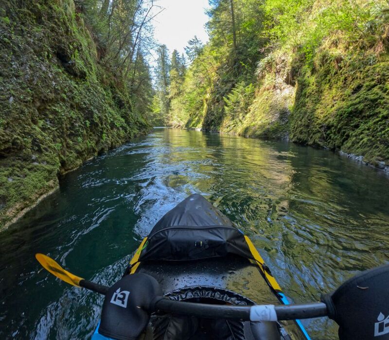
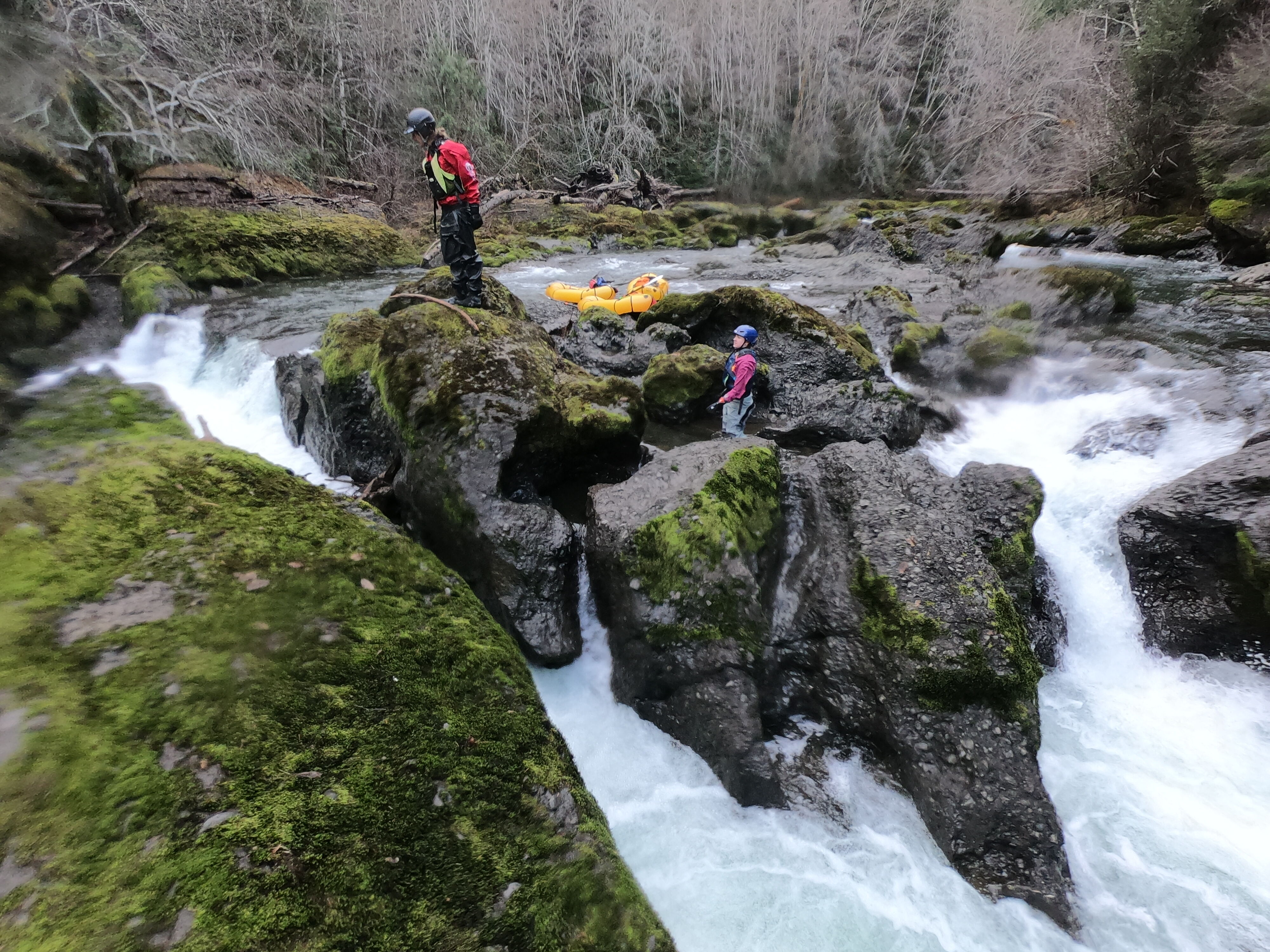
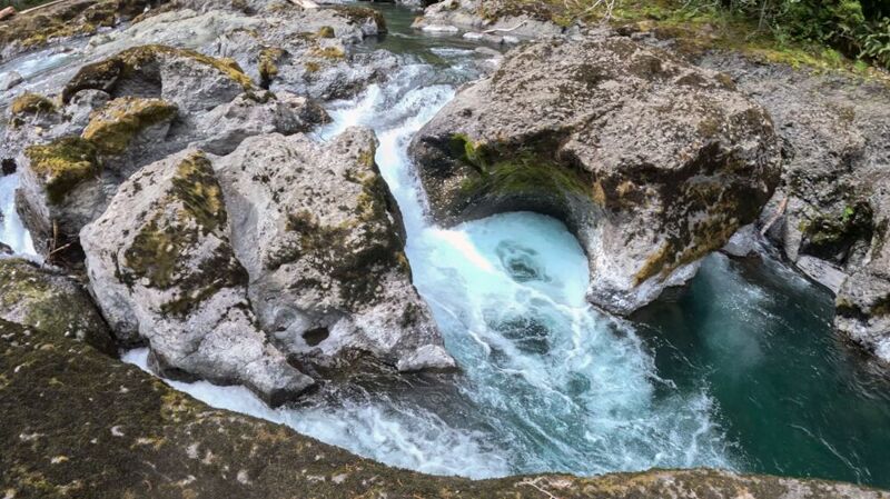
Pool drop rapids- lots of fun sluices followed by deep pools. Beautiful narrow and twisty gorge. Near the end of the run are the Falls, which are at least class IV and have an undercut slot as well. Portage river-right over large boulders.
Packrafts successfully ran this section and the lower gorge section at 450cfs in April 2026.
for additional information see:
Two drops- the first an easy class III if there's no wood, but the second is a vertical drop of 4-5 feet with dangerous currents. Portage on river-right.
Apr 26, 2026
We were 4 packrafters on a Mountaineers trip, and none of us had done this river, so this was a scouting mission. It's now my favorite river! Beautiful gorges, crystal clear water, fun pool drop rapids. We portaged twice for wood, twice for drops that were too big for us, and we walked a few shallow areas, but despite it being nearly 50cfs lower than the recommended, we had a great time. We decided that 450 should be the lowest that packrafts should do it, though.
The Falls are near the end of this run (before the bridge that marks the start of the lower gorge run). There are two drops- the first of which we could have run if there hadn't been an inconvenient tree in the middle of it. The second drop is vertically 5 or 6 feet with a big hole at the bottom- well over our skill level to attempt. We portaged on river right.
We left a car at the locked gate on E. Humptulips Rd (47.240245, -123.848956), which is about 1/2 mile walk up from the takeout at Boise Bridge. We parked at the electrical box at mile 12.6 on FR22 and made the easy walk through the woods to the river. We had scouted the bridge at mile 13 that is supposedly a put-in for this stretch, but we couldn't figure out how to get down to the river from there.
We spent about 6 hours on the river. I'm sure that would have been shortened if we'd had more water. There were a lot of very flat sections that were pretty, but slow. I can't wait to go back and see what it's like at higher flows.
Nov 28, 2020
The logging road to the take-out of the Falls section/ put-in to the Gorge section has a locked gate on it.