Humptulips, W. Fork
2 - FR 2203 access to Donkey Creek Rd. (FR 22)
| Difficulty | II |
| Length | 7.5 mi |
| Avg Gradient | n/a |
| Gauge | Humptulips River Below Hwy 101 Nr Humptulips, Wa |
| Reach Info Last Updated | June 1, 2019 |
SEASON: November to May with rainfall
ACCESS: At Hwy 101 mile 112.6 (approximately 4 miles north of the bridge across the Humptulips), take Donkey Creek Road (FR 22) east off Highway 101. Put-in at FR 2203-030 where it ends near the river or continue past Rainbow Creek up to 2203-040. Take-out where FR 22 crosses the Humptulips on upstream river left.
DESCRIPTION:
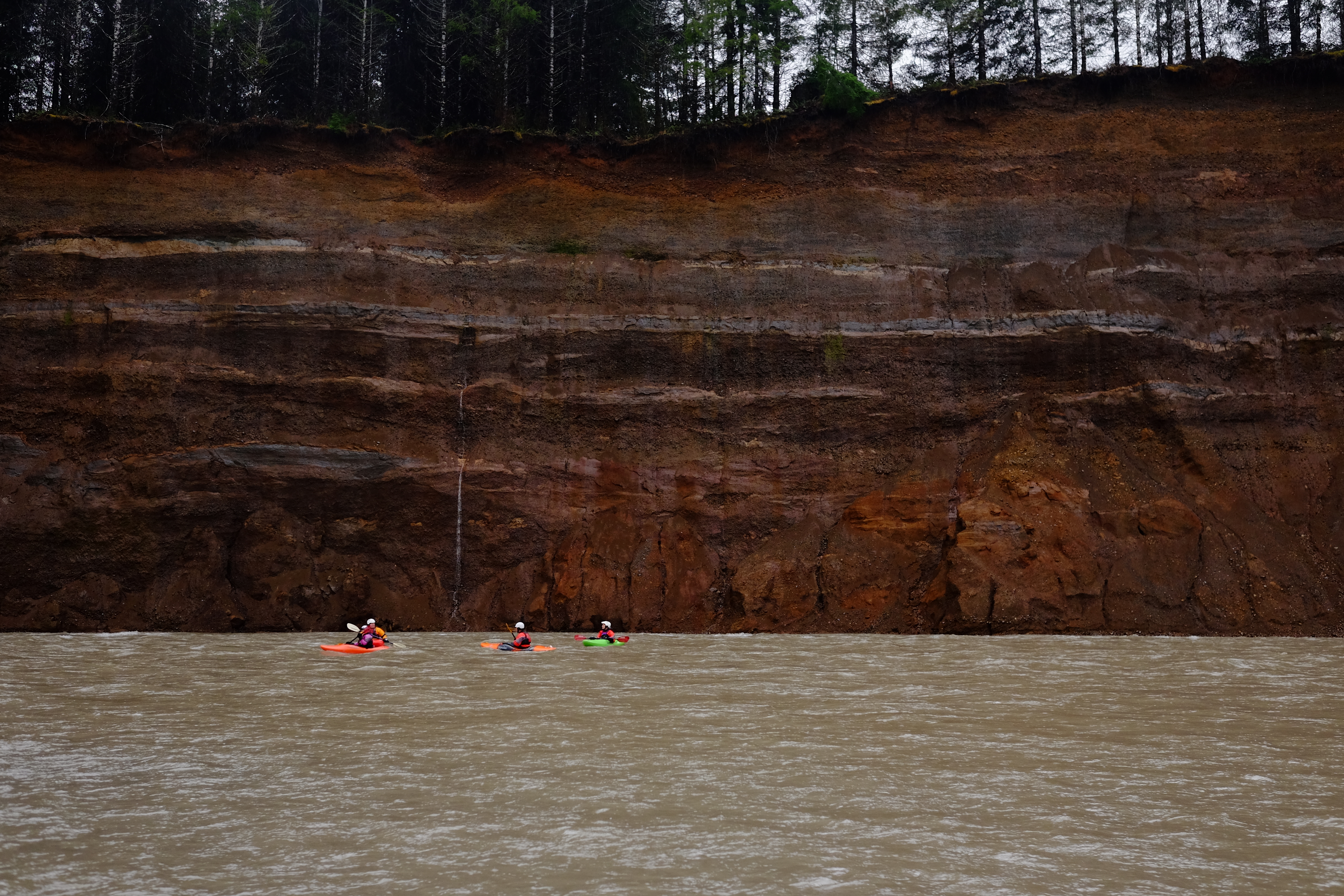
This section of the West Fork of the Humptulips flows through mostly private lands as it meanders to the take out on Donkey Creek Road. Along the way, intermittent bluffs rise high above the water and during wetter periods can create a scenic backdrop as numerous small cascades tumble down to the river. Although this is a mostly flatwater stretch without much in the way of whitewater, paddlers will want to keep their eyes open for wood hazards as the unstable shoreline has a tendency to calve trees into the water.
for additional information see:
Korb, G. 1997. A paddlers guide to the Olympic Peninsula. third edition.
Apr 7, 2024
Parked at take-out and walked about 7 miles to the put-in (there's parking available at put-in and I found a nice stretch of rocky shore just upriver for staging). First 1.5 to 2 miles has quite a number of downed trees in the water, but most of them were avoidable. Only one area that I felt needed portaging, and it was easy. The rest of the float was pretty pleasant, though it was a little shallow for comfort at mid-700s cfs. Walked the raft over shallow rocks at two points, but starfished over a couple more sections. Lovely turquoise water in several areas. Overall pretty chill float.
