Icicle Creek
2 - Middle Icicle - Eightmile Campground to Snow Creek Falls
| Difficulty | V |
| Length | 2.5 mi |
| Avg Gradient | 180 fpm |
| Gauge | Icicle Creek Above Snow Creek Near Leavenworth, Wa |
| Flow Rate as of 57 minutes | 236 cfsbelow recommended |
| Reach Info Last Updated | May 30, 2026 |
The Okanogan and Wenatchee National Forests encompass more than four million acres and are jointly managed with headquarters in Wenatchee, Washington. The rivers flowing through these forests are essential to the whitewater paddling community—both as close-to-home runs for Washington residents and as classic objectives for paddlers traveling from across [...]Read More
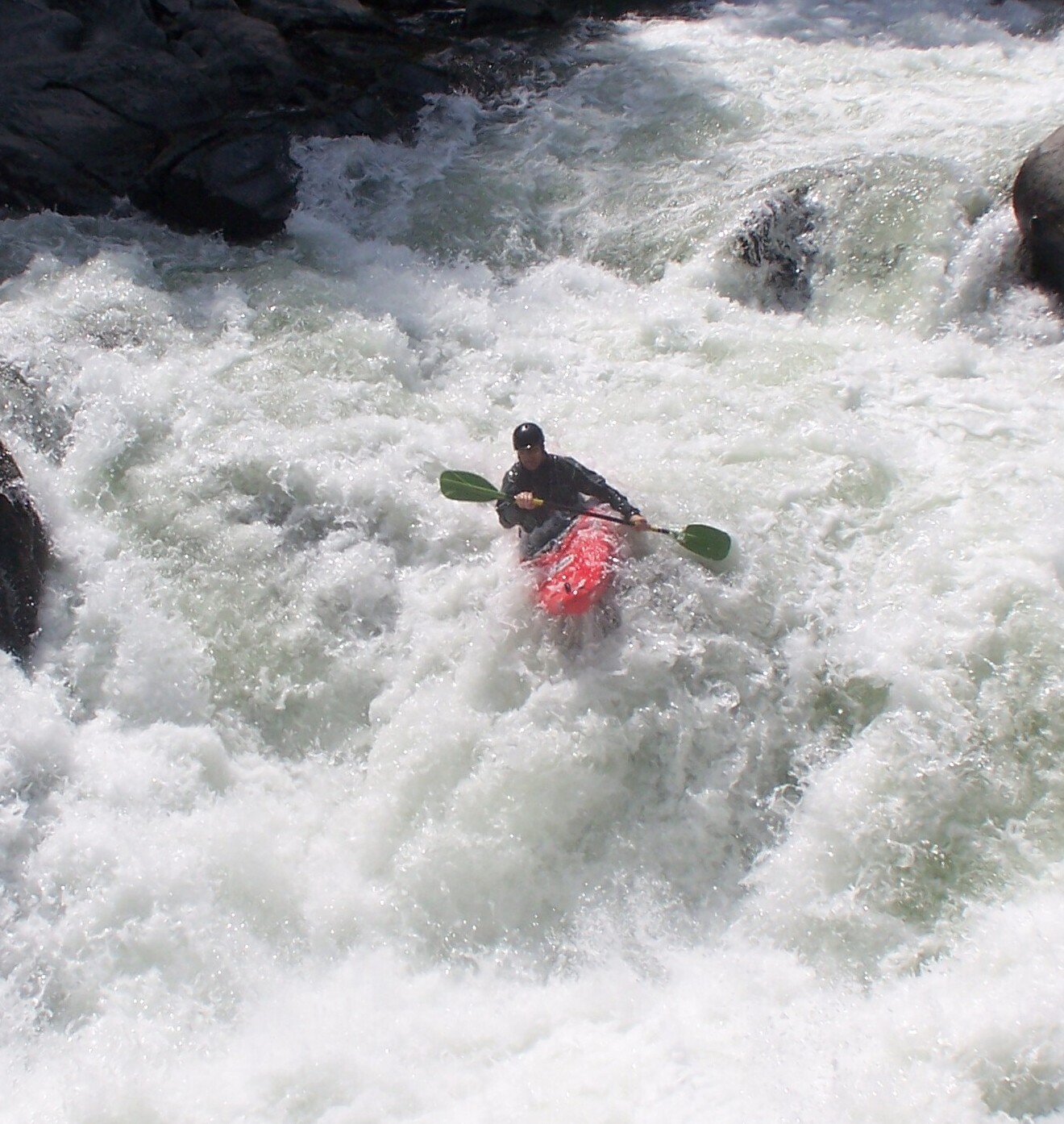
The Middle Icicle Creek run is a classic expert creek, really more of a river, pioneered in the 1960's but with challenging sections that have been tackled more recently. Beautiful granite boulders, impressive alpine scenery, and great riverside camping make this a run locals consider lucky to have in their back yard, while those on their Pacific Northwest road trips make it a scheduled stop. The Icicle Creek Road parallels the length of this run and most of the land along the river is publicly owned so you have several options for accessing the river and putting together a run appropriate for your set of skills and the time available. Camping is also plentiful along this river at one of several National Forest campgrounds but during the spring boating season, paddlers, rock climbers, and mountain bikers all call this valley their outdoor playground making this a very busy place (Memorial Day weekend can be particularly crowded). Historically, some used to consider Middle Icicle to include the RV lot access to Eightmile Campground. Colloquially, RV to Eightmile is now considered Upper Icicle. As of 2026, this write-up has been changed to reflect that. After Eightmile, the gradient increases through a short section about 2.5 miles in length at about 180 feet per mile (keep in mind however that this no small volume creek). You can see a lot of this section from the road but not all of it. There is more private land once you pass Eightmile so you have to be a bit more selective in your river access. Expect to take your time portaging and probably scouting as there's plenty of action from here down to Snow Creek Falls, an unrunnable sequence of massive boulders and sieves created that owe some of their legacy to road building activity. After Eightmile Campground things start to kick up another notch with some solid V whitewater. A few class III rapids lead to Ricochet. This three part rapid (Ricochet Proper, Ricochet Rock, and Son of Ricochet) is an quarter mile expl
...From Highway 2 mile 99.1 (the west end of Leavenworth) turn on to Icicle Creek Road. Johnny Creek Campground is at mile 11.2. Several sites in the campground provide convenient river access but if they are all full, you can find a good access at a mini beach between sites 5 and 6 that avoids walking through someone's campsite. Icicle Creek quickly builds to class IV downstream of this access point.
From Highway 2 mile 99.1 (the west end of Leavenworth) turn on to Icicle Creek Road. Bridge Campground is at mile 8.4 on Icicle Creek Road. You can access the river at the Forest Road 7601 Bridge. A challenging class V+ rapid awaits just downstream of this access.
From Highway 2 mile 99.1 (the west end of Leavenworth) turn on to Icicle Creek Road. Eight Mile Campground is at mile 7.0 on Icicle Creek Road. Downstream of this access point you enter solid class V territory. Be prepared to carefully scout and choose your take-out wisely while being mindful of private property.
From Highway 2 mile 99.1 (the west end of Leavenworth) turn on to Icicle Creek Road. The Snow Creek Trailhead is at mile 4.1.
Apr 3, 2002
This is the most significant rapid
between Ida Creek and Bridge
Creek. Scout from the road at mile
9.2 where you see a large bedrock
face between the road and the river
with a pullout. The typical line is to
take the right chute at the top then
move to the left.
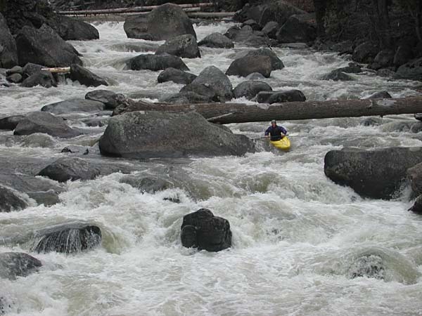
Jan 1, 1900
Looking down the valley at the
middle section of Icicle Creek.
Video footage from the Twitch
series, featuring runs from
Washington and around the world.
Available through the [books & videos link](http://
www.americanwhitewater.org/library/
).