Kalama
2. Gobar Creek to Kalama Falls Hatchery(Gate to Bridge)
| Difficulty | II-IV |
| Length | 9.8 mi |
| Avg Gradient | 27 fpm |
| Reach Info Last Updated | February 8, 2026 |
Washington’s legendary volcanoes – Mount Rainier, Mount St. Helens, and Mount Adams – are the source of wild, free-flowing rivers and streams that cascade over big drops and through deep basalt canyons on their way to the Columbia River. Rivers like the Clear Fork of the Cowlitz, Cispus, Green, [...]Read More
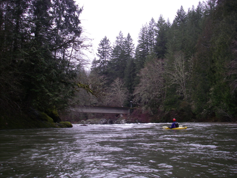
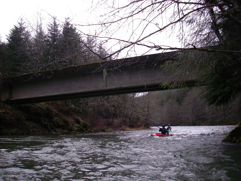
This run can be divided into a couple of sections. For the first half, most boaters will need to put in at the Weyerhaeuser gate, as access above is limited to those who have secured a limited-entry permit for Weyerhaeuser lands. The traditional put-in is a half mile upstream at the 6450 Bridge on Weyerhaeuser property. From your chosen put-in down to the 8100 Bridge, the river offers a number of enjoyable class II rapids. The primary class III rapid in this section is What’s That Falls, a river-wide ledge that is easy to scout from river left.
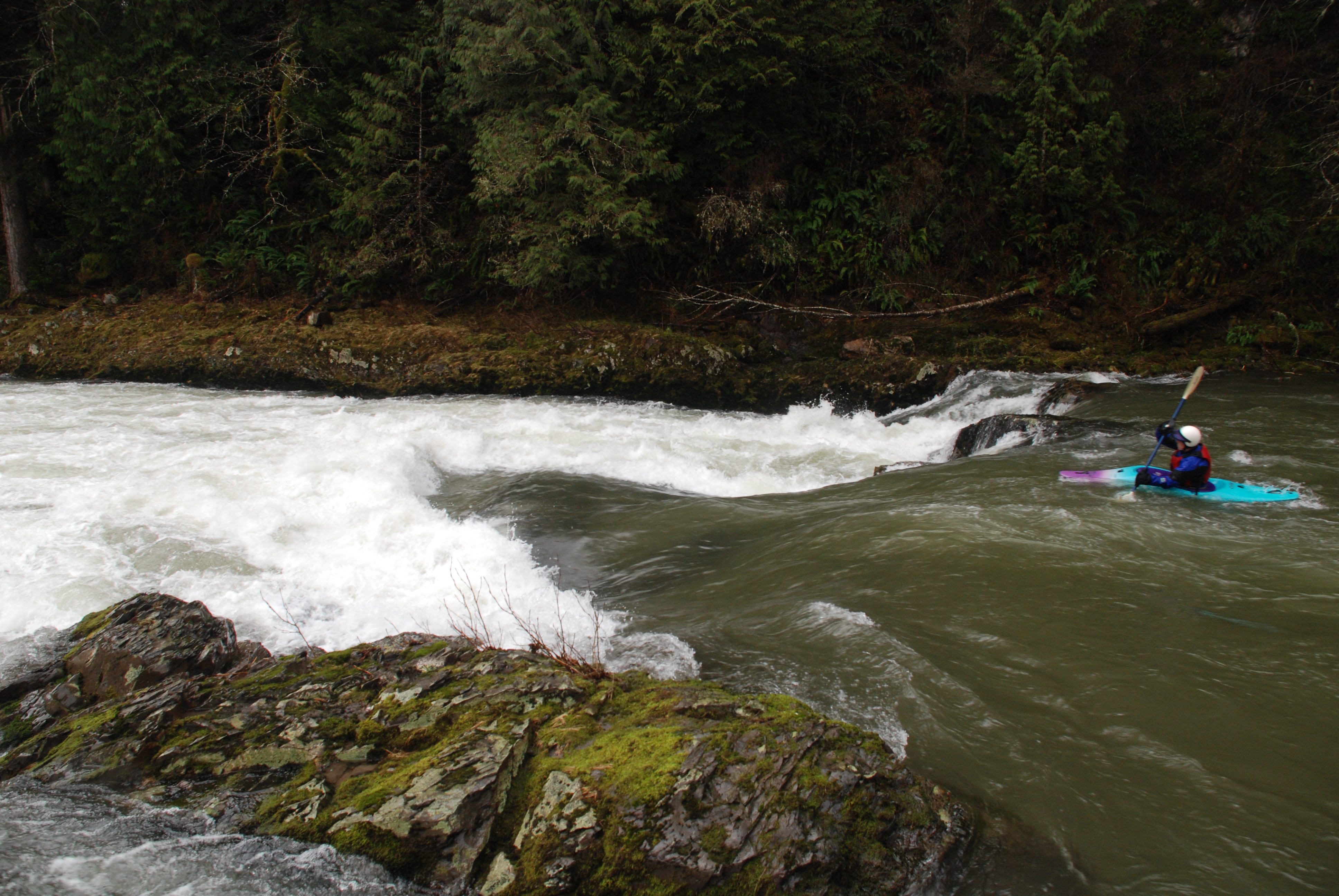
Those looking for a shorter class II/III outing may take out at the 8100 Bridge, but paddlers wanting to check out the most challenging drop on the run can continue downstream. Just below the bridge, the river passes through a short mini-gorge before reaching the horizon line at Leader Rapids. This boulder garden has a good line down the left, and at higher flows you can also pick your way through the boulders on river right. A couple more class II rapids follow, but the pace calms down considerably after that. From here, you can continue to the state salmon hatchery, which involves about four miles of mostly class I floating, or find a take-out along the road. Be mindful of private property, as there are several houses lining this stretch.
If you continue down to the hatchery, you can take out or portage Lower Kalama Falls on river left, then enjoy another three miles of excellent intermediate whitewater on the Red Barn run.
The gauge on the Kalama is located here. 500 cfs and up is best, Leader Rapids get harder below that, but the run was reported to still be enjoyable at 400 cfs.
A put-in is available on upstream river right of the bridge. This is the put-in described in Bennett's guidebook for the Gobar Creek to Fish Hatchery Run. It is just upstream of the Weyerhaeuser gate so if you don't have a Weyerhaeuser acccess permit you will need to park outside the gate, and put-in there.
The Kalama River Road maintained by the county becomes the Weyerhauser 6000 Road which is a private timber road that is gated with access upstream of this point limited to those with permits. You can put-in on the downstream side of the gate. Located at USGS river mile 19.9.
A fun river wide ledge that can be scouted from river left.
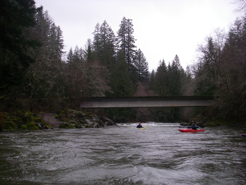
A fun little rapid as you approach the bridge. Located at USGS river mile 16.75.
This access can be used as an alternate take-out for those who do not want to continue on downstream to the Class IV Leader Rapids. Located at USGS river mile 16.7.

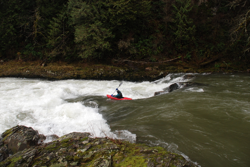
Leader Rapids is a boulder garden with a route down center left. At higher water you can pick your way through the boulders on river right. Located at river mile 16.2.
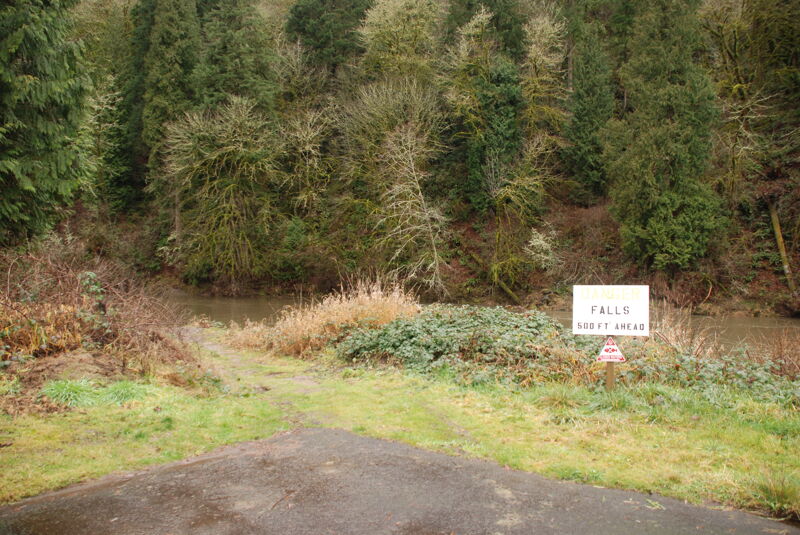
Unless you are going to portage Lower Kalama Falls and continue on downstream you will want to take out at the fish hatchery on river right. Be sure not to venture down towards the falls as the banks are lined with blackberries. Located at USGS river mile 10.9.
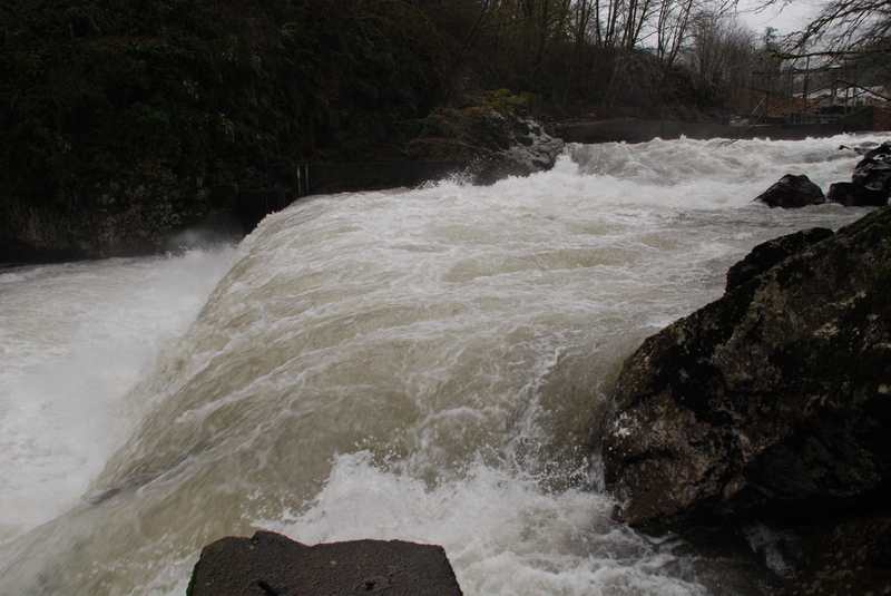
Lower Kalama Falls is located immediately downstream of the fish hatchery. Most put-in below the falls for this run. The falls itself is a severe hazard due to the riverwide dam at the end of the falls that forms a deadly hydraulic. A portage on the left side is available but be sure to get out at the first eddy above the start of the falls. Located at USGS river mile 10.8.
Jan 5, 2008
We dropped car at one of the WDFW access sites below Red Barn and decided to cruise upstream as far as we could. We found the Weyerhaeuser gate open and continued on locating a put-in and then starting our journey downstream. We portaged Lower Kalama Falls on river left shortly after we passed the hatchery.
Jan 1, 1900
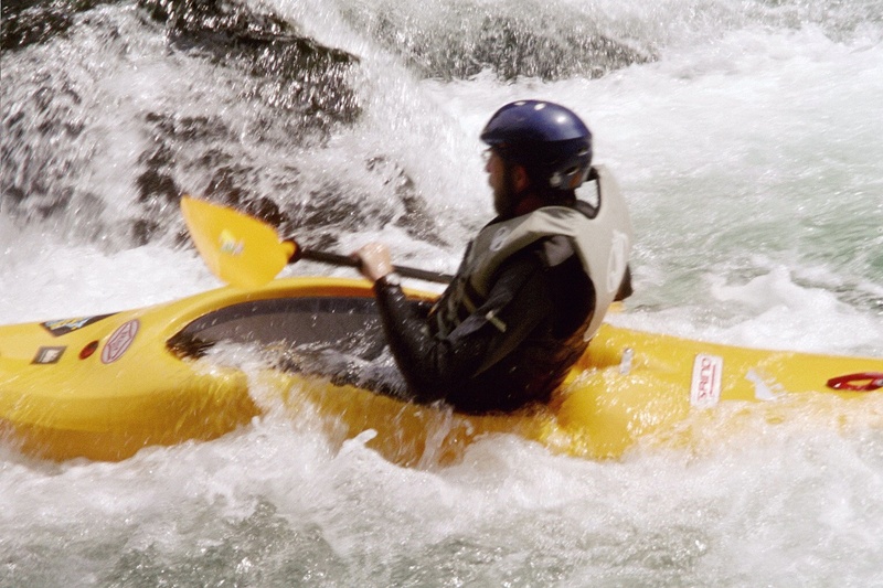
nice play spot