Naches
Sawmill Flat to bl. Town of Naches
| Difficulty | II-III |
| Length | 44 mi |
| Avg Gradient | 35 fpm |
| Gauge | Naches River Near Cliffdell, Wa. |
| Flow Rate as of 8 hours | 357 cfsbelow recommended |
| Reach Info Last Updated | May 24, 2025 |
The Okanogan and Wenatchee National Forests encompass more than four million acres and are jointly managed with headquarters in Wenatchee, Washington. The rivers flowing through these forests are essential to the whitewater paddling community—both as close-to-home runs for Washington residents and as classic objectives for paddlers traveling from across [...]Read More
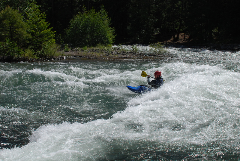
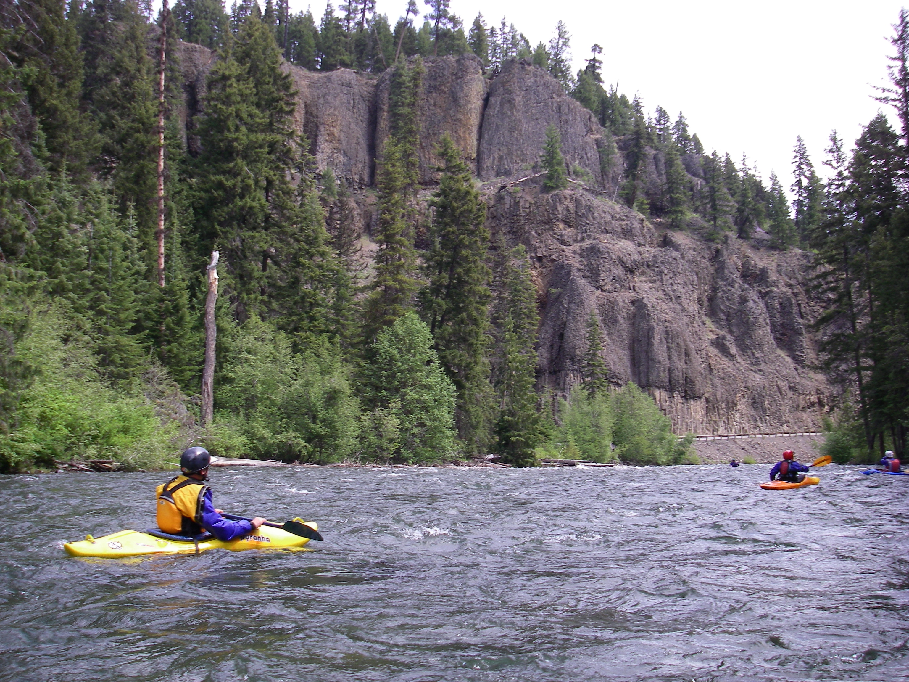
The Naches is a great river with some wonderful scenery, and good weather in the spring makes this a great day trip on the east side. You can easily turn the run into a two-day trip, starting out on the American, Bumping, or Little Naches, and spend the night at one of the campgrounds along the way. More typically the run is divided into sections which have their own characteristics.
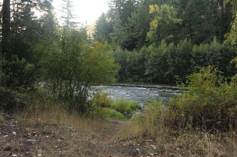
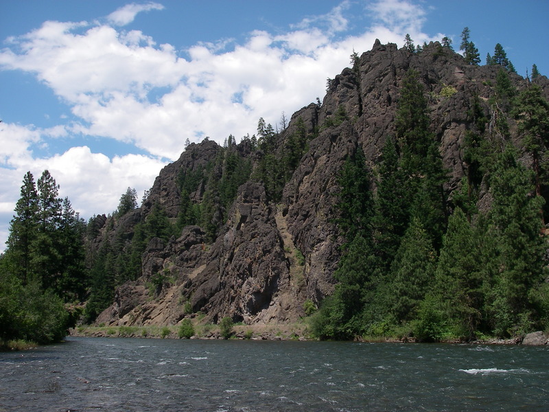
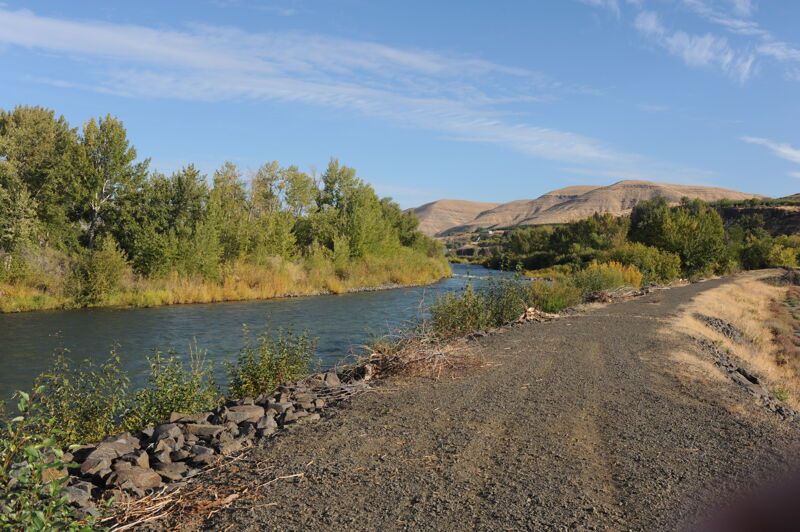
For the first 7.6 miles in the National Forest the run starts out forested with a few cabins and a couple of small riverside communities at Cliffdell and Nile. The river leaves the National Forest shortly after you pass Cottonwood Campground and the trees start to diminish as you float into more arid country and agricultural lands for 18.4 miles down to the Tieton confluence. The geology is impressive throughout and the river provides a great escape for those hot days in late spring and early summer. After you pass the Tieton it's another 8.3 miles to the town of Naches through a rural landscape. You get a second shot at this section in the fall when the Tieton Reservoir starts releasing in early September.
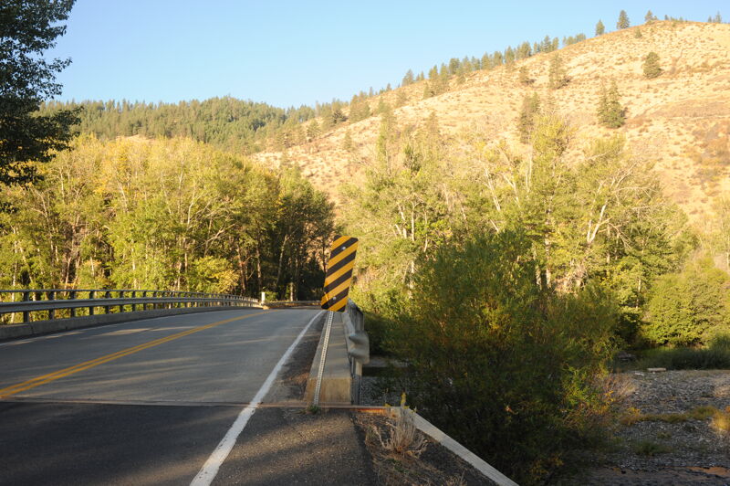
Be cautious of diversion structures on this river. There is one dam above the Tieton confluence and another just downstream of the confluence that is extremely deadly and must be portaged.
Logistics
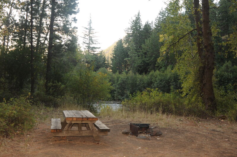
One popular alternative for this run is to begin your day further upstream by starting on the Bumping at the FR 1709 Bridge (the road to Halfway Flat) or Little Naches. The standard put-in though is to access the Naches at Sawmill Flat Campground, about a mile downstream of where the Bumping and Little Naches join to form the Naches. Sawmill Flat Campground is at Highway 410 mile 93.3 and it has a picnic and day-use area with good river access (i.e. you don't have to hike throug
...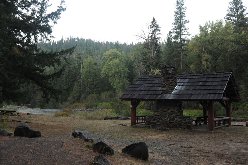
Sawmill Flat Campground is at Highway 410 mile 93.3 and it has a picnic and day-use area with good dedicated river access and parking (i.e. you don't have to hike through someone's campsite to get to the river). This is a good access for rafts, one of the few, with a short carry and lowbank access.
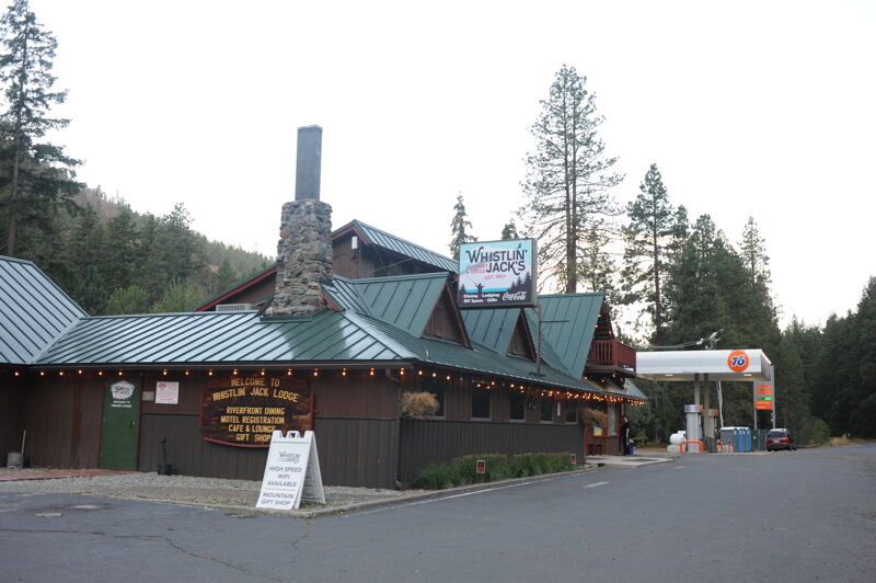
Located at Highway 410 mile 96.2, Whistlin' Jacks has lodging, campsites, a full restaurant, and outpost with gas and basic supplies.
Cottonwood Campground at Highway 410 mile 99.3 is about the last potential access before the river leaves Forest Service lands but unfortunately no designated access is provided and you have to find your way through a campsite to the water. The campground has 16 sites. Good river access is available through site 6. Parking is very limited here.
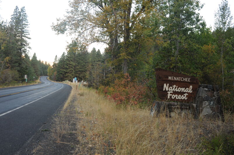
The Forest Service boundary is at Highway 410 mile 100. Upstream of this point there are still private inholdings but most of the land is public. Downstream of this point the land is mostly private with a few parcels of state land.
Access at the Upper Nile Road Bridge. Located by turning off Highway 410 at mile 104.5.
Access at the Nile Road Bridge near the Wood Shed Bar and Grill at Highway 410 mile 108.4.
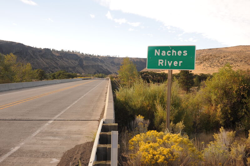
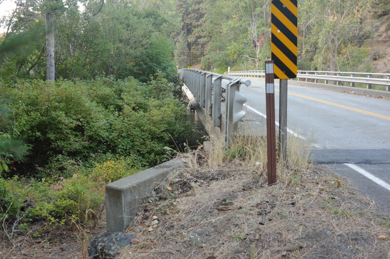
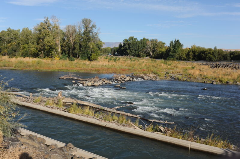
Bridge immediately upstream of the Tieton River confluence at Highway 12 mile 185.2 and a hazardous dam just downstream.
Lowhead dam located just downstream of the Highway 12 bridge and below the Tieton River confluence. The dam is visible at Highway 12 mile 185.8.
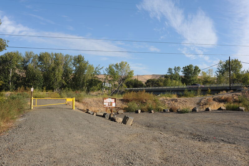
The access is reached by turning south at Highway 12 mile 189.8 on to South Naches Road in the town of Naches. The access is on the upstream river right side of the South Naches Road bridge and is managed by Washington Department of Fish and Wildlife requiring a Discover Pass.
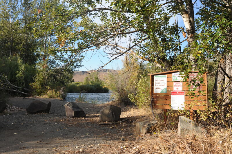
Small access site managed by Washington Department of Fish and Wildlife requiring a Discover Pass. Located at Highway 12 mile 192.5.
Take out on river left at the water treatment plant. Located at Highway 12 mile 193.7. The site is managed by Washington Department of Fish and Wildlife and requires a Discover Pass.
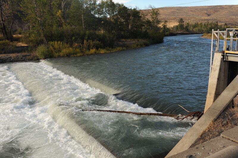
The Nelson dam removal began in 2021 and was completed in 2023. The removal of this extremely hazardous low head dam enhanced fish passage, widened the floodplain, restored natural sediment flow, improved river safety and navigability, and consolidated water diversion infrastructure. Informal access is available at this site on river left where the wide shoulders provide a place to park off the highway. The site has no developed facilities.
Apr 26, 2025
Put in at lower Nile road behind the woodshed and floated down to the confluence with the Tieton. ~2hr. Wood on the margins but easily avoidable. A couple of fun holes in the 10.5ft raft. Put in requires walking on large riprap and the take out would be a bit much with heavy rafts. Would be a super fun level for an IK.
Sep 28, 2024
Apr 30, 2023
Ran the lower Naches with my wife from Nile to the HWY 12 bridge in a double IK at 2700cfs. River was fairly rowdy in spots for an IK, definitely solid Class III in places. Most features can be sneaked except for the old diversion dam remnants. Lots of wood in the river and some nasty log jams that were easy enough to avoid, but high consequence nonetheless. Way fun and not too technical. ~13 miles in 1.5 hours