Satsop, Middle Fork
1. Walter Creek to Baker Creek (Upper Upper)
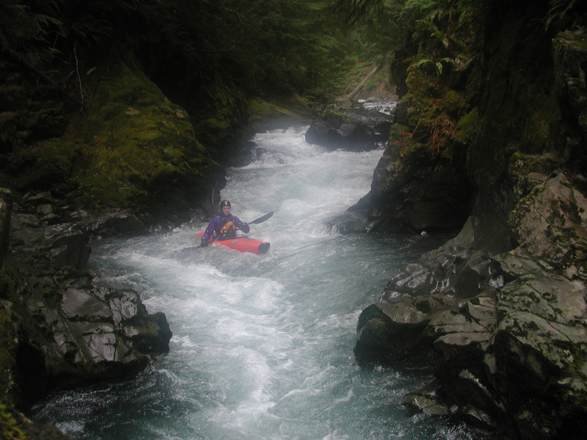
| Difficulty | III+(IV) |
| Length | 7.2 mi |
| Avg Gradient | 69 fpm |
| Reach Info Last Updated | July 9, 2004 |
SEASON: November to May after heavy rainfall.
LOGISTICS: This is a long shuttle, and although the roads are good, snow can
sometimes restrict access at the highest point on the route which is 1500'. A high
clearance vehicle is recommended. The best way to do this river is by setting a drop
shuttle. To get to the take-out, head towards Shelton, WA and from Highway 101 mile
347.0 turn onto Dayton-Matlock Road headed west towards Matlock. Stay on this road for
15.2 miles (past a lake circled with vacation homes) to Matlock and there turn right onto
West Beeville Road (this is at milepost 16.9). Stay on the main road for 5.0 miles miles
(you'll pass farms) and then turn right at the T junction onto Kelley Road. From here it's
1.5 miles to an intersection where 5 forest roads come together. Turn left onto FR 2341.
You'll start to parrallel the river (Fools Canyon section) and in 1.3 miles you'll be at the
bridge across Baker Creek. This is the take-out. In theory you could continue upstream
on FR 2341 to reach the put-in, but it goes up over the ridge (2500') and this route is
snowed in for most of the paddling season. The standard shuttle is to head 1.3 miles
back to the forest road intersection, but this time head straight (southeast) through the
gate onto the Simpson 800 road. Stay on this road for 6.6 miles and then turn left onto FR
2341. Take this road down towards Vance Creek (you'll cross it in 3.4 miles) and then
back up the hill to FR 23 (another 1.3 miles). Turn left on FR 23 and in 1.6 miles turn left
on FR 2350. Stay on this road to the put-in. FR 2350 parrallels Vance Creek and heads
gradually uphill where in 8.8 miles you eventually meet FR 2341 again (this is where you
would come out if you continued upstream on FR 2341 from the take-out). FR 2350 drops
back downhill again and in another 2.2 miles you'll reach a bridge across Walter Creek,
a s