Satsop, Middle Fork
2. Baker Creek to road off Kelly Hall Road (Fools Canyon)
| Difficulty | IV-V |
| Length | 1.6 mi |
| Avg Gradient | 115 fpm |
| Gauge | Satsop River Near Satsop, Wa |
| Flow Rate as of 59 minutes | 312 cfsbelow recommended |
| Reach Info Last Updated | January 20, 2023 |
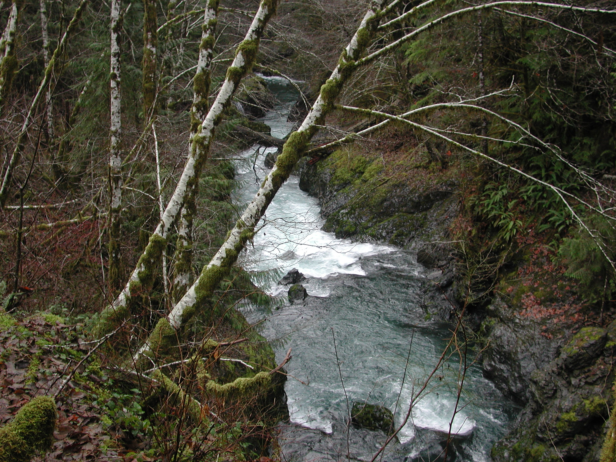
FUN FACT: Beautiful bedrock gorge with some great drops but difficult to scout or portage at river level.
SEASON: November to May
LOGISTICS: Head towards Shelton, WA and from Highway 101 mile 347.0 turn onto Dayton-Matlock Road headed west towards Matlock. Stay on this road for 15.2 miles (past a lake circled with vacation homes) to Matlock and there turn right onto West Beeville Road (this is at milepost 16.9). Stay on the main road for 5.0 miles miles (you'll pass farms) and then turn right at the T junction onto Kelley Road. From here it's 1.5 miles to an intersection where 5 forest roads come together. A short spur road, now closed, heads west to the river and the take-out. To reach the put-in, head north on FR 2341. You'll start to parrallel the river, scout carefully along the way, and in 1.3 miles you'll be at the bridge across Baker Creek. Scramble down the bank to the put-in.
DESCRIPTION:
This short section has some sweet whitewater and with great drops in a beautiful bedrock canyon. Scouting and portaging at river level are difficult and trees could form a serious hazard. If you want to run this section you'll probably want to scout the run from the road. It's a little more than a mile in length but a nice run if you're in the area. As of 2020, there is a new landslide at the end of the canyon. It flooded out a few rapids upstream and created a large rapid at the end of the gorge. Most will choose to portage (it has been portageable at river level) but there may be a a line for some at higher flows.
lat/long approximated by Tiger map server
for additional information see
Dec 17, 2024
We didn't end up running this unfortunately. However, to save you some time here is some updated info on the takeout. When you turn onto Kelley Road, the actual spur road where you park for the takeout is on the left before the 5 way 'intersection' of FS roads mentioned on this page. It is the closest one to the intersection, but still at least .25 miles away, and the only spur road facing due west (according to the compass on my car). Park at the foot of the road and after maybe ¼ of a mile turn right, and then in a little while veer left as the road splits. This takes you to a gully that you can use to get down to river level to scout the takeout. I will update this with longitude and latitude when we go back out there.
Apr 18, 2005
Mark Corsentino reports as of April 2005:
Very high quality run. Lot's of drops you can't scout from river level though, but all are very clean, if you pick the right slot. You can scout some from above, but not all. Very tight box canyon in parts. There is one unfortunate and new landslide. Portage the top on river right, and you need to run the second half, which is fine. Short and sweet, similar to Stilly CC with more drops and cleaner water.