Kern
4) Slippery Rock to Miracle (Jungle Run)
| Difficulty | II-III |
| Length | 8.1 mi |
| Avg Gradient | n/a |
| Gauge | Kern Above Borel Powerhouse |
| Reach Info Last Updated | December 22, 2019 |
Table of Contents Kern River #3 Hydropower Project, P-2290 Borel Hydropower Project, P-382 Kern River #1 Hydropower Project, P-1930 Kern Canyon Hydropower Project, P-178 Wild and Scenic River Management American Whitewater’s work on the Kern River has included engagement in the management of the Kern Wild and Scenic River [...]Read More
This section of the lower Kern is easier than the downstream Miracle to Democrat section and equally scenic. The river flows past low granite cliffs in a narrow but deep bedrock channel. There are long sections of flatwater paddling, broken up by some class 2 rapids, but there are also several serious class 3 to 3+ rapids.
Other Information Sources:
Dreamflows guides: Kern - Jungle Run
Sequoia National Forest Kernville office phone # 760-376-3781
Lower Kern Guide Book - Jungle Run Section
Cassady & Calhoun, Martin, Alan Baty
Links to important documents:
Extension of Time for boating release agreement.
Objections of Kern Water Users to boating flows
...Borel Powerhouse (FERC P-382). This hydropower plant has an installed capacity of 12 MW and predates the construction of Isabella Dam. At the time Isablla Dam was constructed, SCE modified the Borel Canal and added a new intake structure.
Aug 16, 2007
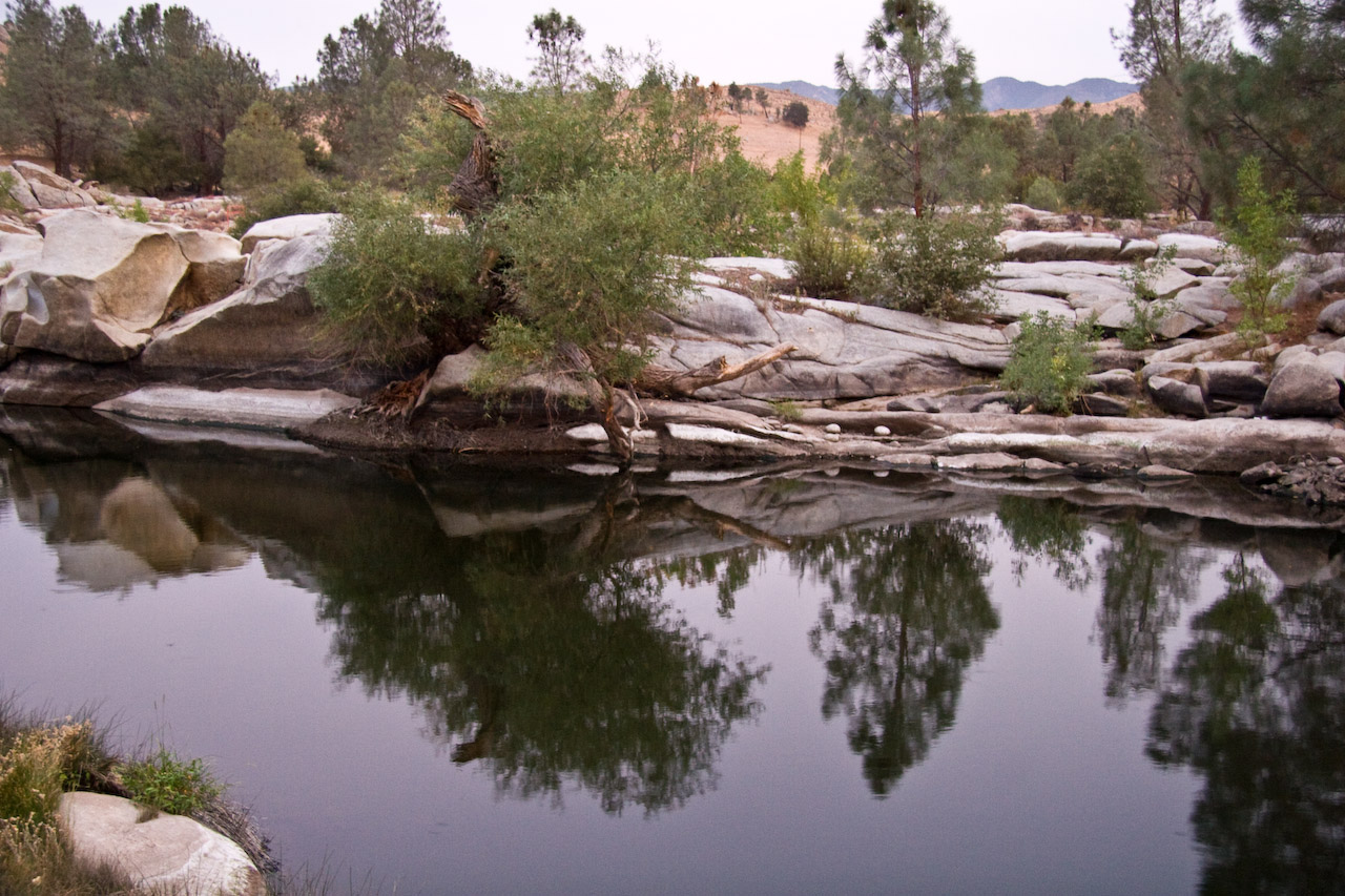
Lake Isabella stores the spring runoff and then releases water for irrigation throughout the summer. A minimum 'fish' flow of 25 to 50 cfs is released into the natural channel from the main dam, which is about one kilometer from this picture. The next 600 cfs is released through the auxiliary dam into the Borel Canal, both pictured here. This canal delivers water to the Borel Powerhouse and then back into the natural river channel, bypassing the 6 miles of river between the main dam and the powerhouse. Once releases exceed the 600 cfs capacity of the powerhouse, the excess is released into the river from the main dam. There is also a small powerhouse at the main dam operated by a separate company which generates power from the fish release and larger releases.
Rock formations near the start of section.
Rock formations near the put-in.
View south from the keysville put-in launching area.
Aug 15, 2007
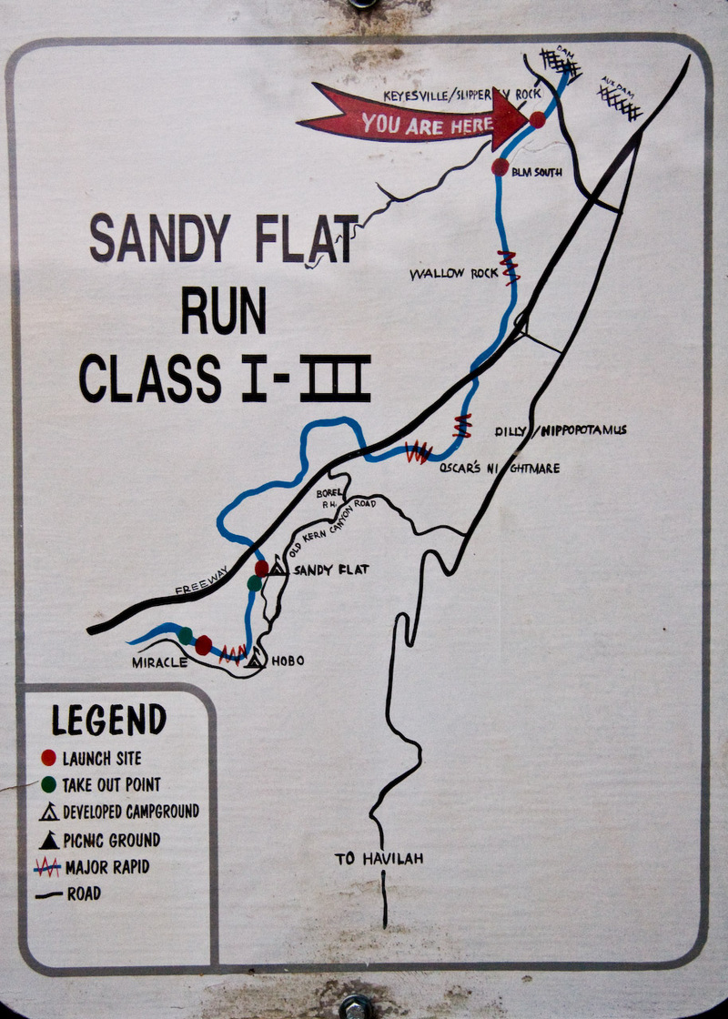
Map of the river from the dam to Miracle Hot Springs. This one is posted at the Keysville put in.